Truxton, Arizona

Last updated

Truxton, Arizona
Bell Gas sign, Truxton, Arizona LCCN2010630194.tif
Bell Gas sign, Truxton, Arizona
Mohave County Arizona Incorporated and Unincorporated areas Truxton Highlighted 0475590.svg
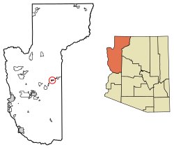
Location in Mohave County, Arizona
USA Arizona location map.svg
Red pog.svg
Truxton
Usa edcp location map.svg
Red pog.svg
Truxton
Coordinates: 35°29′26″N113°33′44″W / 35.49056°N 113.56222°W / 35.49056; -113.56222
Country United States
State Arizona
County Mohave
Area
[1]
  Total3.83 sq mi (9.90 km2)
  Land3.77 sq mi (9.77 km2)
  Water0.05 sq mi (0.13 km2)
Population
 (2020) [2]
  Total104
  Density27.56/sq mi (10.64/km2)
Time zone UTC-7 (MST (no DST))
FIPS code 04-75590

Truxton is an unincorporated community and census-designated place (CDP) in Mohave County, in the U.S. state of Arizona. [3] The population was 104 at the 2020 census, [2] down from 134 in 2010. [4]

Contents

History and location

Truxton is in eastern Mohave County, along Arizona State Route 66, former U.S. Route 66. It is 41 miles (66 km) northeast of Kingman, the county seat, and 45 miles (72 km) west of Seligman.

The Atlantic and Pacific Railroad section across northern Arizona was built in the early 1880s, and later acquired by the Santa Fe (now BNSF Railway), and included a stop at Truxton. The name comes from Truxton Springs, found by Edward Fitzgerald Beale when surveying and a laying wagon road through Arizona in 1857-58, see Beale's Wagon Road. "Truxtun" (slightly different spelling) was a family name; his son was Truxtun Beale, and his mother's maiden name was Emily Truxtun, a daughter of Thomas Truxtun.

Modern Truxton began to grow in 1951 when a few people moved in on Route 66, just northeast of the railstop, in anticipation of the building of the proposed Bridge Canyon Dam which would be nearby and would generate commerce. Though the dam was never built, business grew from Route 66 traffic coming through the very sparsely populated area. [5] When Interstate 40 opened in 1978 and bypassed this stretch of U.S. 66, it greatly reduced traffic and commerce in Truxton. [6] [7]

Education

The Valentine Elementary School District, which contains Truxton, [8] has its single K-8 school in Truxton. The school has been there since 1969, and was previously in Valentine. [9]

Demographics

Historical population
CensusPop.Note
2010 134
2020 104−22.4%
U.S. Decennial Census [10]

Related Research Articles

<span class="mw-page-title-main">Mohave County, Arizona</span> County in Arizona, United States

Mohave County is in the northwestern corner of the U.S. state of Arizona. As of the 2020 census, its population was 213,267. The county seat is Kingman, and the largest city is Lake Havasu City. It is the fifth largest county in the United States.

<span class="mw-page-title-main">Arizona Village, Arizona</span> Census-designated place in Arizona, United States

Arizona Village is a census-designated place (CDP) on the Fort Mojave Indian Reservation in Mohave County, Arizona, United States. The population was 1,057 at the 2020 census, up from 946 in 2010 and 351 in 2000.

<span class="mw-page-title-main">Dolan Springs, Arizona</span> CDP in Mohave County, Arizona

Dolan Springs is an unincorporated community and census-designated place (CDP) in Mohave County, Arizona, United States. The population was 1,989 at the 2020 census, down from 2,033 at the 2010 census.

<span class="mw-page-title-main">Kingman, Arizona</span> City in Arizona, United States

Kingman is a city in, and the county seat of, Mohave County, Arizona, United States. It is named after Lewis Kingman, an engineer for the Atlantic and Pacific Railroad. It is located 105 miles (169 km) southeast of Las Vegas, Nevada, and 180 miles (290 km) northwest of Arizona's state capital, Phoenix. The population was 32,689 at the 2020 census.

<span class="mw-page-title-main">Mohave Valley, Arizona</span> CDP in Mohave County, Arizona

Mohave Valley is an unincorporated community and census-designated place (CDP) in Mohave County, Arizona, United States. The population was 2,693 at the 2020 census. It is geographically connected to Needles, California, Fort Mohave and Bullhead City.

<span class="mw-page-title-main">Peach Springs, Arizona</span> CDP in Mohave County, Arizona

Peach Springs is a census-designated place (CDP) in Mohave County, Arizona, United States. The population was 1,098 at the 2020 census. Peach Springs serves as the administrative headquarters of the Hualapai people and is located on the Hualapai Reservation.

<span class="mw-page-title-main">Ash Fork, Arizona</span> CDP in Yavapai County, Arizona

Ash Fork is a census-designated place in Yavapai County, Arizona, United States. Its population was 396 at the 2010 U.S. Census, down from 457 in 2000.

<span class="mw-page-title-main">Hualapai</span> Native American tribe

The Hualapai is a federally recognized Native American tribe in Arizona with about 2300 enrolled members. Approximately 1353 enrolled members reside on the Hualapai Reservation, which spans over three counties in Northern Arizona.

<span class="mw-page-title-main">Littlefield, Arizona</span> Census-designated place in Mohave County, Arizona, United States

Littlefield is an unincorporated community and census-designated place in Mohave County, Arizona, United States, that is located in the Arizona Strip region. As of the 2020 census, its population was 256, a decline from the figure of 308 tabulated in 2010. It lies just south of Interstate 15, next to the Virgin River, approximately 10 miles (16 km) northeast of Mesquite, Nevada. Littlefield is located in the 86432 ZIP Code.

<span class="mw-page-title-main">Wikieup, Arizona</span> Unincorporated community in the state of Arizona, United States

Wikieup is an unincorporated community and census-designated place (CDP) located on U.S. Route 93 in Mohave County, Arizona, United States. It is located approximately 139 miles (224 km) northwest of Phoenix and 162 miles (261 km) southeast of Las Vegas. As of the 2020 census, the population of Wikieup was 135.

Centennial Park is an unincorporated community and census-designated place (CDP) in Mohave County, Arizona, United States. The population was 1,578 at the 2020 census, up from 1,264 at the 2010 census. It is the central location for the Centennial Park group, a fundamentalist Mormon group.

<span class="mw-page-title-main">Beaver Dam, Arizona</span> Census-designated place in Arizona, United States

Beaver Dam is an unincorporated community and census-designated place (CDP) in Mohave County, Arizona, United States, that is located in the Arizona Strip region and was settled on December 2, 1863. It is located along Interstate 15 approximately 10 miles (16 km) northeast of Mesquite, Nevada. It is located in the 86432 ZIP Code. It had a population of 1,552 as of the 2020 census, a decline from the figure of 1,962 tabulated in 2010.

<span class="mw-page-title-main">Fort Mohave, Arizona</span> Census-designated place in Arizona, United States

Fort Mohave is an unincorporated community and census-designated place in Mohave County, Arizona, United States. It is named for a nearby fort that was used during the Mohave War. As of the 2020 census, the population of Fort Mohave was 16,190, up from 14,364 in 2010 and 8,919 in 2000. It is a suburb of Bullhead City. Its recent growth has made it the most populous unincorporated community in Mohave County.

<span class="mw-page-title-main">Hackberry, Arizona</span> Unincorporated community in the state of Arizona, United States

Hackberry is an unincorporated community and census-designated place (CDP) in Mohave County, Arizona, United States. It is located on Arizona State Route 66 28 miles (45 km) northeast of Kingman. Hackberry has a post office which as of 2015 served 68 residential mailboxes with ZIP code 86411. As of the 2020 census, Hackberry had a population of 103.

<span class="mw-page-title-main">Valentine, Arizona</span> Unincorporated community in the state of Arizona, United States

Valentine is an unincorporated community and census-designated place (CDP) in Mohave County, Arizona, United States. As of the 2020 census it had a population of 39. Valentine is located on Arizona State Route 66 32 miles (51 km) northeast of Kingman. The majority of Valentine is located in a geographically isolated exclave of the Hualapai Reservation and the rest of the community is located in unincorporated Mohave County.

Valentine Elementary School District 22 is a public school district based in Mohave County, Arizona.

Hualapai Valley is a valley in Mohave County, Arizona.

<span class="mw-page-title-main">Antares, Arizona</span> Census-designated place in Arizona, United States

Antares is an unincorporated community and census designated place (CDP) in Mohave County, Arizona, United States. As of the 2020 census, it had a population of 132. It exists along part of historic U.S. Route 66.

Crozier is an unincorporated community and census-designated place (CDP) in Mohave County, Arizona, United States. The population was 21 at the 2020 census.

<span class="mw-page-title-main">Valle Vista, Arizona</span> CDP in Mohave County, Arizona

Valle Vista is an unincorporated community and census-designated place (CDP) in Mohave County, in the U.S. state of Arizona. The population was 1,802 at the 2020 census.

References

  1. "2021 U.S. Gazetteer Files: Arizona". United States Census Bureau. Retrieved May 26, 2022.
  2. 1 2 "P1. Race – Truxton CDP, Arizona: 2020 DEC Redistricting Data (PL 94-171)". U.S. Census Bureau. Retrieved May 26, 2022.
  3. U.S. Geological Survey Geographic Names Information System: Truxton, Arizona
  4. "2010 Census Gazetteer Files - Places: New Mexico". U.S. Census Bureau . Retrieved February 26, 2017.
  5. Branning, Debe. Arizona's Haunted Route 66, p. 131 (2021)
  6. (March 11, 1979). Nobody bets on Truxton, Arizona Republic
  7. Daniels, Steve (March 23, 1987). Route 66 revival, Arizona Republic
  8. "2020 CENSUS - SCHOOL DISTRICT REFERENCE MAP: Mohave County, AZ" (PDF). U.S. Census Bureau . Retrieved January 24, 2022.
  9. "About Valentine Elementary". Valentine Elementary School District. Retrieved January 24, 2022. - The address states "Peach Springs, AZ" but the school, as per the page, is in Truxton.
  10. "Census of Population and Housing". Census.gov. Retrieved June 4, 2016.