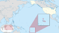
The National Park of American Samoa is a national park in the United States territory of American Samoa, distributed across four islands: Tutuila, Ofu, Olosega, and Ta‘ū. The park preserves and protects coral reefs, tropical rainforests, fruit bats, and the Samoan culture. Popular activities include hiking and snorkeling. Of the park's 8,257 acres (3,341 ha), 2,500 acres (1,000 ha) is coral reefs and ocean. The park is the only American National Park Service system unit south of the equator.

Peggy's Cove is a small rural community located on the eastern shore of St. Margarets Bay in the Halifax Regional Municipality, which is the site of Peggys Cove Lighthouse.
The traditional culture of Samoa is a communal way of life based on Fa'a Samoa, the unique socio-political culture. In Samoan culture, most activities are done together. The traditional living quarters, or fale (houses), contain no walls and up to 20 people may sleep on the ground in the same fale. During the day, the fale is used for chatting and relaxing. One's family is viewed as an integral part of a person's life. The aiga or extended family lives and works together. Elders in the family are greatly respected and hold the highest status, and this may be seen at a traditional Sunday umu.

Tutuila is the largest and most populous island of American Samoa and is part of the archipelago of the Samoan Islands. It is the third largest island in the Samoan Islands chain of the Central Pacific. It is located roughly 4,000 kilometers (2,500 mi) northeast of Brisbane, Australia and lies over 1,200 kilometers (750 mi) to the northeast of Fiji. It contains a large, natural harbor, Pago Pago Harbor, where Pago Pago, the capital of American Samoa, is situated. Pago Pago International Airport is also located on Tutuila. The island's land expanse is about 68% of the total land area of American Samoa. With 56,000 inhabitants, it is also home to 95% of the population of American Samoa. The island has six terrestrial and three marine ecosystems.

The Sydney Heads are a series of headlands that form the 2 km (1.2 mi) wide entrance to Sydney Harbour in Sydney, New South Wales, Australia. North Head and Quarantine Head are to the north; South Head and Dunbar Head are to the south; and Middle Head, Georges Head, and Chowder Head are to the west and within the harbour. The Heads are contained within the Sydney Harbour National Park.
Puʻu o Mahuka Heiau State Historic Site on the North Shore of Oʻahu is the largest heiau (temple) on the island, covering 2 acres (8,100 m2) on a hilltop overlooking Waimea Bay and Waimea Valley. From its commanding heights, sentries could once monitor much of the northern shoreline of Oʻahu, and even spot signal fires from the Wailua Complex of Heiaus on Kauaʻi, with which it had ties. It was designated a National Historic Landmark in 1962, when it became the center of a 4-acre (16,000 m2) state park. It was added to the National Register of Historic Places in 1966.
Utulei or ʻUtulei is a village in Maoputasi County, in the Eastern District of Tutuila, the main island of American Samoa. Utulei is traditionally considered to be a section of Fagatogo village, the legislative capital of American Samoa, and is located on the southwest edge of Pago Pago Harbor. Utulei is the site of many local landmarks: The A. P. Lutali Executive Office Building, which is next to the Feleti Barstow Library; paved roads that wind up to a former cablecar terminal on Solo Hill; the governor's mansion, which sits on Mauga o Alii, overlooking the entrance to Goat's Island, and the lieutenant governor's residence directly downhill from it; the Lee Auditorium, built in 1962; American Samoa's television studios, known as the Michael J. Kirwan Educational Television Center; and the Rainmaker Hotel. Utulei Terminal offers views of Rainmaker Mountain.
The Menoken Indian Village Site, also known as Menoken Site, Verendrye Site or Apple Creek Site is an archeological site near Bismarck, North Dakota. The site, that of a fortified village occupied c. 1300, is important in the region's prehistory, as it is one of the only sites that predates sites that are more clearly associated with the historic Hidatsa, Mandan, and Arikara cultures. It was declared a National Historic Landmark in 1964, and was listed on the National Register of Historic Places in 1966. It is located on 171st Street NE, north of Menoken, about 10 miles (16 km) east of Bismarck. The site managed by the state as the Menoken Indian Village State Historic Site, and is open to the public.
The Greenwich Cove Site is a prehistoric archaeological site in Warwick, Rhode Island, US. The site is a significant multi-component site, with finds dating from the Late Archaic to the Middle Woodland Period. It notably includes a shell midden that has only been moderately affected by vandalism and development; these are particularly rare in coastal Rhode Island. The site was added to the National Register of Historic Places in 1980.
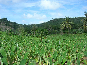
Futiga is a village in the southwest of Tutuila Island, American Samoa. It is located inland, 7 miles (11 km) southwest of Pago Pago, between the villages of 'Ili'ili and Puapua. It is in Tualatai County.
Vaitogi is a village in American Samoa. It has many missionaries and tourists who are attracted by shopping for local products. Vaitogi might be most famous of its legends about the Turtle and Shark. It is said that once, at a time when food was scarce, an old woman took her granddaughter to the bluff at Vaitogi, and holding hands, they leaped into the sea down below. While the young girl was transformed into a shark, the blind grandmother became a turtle. It gives its name to a local U-shaped cove in town, which was listed on the U.S. National Register of Historic Places in 2014.

The Rose Island Concrete Monument is a historic commemorative marker on Rose Island, part of Rose Atoll, a remote island located in the far eastern reaches of the territorial waters of American Samoa. The marker is a concrete structure in the shape of a truncated pyramid with a rectangular cross-section. It is 1.53 metres (5.0 ft) wide, 1.59 metres (5.2 ft) high, and 0.74 metres (2.4 ft) deep. On the west side of the marker is raised lettering stating "ROSE ISLAND / AMERICAN SAMOA / TRESPASSING PROHIBITED / WARREN J. TERHUNE / JAN 10 1920 GOVERNOR". A brass plaque on the opposite side of the monument conveys a similar message. The monument was placed in 1920 by the order of Naval Governor Warren J. Terhune during a tour he made of all of the islands of the territory of American Samoa, and serves as a continuing reminder of the American claim to the atoll.
The Governor H. Rex Lee Auditorium, also called Fale Laumei in Samoan, is the largest indoor meeting space in the United States territory of American Samoa. It is located in the village of Utulei, surrounded by other government buildings. The main body of the building is a roughly ovoid structure, with a curved roof that is reminiscent of the thatch roofs of traditional Samoan structures. The auditorium was built in 1962 under orders from Governor Hyrum Rex Lee as part of a major initiative to modernize the territory's infrastructure and facilities. It was built by a construction squadron of the United States Navy, and was completed in time for the 1962 South Pacific Conference. It was later named in honor of Lee, who was the territory's longest-serving governor, and oversaw much of its modernization.
The Mana Pillbox is an old World War II-era Japanese-built defensive fortification on the east coast of the island of Guam. It is located south of the village of Talofofo, about 50 metres (160 ft) inland from the point marking the south end of As Anite Cove. It is a structure built out of coral limestone and concrete, with an interior chamber about 3 by 1.8 metres in size. The entrance is on the south side, measuring 0.85 by 1.45 metres. There is one gun port, facing north, measuring 0.32 by .9 metres. The structure was designed to be well hidden in view from the sea and air. It was built, probably by conscripted Chamorro labor, during the Japanese occupation period 1941–44.
Site As-31-72 is a prehistoric archaeological site on the island of Tutuila in the United States territory of American Samoa. Located on the Tafuna Plain, an inland area on the western half of the island, its principal feature is a long stone wall, 300 metres (980 ft) long with a maximum height of 5.4 metres (18 ft). Set on sloping ground, the top of the wall is roughly level, and is only 2.8 metres (9.2 ft) high at the upper end of the slope. Platforms and other features have been identified during archaeological examination of the structure and its surroundings in the 1990s. Its purpose is unknown; the researchers conjecture it was built because of warfare.

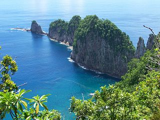
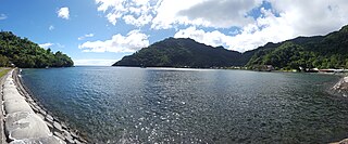
Vatia is a village on Tutuila Island in American Samoa. It is a north shore village located on Vatia Bay. The road to Vatia, American Samoa Highway 006, is the only road going through National Park of American Samoa. Vatia is a scenic community at the foot of Pola Ridge and surrounded by the national park. It is only reached by Route 6 which traverses the national park before reaching Vatia. There was once a hiking trail over Maugaloa Ridge from Leloaloa, but since the completion of Route 6, this trail is now overgrown. It is home to a beach, and panoramic views of jungle-covered peaks surround the village on all sides. Vatia is the center of the Tutuila-section of National Park of American Samoa. It is located in Vaifanua County.
Fagasā is a village in the Eastern District of Tutuila Island in American Samoa. The village lies by Fagasa Bay, on the north shore of the island. Its name is Samoan and translates to “Forbidden Bay.” The village borders the Tutuila-section of National Park of American Samoa. The trailhead to Mount ‘Alava is located near the village by Fagasa Pass.
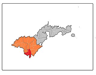
Tuālā-tai County is one of the five counties that make up the Western District of American Samoa.
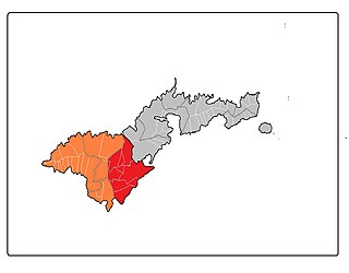
Tuālāuta County is a county in the Western District in American Samoa. It is the largest and also the most populated county in American Samoa. The county is represented by two seats in the Senate and two seats in House of Representatives in the American Samoa Legislature. 'Ili'ili is the principal place in Tualauta County, a county which consists of 'Ili'ili, Pava'ia'i, Mapusaga, Faleniu, Mesepa, Malae'imi, Tafuna, and Vaitogi.
Fogama'a Crater is a valley basin on Tutuila Island, American Samoa, immediately north of Larsen Bay. It is within the village of Futiga, just below Logotala Hill. It is also known as Hidden Beach or Larsen’s Cove.