
Pago Pago is the territorial capital of American Samoa. It is in Maoputasi County on Tutuila, which is American Samoa's main island.

This is a list of the buildings, sites, districts, and objects listed on the National Register of Historic Places in American Samoa. There are currently 31 listed sites spread across the three districts of American Samoa. There are no sites listed on the unorganized atoll of Swains Island.

Fagatogo is the downtown area of Pago Pago. Located in the low grounds at the foot of Matafao Peak, it was the location of the first American settlement on Tutuila Island. It includes the sub-village of Malaloa. Today, Fagatogo is the government, commercial, financial, and shipping center of Tutuila. It is also the administrative capital of American Samoa. It is the location of the American Samoa Fono (legislature), and is listed in the Constitution of American Samoa as the territory's official seat of government. Its population is 1,737.
Poloa is a village in American Samoa. It is located at the west side of Tutuila in the Alataua District. The village has 193 residents in 2010. The main denominations in the area are Methodist and Christian. Poloa has one elementary school. It is located in Lealataua County.

United States Naval Station Tutuila was a naval station in Pago Pago Harbor on the island of Tutuila, part of American Samoa, built in 1899 and in operation until 1951. During the United States Navy rule of American Samoa, from 1900 to 1951, it was customary for the commandant of the station to also serve as Military Governor of the territory. Benjamin Franklin Tilley was the first commandant and the first officer responsible for the naval station's construction.

Government House, also known as Building No.1, Naval Station, Tutuila or Government House, U.S. Naval Station Tutuila, is a historic government building on the grounds of the former United States Naval Station Tutuila in Pago Pago, American Samoa. Built in 1903, it has served as a center of government on the island for much of the time since then. Government House was listed on the United States National Register of Historic Places in 1972, and was declared a National Historic Landmark in 1990.

The Blunts Point Battery, also known as Blunts Point Naval Gun or Matautu Ridge Gun Site, is a gun battery on Matautu Ridge near Pago Pago, American Samoa. It was part of the fortification of the Samoan Islands which took place after the attack on Pearl Harbor, and is a rare example of a World War II Pacific coastal gun which remains in relatively pristine condition. It was declared a National Historic Landmark in 1987.

A pillbox is a type of blockhouse, or concrete dug-in guard post, normally equipped with loopholes through which to fire weapons. It is in effect a trench firing step hardened to protect against small-arms fire and grenades and raised to improve the field of fire.

The Courthouse of American Samoa, formerly Administration Building, Navy No. 21, is a historic building near Pago Pago Harbor in Fagatogo, American Samoa. It is a two-story wood-frame building mounted on concrete piers, with a two-story veranda on three sides. A concrete vault is located at the back of the building. The court house was reported by the local commander to have been completed about 1904. It housed the offices and other facilities from which the United States Navy administered the island from its construction until 1952, and was where advisory councils of the island's indigenous leaders were held. The building is one of the oldest standing in American Samoa, having survived typhoons and other perils.

The As Sombreru Pillbox I, As Sombreru Pillbox II, and As Sombreru Pillbox III are three historic defensive fortifications on Guam, near Tumon, that were listed on the U.S. National Register of Historic Places in 1991. They are pillboxes, a type of defensive fortification, built by the 48th Independent Mixed Brigade; 29th Division of the Imperial Japanese Army during 1941-1944, between Japan capturing Guam on December 8, 1941 from the United States and the U.S. recapturing Guam in 1944.

The Atauloma Girls School is a historic parochial school building in Afao village on the island of Tutuila in American Samoa. The London Missionary Society opened it in 1900 as the second secondary school on Tutuila, and the first to admit girls. For most of its history it prepared girls primarily to be pastors' wives, and after 1913 provided graduates to the nursing school at the naval station at Pago Pago. Its establishment saved Tutuila girls the necessity of travel to Upolu for secondary school, which separated them from their families and exposed them to the dangers of the international port at Apia. Atauloma was abandoned by 1970.

The Agat Invasion Beach is a historic site in the village of Agat, Guam. The beaches of Agat were one of the landing sites of American forces in the 1944 Battle of Guam, in which the island was retaken from occupying Japanese forces. The designated historic site includes the beaches and inland areas extending between Bangi Point and Togcha Beach. Surviving remnants of the Japanese defenses on this stretch of coast include trenches and rifle pits located a short way inland, and a fortified bunker and 40mm gun emplacements at Ga'an Point. Remnants of pillboxes that had lined the beach also survive, with one at Gangi Point in relatively good condition.

The Unai Lagua Japanese Defense Pillbox is one of the more unusual surviving World War II-era Japanese fortifications on the island of Saipan in the Northern Mariana Islands. It is located at the southern end of Unai Lagua, which stretches along the northern shore of the island. The pillbox is fashioned out of poured concrete and coral boulders, and uses natural rock formations as part of its walls. This construction was necessitated by a severe shortage of building materials on the island as the Japanese prepared the island's defenses against the advancing Allied forces in 1943–44. The use of natural materials and terrain had the added benefit of rendering the position nearly invisible to aerial or offshore observation.
The Breakers Point Naval Guns are a historic World War II-era defensive fortification on the island of Tutuila in American Samoa. It consists of two six-inch Mark 8 Model 2 naval guns, mounted on circular concrete platforms about 200 feet above sea level at the end of Papatele Ridge, which flanks the east side of Pago Pago Harbor. The guns, manufactured in 1907, were emplaced in 1941 amid fears of a Japanese invasion of the island, and were left in situ after invasion fears subsided. They were brought to the site by an innovative railway system that used locally crafted rails fashioned out of ifil wood when steel rails were not available. The guns are located on private family-owned land, but may be hiked to with permission.
The Masefau Defensive Fortifications consist of a pair of concrete pillboxes on the shores of Masefau Bay on the island of Tutuila in the United States territory of American Samoa. These octagonal structures differ from others found in western Tutuila in that they have no separate interior space for the storage of ammunition. The structures were exposed by a typhoon in 2009.

Cape Taputapu is the name of a cape located in the Western District of American Samoa. Located in Tutuila, it is the island's westernmost point. The cape was designated as a National Natural Landmark in 1972.

Maʻopūtasi County is located in the Eastern District of Tutuila Island in American Samoa. Maoputasi County comprises the capital of Pago Pago and its harbor, as well as surrounding villages. It was home to 11,695 residents as of 2000. Maoputasi County is 6.69 square miles (17.3 km2) The county has a 7.42-mile (11.94 km) shoreline which includes Pago Pago Bay.
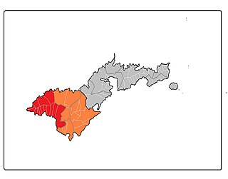
Lealataua County is a county in the Western District in American Samoa.
Itū'au, together with Aitūlagi, make up the village of Malaeloa.
