
Mokuaikaua Church, located on the "Big Island" of Hawaii, is the oldest Christian church in the Hawaiian Islands. The congregation dates to 1820 and the building was completed in 1837.
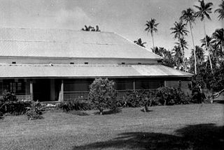
The Fagalele Boys School, in Leone, American Samoa, is a historic building that was listed on the U.S. National Register of Historic Places in 1972. It is a church school built by the London Missionary Society, perhaps as early as 1850-1856, but before 1900. It was the first secondary school in what is now American Samoa, and it perhaps is the oldest surviving building on Tutuila Island.

The Rose Island Concrete Monument is a historic commemorative marker on Rose Island, part of Rose Atoll, a remote island located in the far eastern reaches of the territorial waters of American Samoa. The marker is a concrete structure in the shape of a truncated pyramid with a rectangular cross-section. It is 1.53 metres (5.0 ft) wide, 1.59 metres (5.2 ft) high, and 0.74 metres (2.4 ft) deep. On the west side of the marker is raised lettering stating "ROSE ISLAND / AMERICAN SAMOA / TRESPASSING PROHIBITED / WARREN J. TERHUNE / JAN 10 1920 GOVERNOR". A brass plaque on the opposite side of the monument conveys a similar message. The monument was placed in 1920 by the order of Naval Governor Warren J. Terhune during a tour he made of all of the islands of the territory of American Samoa, and serves as a continuing reminder of the American claim to the atoll.
The A'a Village Site, designated "AS-34-33" by archaeologists, is an abandoned village site on the island of Tutuila in American Samoa. Located on a bay on the northwest coast of the island, the site was first surveyed by professional archaeologists in 1985. The site has four distinct areas, in which features interpreted as house foundations have been located, as have rock walls, grave sites, and platform mounds. The site was not known to be occupied within the living memory of nearby residents, and the size of trees in the site suggests it has been abandoned since the 1860s.
The Fagatele Bay Site is an archaeological site on the shore of Fagatele Bay on the south side of Tutuila, the main island of the United States territory of American Samoa. The site shows evidence of habitation from prehistoric to historic times, and is well preserved in part because of the relative difficulty of land access to the area. It has ten distinct features, including raised platforms, stone walls, and a stone-line path. In one feature, interpreted as a house site, a complete prehistoric-era adze was found. When surveyed in 1985, these features could not be chronologically organized or correlated.

The Breakers Point Naval Guns are a historic World War II-era defensive fortification on the island of Tutuila in American Samoa. It consists of two six-inch Mark 8 Model 2 naval guns, mounted on circular concrete platforms about 200 feet above sea level at the end of Papatele Ridge, which flanks the east side of Pago Pago Harbor. The guns, manufactured in 1907, were emplaced in 1941 amid fears of a Japanese invasion of the island, and were left in situ after invasion fears subsided. They were brought to the site by an innovative railway system that used locally crafted rails fashioned out of ifil wood when steel rails were not available. The guns are located on private family-owned land, but may be hiked to with permission.
The Lau'agae Ridge Quarry is a prehistoric stone quarry on the eastern side of the island of Tutuila in the United States territory of American Samoa. It is located on a ridge above another archaeological site, the prehistoric village of Tulauta. The site includes a carpet of stone flakes, evidence of rough stonework, signs of habitation, and two tia'ave, oval stone platforms found in abundance on the island.
The Maloata Village Site is a prehistoric village site on the northwestern coast of the island of Tutuila in the United States territory of American Samoa. The archaeologically sensitive site includes a variety of stone features, principally stone fences and retaining walls, with evidence from excavation of human habitation. Radiocarbon dating from one of its test pits yielded a date range of CE 550-1000, identifying the site as one of the oldest known on the island. According to oral tradition, the Maloata area was reserved for use by relatively high-status chieftains.
The Faga Village Site is a major archaeological site in the United States territory of American Samoa. Located on the north shore of the island of Ta'u, it is, according to local oral history, one of the oldest settlements in all of the Samoan islands, and an important site in the formation of Samoan culture. The site includes a large number of house foundations, terraces, stone walls, and other stone-built features. Excavations at the site have yielded radiocarbon dates indicating the site was occupied as far back as 1000 CE. The site continues to be of cultural importance to the local Samoan population.
Site As-31-72 is a prehistoric archaeological site on the island of Tutuila in the United States territory of American Samoa. Located on the Tafuna Plain, an inland area on the western half of the island, its principal feature is a long stone wall, 300 metres (980 ft) long with a maximum height of 5.4 metres (18 ft). Set on sloping ground, the top of the wall is roughly level, and is only 2.8 metres (9.2 ft) high at the upper end of the slope. Platforms and other features have been identified during archaeological examination of the structure and its surroundings in the 1990s. Its purpose is unknown; the researchers conjecture it was built because of warfare.
The Masefau Defensive Fortifications consist of a pair of concrete pillboxes on the shores of Masefau Bay on the island of Tutuila in the United States territory of American Samoa. These octagonal structures differ from others found in western Tutuila in that they have no separate interior space for the storage of ammunition. The structures were exposed by a typhoon in 2009.
The Tulauta Village Site is a prehistoric village site in far eastern Tutuila, the largest island of American Samoa. The site includes 10-13 house sites, a number of grave site, and other features, including stone enclosures interpreted as pig sties, fire pits, and walls. An upright basalt slab was found, which may have been of local religious significance. Early archaeological testing took place here in the 1970s, with more extensive examinations in the 1980s and 1990s. A large number of basalt stone flakes led an early researcher to speculate that it was a quarry site; it is more likely the inhabitants were working stone quarried from a site on the ridge above.
The Satala Cemetery is located on the north side of Pago Pago Harbor on the island of Tutuila, the largest in American Samoa. The cemetery was established, apparently late in the 19th century, by the United States Navy, as an interment site for foreigners on the island. Traditional Samoan burial practice is to bury family members on their property, a method not available to outsiders. One section of the cemetery is dedicated to graves of Korean fishermen.
Old Vatia is a prehistoric village site on the north side of Tutuila, the largest island of American Samoa. The site is located on the Faiga ridge, above the modern village of Vatia in the National Park of American Samoa. It is stretched linearly along the ridge, with terraced areas that have features such as stone house foundations and pavement. The site, believed to have been occupied c. 1300-1750, is one of the island's few upland village sites. It was first identified in the 1960s and recorded in detail in 1989.
Turtle and Shark is a place with association to an important legend in the culture of Samoa. It is located on the southern shore of Tutuila, the largest island of American Samoa, a short way south of the village of Vaitogi. The feature known as Turtle and Shark is a U-shaped cove, set between Vaitogi Beach to the north and a basalt cliff to the south. The cove is about 72 metres (236 ft) measured from east to west and 78.5 metres (258 ft) measured from north to south. The topography of the cove is such that it is frequently subjected to high-energy wave action, with spray thrown high into the air. The cove is believed by the Samoan populace to be the location of the climactic scene of the Turtle and Shark legend, one of the island's best-known and popular tales.
The Tataga-Matau Fortified Quarry Complex, designated Site AS-34-10, is a major archaeological complex on Tutuila, the largest island of American Samoa. Located in an upland area on the western side of the island above the village of Leone, the complex consists of a series of basalt quarries and structures that archaeologists have interpreted as having a military defensive purpose. The site has been known since at least 1927, and was first formally surveyed in the 1960s. Features of the site include extraction pits, from which basalt was quarried for the manufacture of stone tools and weapons, as well as domestic features such as grinding stones. Archaeologists in 1985 noted that some of the sites features were, including trenches and terracing, were made in areas that were unsuitable for the production of stone tools, and closely resemble known military defensive structures in other areas of the Samoan islands. The site extends along a network of ridges for more than 1.4 kilometres (0.87 mi). Radiocarbon dating of elements of site indicate periods of occupation and/or use from c. 200 CE to the period of European contact.
The Tui Manu'a Graves Monument is a funerary marker and grave site on the island Ta'u, the largest island of the Manu'a group in American Samoa. It is located northwest of the junction of Ta'u Village and Ta'u Island Roads on the west side of the island. It consists of a stone platform, about 3 feet (0.91 m) in height, that is roughly rectangular in shape with a projection at one end. Three graves are marked by square sections of smoothed stones, while a fourth is marked by a marble column. A possible fifth grave, unmarked, is in the projection. It is the burial site of several tu'i, or kings, of Manu'a, including Tui Manu'a Matelita and Tui Manu'a Elisala, the Samoan leader whose signature granted the United States hegemony over the islands.


