Waikaretu

Last updated • 3 min readFrom Wikipedia, The Free Encyclopedia

Waikaretu
Waikāretu
Hamlet
Waikapakapa Stream waterfall.jpg
Waikapakapa Stream waterfall, Waikaretu
Waikaretu
Coordinates: 37°32′28″S174°49′45″E / 37.54120°S 174.82918°E / -37.54120; 174.82918
CountryNew Zealand
Region Waikato
District Waikato District
WardOnewhero-Te Akau Ward
CommunityOnewhero-Tuakau Community
Electorates
Government
  Territorial Authority Waikato District Council
  Regional council Waikato Regional Council
Area
[1]
  Total133.47 km2 (51.53 sq mi)
Population
 (2018) [2]
  Total141
  Density1.1/km2 (2.7/sq mi)
Waikaretu Hall Waikaretu Hall.jpg
Waikaretu Hall

Waikaretu (Māori : Waikāretu) is a rural community and caving area in the Waikato District and Waikato region of New Zealand's North Island. It is located 49 kilometres south-west of Tuakau. [3]

Contents

A local farmstay also provides guided horse treks. [4]

Waikāretu translates as "waters of the kāretu grass"; wai means water; and kāretu is a sweet-scented grass. [5]

History

20th century

The current Waikaretu settlement was established with the opening of a local school in 1924. [6]

The Waikaretu War Memorial Hall was built in 1952. It has no Roll of Honour, but includes a plaque commemorating those who served in both World War I and World War II. [7]

21st century

By the 2010s the area featured several dairy farms, including the third-generation Whitford farm. [8]

In 2016, the Overseas Investment Office granted a Chinese company, Weihai Station, approval to buy 595 hectares of coastal land. [9] Part of the land will be used for a lodge and training facility, with the rest continuing to operate as a sheep and beef farm. [10] The company gave Waikaretu School $25,000 in grants between 2016 and 2020. [11]

Also in 2016, a secretive group began tunneling into the side of road searching for the skeletons of a mythical race of pre-Polynesian giants. [12] They called off the search in February 2020, after iwi, academics and the landowner raised concerns about the dig. [13]

Nikau Cave

Stalactites and stalagmites in Nikau Cave Stalactites and stalagmites in Nikau Cave.jpg
Stalactites and stalagmites in Nikau Cave

The area features the 1 kilometre (0.62 mi) long Nikau Cave, which has limestone pillars, stalactites and stalagmites. [3] The caves contain many thousands of glow-worms which visitors can observe up close. [14] Ninety minute guided adventure tours are available, which are often wet and muddy. [15] There is a visitor cafe, and there are several accommodation options nearby. [16] A British analysis of TripAdvisor reviews in 2020 identified the cave as one of New Zealand's best secret tourist spots. [17] [18]

Philip and Anne Woodward moved to the area in 1978, [14] purchasing a 204 hectare sheep and dairy farm that included Nikau Cave. They opened the cave to the public in 1994, after their farming lease on a neighbouring 242 hectare block ended and they could no longer make enough money from farming and shearing services. [18] [19] The cave has been formed in Waimai Limestone, [14] which is about 28m years old, hard, flaggy, glauconitic, pebbly [20] and over 90% formed of calcium carbonate. [21] There is also a path beside Waikaretu Stream, through QEII protected areas of bush, from near the cave to the foot of a waterfall. [22]

Demographics

Waikaretu is in an SA1 statistical area which covers 133.47 km2 (51.53 sq mi). [1] The SA1 area is part of the larger Port Waikato-Waikaretu statistical area. [23]

Historical population
YearPop.±% p.a.
2006111    
2013129+2.17%
2018141+1.79%
Source: [2]

Waikaretu had a population of 141 at the 2018 New Zealand census, an increase of 12 people (9.3%) since the 2013 census, and an increase of 30 people (27.0%) since the 2006 census. There were 51 households, comprising 69 males and 72 females, giving a sex ratio of 0.96 males per female. The median age was 35.6 years (compared with 37.4 years nationally), with 33 people (23.4%) aged under 15 years, 24 (17.0%) aged 15 to 29, 75 (53.2%) aged 30 to 64, and 9 (6.4%) aged 65 or older.

Ethnicities were 57.4% European/Pākehā, 48.9% Māori, 2.1% Pacific peoples, 2.1% Asian, and 2.1% other ethnicities. People may identify with more than one ethnicity.

Although some people chose not to answer the census's question about religious affiliation, 66.0% had no religion, 25.5% were Christian, 2.1% had Māori religious beliefs and 2.1% had other religions.

Of those at least 15 years old, 12 (11.1%) people had a bachelor's or higher degree, and 33 (30.6%) people had no formal qualifications. The median income was $32,600, compared with $31,800 nationally. 12 people (11.1%) earned over $70,000 compared to 17.2% nationally. The employment status of those at least 15 was that 63 (58.3%) people were employed full-time, 12 (11.1%) were part-time, and 6 (5.6%) were unemployed. [2]

Education

Waikaretu School is a co-educational state primary school for Year 1 to 8 students, [24] [25] with a roll of 21 as of August 2024. [26]

See also

Related Research Articles

<span class="mw-page-title-main">Waitomo</span> Settlement in Waikato, New Zealand

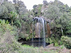
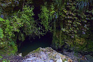
Waitomo is a rural community in the King Country region of New Zealand's North Island. There are several solutional cave systems in the area around the village, which are popular tourist attractions. Restaurants and accommodation are centred in the village to serve visiting tourists.

<span class="mw-page-title-main">Te Kauwhata</span> Town in Waikato, New Zealand

Te Kauwhata is a small town in the north of the Waikato region of New Zealand, situated close to the western shore of Lake Waikare, some 40 km north of Hamilton and approximately 58 km south of Manukau City. The township is surrounded by dairy farms, drystock holdings and horticulture. Its newest building is its Waikato District Council library. Originally known as Wairangi, Te Kauwhata grew around a railway station built in the late 1870s.

<span class="mw-page-title-main">Te Poi</span> Settlement in Waikato, New Zealand

Te Poi is a small village in rural Waikato, New Zealand, established in 1912 at the base of the Kaimai Range. Te Poi is part of a thriving farming area, particularly for dairying, thoroughbred horse breeding and cropping.

Waharoa is a rural community in the Waikato region of New Zealand's North Island. It is located 7 km north of Matamata, and is part of the Matamata-Piako District. It is located at the junction of the Kinleith Branch railway and the East Coast Main Trunk Railway. State Highway 27 runs through the town, which is serviced by several shops and cafes and by a petrol station. Matamata Airport is just over 3 km (1.9 mi) north of Waharoa.

Karetu is a community in the Northland Region of the North Island of New Zealand. Kawakawa is to the west, and Waikare is northeast. The Karetu River flows from the Russell Forest in the southeast through Karetu, and joins the Kawakawa River shortly before it flows into the Bay of Islands.

<span class="mw-page-title-main">Mercer, New Zealand</span> Settlement in Waikato, New Zealand

Mercer is a village in the Waikato District Council area of the Waikato region of the North Island of New Zealand. It is 70 km north of Hamilton and 58 km south of Auckland, on the east bank of the Waikato River, 2 km south of its confluence with the Mangatāwhiri River.

<span class="mw-page-title-main">Mokai</span> Settlement in Waikato, New Zealand

Mokai is a rural community in the Taupō District and Waikato region of New Zealand's North Island.

<span class="mw-page-title-main">Te Ākau</span> Settlement in Waikato, New Zealand

Te Ākau is a small farming settlement in the North Island of New Zealand, located 62 km (39 mi) north west of Hamilton, 39 km (24 mi) south west of Huntly, 45 km (28 mi) south of Port Waikato and 47 km (29 mi), or 19 km (12 mi) by ferry and road, north of Raglan. It has a hall and a school.

Waikeria is a rural community in the Otorohanga District and Waikato region of New Zealand's North Island.

Pukeatua is a rural farming community in Waipa District and Waikato region of New Zealand's North Island. It is situated at the south-western foot of the Pukeatua hill, of the Maungatautari mountain range.

Maihiihi is a rural community in the Ōtorohanga District and Waikato region of New Zealand's North Island.

Rukuhia is a rural community in the Waipa District and Waikato region of New Zealand's North Island.

Roto-o-Rangi or Rotoorangi is a rural community in the Waipa District and Waikato region of New Zealand's North Island, located south of Cambridge and north-east of Te Awamutu.

Tatuanui is a settlement and rural community in the Matamata-Piako District and Waikato region of New Zealand's North Island.

Manawaru or Manawarū is a rural community in the Matamata-Piako District and Waikato region of New Zealand's North Island.

<span class="mw-page-title-main">Eureka, New Zealand</span> Locality in Waikato, New Zealand

Eureka is a rural settlement in the Waikato District and Waikato region of New Zealand's North Island. It is located on State Highway 26, and is surrounded by dairy farmland on a flat plain.

Brunswick is a rural community in the Whanganui District and Manawatū-Whanganui region of New Zealand's North Island.

<span class="mw-page-title-main">Motumaoho</span> Village in Waikato, New Zealand

Motumaoho is a small village in the Waikato region of New Zealand's North Island, just to the west of the Pakaroa Range. It is on SH26, 25 km (16 mi) east of Hamilton and 7 km (4.3 mi) west of Morrinsville. The village is bordered by the Waitakaruru Stream to the east. Motumaoho can be translated as an intruding clump of trees.

<span class="mw-page-title-main">Lower Moutere</span> Rural locality in Tasman, New Zealand

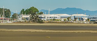
Lower Moutere is a settlement in the Tasman District of New Zealand's upper South Island. It is a farming community it the Lower Moutere valley, 6 km (3.7 mi) from Motueka close to the Moutere Inlet.

Okaiawa or Ōkaiawa is a rural community in South Taranaki, New Zealand. It is located about 14 kilometres north-west of Hāwera, north of State Highway 45 and State Highway 3. The settlement is located south-east of Mount Taranaki, close to Inaka River.

References

  1. 1 2 "ArcGIS Web Application". statsnz.maps.arcgis.com. Retrieved 12 September 2022.
  2. 1 2 3 "Statistical area 1 dataset for 2018 Census". Statistics New Zealand. March 2020. 7011061.
  3. 1 2 Swarbrick, Nancy (11 June 2015). "Waikato places". Te Ara - the Encyclopedia of New Zealand . Ministry for Culture and Heritage.
  4. "Wild west weekend in Waikaretu Valley". Australian Provincial Newspapers. The New Zealand Herald. 15 June 2003.
  5. "Waikaretu". nzhistory.govt.nz. Ministry for Culture and Heritage.
  6. Blomfield, Bruce (1999). Waikaretu Celebrates 75 Years. Waikaretu.{{cite book}}: CS1 maint: location missing publisher (link)
  7. "Waikāretu war memorial hall". nzhistory.govt.nz. Ministry for Culture and Heritage. 17 February 2017.
  8. Chivers, Luke (25 January 2019). "Sheep farming: it's in our nature". Global HQ. Farmers Weekly.
  9. Anthony, John (6 January 2016). "Chinese company Weihai Station to buy large farm west of Auckland". Stuff. Waikato Times.
  10. Reid, Catherin. "Case 201420087 – Weihai Station Limited". linz.govt.nz. Land Information New Zealand.
  11. "School Charter – Waikaretu School" (PDF). waikaretu.school.nz. Waikaretu School.
  12. Strongman, Susan (14 February 2020). "Concerns over secret search for giants' bones near Huntly". Radio New Zealand. rnz.co.nz.
  13. Strongman, Susan (17 February 2020). "Giant skeleton searchers call off dig". Radio New Zealand. rnz.co.nz.
  14. 1 2 3 Smith, G.K. (2023). "Nikau Cave on New Zealand’s North Island". ACKMA Journal 133, 5–10. http://www.ackma.org/journal/133/Nikau%20Cave%20on%20New%20Zealands%20North%20Island%20-%20Garry%20K.%20Smith.pdf
  15. Ell, Sarah (2 September 2017). "Into the deep caves". New Zealand Media and Entertainment. Weekend Magazine.
  16. "Nikau Cave and Cafe". nikaucave.co.nz. Nikau Cave & Cafe – New Zealand Glowworm Cave.
  17. "Tourist data points to little-known island in Hauraki Gulf as New Zealand's top hidden gem". New Zealand Media and Entertainment. The New Zealand Herald. 9 January 2020.
  18. 1 2 Sabin, Brook (8 January 2020). "New Zealand's best secret spots revealed". Stuff. Stuff Travel.
  19. "An underground fantasyland". Stuff. Stuff Travel. 5 January 2017.
  20. Peter J.J. Kamp, Kirsty A. Vincent and Michael J.S. Tayler (2015). "Cenozoic sedimentary and volcanic rocks of New Zealand". University of Waikato.
  21. Tony Christie, Bruce Thompson and Bob Brathwaite. "Mineral Commodity Report 21 - Limestone, marble and dolomite" (PDF). Crown Minerals.
  22. "Waikaretu Bush & Waterfall Walk". Nikau Cave & Cafe. Retrieved 3 May 2024.
  23. 2018 Census place summary: Port Waikato-Waikaretu
  24. "Official School Website". waikaretu.school.nz.
  25. "Ministry of Education School Profile". educationcounts.govt.nz. Ministry of Education.
  26. "Education Review Office Report". ero.govt.nz. Education Review Office.

Commons-logo.svg Media related to Waikaretu at Wikimedia Commons