West Windsor, Vermont

Last updated

West Windsor, Vermont
VT Route 44 eastbound, West Windsor VT.jpg
Vermont Route 44 eastbound
Windsor County Vermont incorporated and unincorporated areas West Windsor highlighted.svg
Location in Windsor County and the state of Vermont.
Usa edcp location map.svg
Red pog.svg
West Windsor, Vermont
Location in the United States
Coordinates: 43°29′8″N72°29′3″W / 43.48556°N 72.48417°W / 43.48556; -72.48417
Country United States
State Vermont
County Windsor
Area
  Total24.7 sq mi (64.0 km2)
  Land24.6 sq mi (63.8 km2)
  Water0.08 sq mi (0.2 km2)
Elevation
1,047 ft (319 m)
Population
 (2020)
  Total1,344
  Density54/sq mi (21/km2)
Time zone UTC-5 (Eastern (EST))
  Summer (DST) UTC-4 (EDT)
ZIP code
05089
Area code 802
FIPS code 50-83050 [1]
GNIS feature ID1462257 [2]
Website www.westwindsorvt.govoffice2.com

West Windsor is a town in Windsor County, Vermont, United States. The population was 1,344 at the 2020 census. [3] It was known for its Ascutney Mountain Resort, which closed in 2010 and was bought by its citizens in 2015.

Contents

Geography

According to the United States Census Bureau, the town has a total area of 24.7 square miles (64.0 km2), of which 24.6 square miles (63.8 km2) is land and 0.077 square miles (0.2 km2), or 0.37%, is water. [4]

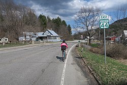
The unincorporated village of Brownsville is one of the few urban areas in the town and sits at the northwestern base of Mount Ascutney (elevation 3143 ft.). [5]

Demographics

Historical population
CensusPop.Note
1850 1,002
1860 924−7.8%
1870 708−23.4%
1880 690−2.5%
1890 570−17.4%
1900 513−10.0%
1910 56910.9%
1920 514−9.7%
1930 512−0.4%
1940 494−3.5%
1950 5042.0%
1960 5396.9%
1970 5715.9%
1980 76333.6%
1990 92321.0%
2000 1,06715.6%
2010 1,0993.0%
2020 1,34422.3%
U.S. Decennial Census [6]

At the 2000 census there were 1,067 people, 456 households, and 327 families in the town. The population density was 43.2 people per square mile (16.7/km2). There were 716 housing units at an average density of 29.0 per square mile (11.2/km2). The racial makeup of the town was 98.31% White, 0.28% African American, 0.28% Native American, 0.19% Asian, and 0.94% from two or more races. Hispanic or Latino of any race were 1.59%. [1]

Of the 456 households 28.9% had children under the age of 18 living with them, 63.4% were married couples living together, 5.5% had a female householder with no husband present, and 28.1% were non-families. 22.8% of households were one person and 7.0% were one person aged 65 or older. The average household size was 2.34 and the average family size was 2.74.

The age distribution was 21.6% under the age of 18, 5.0% from 18 to 24, 23.1% from 25 to 44, 34.9% from 45 to 64, and 15.6% 65 or older. The median age was 45 years. For every 100 females, there were 99.4 males. For every 100 females age 18 and over, there were 99.3 males.

The median household income was $54,792 and the median family income was $63,456. Males had a median income of $33,309 versus $35,750 for females. The per capita income for the town was $28,360. About 5.1% of families and 5.6% of the population were below the poverty line, including 7.7% of those under age 18 and 3.1% of those age 65 or over.

According to the NY Times, between 2010 and 2020, the town’s population jumped over 20 percent and median single-family home sale prices more than doubled, to $329,750. [7]

Economy

In 2010 the Ascutney Mountain Resort closed because of scant snow and mismanagement. In 2015, the town bought the failed ski area with the help of nonprofit Trust for Public Land and residents charted a sustainable, volunteer-driven path. [7]

Notable people

Related Research Articles

<span class="mw-page-title-main">Windsor County, Vermont</span> County in Vermont, United States

Windsor County is a county located in the U.S. state of Vermont. As of the 2020 census, the population was 57,753. The shire town is the town of Woodstock. The county's largest municipality is the town of Hartford.

<span class="mw-page-title-main">Bennington County, Vermont</span> County in Vermont, United States

Bennington County is a county in the U.S. state of Vermont. As of the 2020 census, the population was 37,347. The shire towns are jointly Bennington and Manchester, and the largest municipality is Bennington. The county was created in 1778.

<span class="mw-page-title-main">Bridport, Vermont</span> Town in Vermont, United States

Bridport is a town in Addison County, Vermont, United States. The town was founded October 9, 1761. The population was 1,225 at the 2020 census. The town is named after Bridport, a town in the West of the county of Dorset, in the United Kingdom.

<span class="mw-page-title-main">Goshen, Vermont</span> Town in Vermont, United States

Goshen is a town in Addison County, Vermont, United States. The population was 172 at the 2020 census.

<span class="mw-page-title-main">Kirby, Vermont</span> Town in Vermont, United States

Kirby is a town in Caledonia County, Vermont, United States. The population was 575 at the 2020 census.

<span class="mw-page-title-main">Lemington, Vermont</span> Town in Vermont, United States

Lemington is a town in Essex County, Vermont, United States. The population was 87 as of the 2020 census. It is part of the Berlin, NH–VT Micropolitan Statistical Area.

<span class="mw-page-title-main">Morristown, Vermont</span> Town in Vermont, United States

Morristown is a town in Lamoille County, Vermont, United States. As of the 2020 census, the population was 5,434. Morristown is the largest town by population in Lamoille County, and its central village of Morrisville serves as the county's main commercial center.

<span class="mw-page-title-main">Stratton, Vermont</span> Town in Vermont, United States

Stratton is a town in Windham County, Vermont, United States. The population was 440 at the 2020 census.

<span class="mw-page-title-main">Andover, Vermont</span> Town in Vermont, United States

Andover is a town in Windsor County, Vermont, United States. The population was 568 at the 2020 census.

<span class="mw-page-title-main">Baltimore, Vermont</span> Town in Vermont, United States

Baltimore is a town in Windsor County, Vermont, United States. The population was 229 at the 2020 census.

<span class="mw-page-title-main">Bridgewater, Vermont</span> Town in Vermont, United States

Bridgewater is a town in Windsor County, Vermont, United States. The population was 903 at the 2020 census. Bridgewater contains the hamlets of Bridgewater Village, Bridgewater Corners, West Bridgewater, and Bridgewater Center.

<span class="mw-page-title-main">Hartford, Vermont</span> Town in Vermont, United States

Hartford is a town in Windsor County, Vermont, United States. It is on the New Hampshire border, at the intersection of Interstates 89 and 91. It is the site of the confluence of the White and Connecticut rivers; the Ottauquechee River also flows through the town. The town is composed of five unincorporated villages: Hartford, Quechee, West Hartford, White River Junction and Wilder. As of the 2020 census, the population was 10,686.

<span class="mw-page-title-main">Plymouth, Vermont</span> Town in Vermont, United States

Plymouth is a town in Windsor County, Vermont, United States. The population was 641 at the 2020 census. Calvin Coolidge, the 30th President of the United States, was born and raised in Plymouth and is buried there as well. The State of Vermont Division for Historic Preservation owns and maintains the Coolidge Homestead and the village of Plymouth Notch.

<span class="mw-page-title-main">Reading, Vermont</span> Town in Vermont, United States

Reading is a town in Windsor County, Vermont, United States. The population was 687 at the 2020 census.

<span class="mw-page-title-main">Rochester, Vermont</span> Town in Vermont

Rochester is a town in Windsor County, Vermont, United States. The population was 1,099 at the 2020 census. The central village is delineated as the Rochester census-designated place.

<span class="mw-page-title-main">Stockbridge, Vermont</span> Town in Vermont, United States

Stockbridge is a town in Windsor County, Vermont, United States, which contains the village of Gaysville. The population was 718 at the 2020 census. Stockbridge was one of thirteen Vermont towns isolated by flooding caused by Hurricane Irene in 2011.

<span class="mw-page-title-main">Weston, Vermont</span> Town in Vermont, United States

Weston is a town in Windsor County, Vermont, United States. The population was 623 at the 2020 census. Home to the Weston Playhouse Theatre Company, it includes the villages of Weston and The Island.

<span class="mw-page-title-main">Windsor, Vermont</span> Town in Vermont, United States

Windsor is a town in Windsor County, Vermont, United States. As the "Birthplace of Vermont", the town is where the Constitution of Vermont was adopted in 1777, thus marking the founding of the Vermont Republic, a sovereign state until 1791, when Vermont joined the United States. Over much of its history, Windsor was home to a variety of manufacturing enterprises. Its population was 3,559 at the 2020 census.

<span class="mw-page-title-main">Ludlow (town), Vermont</span> Town in Vermont, United States

Ludlow is a town in Windsor County, Vermont, United States. The population was 2,172 at the 2020 census. Ludlow is the home of Okemo Mountain, a popular ski resort. Before becoming a ski destination, Ludlow was originally a mill town, and was the home of a General Electric plant until 1977. It was named after Ludlow, Massachusetts which is less than 100 miles away. There is also a village of Ludlow in the town.

<span class="mw-page-title-main">Windsor, Wisconsin</span> Village in Wisconsin, United States

Windsor is a village and former town in Dane County, Wisconsin. The population was 8,754 at the time of the 2020 census. The communities of Lake Windsor, Morrisonville, and Token Creek are located within the village. Windsor voted to incorporate as a village on November 3, 2015; prior to its incorporation, it was a town, and a portion of the town was a census-designated place. Windsor is a part of the Census Bureau's Madison metropolitan statistical area.

References

  1. 1 2 "U.S. Census website". United States Census Bureau . Retrieved January 31, 2008.
  2. "US Board on Geographic Names". United States Geological Survey. October 25, 2007. Retrieved January 31, 2008.
  3. "Census - Geography Profile: West Windsor town, Windsor County, Vermont". United States Census Bureau . Retrieved January 7, 2022.
  4. "Geographic Identifiers: 2010 Demographic Profile Data (G001): West Windsor town, Windsor County, Vermont". United States Census Bureau . Retrieved August 1, 2012.
  5. "West Windsor, Vermont". westwindsorvt.govoffice2.com. n.d. Retrieved February 2, 2022.
  6. "U.S. Decennial Census". United States Census Bureau. Retrieved May 16, 2015.
  7. 1 2 Goodman, David (February 1, 2022). "A Town That Saved a Mountain, and a Mountain That Saved a Town". The New York Times. ISSN   0362-4331 . Retrieved February 2, 2022.
  8. "Hon. Rollin Amsden". Vermont Journal. Windsor, VT. February 4, 1899. p. 8 via Newspapers.com.