Weymouth Street

Last updated

Weymouth Street
Weymouth Street Marylebone 2010 from Great Portland Street.jpg
Looking west down Weymouth Street in 2010
Length601 m (1,972 ft)
LocationWestminster, London
Postal code W1
Nearest Tube station Underground no-text.svg Great Portland Street; Oxford Circus; Regent's Park; Bond Street
Coordinates 51°31′16.03″N0°8′39.66″W / 51.5211194°N 0.1443500°W / 51.5211194; -0.1443500
East end Great Portland Street
West end Marylebone High Street
Construction
Completion1770

Weymouth Street lies in the Marylebone district of the City of Westminster and connects Marylebone High Street with Great Portland Street. The area was developed in the late 18th century by Henrietta Cavendish Holles and her husband Edward Harley, 2nd Earl of Oxford. [1] This part of Marylebone was noted to part of Manor of Tyburn and dates back to the year 1086.

Contents

History

Map clipping of Marylebone from around 1770 with Weymouth Street outlined in yellow Marylebone Map Clipping from Neuester Grundriss von London Westminster und Southwark 1770.jpg
Map clipping of Marylebone from around 1770 with Weymouth Street outlined in yellow

The area of Marylebone in which Weymouth Street is located originally belonged to the Manor of Tyburn which existed at the time of the Domesday Book (1086). [2] Weymouth Street was first laid out and built up in the late 1770s and early 1780s in line with the development of Harley Street, Portland Place and Great Portland Street. [3] Approximately a century later, the street was partially rebuilt and modernised mainly with neoclassical architecture. At the beginning of the 1900s, following lease expiries, large mansion blocks were developed near the main intersections of the street. [4] During the London Blitz of 1940–41, the street was struck twice by high explosive bombs. [5] Some of the original 18th century buildings survive to this day, for example at 45-49 Weymouth Street.

Location

Weymouth Street looking west towards Portland Place around 1905. Weymouth Street and Portland Place.jpg
Weymouth Street looking west towards Portland Place around 1905.

Weymouth Street lies in the Parish of St. Marylebone. [6] In administrative terms, the street lies within the City of Westminster's Marylebone High Street Ward as well as the Harley Street Conservation Area. [7] It is one of the four principal streets that cross eastern Marylebone and its renowned medical district in and around Harley Street.

Weymouth Street is part of a rectilinear grid and is crossed by Harley Street, Portland Place, and Hallam Street. The streets that join Weymouth Street on its north side are (east to west) Beaumont Mews, Beaumont Street, Upper Wimpole Street, and Devonshire Mews South. On its south side it is joined by Marylebone Street, Wesley Street, Westmoreland Street, Wimpole Street, Wimpole Mews, and Weymouth Mews.

Land ownership

Almost all of Weymouth Street is now part of the Howard de Walden Estate. Its eastern edge by Great Portland Street is controlled by the Langham Estate (on land once also part of the Howard de Walden Estate). [8]

Character

View east down Weymouth Street in 2010 Weymouth Street Marylebone London.jpg
View east down Weymouth Street in 2010

The street is known for its medical establishments, most notably The Harley Street Clinic built in 1935. Over time, larger institutional and residential buildings replaced earlier Georgian terraces at its intersections with Marylebone High Street, Portland Place and Great Portland Street. In contrast, central sections of the street still "retain much of their former domestic scale and character." [9] The street was lined with trees in 2010 as part of a neighbourhood community and stakeholder-based greening initiative. [10]

Notable residents

Marylebone extract from Charles Booth's 1889 London survey of the lives and occupations of area residents. Booth Povery Map - Weymouth New Cavendish Streets Extract 1888-9.jpg
Marylebone extract from Charles Booth's 1889 London survey of the lives and occupations of area residents.

Notable residents who have lived on Weymouth Street include Edward Foley (1747–1803), MP, the second son of Lord Foley, of Foley House [11] Ernest Vaughan, 4th Earl of Lisburne (no 40), James Butler, 1st Marquess of Ormonde (no 14), the portraitist Mary Grace, the actress Mary Wells (actress) (no 12), Michael Faraday (no 18), the writer Jane Marcet (no 49), Queen Marie-Louise Coidavid of the Kingdom of Haiti - the first Black monarchy established in the Western world - (also no 49) [12] and psychoanalyst Dr Estelle Maud Cole, journalist and broadcaster Gilbert Harding, the entertainer Hughie Green and the pathologist Professor Keith Simpson (the latter four all lived at 1 Weymouth Street). [13]

Listed buildings

22 Weymouth Street is Grade II listed 22 Weymouth Street.JPG
22 Weymouth Street is Grade II listed

There are a large number of listed buildings in Weymouth Street, all of which are Grade II. 69 Portland Place and 115 Harley Street, both of which are on the corner with Weymouth Street, are both Grade II*. 22 Weymouth Street (1934) is notable for its combination of traditional and modernist architectura l elements. [14] All of Weymouth Street lies within the Harley Street Conservation Area. [15]

Related Research Articles

<span class="mw-page-title-main">Fitzrovia</span> Human settlement in England

Fitzrovia is a district of central London, England, near the West End. The eastern part of area is in the London Borough of Camden, and the western in the City of Westminster. It has its roots in the Manor of Tottenham Court, and was urbanised in the 18th century. Its name was coined in the late 1930s by Tom Driberg.

<span class="mw-page-title-main">Metropolitan Borough of St Marylebone</span> Metropolitan borough of England

The Metropolitan Borough of St Marylebone was a metropolitan borough of the County of London from 1900 to 1965. It was based directly on the previously existing civil parish of St Marylebone, Middlesex, which was incorporated into the Metropolitan Board of Works area in 1855, retaining a parish vestry, and then became part of the County of London in 1889.
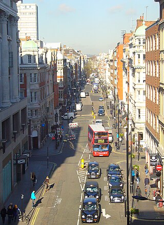
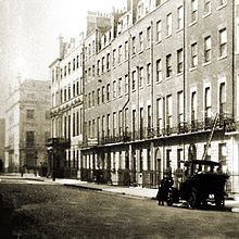
<span class="mw-page-title-main">Great Portland Street</span>

Great Portland Street in Marylebone, in the West End of London, links Oxford Street with the A501 Marylebone Road. A commercial street, it divides Fitzrovia, to the east, from Marylebone to the west. It delineates areas with contrasting identities, the west at strongest in grandiose Portland Place and Harley Street, the east at strongest in artists' and independent businesses of Fitzrovia. Administratively, the street lies in the City of Westminster's West End ward.

<span class="mw-page-title-main">Edward Harley, 2nd Earl of Oxford and Earl Mortimer</span> English Tory politician and peer

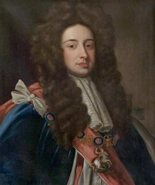
Edward Harley, 2nd Earl of Oxford and Earl Mortimer was an English Tory politician and peer who sat in the House of Commons of Great Britain from 1711 to 1724.

<span class="mw-page-title-main">Henrietta Harley, Countess of Oxford and Countess Mortimer</span> English noblewoman

Henrietta Harley, Countess of Oxford and Countess Mortimer was an English noblewoman, the only child and heiress of John Holles, 1st Duke of Newcastle and his wife, the former Lady Margaret Cavendish, daughter of Henry Cavendish, 2nd Duke of Newcastle-upon-Tyne.
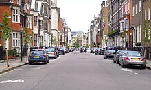
<span class="mw-page-title-main">Marylebone</span> Area in London, England

Marylebone is a district in the West End of London, in the City of Westminster. Oxford Street forms its southern boundary.

<span class="mw-page-title-main">Hallam Street</span>

Hallam Street is a road situated in the Parish of St Marylebone and London's West End. In administrative terms it lies within the City of Westminster's West End Ward as well as the Harley Street Conservation Area. Formerly named both Charlotte Street and Duke Street, it was renamed in the early 1900s after Henry Hallam (1777–1859), a noted historian who had been a local resident, and his son Arthur Henry Hallam (1811–1833), poet and the subject of Tennyson's elegy In Memoriam.

<span class="mw-page-title-main">Bolsover Street</span> Street in City of Westminster, United Kingdom

Bolsover Street is in the Parish of St Marylebone in London's West End. In administrative terms it lies within the City of Westminster's West End Ward and is partly in the Harley Street Conservation Area whilst also sitting on the edges of the Regents Park and East Marylebone Conservation Areas.

<span class="mw-page-title-main">Portland Place</span> Historic thoroughfare in the Marylebone district of London, England

Portland Place is a street in the Marylebone district of central London. Named after the 3rd Duke of Portland, the unusually wide street is home to the BBC's headquarters Broadcasting House, the Chinese and Polish embassies, the Royal Institute of British Architects and numerous residential mansion blocks.

<span class="mw-page-title-main">Howard de Walden Estate</span> London aristocratic property estate

The Howard de Walden Estate is a property estate in Marylebone, London, owned by the Howard de Walden family. As of 2020 the estate was reported to be worth £4.7 billion.

<span class="mw-page-title-main">Devonshire Street</span> Street in City of Westminster, London, England

Devonshire Street is a street in the City of Westminster, London. Adjoining Harley Street, it is known for the number of medical establishments it contains.

<span class="mw-page-title-main">Beaumont Street, London</span>

Beaumont Street is a street in the City of Westminster, London, that runs from Marylebone High Street in the north to the junction of Westmoreland Street and Weymouth Street in the south. The street is crossed midway by Devonshire Street and Clarkes Mews adjoins Beaumont Street on its eastern side at the southern end.

<span class="mw-page-title-main">Devonshire Close</span> Street in London

Devonshire Close, originally known as Devonshire Mews East, is a mews street in the City of Westminster, London, accessed from Devonshire Street. The Close is on a distinctive H plan with a middle downwards leg. It dates from the 1770s and originally contained a timber yard, stables, and accommodation for domestic servants who worked in the larger houses surrounding it. Access was limited to the north side in order to divert traffic from the grander north–south streets around it. The Close was gentrified in the 20th century and its buildings converted to mews houses which, like other mews in London, have become desirable in the modern era because they are quiet and have little traffic. The Close is now part of the Howard de Walden Estate.

<span class="mw-page-title-main">New Cavendish Street</span>

New Cavendish Street is a street in the City of Westminster, London, that runs from Marylebone High Street in the west to Cleveland Street in the east. The street was built in 1775 and named after the Cavendish family, who were related to the ground landlords, the Dukes of Portland.

<span class="mw-page-title-main">Marylebone Lane</span>

Marylebone Lane is one of the original streets of the Marylebone district of the City of Westminster, London. It runs from Oxford Street in the south to Marylebone High Street in the north, its winding shape following the course of the River Tyburn that it once ran alongside and pre-dating the grid pattern of the other streets in the area. Today the lane is largely composed of small shops, cafes and restaurants with some small apartment blocks. There are some larger commercial buildings at the southern end near Oxford Street.

<span class="mw-page-title-main">Henrietta Place</span>

Henrietta Place, originally known as Henrietta Street, is a street in Marylebone in the City of Westminster in central London that runs from Marylebone Lane in the east to Cavendish Square in the west. It is joined on the north side by Welbeck Street and Wimpole Street, and on the south side by Vere Street, Chapel Place, and Old Cavendish Street.

This is a list of the etymology of street names in the London district of Fitzrovia. The following utilises the generally accepted boundaries of Fitzrovia viz. Euston Road to the north, Tottenham Court Road to the east, Oxford Street to the south and Great Portland Street to the west.

This is a list of the etymology of street names in the London district of Marylebone. The following utilises the generally accepted boundaries of Marylebone viz. Marylebone Road to the north, Great Portland Street to the east, Marble Arch and Oxford Street to the south and Edgware Road to the west.

<span class="mw-page-title-main">Langham Estate</span> Property company of the United Kingdom

The Langham Estate is a property estate in Fitzrovia, London, and is owned by the Mount Eden Land Limited (Guernsey). The company controls 14 acres of real estate in central London. A third of its property portfolio was put up for sale in August 2023.

<span class="mw-page-title-main">Wimpole Mews</span> Street in Marylebone, London W1, England

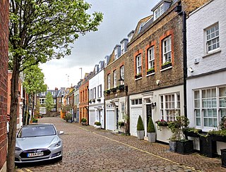
Wimpole Mews is a mews street in Marylebone, London W1, England. It is known for being a key location in the Profumo affair in the early 1960s.

References

  1. Weymouth Street was named after Lady Elizabeth Bentinck, Viscountess Weymouth, daughter of William Bentinck, 2nd Duke of Portland, who owned this estate. Sources: Bebbington, Gillian (1972). London Street Names. BT Batsford & Fairfield, Sheila (1983). The Streets Of London: A Dictionary Of The Names And Their Origins. Papermac
  2. Howard de Walden Estate (undated) The history of Marylebone: from rural manor to urban village, via pleasure gardens and Georgian developers Archived 2 September 2018 at the Wayback Machine , accessed 5 October 2016
  3. The western end of Weymouth Street was initially called Bowling Green Lane. It was built on the site of the bowling green of the old Marylebone Gardens which was a popular attraction until the late 18th century.
  4. Bartlett School of Architecture (2016 Draft) Chapter 15: Devonshire, Weymouth and New Cavendish Streets, Survey of London on South-East Marylebone, Vol. 51-2, pp.1-41.
  5. Source: Air Raid Warden Post D2 (Borough of St Marylebone) located in the Royal Institute of British Architects on Weymouth Street and Portland Place. Records of the explosion noted on Bombsight (2013) Map of the London WW2 bomb census between 7/10/1940 and 06/06/1941 Archived 9 May 2017 at the Wayback Machine , accessed 01/10/2016.
  6. Weymouth Street runs to the East and end at Great Portland Street and with it Marylebone's boundary with Fitzrovia.
  7. Westminster City Council (June 2008). "Marylebone Conservation Area Audit". Westminster City Council. Archived from the original on 5 March 2010. Retrieved 21 May 2010.
  8. The Langham Estate (undated) The Langham Estate Overview Archived 6 September 2018 at the Wayback Machine Accessed 05/10/2016
  9. The Bartlett School of Architecture (2016) Chapter 15: Devonshire, Weymouth and New Cavendish Streets, Survey of London on South-East Marylebone [Draft], Vol. 51-2, pp.1-41.
  10. W1W Tree Planting Initiative (2010) Barbara Windsor completes the planting of new trees on Weymouth Street Archived 14 October 2016 at the Wayback Machine , 4 November 2010, accessed 1 October 2016
  11. Lord Foley was cousin to Edward Harley, 2nd Earl of Oxford. Source: M. Todd (undated) Broadcasting House from the mid-18th century Archived 4 March 2016 at the Wayback Machine , Accessed 08/10/2016
  12. "Caribbean Queen gets London blue plaque". Voice Online. 7 February 2022. Retrieved 18 March 2022.
  13. Bartlett School of Architecture (2016) Survey of London on South-East Marylebone, Vol. 51-2, pp.2-4.
  14. Historic England. "22, Weymouth Street (1393317)". National Heritage List for England . Retrieved 6 October 2016.
  15. Westminster City Council (September 2007). "Harley Street Conservation Area Map" (PDF). Westminster City Council. Archived (PDF) from the original on 28 July 2011. Retrieved 21 May 2010.
  16. "Barbara Windsor completes the planting of new trees on Weymouth Street". WordPress.com. 4 November 2010. Retrieved 7 June 2019.