Winulta, South Australia

Last updated

Winulta
South Australia
Australia South Australia Yorke Peninsula Council location map.svg
Red pog.svg
Winulta
Coordinates 34°17′S137°52′E / 34.28°S 137.86°E / -34.28; 137.86 Coordinates: 34°17′S137°52′E / 34.28°S 137.86°E / -34.28; 137.86
Population 470 (shared with other localities in the ‘State Suburb of Price’) (2011 census) [1]
Postcode(s) 5570
LGA(s) Yorke Peninsula Council
Region Yorke and Mid North [2]
County Daly [3]
Fergusson [3]
State electorate(s) Narungga [4]
Federal Division(s) Grey [5]
Localities around Winulta:
Arthurton Arthurton
Clinton Centre
Clinton Centre
Arthurton
Maitland
Winulta Price
Petersville Petersville
Dowlingville
Dowlingville
Footnotes Adjoining localities [3]

Winulta was a town in the Australian state of South Australia on northern Yorke Peninsula around 10 km from Clinton on the Clinton-Maitland road. It was first settled for farming around 1876. The earliest farmers were William Short, Thomas Kenny and John Sharrad. [6]

Australia Country in Oceania

Australia, officially the Commonwealth of Australia, is a sovereign country comprising the mainland of the Australian continent, the island of Tasmania and numerous smaller islands. It is the largest country in Oceania and the world's sixth-largest country by total area. The neighbouring countries are Papua New Guinea, Indonesia and East Timor to the north; the Solomon Islands and Vanuatu to the north-east; and New Zealand to the south-east. The population of 25 million is highly urbanised and heavily concentrated on the eastern seaboard. Australia's capital is Canberra, and its largest city is Sydney. The country's other major metropolitan areas are Melbourne, Brisbane, Perth and Adelaide.

South Australia State of Australia

South Australia is a state in the southern central part of Australia. It covers some of the most arid parts of the country. With a total land area of 983,482 square kilometres (379,725 sq mi), it is the fourth-largest of Australia's states and territories by area, and fifth largest by population. It has a total of 1.7 million people, and its population is the second most highly centralised in Australia, after Western Australia, with more than 77 percent of South Australians living in the capital, Adelaide, or its environs. Other population centres in the state are relatively small; Mount Gambier, the second largest centre, has a population of 28,684.

Yorke Peninsula Region in South Australia

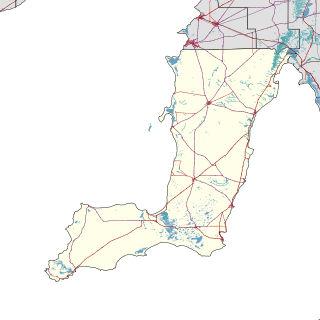
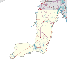
The Yorke Peninsula is a peninsula located north-west and west of Adelaide in South Australia, between Spencer Gulf on the west and Gulf St Vincent on the east. The peninsula is separated from Kangaroo Island to the south by Investigator Strait. The most populous town in the region is Kadina.

Contents

The nearby "Hundred of Tiparra School" opened in 1884, was renamed "Winulta School" in 1891 and closed in 1950. [7]

Winulta is located within the federal division of Grey, the state electoral district of Narungga and the local government area of the Yorke Peninsula Council. [5] [4] [3]

Division of Grey Australian federal electoral division

The Division of Grey is an Australian electoral division in South Australia. The division was one of the seven established when the former Division of South Australia was redistributed on 2 October 1903 and is named for Sir George Grey, who was Governor of South Australia from 1841 to 1845.

Electoral district of Narungga state electoral district of South Australia

Narungga is a single-member electoral district for the South Australian House of Assembly. It was created by the redistribution of 2016, and was contested for the first time at the 2018 state election. It is named for the Narungga people who are the traditional owners of the lands in most of the electorate. It is one of only two state districts named after South Australia's indigenous people.

Yorke Peninsula Council Local government area in South Australia

The Yorke Peninsula Council is a local government area in South Australia. Its boundaries include most of the Yorke Peninsula. The council seat is at Maitland; the council also maintains branch offices at Minlaton, Warooka and Yorketown.

See also

Related Research Articles

Minlaton, South Australia Town in South Australia

Minlaton is a town in central Yorke Peninsula, South Australia. At the 2016 census, Minlaton had a population of 800. It is known as the "Barley capital of the world", due to the rich Barley production in the region.

Yorketown, South Australia Town in South Australia

Yorketown is a town and a locality in the Australian state of South Australia located in the southern Yorke Peninsula about 91 kilometres (57 mi) west of the state capital of Adelaide and about 70 kilometres (43 mi) south of the municipal seat of Maitland. At the 2016 census, the locality had a population of 969 of which 642 lived in its town centre.

Marion Bay, South Australia Town in South Australia

Marion Bay is a small township in the Australian state of South Australia at the southern tip of the Yorke Peninsula. At the 2016 census, Marion Bay had a population of 172. Historically, it formed part of Narungga lands.

Balgowan, South Australia Town in South Australia

Balgowan is a small coastal town on the west coast of South Australia's Yorke Peninsula. It is located approximately 20 kilometres west of Maitland. Like other towns on popular with tourists on Yorke Peninsula, it has a large number of shacks, holiday houses, caravan facilities and a boat ramp. The population generally increases during peak holiday periods.

Clinton, South Australia Town in South Australia

Clinton is a locality in the Australian state of South Australia located on the east coast of Yorke Peninsula overlooking the north west head of Gulf St Vincent about 101 kilometres (63 mi) west of the state capital of Adelaide and about 36 kilometres (22 mi) north-east of the municipal seat of Maitland.

Arthurton Town in South Australia

Arthurton is a settlement in the Australian state of South Australia. At the 2006 census, Arthurton had a population of 295.

Corny Point, South Australia Town in South Australia

Corny Point is a locality in the Australian state of South Australia located about 7.5 kilometres to the east of the north-western tip of the Yorke Peninsula. It was named after the nearby headland, Corny Point.

Weetulta, South Australia Town in South Australia

Weetulta is a locality in the Australian state of South Australia located on the Yorke Peninsula. The locality is in the Yorke Peninsula Council local government area, 162 kilometres (101 mi) west of the state capital, Adelaide.

Sultana Point, South Australia Suburb of Yorke Peninsula Council , South Australia

Sultana Point is a locality in the Australian state of South Australia located on the Yorke Peninsula immediately adjoining the western head of Gulf St Vincent about 80 kilometres west of the state capital of Adelaide.

Agery, South Australia South Australia

Agery is a locality in the Australian state of South Australia located on Yorke Peninsula. It is situated 17 km south-east of Moonta. Its name comes from the Aboriginal word ngadjali meaning "pipe clay".

Kainton, South Australia Town in South Australia

Kainton is a small town in the Australian state of South Australia situated about 10 km south of Paskeville in the upper Yorke Peninsula.

Sunnyvale, South Australia Town in South Australia

Sunnyvale or Sunny Vale is a locality and former small town in the Australian state of South Australia situated about 10 km south west of Kainton in the upper Yorke Peninsula, consisting mostly of a schoolhouse and Methodist church. Farms nearby were owned by the Lamshed families.

Port Arthur, South Australia Town in South Australia

Port Arthur is a locality in the Australian state of South Australia located on the Yorke Peninsula at the northern end of Gulf St Vincent about 100 kilometres north west of the state capital of Adelaide and about 9 kilometres north of the town of Port Wakefield.

Honiton, South Australia South Australia

Honiton is a locality in the Australian state of South Australia located on the south coast of Yorke Peninsula immediately adjoining Investigator Strait about 89 kilometres west of the state capital of Adelaide and about 5 kilometres west of the Edithburgh town centre.

Foul Bay, South Australia South Australia

Foul Bay is a locality in the Australian state of South Australia located on the south coast of Yorke Peninsula immediately adjoining Investigator Strait about 130 kilometres west of the state capital of Adelaide.

Nalyappa, South Australia Suburb of Yorke Peninsula Council , South Australia

Nalyappa is a locality in the Australian state of South Australia located on the west coast of Yorke Peninsula immediately adjoining Spencer Gulf about 128 kilometres north-west of the state capital of Adelaide.

Chinaman Wells, South Australia Suburb of Yorke Peninsula Council , South Australia

Chinaman Wells is a locality in the Australian state of South Australia located on the west coast of Yorke Peninsula immediately adjoining Spencer Gulf about 119 kilometres north-west of the state capital of Adelaide.

Black Point, South Australia Suburb of Yorke Peninsula Council, South Australia

Black Point is a locality in the Australian state of South Australia located on the east coast of Yorke Peninsula about 72 kilometres northwest of the state capital of Adelaide.

Bluff Beach, South Australia Suburb of Yorke Peninsula Council, South Australia

Bluff Beach is a locality in the Australian state of South Australia located on the west coast of Yorke Peninsula overlooking Hardwicke Bay about 104 kilometres west of the state capital of Adelaide. Farms near by were owned by Edwards families, who were also key pioneers in the development of Bluff Beach.

Clinton Centre, South Australia Suburb of Yorke Peninsula Council, South Australia

Clinton Centre is a locality in the Australian state of South Australia located on the northern end of Yorke Peninsula about 99 kilometres north-west of the state capital of Adelaide and about 27 kilometres north-east of the municipal seat in Maitland.

References

  1. Australian Bureau of Statistics (31 October 2012). "Price )". 2011 Census QuickStats. Retrieved 7 May 2017. Blue pencil.svg
  2. "Yorke and Mid North SA Government region" (PDF). The Government of South Australia. Retrieved 17 April 2017.
  3. 1 2 3 4 "Search result(s) for Winulta (LOCB) (Record No. SA0026874) with the following layers being selected - "Suburbs and Localities", "Counties", "Hundreds", "Place names (gazetteer)" and "Road labels"". Property Location Browser. Government of South Australia. Retrieved 28 April 2017.
  4. 1 2 Narungga (Map). Electoral District Boundaries Commission. 2016. Retrieved 1 March 2018.
  5. 1 2 "Federal electoral division of Grey" (PDF). Australian Electoral Commission. Retrieved 24 July 2015.
  6. "Y.P. Octogenarian Honored". The Kadina and Wallaroo Times (SA : 1888 - 1954) . SA: National Library of Australia. 30 October 1926. p. 2. Retrieved 25 October 2015.
  7. "Manning Dictionary of South Australian Placenames". State Library of South Australia. Retrieved 25 October 2015.