Yaquina Bay Bridge | |
---|---|
![]() | |
Coordinates | 44°37′21″N124°03′25″W / 44.62257°N 124.05682°W |
Carries | ![]() |
Crosses | Yaquina Bay |
Locale | Newport, Oregon |
Maintained by | ODOT |
Characteristics | |
Total length | 3,223 feet (982 m) |
Longest span | 600 feet (180 m) |
Clearance below | 133 feet (41 m) |
History | |
Opened | September 6, 1936 [1] |
Yaquina Bay Bridge No. 01820 | |
Location | OR Coast 9, US101, MP141.67, Newport, Oregon |
Coordinates | 44°37′19.45″N124°3′22.9″W / 44.6220694°N 124.056361°W |
Area | 4.4 acres (1.8 ha) |
Built | 1936 |
Architect | Conde B. McCullough, et al. |
MPS | McCullough, C. B., Major Oregon Coast Highway Bridges MPS |
NRHP reference No. | 05000821 [2] |
Added to NRHP | August 5, 2005 |
Location | |
![]() |
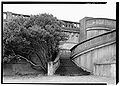
The Yaquina Bay Bridge is an arch bridge that spans Yaquina Bay south of Newport, Oregon. It is one of the most recognizable of the U.S. Route 101 bridges designed by Conde McCullough and one of eleven major bridges on the Oregon Coast Highway designed by him. [3] It superseded the last ferry crossing on the highway.
Work on the Yaquina Bay Bridge began on August 1, 1934. The bridge opened on September 6, 1936, [1] at a cost of $1,301,016 ($27,440,000 in today's dollars). A total of 220 people worked to pour 30,000 cubic yards (23,000 m³) of concrete and fabricate 3,100 tons of steel. The contractors were the Gilpin Construction Company of Portland, Oregon, and the General Construction Company of Seattle, Washington. The main arch was built in toward the center from the anchorages, using tiebacks to support the arch until it could be closed. The piers are supported by timber pilings driven to a depth of about 70 feet (21 m) below sea level. The project received funding from the Public Works Administration. [4]
The 600-foot (180 m) main span is a semi-through arch, with the roadway penetrating the middle of the arch. It is flanked by identical 350-foot (110 m) steel deck arches, with five concrete deck arches of diminishing size extending to the south landing. The main arch is marked by tall obelisk-like concrete finials on the main piers, with smaller decorative elements marking the ends of the flanking spans. [5] [6] The arches are built as box girders. The two-lane road is 27 feet (8.2 m) wide, running inside the arches with two 3.5-foot (1.1 m) sidewalks. The main arch is 246 feet (75 m) above sea level at its crown. Overall length of the bridge is 3,260 feet (990 m), including concrete deck-girder approach spans. The navigable channel measures 400 feet (120 m) wide by 133 feet (41 m) high. [4]
The bridge uses Art Deco and Art Moderne design motifs as well as forms borrowed from Gothic architecture. The Gothic influence is seen in the balustrade, which features small pointed arches, and in the arches of the side span piers. The ends of the bridge are augmented by pedestrian plazas that afford a view of the bridge and provide access to the parks at the landings by stairways. Pedestals were provided for proposed sculptures of seals, but the statues were never executed.
The Yaquina Bay Bridge was placed on the National Register of Historic Places on August 5, 2005. [2]
The Oregon City Bridge, also known as the Arch Bridge, is a steel through arch bridge spanning the Willamette River between Oregon City and West Linn, Oregon, United States. Completed in 1922, it is listed on the National Register of Historic Places. It was built and is owned by the Oregon Department of Transportation (ODOT) as part of Oregon Route 43 and is the third-southernmost Willamette bridge in the Portland metropolitan area, after the Boone Bridge in Wilsonville and the Oregon 219 bridge near Newberg.
The Alsea Bay Bridge is a concrete arch bridge that spans the Alsea Bay on U.S. Route 101 (US 101) near Waldport, Oregon.
The Conde B. McCullough Memorial Bridge, is a cantilever bridge that spans the Coos Bay on U.S. Route 101 near North Bend, Oregon. When completed in 1936 it was named the North Bend Bridge. In 1947 it was renamed in honor of Conde B. McCullough who died May 5, 1946. This and 10 other major bridges on the Oregon Coast Highway were designed under his supervision.
The Siuslaw River Bridge is a bascule bridge that spans the Siuslaw River on U.S. Route 101 in Florence, Oregon. It was designed by Conde McCullough, built by the Mercer-Fraser Company of Eureka, California, and funded by the Federal Emergency Administration of Public Works. It opened in 1936.
The Big Creek Bridge is a bowstring arch bridge that spans Big Creek on U.S. Route 101 in Lane County, Oregon. It was designed by Conde McCullough and opened in 1931.
The Umpqua River Bridge is a swing-span bridge that spans the Umpqua River in Reedsport, Oregon. It consists of a central swing span flanked by two reinforced concrete arches on each end. The swing span was necessary to accommodate tall sailing vessels which were common on the Umpqua River. The final cost of the bridge was $510,500.
The Crooked River High Bridge is a steel arch bridge that spans the Crooked River gorge in Jefferson County, Oregon. The bridge was designed by Conde McCullough and was completed in 1926. Shortly after its completion, Oregon State Highway Division created the Peter Skene Ogden Park just to the south of the bridge.
Cape Creek Bridge is an arch bridge that spans Cape Creek in Lane County, Oregon, United States. The bridge carries U.S. Route 101. Opened in 1932, it was designed by noted bridge engineer Conde McCullough and built of reinforced concrete by John K. Holt. The total length of the bridge is 619 feet (189 m), with a main span of 220 feet (67 m). The bridge resembles a Roman aqueduct, with a single parabolic arch that spans half its length. It was listed as Cape Creek Bridge No. 01113 on the National Register of Historic Places in 2005, as part of the C. B. McCullough Major Oregon Coast Highway Bridges MPS.
The Isaac Lee Patterson Bridge, also known as the Rogue River Bridge and the Isaac Lee Patterson Memorial Bridge, is a concrete arch bridge that spans the Rogue River in Curry County, Oregon. The bridge was constructed by the Mercer Fraser Company of Eureka, California. The bridge carries U.S. Route 101 across the river, near the point where the river empties into the Pacific Ocean, and connects the towns of Gold Beach and Wedderburn. A bridge with strong Art Deco influences, the Isaac Lee Patterson Bridge is a prominent example of the designs of the Oregon bridge designer and highway engineer Conde McCullough. It was designated a National Historic Civil Engineering Landmark by the American Society of Civil Engineers in 1982. It is part of a series of notable bridges designed by McCullough for the Oregon Coast Highway in the 1930s. It was placed on the National Register of Historic Places in 2005.
Wilson River Bridge, also known as Wilson River Bridge at Tillamook or Wilson River Bridge No. 01499, is a bridge near Tillamook, Oregon, United States. The 1931 bridge was designed by Conde McCullough in the Classical Revival and Art Deco styles. It covers a span of 180 feet (55 m) and brings coastal U.S. Route 101 (US 101) over the Wilson River.
The Old Youngs Bay Bridge is a bascule bridge across Youngs Bay in Astoria, Oregon, completed in 1921. Conde McCullough was responsible for designing this bridge, his first for Oregon.
Bridge No. 1132 is an open-spandrel concrete arch bridge carrying the two-lane Connecticut Route 80 across the Hammonasset River, between Killingworth and Madison, Connecticut. Built in 1934, it is one of a small number of open-spandrel concrete bridges in the state, and was noted for its aesthetics at the time of its construction. It was listed on the National Register of Historic Places in 2004.
The Canyon Falls Bridge is a bridge located on US Highway 41 (US 41) over the Sturgeon River in L'Anse Township, Michigan. It was listed on the National Register of Historic Places in 1999.
The Main Street–Black River Bridge is a bridge located on Main Street over the Black River in Ramsay, Bessemer Township, Michigan, USA. It was listed on the National Register of Historic Places in 1999.
The Depoe Bay Bridge is one of a series of significant bridges along the Oregon Coast Highway. The concrete arch bridge spans the mouth of Depoe Bay at milepost 127.61 with a 150-foot (46 m) main span, and a total length of 312 feet (95 m). The bridge's designer was Conde McCullough who designed all of the 1920s bridges on the highway. The original bridge, completed in 1927, was only 18 feet (5.5 m) wide from curb to curb with no sidewalks, and was widened in 1940 with a similar arched concrete bridge immediately adjacent to the original. The added structure is sympathetic to the original and is included in the National Register of Historic Places listing.
Rocky Creek Bridge No. 01089, also known as Ben Jones Bridge, is a concrete highway bridge spanning Rocky Creek along the Pacific Ocean coast of the U.S. state of Oregon. The bridge crosses a gorge near the creek's mouth, about 2 miles (3 km) south of Depoe Bay in Lincoln County. Built in 1927, the bridge originally carried U.S. Route 101 over the creek. After a stretch of the highway was relocated to make it straighter, the abandoned piece of the old highway became Otter Crest Loop Road, a local road west of the new highway.
The Big Piney Creek Bridge is a historic bridge, carrying Arkansas Highway 123 across Big Piney Creek in Ozark-St. Francis National Forest, northeast of Hagarville, Arkansas. Its main span is a Warren through truss structure, 141 feet (43 m) in length, with steel deck girder approach spans giving the bridge a total length of 461 feet (141 m). The trusses are mounted on concrete piers. The bridge was built in 1931, during a period of financial hardship, and was for economic reasons built with a single-lane 12-foot (3.7 m) roadway.
The Hassayampa Bridge is a bridge spanning the Hassayampa River in Hassayampa, Arizona, located in Maricopa County. The bridge was completed in 1929 and was listed on the National Register of Historic Places in 1988. The bridge was scheduled for demolition in 1983.
The Burwell Bridge was a historic bridge on the northern edge of Burwell in Garfield County, Nebraska which was built in 1940–41. It was a steel girder bridge that brings Nebraska Highway 11 over the North Loup River. It is also known as the North Loup River Bridge and denoted as NEHBS Number GFOO-13. It was listed on the National Register of Historic Places in 1992, and was delisted in 2019.
The West Fifth Street Bridge is a historic cantilever concrete girder bridge in downtown Austin, Texas. Built in 1931, the bridge carries Fifth Street across Shoal Creek to link central Austin with neighborhoods that were then the city's western suburbs. It is one of only a handful of curved cantilever girder bridges in Texas, built as part of the city's 1928 master plan for urban development and beautification. The bridge was added to the National Register of Historic Places in 2019.