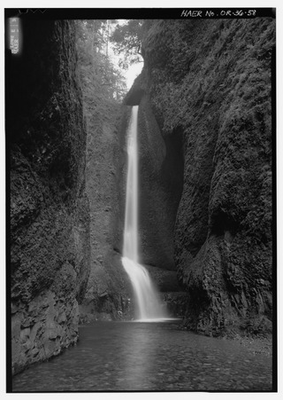
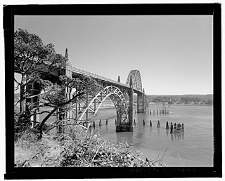
Survey No. Name (as assigned by HAER) Status Type [2] Built Documented Carries Crosses Location County Coordinates OR-7 Burlington Northern Railroad Bridge Replaced Swing span 1908 1985 Burlington Northern Railroad Willamette River Portland Multnomah 45°34′38″N 122°44′48″W / 45.57722°N 122.74667°W / 45.57722; -122.74667 (Burlington Northern Railroad Bridge ) OR-8 Jordan Covered Bridge Replaced Howe truss 1937 1985 CR 829 Thomas Creek Scio Linn 44°43′35″N 122°41′56″W / 44.72639°N 122.69889°W / 44.72639; -122.69889 (Jordan Covered Bridge ) OR-10 Siuslaw River Bridge [lower-alpha 1] Replaced Warren truss 1912 1986 CR 5018 (Richardson Road) Siuslaw River Walton Lane 44°00′21″N 123°42′06″W / 44.00583°N 123.70167°W / 44.00583; -123.70167 (Siuslaw River Bridge ) OR-13 Four Mile Bridge Replaced Timber arch 1943 1988 Copper Creek Road Molalla River , Table Rock Fork Molalla Clackamas 44°57′42″N 122°24′35″W / 44.96167°N 122.40972°W / 44.96167; -122.40972 (Four Mile Bridge ) OR-14 Alsea Bay Bridge [lower-alpha 1] Replaced Reinforced concrete through arch 1936 1990 US 101 (Oregon Coast Highway) Alsea Bay Waldport Lincoln 44°25′55″N 124°04′14″W / 44.43194°N 124.07056°W / 44.43194; -124.07056 (Alsea Bay Bridge ) OR-15 Horse Creek Covered Bridge Demolished Howe truss 1930 1987 Horse Creek Road Horse Creek McKenzie Bridge Lane 43°01′24″N 123°17′23″W / 43.02333°N 123.28972°W / 43.02333; -123.28972 (Horse Creek Covered Bridge ) OR-19 Hayden Bridge Extant Whipple truss 1882 1990 Southern Pacific Railroad McKenzie River Springfield Lane 44°04′19″N 122°57′51″W / 44.07194°N 122.96417°W / 44.07194; -122.96417 (Hayden Bridge ) OR-20 Hawthorne Bridge [lower-alpha 2] Extant Vertical-lift bridge 1910 1990 Hawthorne Boulevard and Madison Street Willamette River Portland Multnomah 45°30′48″N 122°40′15″W / 45.51333°N 122.67083°W / 45.51333; -122.67083 (Hawthorne Bridge ) OR-21 Steel Bridge [lower-alpha 2] Extant Vertical-lift bridge 1912 1990 OR 99 Willamette River Portland Multnomah 45°31′39″N 122°40′09″W / 45.52750°N 122.66917°W / 45.52750; -122.66917 (Steel Bridge ) OR-22 Broadway Bridge [lower-alpha 2] Extant Rolling lift (Rall) bascule 1913 1990 Broadway Street Willamette River Portland Multnomah 45°31′55″N 122°40′26″W / 45.53194°N 122.67389°W / 45.53194; -122.67389 (Broadway Bridge ) OR-23 Shepperd's Dell Bridge [lower-alpha 3] Extant Reinforced concrete open-spandrel arch 1914 1990 Columbia River Highway Young Creek Latourell Multnomah 45°32′48″N 122°11′52″W / 45.54667°N 122.19778°W / 45.54667; -122.19778 (Shepperds Dell Bridge ) OR-24 Latourell Creek Bridge [lower-alpha 3] Extant Reinforced concrete open-spandrel arch 1914 1990 Columbia River Highway Latourell Creek Latourell Multnomah 45°32′19″N 122°13′08″W / 45.53861°N 122.21889°W / 45.53861; -122.21889 (Latourell Creek Bridge ) OR-26 Grave Creek Bridge Extant Howe truss 1920 2000 Sunny Valley Loop Road Grave Creek Sunny Valley Josephine 42°38′10″N 123°22′39″W / 42.63611°N 123.37750°W / 42.63611; -123.37750 (Grave Creek Bridge ) OR-27 Mill Creek Bridge [lower-alpha 1] Replaced Reinforced concrete girder 1920 1990 West Sixth Street Mill Creek The Dalles Wasco 45°36′16″N 121°11′19″W / 45.60444°N 121.18861°W / 45.60444; -121.18861 (Mill Creek Bridge ) OR-29 Rock Point Arch Bridge [lower-alpha 1] Extant Reinforced concrete open-spandrel arch 1920 1990 OR 99 / OR 234 (Sams Valley Highway No. 271) Rogue River and Old Pacific Highway Gold Hill Jackson 42°25′57″N 123°05′25″W / 42.43250°N 123.09028°W / 42.43250; -123.09028 (Rock Point Arch Bridge ) OR-30 Dry Canyon Creek Bridge [lower-alpha 1] Extant Reinforced concrete open-spandrel arch 1921 1990 US 30 (Mosier–The Dalles Highway No. 292) Dry Canyon Creek Rowena Wasco 45°40′53″N 121°18′13″W / 45.68139°N 121.30361°W / 45.68139; -121.30361 (Dry Canyon Creek Bridge ) OR-31 Willamette River Bridge [lower-alpha 1] Extant Reinforced concrete through arch 1922 1990 OR 43 (Oswego Highway No. 3) Willamette River Oregon City and West Linn Clackamas 45°21′33″N 122°36′35″W / 45.35917°N 122.60972°W / 45.35917; -122.60972 (Willamette River Bridge ) OR-32 Coquille River Bridge [lower-alpha 1] Demolished Swing span 1922 1990 OR 42 (Coquille–Bandon Highway No. 244) Coquille River Coquille Coos 43°10′25″N 124°11′35″W / 43.17361°N 124.19306°W / 43.17361; -124.19306 (Coquille River Bridge ) OR-33 Winchester Bridge [lower-alpha 1] Extant Reinforced concrete open-spandrel arch 1924 1990 OR 99 (Pacific Highway) North Umpqua River Winchester Douglas 43°16′59″N 123°21′19″W / 43.28306°N 123.35528°W / 43.28306; -123.35528 (Winchester Bridge ) OR-34 Albany Bridge [lower-alpha 1] Extant Parker truss 1926 1990 US 20 (Albany–Corvallis Highway No. 31) eastbound Willamette River Albany Linn 44°38′21″N 123°06′24″W / 44.63917°N 123.10667°W / 44.63917; -123.10667 (Albany Bridge ) OR-35 Crooked River High Bridge [lower-alpha 1] Extant Steel hinged arch 1926 1990 US 97 (The Dalles–California Highway No. 4) Crooked River Terrebonne Deschutes 44°23′33″N 121°11′39″W / 44.39250°N 121.19417°W / 44.39250; -121.19417 (Crooked River High Bridge ) OR-36-A Historic Columbia River Highway, Sandy River Bridge at Troutdale Extant Pratt truss 1912 1994 Historic Columbia River Highway Sandy River Troutdale Multnomah 45°32′18″N 122°22′36″W / 45.53833°N 122.37667°W / 45.53833; -122.37667 (Historic Columbia River Highway, Sandy River Bridge at Troutdale ) OR-36-B Historic Columbia River Highway, Stark Street Bridge Extant Parker truss 1914 1994 Southeast Stark Street Sandy River Troutdale Multnomah 45°30′55″N 122°21′41″W / 45.51528°N 122.36139°W / 45.51528; -122.36139 (Historic Columbia River Highway, Stark Street Bridge ) OR-36-C Historic Columbia River Highway, Crown Point Viaduct Extant Reinforced concrete cast-in-place slab 1914 1994 Historic Columbia River Highway Crown Point Troutdale Multnomah 45°32′22″N 122°14′39″W / 45.53944°N 122.24417°W / 45.53944; -122.24417 (Historic Columbia River Highway, Crown Point Viaduct ) OR-36-E Historic Columbia River Highway, Bridal Veil Falls Bridge Extant Reinforced concrete girder 1914 1995 Historic Columbia River Highway Bridal Veil Falls Troutdale Multnomah 45°33′15″N 122°10′49″W / 45.55417°N 122.18028°W / 45.55417; -122.18028 (Historic Columbia River Highway, Bridal Veil Falls Bridge ) OR-36-F Historic Columbia River Highway, Wahkeena Falls Footbridge Extant Reinforced concrete closed-spandrel arch 1914 1994 Historic Columbia River Highway Wahkeena Falls Troutdale Multnomah 45°34′28″N 122°07′39″W / 45.57444°N 122.12750°W / 45.57444; -122.12750 (Historic Columbia River Highway, Wahkeena Falls Footbridge ) OR-36-G Historic Columbia River Highway, West Multnomah Falls Viaduct Extant Reinforced concrete cast-in-place slab 1914 1995 Historic Columbia River Highway Oregon Railroad and Navigation Company Troutdale Multnomah 45°34′38″N 122°07′17″W / 45.57722°N 122.12139°W / 45.57722; -122.12139 (Historic Columbia River Highway, West Multnomah Falls Viaduct ) OR-36-H Historic Columbia River Highway, Multnomah Creek Bridge Extant Reinforced concrete closed-spandrel arch 1914 1994 Historic Columbia River Highway Multnomah Falls Troutdale Multnomah 45°34′40″N 122°07′01″W / 45.57778°N 122.11694°W / 45.57778; -122.11694 (Historic Columbia River Highway, Multnomah Creek Bridge ) OR-36-I Historic Columbia River Highway, Multnomah Falls Footbridge Extant Reinforced concrete open-spandrel arch 1914 1994 Historic Columbia River Highway Multnomah Falls Troutdale Multnomah 45°34′36″N 122°06′58″W / 45.57667°N 122.11611°W / 45.57667; -122.11611 (Historic Columbia River Highway, Multnomah Falls Footbridge ) OR-36-J Historic Columbia River Highway, East Multnomah Falls Viaduct Extant Reinforced concrete cast-in-place slab 1914 1994 Historic Columbia River Highway Oregon Railroad and Navigation Company Troutdale Multnomah 45°34′45″N 122°06′44″W / 45.57917°N 122.11222°W / 45.57917; -122.11222 (Historic Columbia River Highway, East Multnomah Falls Viaduct ) OR-36-K Historic Columbia River Highway, Oneonta Gorge Creek Bridge Extant Reinforced concrete cast-in-place slab 1914 1995 Historic Columbia River Highway Oneonta Gorge Troutdale Multnomah 45°35′23″N 122°04′31″W / 45.58972°N 122.07528°W / 45.58972; -122.07528 (Historic Columbia River Highway, Oneonta Gorge Creek Bridge ) OR-36-M Historic Columbia River Highway, Horsetail Falls Bridge Extant Reinforced concrete cast-in-place slab 1914 1995 Historic Columbia River Highway Horsetail Falls Troutdale Multnomah 45°35′25″N 122°04′09″W / 45.59028°N 122.06917°W / 45.59028; -122.06917 (Historic Columbia River Highway, Horsetail Falls Bridge ) OR-36-N Historic Columbia River Highway, Toothrock and Eagle Creek Viaducts Extant Reinforced concrete cast-in-place slab 1915 1995 Historic Columbia River Highway Eagle Creek Troutdale Multnomah 45°38′19″N 121°56′03″W / 45.63861°N 121.93417°W / 45.63861; -121.93417 (Historic Columbia River Highway, Toothrock and Eagle Creek Viaducts ) OR-36-P Historic Columbia River Highway, Eagle Creek Bridge Extant Reinforced concrete closed-spandrel arch 1915 1994 Historic Columbia River Highway Eagle Creek Troutdale Multnomah 45°38′28″N 121°55′42″W / 45.64111°N 121.92833°W / 45.64111; -121.92833 (Historic Columbia River Highway, Eagle Creek Bridge ) OR-36-R Historic Columbia River Highway, Mitchell Point Tunnel and Viaduct Demolished Reinforced concrete cast-in-place slab 1915 1995 Historic Columbia River Highway Lower Mitchell Point Troutdale Multnomah 45°42′15″N 121°37′01″W / 45.70417°N 121.61694°W / 45.70417; -121.61694 (Historic Columbia River Highway, Mitchell Point Tunnel and Viaduct ) OR-36-U Historic Columbia River Highway, Mosier Creek Bridge [lower-alpha 3] Extant Reinforced concrete open-spandrel arch 1920 1994 Historic Columbia River Highway Mosier Creek Troutdale Multnomah 45°41′05″N 121°23′40″W / 45.68472°N 121.39444°W / 45.68472; -121.39444 (Historic Columbia River Highway, Mosier Creek Bridge ) OR-37 Gold Hill Bridge [lower-alpha 1] Extant Reinforced concrete open-spandrel arch 1927 1990 OR 99 / OR 234 Rogue River Gold Hill Jackson 42°25′51″N 123°02′36″W / 42.43083°N 123.04333°W / 42.43083; -123.04333 (Gold Hill Bridge ) OR-38 Bridge at Mouth of Rogue River [lower-alpha 1] Extant Reinforced concrete open-spandrel arch 1932 1990 US 101 (Oregon Coast Highway) Rogue River Gold Beach Curry 42°25′38″N 124°24′48″W / 42.42722°N 124.41333°W / 42.42722; -124.41333 (Bridge at Mouth of Rogue River ) OR-39 Wilson River Bridge [lower-alpha 1] Extant Reinforced concrete through arch 1931 1990 US 101 (Oregon Coast Highway) Wilson River Tillamook Tillamook 45°28′42″N 123°50′40″W / 45.47833°N 123.84444°W / 45.47833; -123.84444 (Wilson River Bridge ) OR-40 St. Johns Bridge [lower-alpha 2] Extant Suspension 1931 1990 US 30 Byp. Willamette River Portland Multnomah 45°35′06″N 122°45′53″W / 45.58500°N 122.76472°W / 45.58500; -122.76472 (St. Johns Bridge ) OR-41 Cape Creek Bridge [lower-alpha 1] Extant Reinforced concrete open-spandrel arch 1932 1990 US 101 (Oregon Coast Highway) Cape Creek Florence Lane 44°08′01″N 124°07′19″W / 44.13361°N 124.12194°W / 44.13361; -124.12194 (Cape Creek Bridge ) OR-42 Santiam River Bridge [lower-alpha 1] Extant Reinforced concrete through arch 1933 1990 OR 164 Santiam River Jefferson Marion 44°42′54″N 123°00′50″W / 44.71500°N 123.01389°W / 44.71500; -123.01389 (Santiam River Bridge ) OR-44 Yaquina Bay Bridge [lower-alpha 1] Extant Steel arch 1936 1990 US 101 (Oregon Coast Highway) Yaquina Bay Newport Lincoln 44°37′21″N 124°03′25″W / 44.62250°N 124.05694°W / 44.62250; -124.05694 (Yaquina Bay Bridge ) OR-45 Umpqua River Bridge [lower-alpha 1] Extant Swing span 1936 1990 US 101 (Oregon Coast Highway) Umpqua River Reedsport Douglas 43°42′36″N 124°06′03″W / 43.71000°N 124.10083°W / 43.71000; -124.10083 (Umpqua River Bridge ) OR-46 Coos Bay Bridge [lower-alpha 1] Extant Cantilever 1936 1990 US 101 (Oregon Coast Highway) Coos Bay North Bend Coos 43°25′44″N 124°13′19″W / 43.42889°N 124.22194°W / 43.42889; -124.22194 (Coos Bay Bridge ) OR-49 Moffett Creek Bridge [lower-alpha 3] Extant Reinforced concrete closed-spandrel arch 1915 1995 Historic Columbia River Highway Moffett Creek Warrendale Multnomah 45°37′26″N 121°58′40″W / 45.62389°N 121.97778°W / 45.62389; -121.97778 (Moffett Creek Bridge ) OR-50 Columbia River Gorge Bridge at Astoria Extant Cantilever 1966 1990 US 101 (Oregon Coast Highway) Columbia River Astoria, Oregon , and Megler, Washington Clatsop County, Oregon , and Pacific County 46°13′01″N 123°51′47″W / 46.21694°N 123.86306°W / 46.21694; -123.86306 (Columbia River Gorge Bridge at Astoria ) OR-51 Oregon Trunk Railroad Bridge Extant Steel hinged arch 1911 1990 Oregon Trunk Railroad Crooked River Terrebonne Deschutes 44°23′28″N 121°11′46″W / 44.39111°N 121.19611°W / 44.39111; -121.19611 (Oregon Trunk Railroad Bridge ) OR-52 Rogue River Bridge (Caveman Bridge) Extant Reinforced concrete through arch 1990 OR 99 southbound Rogue River Grants Pass Josephine 42°25′49″N 123°19′54″W / 42.43028°N 123.33167°W / 42.43028; -123.33167 (Rogue River Bridge ) OR-54 Oregon Historic Highway Bridges 1990 Salem Marion OR-55 Willamette River Bridges 1990 Willamette River Portland Multnomah OR-56 Columbia River Highway Bridges 1990 Columbia River Portland Multnomah OR-58 Siuslaw River Bridge Extant Simple trunnion bascule 1936 1990 US 101 (Oregon Coast Highway) Siuslaw River Florence Lane 43°57′53″N 124°06′31″W / 43.96472°N 124.10861°W / 43.96472; -124.10861 (Siuslaw River Bridge ) OR-64 New Alsea Bay Bridge Extant Steel arch 1993 1993 US 101 (Oregon Coast Highway) Alsea Bay Waldport Lincoln 44°25′55″N 124°04′14″W / 44.43194°N 124.07056°W / 44.43194; -124.07056 (New Alsea Bay Bridge ) OR-66-B Umatilla Project, East Division Irrigation System, Outlet Works Gate Tower and Bridge Extant 1908 1995 Walkway Cold Springs Reservoir Hermiston Umatilla 45°51′36″N 119°10′21″W / 45.86000°N 119.17250°W / 45.86000; -119.17250 (Umatilla Project, East Division Irrigation System, Outlet Works Gate Tower and Bridge ) OR-86 Big Creek Bridge Extant Reinforced concrete through arch 1931 1993 US 101 (Oregon Coast Highway) Big Creek Florence Lane 44°10′28″N 124°06′55″W / 44.17444°N 124.11528°W / 44.17444; -124.11528 OR-87 Beaver Creek Bridge Replaced Warren truss 1915 1996 Kukkala County Road (Road 4087) Beaver Creek Clatskanie Columbia 46°06′37″N 123°09′33″W / 46.11028°N 123.15917°W / 46.11028; -123.15917 (Beaver Creek Bridge ) OR-88 South Fork Malheur River Bridge Replaced King post truss 1964 1996 Crane–Venator Road South Fork Malheur River Crane Harney 43°24′29″N 118°17′00″W / 43.40806°N 118.28333°W / 43.40806; -118.28333 (South Fork Malheur River Bridge ) OR-97 Depoe Bay Bridge Extant Reinforced concrete open-spandrel arch 1927 1990 US 101 (Oregon Coast Highway) Depoe Bay Depoe Bay Lincoln 44°48′35″N 124°03′43″W / 44.80972°N 124.06194°W / 44.80972; -124.06194 (Depoe Bay Bridge ) OR-99 East Pendleton Overcrossing Replaced Reinforced concrete girder 1937 1998 US 30 (Pendleton Highway) Union Pacific Railroad Pendleton Umatilla 45°40′24″N 118°46′25″W / 45.67333°N 118.77361°W / 45.67333; -118.77361 (East Pendleton Overcrossing ) OR-100 Morrison Bridge Extant Simple trunnion bascule 1958 1999 Morrison Avenue Willamette River Portland Multnomah 45°31′04″N 122°40′11″W / 45.51778°N 122.66972°W / 45.51778; -122.66972 (Morrison Bridge ) OR-101 Burnside Bridge Extant Strauss bascule 1926 1999 Burnside Street Willamette River Portland Multnomah 45°31′23″N 122°40′01″W / 45.52306°N 122.66694°W / 45.52306; -122.66694 (Burnside Bridge ) OR-102 Ross Island Bridge Extant Cantilever 1926 1999 US 26 (Powell Boulevard) Willamette River Portland Multnomah 45°30′04″N 122°39′52″W / 45.50111°N 122.66444°W / 45.50111; -122.66444 (Ross Island Bridge ) OR-103 Sellwood Bridge Replaced Warren truss 1925 1999 Southeast Tacoma Street Willamette River Portland Multnomah 45°27′51″N 122°39′56″W / 45.46417°N 122.66556°W / 45.46417; -122.66556 (Sellwood Bridge ) OR-104 Fremont Bridge Extant Steel tied arch 1973 1999 I-405 / US 30 Willamette River Portland Multnomah 45°32′16″N 122°40′57″W / 45.53778°N 122.68250°W / 45.53778; -122.68250 (Fremont Bridge ) OR-106 Marquam Bridge Extant Cantilever 1966 1999 I-5 Willamette River Portland Multnomah 45°30′28″N 122°40′08″W / 45.50778°N 122.66889°W / 45.50778; -122.66889 (Marquam Bridge ) OR-107-A Crater Lake National Park Roads, Goodbye Creek Bridge Extant Timber stringer 1954 2000 Munson Valley Road Goodbye Creek Klamath Falls Klamath 42°52′11″N 122°09′10″W / 42.86972°N 122.15278°W / 42.86972; -122.15278 (Crater Lake National Park Roads, Goodbye Creek Bridge ) OR-109 Robertson Bridge Bypassed Parker truss 1999 OR 260 (Rogue River Loop Highway No. 260) Rogue River Merlin Josephine 42°29′48″N 123°29′19″W / 42.49667°N 123.48861°W / 42.49667; -123.48861 (Robertson Bridge ) OR-110 Drift Creek Bridge Relocated Howe truss 1914 1997 Drift Creek County Road Drift Creek Lincoln City Lincoln 44°59′35″N 123°53′11″W / 44.99306°N 123.88639°W / 44.99306; -123.88639 (Drift Creek Bridge ) OR-111 Rocky Creek Bridge Extant Reinforced concrete closed-spandrel arch 1927 1999 US 101 (Oregon Coast Highway) (former) Rocky Creek Depoe Bay Lincoln 44°46′43″N 124°04′17″W / 44.77861°N 124.07139°W / 44.77861; -124.07139 (Rocky Creek Bridge ) OR-113-B Oregon Electric Railroad, Cattle Pass Trestle Extant Trestle 1908 2000 Oregon Electric Railway Coffee Lake Creek tributary Garden Home Washington 45°19′22″N 122°46′45″W / 45.32278°N 122.77917°W / 45.32278; -122.77917 (Oregon Electric Railroad, Cattle Pass Trestle ) OR-113-D Oregon Electric Railroad, Hedges Creek Trestle Extant Trestle 1908 2000 Oregon Electric Railway Hedges Creek Garden Home Washington 45°21′25″N 122°47′39″W / 45.35694°N 122.79417°W / 45.35694; -122.79417 (Oregon Electric Railroad, Hedges Creek Trestle ) OR-113-E Oregon Electric Railroad, Hedges Creek Trestle Extant Trestle 1908 2000 Oregon Electric Railway Hedges Creek Garden Home Washington 45°22′04″N 122°47′18″W / 45.36778°N 122.78833°W / 45.36778; -122.78833 (Oregon Electric Railroad, Hedges Creek Trestle ) OR-113-F Oregon Electric Railroad, Tualatin River Bridge Extant Warren truss 1908 2000 Oregon Electric Railway Tualatin River Garden Home Washington 45°23′35″N 122°45′52″W / 45.39306°N 122.76444°W / 45.39306; -122.76444 (Oregon Electric Railroad, Tualatin River Bridge ) OR-113-G Oregon Electric Railroad, Fanno Creek Trestle Extant Trestle 1908 2000 Oregon Electric Railway Fanno Creek Garden Home Washington 45°24′04″N 122°45′26″W / 45.40111°N 122.75722°W / 45.40111; -122.75722 (Oregon Electric Railroad, Fanno Creek Trestle ) OR-119 Pengra Bridge Extant Howe truss 1938 2004 CR 480 (Place Road) Fall Creek Jasper Lane 43°57′58″N 122°50′43″W / 43.96611°N 122.84528°W / 43.96611; -122.84528 (Pengra Bridge ) OR-120 Short Bridge Extant Howe truss 1945 2004 High Deck Road South Santiam River Cascadia Linn 44°23′30″N 122°30′35″W / 44.39167°N 122.50972°W / 44.39167; -122.50972 (Short Bridge ) OR-123 Gallon House Bridge Extant Howe truss 1917 2004 CR 647 (Gallon House Road) Abiqua Creek Silverton Marion 45°01′56″N 122°47′53″W / 45.03222°N 122.79806°W / 45.03222; -122.79806 (Gallon House Bridge ) OR-124 Larwood Bridge Extant Howe truss 1939 2003 CR 648 (Fish Hatchery Road) Crabtree Creek Lacomb Linn 44°37′49″N 122°44′27″W / 44.63028°N 122.74083°W / 44.63028; -122.74083 (Larwood Bridge ) OR-125 Office Bridge Extant Howe truss 1944 2004 Old Mill Road North Fork Middle Fork Willamette River Westfir Lane 43°45′30″N 122°29′45″W / 43.75833°N 122.49583°W / 43.75833; -122.49583 (Office Bridge ) OR-126 Neal Lane Bridge Extant King post truss 1939 2004 CR 124 (Neal Lane) Myrtle Creek Myrtle Creek Douglas 43°01′01″N 123°16′28″W / 43.01694°N 123.27444°W / 43.01694; -123.27444 (Neal Lane Bridge ) OR-127 Lewis and Clark Bridge Extant Simple trunnion bascule 1924 2001 US 101 Bus. Lewis and Clark River Astoria Clatsop 46°09′08″N 123°51′34″W / 46.15222°N 123.85944°W / 46.15222; -123.85944 (Lewis and Clark Bridge ) OR-128 Old Youngs Bay Bridge Extant Simple trunnion bascule 1921 2001 US 101 Bus. (Warrenton–Astoria Highway No. 9) Youngs Bay Astoria Clatsop 46°10′08″N 123°50′17″W / 46.16889°N 123.83806°W / 46.16889; -123.83806 (Old Youngs Bay Bridge ) OR-129 Neawanna Creek Bridge Extant Reinforced concrete T-beam 1930 2000 US 101 (Oregon Coast Highway) Neawanna Creek Seaside Clatsop 46°00′39″N 123°54′41″W / 46.01083°N 123.91139°W / 46.01083; -123.91139 (Neawanna Creek Bridge ) OR-130 Dry Creek Bridge Replaced Warren truss 1935 2001 CR 697 (Harris Road) Dry Creek Umapine Umatilla 45°57′44″N 118°30′24″W / 45.96222°N 118.50667°W / 45.96222; -118.50667 (Dry Creek Bridge ) OR-131 A Canal Bridge Replaced Reinforced concrete girder 1931 2001 Wall Street A Canal Klamath Falls Klamath 42°13′47″N 121°46′38″W / 42.22972°N 121.77722°W / 42.22972; -121.77722 (A Canal Bridge ) OR-132 Union Avenue Viaduct Replaced Reinforced concrete girder 1937 1999 OR 99E (Union Avenue) Southern Pacific Railroad Portland Multnomah 45°30′26″N 122°39′39″W / 45.50722°N 122.66083°W / 45.50722; -122.66083 (Union Avenue Viaduct ) OR-133 Crooked River Bridge Replaced Warren truss 1914 2002 CR 124 (Elliot Lane) Crooked River Prineville Crook 44°20′13″N 120°55′37″W / 44.33694°N 120.92694°W / 44.33694; -120.92694 (Crooked River Bridge ) OR-134 Rogue River Bridge Replaced Parker truss 1950 2002 Depot Street Rogue River Rogue River Jackson 42°25′53″N 123°10′15″W / 42.43139°N 123.17083°W / 42.43139; -123.17083 (Rogue River Bridge ) OR-135 McCord Creek Bridge Replaced Reinforced concrete girder 1915 1997 I-84 / US 30 McCord Creek Warrendale Multnomah 45°36′53″N 121°59′50″W / 45.61472°N 121.99722°W / 45.61472; -121.99722 (McCord Creek Bridge ) OR-136 Goodpasture Bridge Extant Howe truss 1938 2004 Goodpasture Road McKenzie River Vida Lane 44°08′53″N 122°35′15″W / 44.14806°N 122.58750°W / 44.14806; -122.58750 (Goodpasture Bridge ) OR-138 Applegate River Bridge No. 01985 Replaced Parker truss 1935 2003 OR 238 (Jacksonville Highway No. 272) Applegate River Murphy Josephine 42°20′38″N 123°19′58″W / 42.34389°N 123.33278°W / 42.34389; -123.33278 (Applegate River Bridge No. 01985 ) OR-139 North Fork Butter Creek Bridge Replaced Reinforced concrete girder 1926 2003 OR 74 (Heppner Highway No. 52) Butter Creek north fork Pilot Rock Umatilla 45°27′59″N 119°05′42″W / 45.46639°N 119.09500°W / 45.46639; -119.09500 (North Fork Butter Creek Bridge ) OR-140 Spring Creek Bridge Replaced Reinforced concrete T-beam 1948 2004 US 97 (The Dalles–California Highway No. 4) Spring Creek Chiloquin Klamath 42°38′37″N 121°52′49″W / 42.64361°N 121.88028°W / 42.64361; -121.88028 (Spring Creek Bridge ) OR-141 Grande Ronde River Bridge Bypassed Reinforced concrete open-spandrel arch 1924 2004 US 30 (Old Oregon Trail Highway No. 6) (former) Grande Ronde River La Grande Union 45°21′9″N 118°10′14″W / 45.35250°N 118.17056°W / 45.35250; -118.17056 (Grande Ronde River Bridge ) OR-142 Partial Viaduct Replaced Viaduct 1947 2004 OR 22 (North Santiam Highway No. 162) Big Cliff Reservoir Detroit Marion 44°44′53″N 122°16′42″W / 44.74806°N 122.27833°W / 44.74806; -122.27833 (Partial Viaduct ) OR-143 Cazadero Powerhouse and Bridge Extant Steel arch 1907 1996 Faraday Dam access road Clackamas River Estacada Clackamas 45°16′02″N 122°18′52″W / 45.26722°N 122.31444°W / 45.26722; -122.31444 (Cazadero Powerhouse and Bridge ) OR-144 Isthmus Slough Bridge Replaced Simple trunnion bascule 1955 2003 Coos–Sumner Road Isthmus Slough Coos Bay Coos 43°18′03″N 124°12′31″W / 43.30083°N 124.20861°W / 43.30083; -124.20861 (Isthmus Slough Bridge ) OR-145 Fisher School Covered Bridge Bypassed Howe truss 1919 2003 Crab Creek Road (former) Five Rivers Fisher Lincoln 44°17′30″N 123°50′28″W / 44.29167°N 123.84111°W / 44.29167; -123.84111 (Fisher School Covered Bridge ) OR-146 Ten Mile Creek Bridge Extant Reinforced concrete through arch 1931 2004 US 101 (Oregon Coast Highway) Tenmile Creek Yachats Lincoln 44°13′27″N 124°06′35″W / 44.22417°N 124.10972°W / 44.22417; -124.10972 (Ten Mile Creek Bridge ) OR-147 Marion Creek Bridge Replaced Steel built-up girder 1934 2003 OR 22 (North Santiam Highway No. 162) Marion Creek Marion Forks Linn 44°36′51″N 121°56′55″W / 44.61417°N 121.94861°W / 44.61417; -121.94861 (Marion Creek Bridge ) OR-148 North Santiam River Bridge Replaced Steel built-up girder 1938 2003 OR 22 (North Santiam Highway No. 162) North Santiam River Santiam Junction Linn 44°30′03″N 122°00′12″W / 44.50083°N 122.00333°W / 44.50083; -122.00333 (North Santiam River Bridge ) OR-149 Pamelia Creek Bridge Replaced Reinforced concrete girder 1934 2003 OR 22 (North Santiam Highway No. 162) Pamelia Creek Marion Forks Linn 44°39′46″N 121°57′23″W / 44.66278°N 121.95639°W / 44.66278; -121.95639 (Pamelia Creek Bridge ) OR-150 Whitewater Creek Bridge Replaced Steel built-up girder 1932 2003 OR 22 (North Santiam Highway No. 162) Whitewater Creek Marion Forks Linn 44°41′21″N 121°58′17″W / 44.68917°N 121.97139°W / 44.68917; -121.97139 (Whitewater Creek Bridge ) OR-152 Rex T. Barber Veterans Memorial Bridge Extant Reinforced concrete open-spandrel arch 2000 1999 US 97 (The Dalles–California Highway No. 4) Crooked River Terrebonne Deschutes 44°23′35″N 121°11′35″W / 44.39306°N 121.19306°W / 44.39306; -121.19306 (Rex T. Barber Veterans Memorial Bridge ) OR-153 Whiteson Bridge Replaced Steel built-up girder 1938 1999 OR 99W (Pacific Highway West No. 91) South Yamhill River Whiteson Yamhill 45°10′07″N 123°12′29″W / 45.16861°N 123.20806°W / 45.16861; -123.20806 (Whiteson Bridge ) OR-156 Cape Arago Light Station Footbridge Demolished Howe truss 1938 2008 Cape Arago Lighthouse access path Pacific Ocean Charleston Coos 43°20′25″N 124°22′28″W / 43.34028°N 124.37444°W / 43.34028; -124.37444 (Cape Arago Light Station Footbridge ) WA-86 Vancouver–Portland Interstate Bridge Extant Vertical-lift bridge 1916 1993 I-5 Columbia River Vancouver, Washington , and Portland, Oregon Clark County, Washington , and Multnomah County, Oregon 45°37′05″N 122°40′31″W / 45.61806°N 122.67528°W / 45.61806; -122.67528 (Vancouver–Portland Interstate Bridge ) WA-89 Longview Bridge Extant Cantilever 1930 1993 SR 433 Columbia River Rainier, Oregon , and Longview, Washington Columbia County, Oregon , and Cowlitz County, Washington 46°06′17″N 122°57′43″W / 46.10472°N 122.96194°W / 46.10472; -122.96194 (Longview Bridge )