Fort Devens (CDP), Massachusetts

Last updated
Fort Devens, Massachusetts
Former CDP
Coordinates: 42°32′13.70″N72°36′55.77″W / 42.5371389°N 72.6154917°W / 42.5371389; -72.6154917
Country United States
State Massachusetts
County Middlesex
Worcester
Area
  Total5.24 sq mi (8.43 km2)
  Land5.17 sq mi (8.31 km2)
  Water0.07 sq mi (0.12 km2)
Elevation
614 ft (187 m)
Population
 (2000)
  Total1,017
  Density194.1/sq mi (122.4/km2)
Time zone UTC-5 (Eastern (EST))
  Summer (DST) UTC-4 (EDT)
Area code 508

Fort Devens was a census-designated place (CDP) in the towns of Ayer and Shirley, in Middlesex County and Harvard in Worcester County in the U.S. state of Massachusetts. It encompassed the former Fort Devens. The population was 1,017 at the 2000 census. Prior to the 2010 census, the area was redefined as the Devens census-designated place.

Contents

Geography

Fort Devens is located at 42°32′14″N71°36′56″W / 42.53722°N 71.61556°W / 42.53722; -71.61556 (42.537137, -71.615493). [1]

According to the United States Census Bureau, the Fort Devens CDP had a total area of 17.7 km2 (6.8 mi2). 17.4 km2 (6.7 mi2) of it is land and 0.2 km2 (0.1 mi2) of it (1.32%) is water..

Demographics

As of the census [2] of 2000, there were 1,017 people, 3 households, and 1 family residing in the CDP. The population density was 151.1/mi2 (58.3/km2). There were 316 housing units at an average density of 46.9/mi2 (18.1/km2). The racial makeup of the CDP was 57.23% White, 32.45% African American, 0.39% Native American, 2.46% Asian, 6.69% from other races, and 0.79% from two or more races. Hispanic or Latino of any race were 35.89% of the population.

There were 3 households, out of which 1 had children under the age of 18 living with them, 1 was a married couple living together, and 2 were non-families. None had a female householder with no husband present. 2 of the households were made up of individuals, and 2 had someone living alone who was 65 years of age or older. The average household size was 2 and the size of the only family was 4. 1,011 of the 1,017 residents were listed as living in group quarters.

In the CDP, the population was spread out, with 9.6% under the age of 18, 21.6% from 18 to 24, 51.1% from 25 to 44, 15.9% from 45 to 64, and 1.7% who were 65 years of age or older. The median age was 32 years. For every 100 females, there were 850.5 males. For every 100 females age 18 and over, there were 1,251.5 males.

The median income for a household in the CDP was $0, and the median income for a family was $0. Males had a median income of $19,423 versus $0 for females. Only 78 residents were listed as being in the labor force. The per capita income for the CDP was $10,354. About 78.6% of the population were below the poverty line, including no persons under the age of 18 and none ages 65 or older.

Related Research Articles

<span class="mw-page-title-main">North Seekonk, Massachusetts</span> Census-designated place in Massachusetts, United States

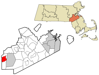
North Seekonk is a census-designated place (CDP) in the town of Seekonk in Bristol County, Massachusetts, United States. The population was 2,643 at the 2010 census.

<span class="mw-page-title-main">West Concord, Massachusetts</span> CDP in Massachusetts, United States

West Concord is an unincorporated village and census-designated place (CDP) in the town of Concord in Middlesex County, Massachusetts, United States. The population was 6,028 at the 2010 census.

<span class="mw-page-title-main">Cordaville, Massachusetts</span> CDP in Massachusetts, United States

Cordaville is a census-designated place (CDP) in the town of Southborough in Worcester County, Massachusetts, United States. The population was 2,650 at the 2010 census.

<span class="mw-page-title-main">East Douglas, Massachusetts</span> CDP in Massachusetts, United States

East Douglas is a census-designated place (CDP) in the town of Douglas in Worcester County, Massachusetts, United States. The population was 2,557 at the 2010 census.

<span class="mw-page-title-main">South Ashburnham, Massachusetts</span> CDP in Massachusetts, United States

South Ashburnham is a census-designated place (CDP) in the town of Ashburnham in Worcester County, Massachusetts, United States. The population was 1,062 at the 2010 census.

<span class="mw-page-title-main">Princeton Meadows, New Jersey</span> Census-designated place in New Jersey, United States

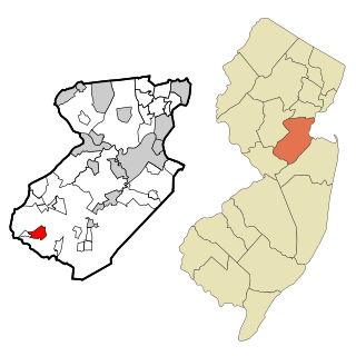
Princeton Meadows is an unincorporated community and census-designated place (CDP) located within Plainsboro Township, in Middlesex County, in the U.S. state of New Jersey. As of the 2010 United States Census, the CDP's population was 13,834.

<span class="mw-page-title-main">Rowley (CDP), Massachusetts</span> Census-designated place in Massachusetts, United States

Rowley is a census-designated place (CDP) in the town of Rowley in Essex County, Massachusetts, United States. The population was 1,416 at the 2010 census.

<span class="mw-page-title-main">Ayer (CDP), Massachusetts</span> Census-designated place in Massachusetts, United States

Ayer is a census-designated place (CDP) and the primary settlement in the town of Ayer in Middlesex County, Massachusetts, United States. The population of the CDP was 2,986 at the 2020 census, out of 8,479 in the entire town.

<span class="mw-page-title-main">Clinton (CDP), Massachusetts</span> CDP in Massachusetts, United States

Clinton is a census-designated place (CDP) in the town of Clinton in Worcester County, Massachusetts, United States. The population was 7,389 at the 2010 census.

<span class="mw-page-title-main">Lunenburg (CDP), Massachusetts</span> CDP in Massachusetts, United States

Lunenburg is a census-designated place (CDP) in the town of Lunenburg in Worcester County, Massachusetts, United States. The population was 1,760 at the 2010 census.

<span class="mw-page-title-main">Milford (CDP), Massachusetts</span> CDP in Massachusetts, United States

Milford is a census-designated place (CDP) in the town of Milford in Worcester County, Massachusetts, United States. The population was 25,055 at the 2010 census.

<span class="mw-page-title-main">Oxford (CDP), Massachusetts</span> CDP in Massachusetts, United States

Oxford is a census-designated place (CDP) in the town of Oxford in Worcester County, Massachusetts, United States. The population was 6,103 at the 2010 census.

<span class="mw-page-title-main">Rutland (CDP), Massachusetts</span> CDP in Massachusetts, United States

Rutland is a census-designated place (CDP) in the town of Rutland in Worcester County, Massachusetts, United States. The population was 2,111 at the 2010 census.

<span class="mw-page-title-main">Webster (CDP), Massachusetts</span> CDP in Massachusetts, United States

Webster is a census-designated place (CDP) in the town of Webster in Worcester County, Massachusetts, United States. The population was 11,412 at the 2010 census.

<span class="mw-page-title-main">Groton (CDP), Massachusetts</span> Census-designated place in Massachusetts, United States

Groton is a census-designated place (CDP) comprising the main village in the town of Groton in Middlesex County, Massachusetts, United States. The population of the CDP was 1,353 at the 2020 census, out of 11,315 in the entire town of Groton.

<span class="mw-page-title-main">Hudson (CDP), Massachusetts</span> Census-designated place in Massachusetts, United States

Hudson is a census-designated place (CDP) comprising the densely developed central part of the town of Hudson in Middlesex County, Massachusetts, United States. The population of the CDP was 15,749 at the 2020 census, out of 20,092 in the entire town.

<span class="mw-page-title-main">Pepperell (CDP), Massachusetts</span> Census-designated place in Massachusetts, United States

Pepperell is a census-designated place (CDP) in the town of Pepperell in Middlesex County, Massachusetts, United States. The population was 2,504 at the 2010 census.

<span class="mw-page-title-main">Shirley (CDP), Massachusetts</span> Census-designated place in Massachusetts, United States

Shirley is a census-designated place (CDP) in the town of Shirley in Middlesex County, Massachusetts, United States. The population was 1,441 at the 2010 census.

<span class="mw-page-title-main">Townsend (CDP), Massachusetts</span> Census-designated place in Massachusetts, United States

Townsend is a census-designated place (CDP) in the town of Townsend in Middlesex County, Massachusetts, United States. The population was 1,128 at the 2010 census.

<span class="mw-page-title-main">Bellingham (CDP), Massachusetts</span> CDP in Massachusetts, United States

Bellingham is a census-designated place (CDP) in the town of Bellingham in Norfolk County, Massachusetts, United States. The population was 4,854 at the 2010 census.

References

  1. "US Gazetteer files: 2010, 2000, and 1990". United States Census Bureau. 2011-02-12. Retrieved 2011-04-23.
  2. "U.S. Census website". United States Census Bureau . Retrieved 2008-01-31.