
Madikeri is a hill station town in Madikeri taluk in Karnataka state, India. It is the headquarters of the district of Kodagu.
Hassan is a district in Karnataka state, India. The district headquarter is Hassan.
Channarayapatna is a town and taluka in Hassan district of Karnataka, India. It lies on the Bangalore-Mangalore National Highway.

Pushpagiri, at 1,712 metres (5,617 ft), is the highest peak in Pushpagiri Wildlife Sanctuary in the Western Ghats of Karnataka. It is located in the Somwarpet Taluk, 20 kilometres (12 mi) from Somwarpet in the northern part of Kodagu district on the border between Dakshina Kannada and Kodagu district and hassan districts. It is 4th highest peak of Karnataka. The Sanskrit name of the mountain is Puṣpagiri while its Prakrit form is Puphagiri, which is mentioned in the Nagarjunakond Second Apsidal Temple inscription, although this may refer to a different mountain to the north of Cuddapah, in Andhra Pradesh.
Arehalli is a village in the state of Karnataka in southern India. It is located in the Belur taluk of Hassan district in Karnataka, and is about 230 kilometres from the state capital Bengaluru. It is well connected by road through the city of Hassan. The nearest airport is Mangalore International Airport, and Sakleshpur Railway Station is located at a distance of 14 kilometres.
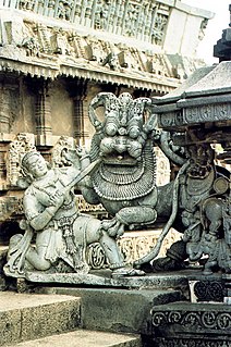
Javagal is a town in the southern state of Karnataka, India. It is located in the Arsikere taluk of Hassan district in Karnataka. The Lakshminarasimha temple, built in 1250 A.D., is an important Hoysala architectural show piece in this town.
Mustur is a village in the southern state of Karnataka, India. It is located in the Gangawati taluk of Koppal district in Karnataka.
Singanamane is a village in the southern state of Karnataka, India. It is located in the Bhadravati taluk of Shimoga district in Karnataka.
Achanahalli is a village in the southern state of Karnataka, India. It is located in the Sakleshpur taluk of Hassan district in Karnataka.
Achangi is a village in the southern state of Karnataka, India. It is located in the Sakleshpur taluk of Hassan district in Karnataka.
Acharadi is a village in the southern state of Karnataka, India. It is located in the Sakleshpur taluk of Hassan district in Karnataka.
Adalli is a village in the southern state of Karnataka, India. It is located in the Sirsi taluk of Uttara Kannada district.
Adarvalli is a village in the southern state of Karnataka, India. It is located in the Sakleshpur taluk of Hassan district in Karnataka.
Adnalli is a village in the southern state of Karnataka, India. It is located in the Sirsi taluk of Uttara Kannada district in Karnataka.
Agachahalli is a village in the southern state of Karnataka, India. It is located in the Nagamangala taluk of Mandya district in Karnataka.
Agalahalli is a village in the southern state of Karnataka, India, in the Hassan taluk of Hassan district.
Agalahatti is a village in the southern state of Karnataka, India. It is located in the Sakleshpur taluk of Hassan district in Karnataka.

Akkalavadi is a village in the southern state of Karnataka, India. It is located in the Arkalgud taluk of Hassan district in Karnataka.

Aladagudde is a village in the southern state of Karnataka, India. It is located in the Chikkamagaluru Taluk of Chikkamagaluru District in Karnataka.


