Albinia, Queensland

Last updated

Albinia
Queensland
Australia Queensland location map.svg
Red pog.svg
Albinia
Coordinates 24°26′42″S148°23′33″E / 24.445°S 148.3925°E / -24.445; 148.3925 (Albinia (centre of locality))
Population165 (2021 census) [1]
 • Density0.1546/km2 (0.4004/sq mi)
Area1,067.4 km2 (412.1 sq mi)
Time zone AEST (UTC+10:00)
Location
LGA(s) Central Highlands Region
State electorate(s) Gregory
Federal division(s) Flynn
Suburbs around Albinia:
Cairdbeign Orion Lowesby
Wealwandangie Albinia Rolleston
Consuelo Consuelo Consuelo

Albinia is a rural locality in the Central Highlands Region, Queensland, Australia. [2] In the 2021 census, Albinia had a population of 165 people. [1]

Contents

Geography

The western part of the locality is mountainous with individual peaks such as Mount Hope at 596 metres (1,955 ft) and Mount Kelman at 470 metres (1,540 ft). [3] [4] The eastern part of the locality falls toward the east to elevations of 200 metres (660 ft). [5] The Mount Hope State Forest is in the western part of the locality including the mountain itself.

A number of creeks flow from west to east across the locality including Albinia Creek. These creeks are tributaries of the Comet River and ultimately contribute to the Fitzroy River which flows into the Coral Sea. [5] [6]

The large Rolleston coal mine is operated by Glencore Coal in the centre of the locality. The mine is supported by a number of dams and other infrastructure. A branch of the Blackwater railway system provides transport for the coal. [5]

To the east of the mine is the Albinia National Park. [7]

The Dawson Highway passes through from east to north.

History

The locality and creek are believed to derive their names from the Albinia Downs, which was named by Ludwig Leichhardt on 28 December 1844 during his overland journey from Moreton Bay to Port Essington in the Northern Territory. [6]

Demographics

In the 2016 census, Albinia had a population of 112 people. [8]

In the 2021 census, Albinia had a population of 165 people. [1]

Economy

There are a number of homesteads in the locality: [9]

Education

There are no schools in Albinia. The nearest government primary school is Rolleston State School in neighbouring Rolleston to the east. [10] The nearest government schools offering secondary education is Springsure State School (to Year 10) in Springsure to the north-west. For secondary education to Year 12, the options are distance education and boarding school. [11]

Related Research Articles

<span class="mw-page-title-main">Rolleston, Queensland</span> Town in Queensland, Australia

Rolleston is a rural town and locality in the Central Highlands Region, Queensland, Australia. In the 2016 census, the locality of Rolleston had a population of 309 people.

<span class="mw-page-title-main">Dawson Highway</span>

The Dawson Highway is a state highway in Queensland, Australia. It runs for 405 kilometres (252 mi) between Gladstone and Springsure where it terminates. From Gladstone to Rolleston it is signed as State Route 60, and then A7 onwards to Springsure. It continues west for another 247 kilometres (153 mi) as Dawson Developmental Road to Tambo on the Landsborough Highway. North of Springsure, A7 becomes the Gregory Highway.

<span class="mw-page-title-main">Springsure</span> Town in Queensland, Australia

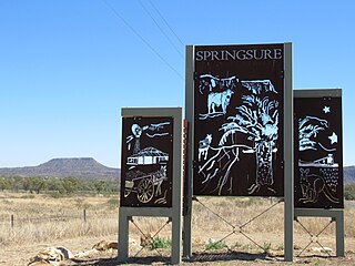
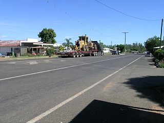
Springsure is a rural town and locality in the Central Highlands Region, Queensland, Australia. In the 2021 census, the locality of Springsure had a population of 950 people.

<span class="mw-page-title-main">Shire of Bauhinia</span> Local government area in Queensland, Australia

The Shire of Bauhinia was a local government area in Central Queensland, Queensland, Australia. The Shire, administered from the town of Springsure, covered an area of 23,649.6 square kilometres (9,131.2 sq mi), and existed as a local government entity from 1879 until 2008, when it was amalgamated with the Shires of Duaringa, Emerald and Peak Downs to form the Central Highlands Region.

<span class="mw-page-title-main">Central Highlands Region</span> Local government area in Queensland, Australia

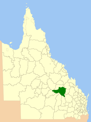
Central Highlands Region is a local government area in Queensland, Australia.

Arcadia Valley is a rural locality in the Central Highlands Region, Queensland, Australia. In the 2021 census, Arcadia Valley had a population of 141 people.

<span class="mw-page-title-main">Felton, Queensland</span> Suburb of Toowoomba Region, Queensland, Australia

Felton is a rural locality in the Toowoomba Region, Queensland, Australia. In the 2016 census, Felton had a population of 276 people.

<span class="mw-page-title-main">Waverley, Queensland</span> Suburb of Shire of Boulia, Queensland, Australia

Waverley is an outback locality in the Shire of Boulia, Queensland, Australia. In the 2021 census, Waverley had a population of 6 people.

<span class="mw-page-title-main">Amby, Queensland</span> Town in Queensland, Australia

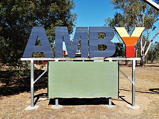
Amby is a rural town and locality in the Maranoa Region, Queensland, Australia. In the 2016 census, the locality of Amby had a population of 86 people.

<span class="mw-page-title-main">Orion, Queensland</span> Suburb of Central Highlands Region, Queensland, Australia

Orion is a rural locality in the Central Highlands Region, Queensland, Australia. In the 2021 census, Orion had a population of 87 people.

Nandowrie is a rural locality in the Central Highlands Region, Queensland, Australia. At the 2021 census, Nandowrie had a population of 31 people.

Fernlees is a rural town in the locality of Gindie, Central Highlands Region, Queensland, Australia.

Humboldt is a rural locality in the Central Highlands Region, Queensland, Australia. In the 2016 census, Humboldt had a population of 13 people.

Arcturus is a rural locality in the Central Highlands Region, Queensland, Australia. At the 2021 census, Arcturus had a population of 130 people.

Minerva is a rural locality in the Central Highlands Region, Queensland, Australia. At the 2021 census, Minerva had a population of 55 people.

Mantuan Downs is a rural locality in the Central Highlands Region, Queensland, Australia. In the 2016 census Mantuan Downs had a population of 31 people.

<span class="mw-page-title-main">Rewan, Queensland</span> Suburb of Central Highlands Region, Queensland, Australia

Rewan is a rural locality in the Central Highlands Region, Queensland, Australia. In the 2021 census, Rewan had a population of 49 people.

Laglan is a rural locality in the Isaac Region, Queensland, Australia. In the 2016 census Laglan had a population of 3 people, but its boundaries have subsequently changed.

Mount Howe is a rural locality in the Maranoa Region, Queensland, Australia. In the 2016 census Mount Howe had a population of 3 people.

Mount Bindango is a rural locality in the Maranoa Region, Queensland, Australia. In the 2016 census Mount Bindango had a population of 33 people.

References

  1. 1 2 3 Australian Bureau of Statistics (28 June 2022). "Albinia (SAL)". 2021 Census QuickStats. Retrieved 28 February 2023. OOjs UI icon edit-ltr-progressive.svg
  2. "Albinia – locality in Central Highlands Region (entry 46907)". Queensland Place Names. Queensland Government . Retrieved 23 April 2019.
  3. "Mount Hope – mountain in the Central Highlands Region (entry 16121)". Queensland Place Names. Queensland Government . Retrieved 23 April 2019.
  4. "Mount Kelman – mountain in the Central Highlands Region (entry 17894)". Queensland Place Names. Queensland Government . Retrieved 23 April 2019.
  5. 1 2 3 "Queensland Globe". State of Queensland . Retrieved 22 April 2019.
  6. 1 2 "Albinia Creek – watercourse in the Central Highlands Region (entry 234)". Queensland Place Names. Queensland Government . Retrieved 23 April 2019.
  7. "Albinia National Park – state forest in Central Highlands Region (entry 49137)". Queensland Place Names. Queensland Government . Retrieved 23 April 2019.
  8. Australian Bureau of Statistics (27 June 2017). "Albinia (SSC)". 2016 Census QuickStats. Retrieved 20 October 2018. OOjs UI icon edit-ltr-progressive.svg
  9. "Homesteads - Queensland". Queensland Open Data. Queensland Government. 18 November 2020. Archived from the original on 24 November 2020. Retrieved 24 November 2020.
  10. "Layers: Locality; Schools and school catchments". Queensland Globe. Queensland Government. Archived from the original on 19 December 2017. Retrieved 1 May 2024.
  11. "Queensland Globe". State of Queensland . Retrieved 24 February 2022.