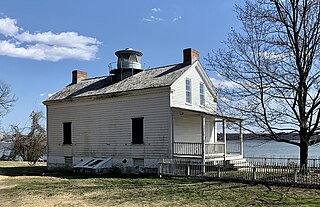
The Jones Point Light is a small river lighthouse located on the Potomac River in Alexandria, Virginia. It was built in 1855.

Broad Street is a 15-mile-long (24 km) road located in the independent city of Richmond, Virginia, and adjacent Henrico County. Broad Street is significant to Richmond due to the many commercial establishments that have been built along it throughout Richmond's history. From downtown through miles into the suburbs, the street is largely dedicated to retailing and offices, including regional and neighborhood shopping centers and malls.

The George Washington Memorial Parkway, colloquially the G.W. Parkway, is a 25-mile-long (40 km) limited-access parkway that runs along the south bank of the Potomac River from Mount Vernon, Virginia, northwest to McLean, Virginia, and is maintained by the National Park Service (NPS). It is located almost entirely in Northern Virginia, except for a short portion of the parkway northwest of the Arlington Memorial Bridge that passes over Columbia Island in Washington, D.C.

Potomac is an extinct incorporated town formerly located in Arlington County, Virginia. Today the dissolved town's former territory is located within the City of Alexandria after municipal annexation in 1930. As a planned community, its proximity to Washington D.C. made it a popular place for employees of the U.S. government to live. Potomac was located adjacent to the massive Potomac Yard of the Richmond, Fredericksburg and Potomac Railroad.

Fairlington is an unincorporated neighborhood in Arlington County, Virginia, located adjacent to Shirlington in the southernmost part of the county on the boundary with the City of Alexandria. The main thoroughfares are Interstate 395, which divides the neighborhood into North and South Fairlington, State Route 7 and State Route 402.

Buildings, sites, districts, and objects in Virginia listed on the National Register of Historic Places:

Alexandria National Cemetery is a United States National Cemetery, of approximately 5.5 acres (2.2 ha), located in the city of Alexandria, Virginia. Administered by the United States Department of Veterans Affairs, it is one of the original national cemeteries that were established in 1862. As of 2014, it was site to over 4,500 interments. The cemetery can accommodate the cremated remains of eligible individuals.
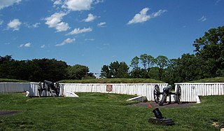
Fort Ward is a former Union Army installation now located in the city of Alexandria in the U.S. state of Virginia. It was the fifth largest fort built to defend Washington, D.C. in the American Civil War. It is currently well-preserved with 90-95% of its earthen walls intact.

The Bank of Alexandria is a historic bank building located at Alexandria, Virginia, United States. It was built in 1807, and consists of a three-story main block, with a two-story east wing. The main block is five bays wide and 7 bays deep. In 1848, James Green purchased the building and turned it into a hotel, then in 1855, he expanded it across the lawn of the Carlyle House next door, tripling the size of the Mansion House Hotel. The hotel was used as a hospital during the Civil War. In the late 1960's, the expansion, by then an aging apartment building, was torn down by the Northern Virginia Regional Park Authority to reveal Carlyle House, which was restored in 1976.

Alexandria is an independent city in the northern region of the Commonwealth of Virginia, United States. It lies on the western bank of the Potomac River approximately 7 miles (11 km) south of downtown Washington, D.C. Alexandria is the third-largest principal city of the Washington metropolitan area, which is part of the larger Washington–Baltimore combined statistical area. As of 2022, the city's population of 159,467 made it the sixth-most populous city in Virginia and the 173rd-most populous city in the nation.
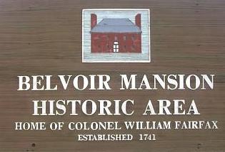
Belvoir was the plantation and estate of colonial Virginia's prominent William Fairfax family. Operated with the forced labor of enslaved people, it was located on the west bank of the Potomac River on the present site of Fort Belvoir in Fairfax County, Virginia.
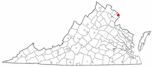
This is a list of the National Register of Historic Places listings in Alexandria, Virginia.

This is a list of the National Register of Historic Places listings in Fairfax County, Virginia.

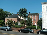
The Potts-Fitzhugh House is a historic house at 607 Oronoco Street, Alexandria, Virginia. It served in the early 1800s as the home of Anne Hill Carter Lee and her family, including Robert E. Lee. It should not be confused with the Lee–Fendall House, which is located at 614 Oronoco Street.
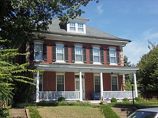
The Rosemont Historic District is a historic district in Alexandria, in the U.S. state of Virginia. It was added to the National Register of Historic Places in 1992.
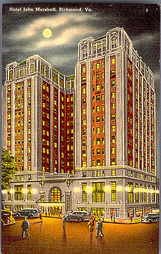
The Grace Street Commercial Historic District is a national historic district located in Richmond, Virginia. The district encompasses 93 contributing buildings located in downtown Richmond. The buildings reflect the core of the city's early 20th-century retail development and the remnants of a 19th-century residential neighborhood. The buildings are in a variety of popular 19th-century and early 20th-century architectural styles, including Classical Revival, Mission Revival, International Style, and Colonial Revival. Notable buildings include the Administration and Equipment Building for the Chesapeake & Potomac Telephone Company (1929), Thalhimer's Department Store, Atlantic Life Building (1950-1959), Miller & Rhoads Department Store, Berry-Burk Building, former W. W. Foster Studios (1927), Bank of Virginia (1949), Investment Realty Company building (1930), W.T. Grant Store (1939), Hotel John Marshall (1927), Franklin Federal Savings and Loan building (1954), and the Tompkins House (1820). Located in the district and separately listed are the Loew's Theatre, Centenary United Methodist Church, Joseph P. Winston House, Central National Bank, and National Theater.

The Main Street Banking Historic District is a national historic district located in downtown Richmond, Virginia. The district encompasses 19 contributing buildings located south of the Virginia State Capitol and west of the Shockoe Slip Historic District. It is the location of a number of buildings built for or occupied by banking institutions. The district includes representative examples of the Late Victorian and International Style architecture built between about 1865 and 1965. Notable buildings include the Virginia Employment Commission Building (1960), the 700 Building (1964), the Ross Building (1964), the Fidelity Building (1965). Located in the district is the separately listed First National Bank Building.

The Winchester Historic District is a national historic district located at Winchester, Virginia. The district encompasses 1,116 contributing buildings in Winchester. The buildings represent a variety of popular architectural styles including Late Victorian and Italianate. They include residential, commercial, governmental, industrial, and institutional buildings dating from the 18th to mid-20th centuries. Notable buildings include the A.M.E Church (1878), Masonic Lodge and Gray and Eddy Building, First Presbyterian Church, Farmers and Merchants Bank (1902), Frederick County Courthouse (1840), Grace Lutheran Church, Friendship Fire Hall (1892), John Kerr School, City Hall (1900), Lewis Jones Knitting Mill (1895), Tidball Residence, William F. Hottle Residence, McGuire Residence, and Robert Long House. Located in the district are the separately listed Thomas J. Jackson Headquarters, Fair Mount, Handley Library, Adam Kurtz House, and Daniel Morgan House.
Alexandria, Virginia is an independent city in the Commonwealth of Virginia, located along the western bank of the Potomac River. The city of approximately 151,000 is about six miles south of downtown Washington, D.C.


