Air Regional was an airline based in Jakarta, Indonesia. It operated domestic and international air charter services in the Papua region, with principal bases in 2018 focussing at Sorong Airport (SOQ), serving the West Central Region and Nabire Airport (NBX) to handle the East Central Region.

Taylor County Airport is a county-owned public-use airport located two nautical miles (4 km) northeast of the central business district of Campbellsville, a city in Taylor County, Kentucky, United States.

Selaparang Airport(IATA: AMI, ICAO: WADA), was the sole airport serving the island of Lombok and the city of Mataram, the capital of the province of West Nusa Tenggara, Indonesia until its closure on 30 September 2011. The IATA code AMI came from the nearby port of Ampenan, now a part of Mataram. The airport was operated by PT. Angkasa Pura 1 (PERSERO). The new Lombok International Airport operated under the IATA code AMI until late November 2011, toward the end of the month the IATA code LOP was formally listed for the new airport and was slowly being transitioned by the airlines operating to Lombok.

Sultan Muhammad Salahuddin Airport, also known as Bima Airport, is an airport located approximately 10 kilometres (6.2 mi) to the south of the city of Bima, on the island of Sumbawa, West Nusa Tenggara, Indonesia.

Long Apung Airport is an airport serving the city of Long Apung, located in the Malinau Regency, North Kalimantan, Indonesia.
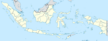
Juvai Semaring Airport is an airport serving Long Bawan, located in the province of North Kalimantan in Indonesia. It is also known as Long Bawan Airport.

Maimun Saleh Airport is a small airport with a runway length of 1,844 m (6,050 ft) and altitude of 120 m (390 ft) in Sabang, Pulau Weh, Indonesia. It is situated on the island right above the northern tip of Sumatra in the Andaman Sea. It is part of the Sabang city in Aceh province. This airport was named after Indonesian Air Force pilot Maimun Saleh, who died in a plane crash at Bogor on August, 1952. It is considered to be Indonesia's westernmost and northernmost airport.

Sutan Sjahrir Air Force Base, formerly Tabing Airport, is a military air base in Padang, Indonesia. Tabing Airport was West Sumatra's primary airport for civil aviation prior to the opening of Minangkabau International Airport on 22 July 2005. Tabing Airport is now used by the Indonesian Air Force, renaming it after Sutan Sjahrir, Indonesia's first prime minister.

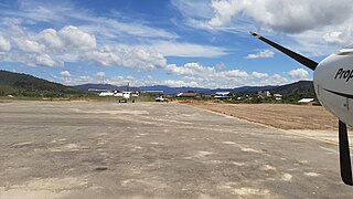
Lombok International Airport, also known as Zainuddin Abdul Madjid International Airport, is an international airport on the island of Lombok in Indonesia. It is the island's only fully operational airport.
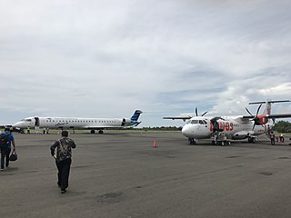
Tampa Padang Airport is an airport near Mamuju, the capital city of the province of West Sulawesi on the island of Sulawesi in Indonesia.
West Kutai Melalan Airport is an airport serving Melak, a district in West Kutai Regency, located in the province of East Kalimantan in Indonesia.
Cijulang Nusawiru Airport, also known as Pangandaran Airport, is an airport near Pangandaran, Pangandaran Regency, a city in the province of West Java on the island of Java in Indonesia.
A.A. Bere Tallo Airport, previously known as Haliwen Airport is an airport in Atambua, East Nusa Tenggara, Indonesia.
Anggi Airport is an airport in Anggi, Indonesia.

Alor Island Airport, also known as Mali Airport, is an airport in Alor Island, Indonesia.
Rar Gwamar Airport is an airport in Dobo, Aru Islands, Indonesia. The airport is principal point of entry to the Aru Islands. The distance from Dobo city center is about 5 km (3.1 mi). It is planned that the current 1,400-meter (4,600 ft) runway is planned to be extended to 1,800 meters (5,900 ft) according to the master plan. The runway extension is done gradually, starting from 1,500 meters (4,900 ft) which is planned to be finished by 2018.

Namniwel Airport is an airport close to the city of Namlea on the Buru island, which is one of the Maluku Islands in Indonesia.
Sei Pakning Airport or Sei Selari Airport is a domestic airport located in Sungai Pakning, Bengkalis Regency, Riau Province, Indonesia. It serves the town of Sungai Pakning. The airport was served charter flights for Pertamina. Currently, there are no flights to and from this airport.