Ernakulam is one of the 14 districts in the Indian state of Kerala, and takes its name from the eponymous city division in Kochi. It is situated in the central part of the state, spans an area of about 2,924 square kilometres (1,129 sq mi), and is home to over 9% of Kerala's population. Its headquarters are located at Kakkanad. The district includes Kochi, also known as the commercial capital of Kerala, which is famous for its ancient Churches, Hindu temples, synagogues and mosques. The district includes the largest metropolitan region of the state: Greater Cochin. Ernakulam is the district that yields the most revenue and the largest number of industries in the state. Ernakulam is the third most populous district in Kerala, after Malappuram and Thiruvananthapuram. The district also hosts the highest number of international and domestic tourists in Kerala state.

Nedumbassery, is a suburb of the city of Kochi in Kerala, India. Situated around 25 kilometres (16 mi) northeast of the city centre, Nedumbassery is also an integral part of the Kochi Metropolitan Area.
Aluva is a municipality in the Ernakulam district of Kerala, India. Aluva is situated 14.5 km (9.0 mi) from Kochi, along the banks of the Periyar River, and is a part of the Kochi metropolitan area. Aluva is a transportation hub, connecting North Malabar and Central Kerala to Kochi. The Cochin International Airport at Nedumbassery, located 11.7 km from Aluva, is an aviation hub hosting both domestic and international flights. Aluva is also the northern terminus of the Kochi Metro.

Manjapra is a village in Ernakulam district in Kerala, India. It is situated about 10 km from Angamaly and 6 km from Kalady. Chandrappura and Vadakkumbhagom are the main business centers.

Perumbavoor is a place located at the bank of Periyar in Ernakulam District in the Indian state of Kerala. It is a part of the Kochi metropolitan area. It lies in the northeastern tip of the Greater Cochin area and is also the headquarters of Kunnathunad Taluk. Perumbavoor is famed in the state for wood industries and small-scale industries. Ernakulam lies 30 km southwest of Perumbavoor. The town lies between Angamaly and Muvattupuzha on the Main Central Road (MC), which connects Thiruvananthapuram to Angamaly through the old Travancore part of Kerala.
North Paravur. formerly known as Paravur or Parur, is a municipality and suburb in Ernakulam district in the Indian state of Kerala. It is a northern suburb of the city of Kochi and is situated around 20 km from the city centre. It is also the first place in India to use electronic voting machine during the by-elections in 1982.

Chengamanad is a small town in Aluva, Ernakulam district in the state of Kerala, India. It is situated on the banks of the river Periyar.

Chowara is a small town near Aluva in the Ernakulam district in the state of Kerala, India.

Kadungalloor, IPA:[kɐɖuŋːɐlːuːr], is a village situated near Aluva. The village belongs to the Paravur Taluk of the Ernakulam district in the Indian state of Kerala. The industrial estates of Muppathadam and Edayar are located in Kadungalloor.

Kodanad is a rural riverside village of Ernakulam district in Kerala, South India. It is 18 km from Angamaly. Kodanad is situated on the south bank of Periyar river, about 42 kilometers east of Kochi. The village is a major tourist destination because it houses an Elephant training center.

Valayanchirangara is a village in the Ernakulam district of Kerala state, India. It is 7 km away from Perumbavoor. The name Valayanchirangara means "Valanja Chirayude Kara", a land on the shore of a curve shaped pond. Valayanchirangara is under Kunnathunadu Taluk and a converging place of three Panchayats: Vengola, Mazhuvanoor and Rayamangalam. Here exists an 'A' graded library, Schools from KG levels to +2, a college under MG University, traditional temples, churches, mosques, Drama theater called Suvarna Theaters, banks, a telephone exchange, post office & electricity board, hospitals, various shops and business ventures. The main central road connecting to NH-47 at Angamaly is ½km away running parallel to Valayanchirangara.
Ernakulam District is a district of the state of Kerala in southern India. The district headquarters are at Kakkanad. The district includes the city of Kochi, an important seaport.
Paravur Taluk, IPA:[pɐrɐʋuːr], is a taluk of Ernakulam District in the Indian State of Kerala. North Paravur is the capital of the taluk. Paravur Taluk lies in the north western part of Ernakulam district bordering Thrissur district. The surrounding taluks are Kochi to the west consisting of Vypin Island, Kodungallur to the north, Chalakudy to the north consisting of Mala, Aluva to the east consisting of Angamaly, Nedumbassery and Aluva, Kanayanur to the south consisting of Cochin City. Paravur is a part of Kochi urban agglomeration area. The western parts of taluk are coastal areas with cultivations like prawn and pokkali rice. The eastern parts are fertile lands. The heavy industries of Kochi is located in Udyogmandal area of the taluk.
Kunnukara is a census town and panchayat in Paravur Taluk of Ernakulam district, Kerala, India. The village is situated on the airport road connecting North Paravur (NH66) and Nedumbassery (NH544). North Paravur is the nearest town, 7 km from this village. Aluva (10 km) and Angamaly (12 km) are also near to Kunnukara. Its administrative headquarters is in Kunnukara Town itself. The Mini Civil Station has four hospitals, all the Govt. offices, a Khadi Unit Supermarkets etc.

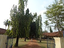
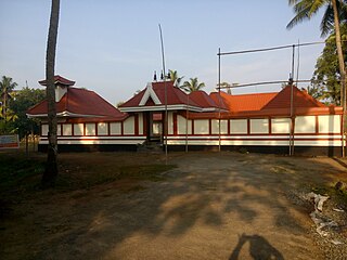
Blandevar is a small village in the North Mazhuvannoor area of the Ernakulam district of India. The renowned Blandevar Mahavishnu Temple is located here.
Rajakkad is a town in the Idukki district in the Indian state of Kerala situated in the Western Ghats.

Thuravoor is a Gram Panchayat in Aluva Taluk of Ernakulam District in the South Indian state of Kerala. Thuravoor Grama Panchayath is nearly 5 km from Angamaly Town. The Panchayat covers 12.13 km2 in area. The borders of this panchayat are Mookkannoor and Manjapra Panchayat in the north, Manjapra, Malayattoor-Neeleeswaram Panchayat in the East. Kalady panchayat and Angamaly Municipality in the south, and Karukutty and Mookkannoor Panchayat on the west.

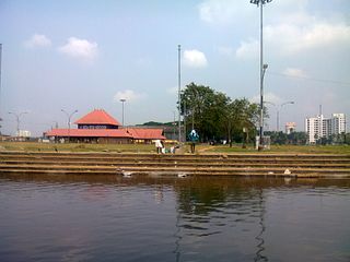
Kaloor is a downtown region in the city of Kochi, in the state of Kerala, India. It is two kilometres (1.2 mi) from the Ernakulam North Railway Station. Kaloor Junction is also the name of a major intersection in this part of the city, intersecting the two major arteries of downtown Kochi, namely Banerji Road and the Kaloor-Kadavanthra Road. The nearest major intersections are Palarivattom to the east and Lissie Junction to the west.

Kaprassery is a village in the district of Ernakulam and is situated on the National Highway 544 (India) that stretches from Salem to Kochi. It is located between the two major towns of the Indian state Kerala, namely, Aluva and Angamaly.
Kaprikad is a rural riverside village of Ernakulam district, Kerala, southern India. Kaprikad is situated on the south bank of Periyar river, about 42 kilometers east of Kochi. The nearest airport is Cochin International Airport which is about 18 km (12 mi) by road. The village is a major tourist destination in the district because it houses the Kodanad Abhayaranyam animal shelter and elephant training centre.