Milk River is a tributary of the Missouri River, 729 miles (1,173 km) long, in the U.S. state of Montana and the Canadian province of Alberta. Rising in the Rocky Mountains, the river drains a sparsely populated, semi-arid watershed of 23,800 square miles (62,000 km2), ending just east of Fort Peck, Montana.

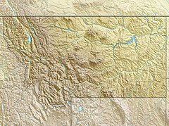
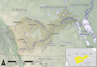
The Saskatchewan River is a major river in Canada. It stretches about 550 kilometres (340 mi) from where it is formed by the joining of the North Saskatchewan River and South Saskatchewan River just east of Prince Albert, Saskatchewan. It flows roughly eastward across Saskatchewan and Manitoba to empty into Lake Winnipeg. Through its tributaries the North Saskatchewan and South Saskatchewan, its watershed encompasses much of the prairie regions of Canada, stretching westward to the Rocky Mountains in Alberta and north-western Montana in the United States.

The South Saskatchewan River is a major river in the Canadian provinces of Alberta and Saskatchewan. The river begins at the confluence of the Bow and Oldman Rivers in southern Alberta and ends at the Saskatchewan River Forks in central Saskatchewan. The Saskatchewan River Forks is the confluence of the South and North Saskatchewan Rivers and is the beginning of the Saskatchewan River.

The Saint Mary River, is a cross-border tributary of the Oldman River, itself a tributary of the South Saskatchewan River. The Saint Mary together with the Belly River and Waterton River drains a small portion of Montana, in the United States, to the Hudson Bay watershed in Canada.

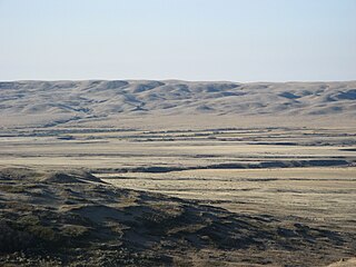
The Cypress Hills are a geographical region of hills in southwestern Saskatchewan and southeastern Alberta, Canada. The hills are part of the Missouri Coteau upland. The hills cover an area of approximately 2,500 km2 (970 sq mi). About 400 km2 (150 sq mi) or 16% of this area is an interprovincial park.

The Oldman River is a river in southern Alberta, Canada. It flows roughly west to east from the Rocky Mountains, through the communities of Fort Macleod, Lethbridge, and on to Grassy Lake, where it joins the Bow River to form the South Saskatchewan River, which eventually drains into the Hudson Bay.
Cypress Hills Interprovincial Park is a natural park in Canada straddling the Alberta / Saskatchewan boundary and jointly administered by the two provinces. Located south-east of Medicine Hat in the Cypress Hills, it became Canada's first interprovincial park in 1989.
Battle River is a river in central Alberta and western Saskatchewan, Canada. It is a major tributary of the North Saskatchewan River.

Southern Alberta is a region located in the Canadian province of Alberta. In 2016, the region's population was approximately 291,112. The primary cities are Lethbridge and Medicine Hat. The region is known mostly for agricultural production, but other sectors, such as alternative energy, film production and tourism, are emerging.

Highway 21 is a provincial highway in the Canadian province of Saskatchewan. It runs from Montana Secondary Highway 233 at the United States border at Willow Creek to Highway 950 / Highway 919 within the Meadow Lake Provincial Park. Highway 21 is about 715 kilometres (444 mi) long.
The Rural Municipality of Reno No. 51 is a rural municipality (RM) in the Canadian province of Saskatchewan within Census Division No. 4 and SARM Division No. 3. Located in the southwest corner of the province, it is adjacent to the United States border to the south and the Alberta boundary to the west.
Carmichael is a special service area within the Rural Municipality of Carmichael No. 109, Saskatchewan, Canada that held village status prior to 2019. The population was 58 at the 2016 Census. Carmichael lies 1 km (1 mi) south of Highway 1 commonly known as the Trans Canada Highway, approximately 158 km (98 mi) east of city of Medicine Hat, Alberta.
Torch River is a river in the Canadian province of Saskatchewan. The river's source is the dam at Candle Lake, near Candle Lake Provincial Park, and it travels east through boreal forest and muskeg en route to its mouth in the Saskatchewan River Delta. Torch River Provincial Forest, a conservation area, is located along the course of the river, near where White Fox River flows into Torch River. Torch River is a significant tributary of the Saskatchewan River and it is part of the Hudson Bay drainage basin.
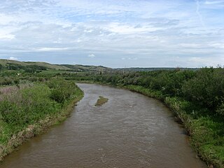
The Frenchman River,, also known locally as the Whitemud River, is a river in Saskatchewan, Canada and Montana, United States. It is a tributary of the Milk River, itself a tributary of the Missouri and, in turn, part of the Mississippi River watershed, which flows to the Gulf of Mexico.

Thunder Creek is a river in the Canadian province of Saskatchewan. The watershed of Thunder Creek is within the semi-arid Palliser's Triangle in south-central Saskatchewan. It begins at small, man-made reservoir near Lake Diefenbaker and flows in a south-easterly direction towards the city of Moose Jaw and the Moose Jaw River. The Moose Jaw River is a major tributary of the Qu'Appelle River For most of its course, Thunder Creek follows a valley called the Thunder Creek meltwater channel that was formed over 10,000 years ago near the end of the last ice age.
Wood River is a river in the Canadian province of Saskatchewan. It has its source in the Wood Mountain Hills of south-western Saskatchewan and flows in a north-easterly direction to its mouth at Old Wives Lake. Old Wives Lake is a salt water lake with no outflow. As a result, the drainage basin of Wood River is an endorheic one. Along the course of the river, there are several parks, historical sites, and small towns.
Cypress Lake is an interbasin transfer reservoir in the Canadian province of Saskatchewan on the southern slopes of the Cypress Hills in the Rural Municipality of Reno No. 51. The reservoir was created by the damming of the east and west sides of a much smaller Cypress Lake in the late 1930s. There is a provincial recreation site on the southern shore and a wildlife refuge on Heglund Island in the lake. Access to the lake is from Township Road 60 off of Highway 21.

Bigstick Lake is a shallow endorheic alkali lake in the south-west region of the Canadian province of Saskatchewan. The lake was named after the Big Stick Trail that ran between the town of Maple Creek and the South Saskatchewan River. The trail was notable for a large, solitary tree along its route. The lake and its drainage basin are in a semi-arid region known as Palliser's Triangle.

Maple Creek is a river in the south-west region of the Canadian province of Saskatchewan. The river is in the semi-arid region known as Palliser's Triangle. It begins in the Cypress Hills and flows generally in a northward direction and empties into the endorheic Bigstick Lake. The town of Maple Creek is the only notable community along the course of the river. Due to the generally dry and drought-prone conditions of the area, reservoirs were built along the river's course and in its watershed to ensure a stable water supply for irrigation. Two Important Bird Areas (IBA) of Canada cover much of the lower watershed of the river.
Eyehill Creek is a river in the Canadian provinces of Alberta and Saskatchewan. The river begins at Sounding Lake in Alberta and flows east and north into Manitou Lake in Saskatchewan. Eyehill Creek is the primary inflow for Manitou Lake, which has no outflow. The Manitou Lake watershed is a large endorheic basin between the Battle River watershed to the north and the South Saskatchewan River watershed to the south.