
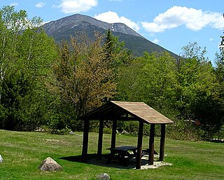
Baxter County is a county in the U.S. state of Arkansas. As of the 2010 census, the county's population was 41,513. The county seat is Mountain Home. It is Arkansas's 66th county, formed on March 24, 1873, and named for Elisha Baxter, the tenth governor of Arkansas.

Mountain Home is a city in, and the county seat of, Baxter County, Arkansas, United States, in the southern Ozark Mountains near the northern state border with Missouri. As of the 2010 census, the city had a population of 12,448. A total of 41,307 persons lived within the city and micropolitan area combined, which encompasses the majority of Baxter County.

Mount Katahdin is the highest mountain in the U.S. state of Maine at 5,267 feet (1,605 m). Named Katahdin by the Penobscot Indians, which means "The Greatest Mountain", it is located within Northeast Piscataquis, Piscataquis County, and is the centerpiece of Baxter State Park. It is a steep, tall masiff formed from a granite intrusion weathered to the surface. The flora and fauna on the mountain are typical of those found in northern New England.

The Cumberland River is a major waterway of the Southern United States. The 688-mile-long (1,107 km) river drains almost 18,000 square miles (47,000 km2) of southern Kentucky and north-central Tennessee. The river flows generally west from a source in the Appalachian Mountains to its confluence with the Ohio River near Paducah, Kentucky, and the mouth of the Tennessee River. Major tributaries include the Obey, Caney Fork, Stones, and Red rivers.
Baxter State Park is a large wilderness area permanently preserved as a state park, located in Northeast Piscataquis, Piscataquis County in north-central Maine, United States. It is in the North Maine Woods region, and the Katahdin Woods and Waters National Monument borders Baxter State Park.

Crocker Mountain is a 4,228 ft (1,289 m) peak located in Carrabassett Valley, Franklin County, Maine, in the United States. Crocker Mountain is the fourth highest mountain in the state after the Katahdins and Sugarloaf Mountain, and is part of the Appalachian Mountains. Crocker Mountain is traversed by the Appalachian Trail (AT), a 2,170 mi (3,490 km) National Scenic Trail from Georgia to Maine.

Tony Wayne Baxter is the former senior vice president of creative development in Walt Disney Imagineering and was responsible for creating designs and carrying out the construction of attractions all over the world. He announced his departure from his full-time position to become a part-time adviser on February 1, 2013, which was also his 66th birthday. During his 47-year tenure with the company, he oversaw the construction of multiple contemporary Disney theme park attractions, including Big Thunder Mountain Railroad, Star Tours, Splash Mountain, The Indiana Jones Adventure, and Journey Into Imagination.

North Brother is a mountain located in Baxter State Park, Piscataquis County, Maine. North Brother is flanked to the northeast by Fort Mountain, and to the southwest by South Brother; collectively the two are called "The Brothers."

South Brother is a mountain located in Piscataquis County, Maine, in Baxter State Park. South Brother is flanked to the southwest by Mount Coe, and to the northeast by North Brother; collectively the two are called "The Brothers".

Hamlin Peak is a 4,756-foot (1,450 m) mountain located in Baxter State Park in Piscataquis County, Maine. Hamlin Peak is a northern spur of the greater Mount Katahdin massif and is flanked to the south by Baxter Peak, and to the north by the Howe Peaks. Since it rises nearly 500 feet (150 m) above the col joining it to the higher Baxter Peak, Hamlin Peak qualifies as a four-thousand footer based on the topographic prominence criterion used by the Appalachian Mountain Club, and is ranked as the second-highest peak in Maine.
Doubletop Mountain is a mountain located in Piscataquis County, Maine, in Baxter State Park. As the name implies, the mountain has two peaks; a north peak and a south peak. From the north a trail from the Nesowednehunk Campground to the north peak is 3.1 miles (5.0 km) long and another 0.2 miles (0.32 km) to the south peak. From Foster Field, to the south, a 4-mile (6.4 km) trail leads to the summit. The last third of mile (0.53 km) is steep and climbs about 900 feet (270 m). The north peak is wooded while the south peak is more open.

Mount Coe is a mountain located in Piscataquis County, Maine, within Baxter State Park, about 5.5 mi (9 km) northwest of Mount Katahdin. Mt. Coe is flanked to the northeast by South Brother, and to the southwest by Mount O-J-I. The Mount Coe trail starts at Slide Dam on Newsowdnehunk Stream east bank at around 1,190 ft (360 m). The trail goes up to the east for about 1.2 mi (1.9 km) and then goes right (south) along the drainage from the Mt. Coe slide bending to the east and then northeast. The last 0.5 mi (0.80 km) is up the slide featured on the left margin of the photo where the trail gains around 800 ft (240 m).

Clem is an unincorporated community in Braxton County, West Virginia, United States. Clem is located along County Route 30 11.25 miles (18.11 km) west-southwest of Sutton.

Fuller Hill is a mountain located in the Catskill Mountains of New York northwest of Roscoe. Morton Hill is located east-southeast of Fuller Hill and Baxter Mountain is located west-southwest.
Twadell Mountain is a mountain located in the Catskill Mountains of New York west-southwest of Gregorytown. Rock Rift Mountain is located north-northwest, and Baxter Mountain is located east of Twadell Mountain.
Richmond Mountain is a mountain located in the Catskill Mountains of New York east-northeast of Hunter. Richtmyer Peak is located northeast, Bump Mountain is located south, Steenburg Mountain is located north, and Ashland Pinnacle is located west-southwest of Richmond Mountain.
Bump Mountain is a mountain located in the Catskill Mountains of New York northeast of Ashland. Richtmyer Peak is located north-northeast, The Knob is located west, and Ashland Pinnacle is located west-southwest of Bump Mountain.

Richtmyer Peak is a mountain in Greene County, New York and partly in Schoharie County, New York. It is located in the Catskill Mountains southwest of West Durham. Mount Pisgah is located east, and Richmond Mountain is located southwest of Richtmyer Peak.


