Belmont, Ohio | |
---|---|
Coordinates: 40°01′41″N81°02′27″W / 40.02806°N 81.04083°W | |
Country | United States |
State | Ohio |
County | Belmont |
Township | Goshen |
Government | |
• Mayor | Ron Woods [1] |
Area | |
• Total | 0.27 sq mi (0.69 km2) |
• Land | 0.27 sq mi (0.69 km2) |
• Water | 0.00 sq mi (0.00 km2) |
Elevation | 1,188 ft (362 m) |
Population (2020) | |
• Total | 414 |
404 | |
• Density | 1,556.39/sq mi (600.33/km2) |
Time zone | UTC-5 (Eastern (EST)) |
• Summer (DST) | UTC-4 (EDT) |
ZIP code | 43718 |
Area code | 740 |
FIPS code | 39-05312 [5] |
GNIS feature ID | 2398086 [3] |
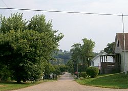
Belmont is a village in central Belmont County, Ohio, United States. The population was 414 at the 2020 census. It is part of the Wheeling metropolitan area.
Belmont was originally known as Wrightstown, and under the latter name was laid out in 1808 by Joseph Wright. [6] The name was switched to Belmont in anticipation of being the county seat of Belmont County. [7] St. Clairsville, however, was given the honor of having Belmont County's center of government. The Baltimore and Ohio Railroad cut through the town until its dismantling in the 1980s.
According to the United States Census Bureau, the village has a total area of 0.27 square miles (0.70 km2), all land. [8]
Belmont is also located approximately one mile south of Barkcamp State Park. [9]
The Village is also part of the historic Drover's Trail that winds through the hills and valleys of Belmont County. [10]
Census | Pop. | Note | %± |
---|---|---|---|
1880 | 319 | — | |
1890 | 384 | 20.4% | |
1900 | 422 | 9.9% | |
1910 | 572 | 35.5% | |
1920 | 680 | 18.9% | |
1930 | 674 | −0.9% | |
1940 | 697 | 3.4% | |
1950 | 638 | −8.5% | |
1960 | 563 | −11.8% | |
1970 | 666 | 18.3% | |
1980 | 714 | 7.2% | |
1990 | 471 | −34.0% | |
2000 | 532 | 13.0% | |
2010 | 453 | −14.8% | |
2020 | 414 | −8.6% | |
2023 (est.) | 404 | [4] | −2.4% |
U.S. Decennial Census [11] |
As of the census [12] of 2010, there were 453 people, 197 households, and 129 families living in the village. The population density was 1,677.8 inhabitants per square mile (647.8/km2). There were 218 housing units at an average density of 807.4 per square mile (311.7/km2). The racial makeup of the village was 97.4% White, 0.4% African American, 1.3% Native American, and 0.9% from two or more races. Hispanic or Latino of any race were 0.2% of the population.
There were 197 households, of which 27.9% had children under the age of 18 living with them, 48.7% were married couples living together, 11.2% had a female householder with no husband present, 5.6% had a male householder with no wife present, and 34.5% were non-families. 31.5% of all households were made up of individuals, and 13.2% had someone living alone who was 65 years of age or older. The average household size was 2.26 and the average family size was 2.77.
The median age in the village was 44 years. 20.8% of residents were under the age of 18; 8.7% were between the ages of 18 and 24; 22.9% were from 25 to 44; 31.7% were from 45 to 64; and 15.9% were 65 years of age or older. The gender makeup of the village was 46.1% male and 53.9% female.
As of the census [5] of 2000, there were 532 people, 208 households, and 148 families living in the village. The population density was 1,886.6 inhabitants per square mile (728.4/km2). There were 224 housing units at an average density of 794.4 per square mile (306.7/km2). The racial makeup of the village was 96.43% White, 1.13% African American, 0.38% Native American, 0.94% Pacific Islander, and 1.13% from two or more races. Hispanic or Latino of any race were 0.94% of the population.
There were 208 households, out of which 29.3% had children under the age of 18 living with them, 55.3% were married couples living together, 11.5% had a female householder with no husband present, and 28.8% were non-families. 24.5% of all households were made up of individuals, and 10.1% had someone living alone who was 65 years of age or older. The average household size was 2.56 and the average family size was 3.05.
In the village, the population was spread out, with 25.6% under the age of 18, 7.7% from 18 to 24, 27.8% from 25 to 44, 25.2% from 45 to 64, and 13.7% who were 65 years of age or older. The median age was 38 years. For every 100 females there were 99.3 males. For every 100 females age 18 and over, there were 96.0 males.
The median income for a household in the village was $28,875, and the median income for a family was $35,000. Males had a median income of $25,000 versus $19,688 for females. The per capita income for the village was $13,015. About 9.9% of families and 12.0% of the population were below the poverty line, including 12.1% of those under age 18 and 13.2% of those age 65 or over.
Union Local School District. [13]
Faith Community Christian High School. While formerly Belmont Elementary School, it is now home to a private school. [14]
Barnesville is a village in Belmont County, Ohio, United States. It is located in the central portion of Warren Township in Belmont County and is part of the Wheeling metropolitan area. The population was 4,008 at the 2020 census.
Bethesda is a village in west-central Belmont County, Ohio, United States. The population was 1,211 at the 2020 census. It is part of the Wheeling metropolitan area.
Bridgeport is a village in eastern Belmont County, Ohio, United States. It lies across the Ohio River from Wheeling, West Virginia, at the mouth of Wheeling Creek and is connected by two bridges to Wheeling Island. The population was 1,582 at the 2020 census. It is part of the Wheeling metropolitan area.
Brookside is a village in eastern Belmont County, Ohio, United States. The population was 538 at the 2020 census. It is part of the Wheeling metropolitan area.
Flushing is a village in Belmont County, Ohio, United States. The population was 830 at the 2020 census.
Holloway is a village in Belmont County, Ohio, United States. The population was 330 at the 2020 census. It is part of the Wheeling metropolitan area. Holloway was laid out in 1883, and named after the local Holloway family.
Morristown is a village in Belmont County, Ohio, United States. The population was 248 at the 2020 census. It is part of the Wheeling metropolitan area.
Powhatan Point is a village in southeastern Belmont County, Ohio, United States, along the Ohio River. The population was 1,461 at the 2020 census. It is part of the Wheeling metropolitan area.
Shadyside is a village in eastern Belmont County, Ohio, United States, along the Ohio River. The population was 3,454 at the 2020 census. It is part of the Wheeling metropolitan area.
Addyston is a village in Miami Township, Hamilton County, Ohio, United States. Located along the Ohio River, it is a western suburb of the neighboring city of Cincinnati. The population was 927 at the 2020 census.
Brinkhaven, once known as Mount Holly and Gann, is a village in Knox County, Ohio, United States. The population was 114 at the 2020 census.
Limaville is a census-designated place (CDP) and former village in Stark County, Ohio, United States. The population was 151 at the 2020 census. It is part of the Canton–Massillon Metropolitan Statistical Area.
Belmont is a town in Pleasants County, West Virginia, United States. It is part of the Parkersburg–Vienna metropolitan area. The population was 872 at the 2020 census. Belmont was incorporated on April 19, 1946, by the Circuit Court of Pleasants County. The city was named for the beautiful hills in the area.
Fairview is a village in Belmont and Guernsey counties in the U.S. state of Ohio. The population was 67 as of the 2020 census. It is part of the Wheeling metropolitan area.
Wilson is a village in Belmont and Monroe counties in the U.S. state of Ohio. The population was 129 at the 2020 census. It is part of the Wheeling metropolitan area.
Yorkville is a village in Belmont and Jefferson counties in the U.S. state of Ohio. The population was 968 at the 2020 census. Yorkville lies within two Metropolitan Statistical Areas; the Belmont County portion is part of the Wheeling metropolitan area, while the Jefferson County portion is part of the Weirton–Steubenville metropolitan area.
Adena is a village in southwestern Jefferson and southeastern Harrison counties in the U.S. state of Ohio. The population was 664 at the 2020 census. It is part of the Weirton–Steubenville metropolitan area.
Gratiot is a village in Licking and Muskingum counties in the U.S. state of Ohio. The population was 215 at the 2020 census.
Verona is a village in Montgomery and Preble counties in the U.S. state of Ohio. The population was 403 at the 2020 census. It is part of the Dayton Metropolitan Statistical Area.
Belmont is a village in Lafayette County, Wisconsin, United States. The population was 989 at the 2020 census. It was the original capital of the Wisconsin Territory during the first legislative assembly in 1836.