Berrinba, Queensland

Last updated

Map all coordinates using: OpenStreetMap
Berrinba
Logan City,  Queensland
Berrinba Wetlands picnic area.jpg
Berrinba Wetlands picnic area, 2014
Australia Queensland location map.svg
Red pog.svg
Berrinba
Coordinates 27°39′32″S153°04′34″E / 27.6588°S 153.0761°E / -27.6588; 153.0761 (Berrinba (centre of suburb))
Population2,615 (2021 census) [1]
 • Density443/km2 (1,148/sq mi)
Established1971
Postcode(s) 4117
Area5.9 km2 (2.3 sq mi)
Time zone AEST (UTC+10:00)
Location
LGA(s) Logan City
State electorate(s) Woodridge
Federal division(s) Rankin
Suburbs around Berrinba:
Drewvale Karawatha Logan Central
Browns Plains Berrinba Kingston
Heritage Park Crestmead Marsden

Berrinba is a suburb in Logan City, Queensland, Australia. [2] In the 2021 census, Berrinba had a population of 2,615 people. [1]

Contents

History

Berrinba was named as a suburb within the City of Brisbane on 1 November 1971 by the Queensland Place Names Board. [2] The name Berrinba is an Aboriginal word meaning towards the south. [2]

Berrinba East State School opened on 24 January 1977. [3]

In 1979, Logan City Council and Brisbane City Council agreed to transfer Berrinba to Logan City in 1979, but it was not implemented until January 1997. [4]

Demographics

In the 2011 census, Berrinba had a population of 1,382 people. [5] The population was 51.7% female and 48.3% male. [5] The median age of the Berrinba population was 30 years of age, 7 years below the Australian median. [5] 59.6% of people living in Berrinba were born in Australia, compared to the national average of 69.8%; the next most common countries of birth were New Zealand 6.5%, England 2.7%, India 2%, South Africa 1.8%, Fiji 1.7%. [5] 67.5% of people spoke only English at home; the next most popular languages were 3% Mandarin, 2.2% Cantonese, 2.2% Hindi, 2.2% Arabic, 2.2% Samoan. [5]

In the 2016 census, Berrinba had a population of 1,345 people. [6]

In the 2021 census, the population had grown to 2,615 (50.6% female and 49.4% male), with a median age of 27, 11 years below the Australian median of 38. 52.3% of people living in Berrinba were born in Australia, compared to the national average of 66.9%; the next most common countries of birth were New Zealand 10.6%, India 3.9%, Afghanistan 3.0%, Fiji 2.3% and the Philippines 2.1%. 52.9% of people spoke only English at home; the next most popular languages were 4.1% Punjabi, 4.0% Arabic, 2.6% both Hindi and Samoan and 2.3% Hazaraghi. 27.8% of people did not have a religious affiliation. Most common religions were Islam (19.7%), Catholic (13.8%) and Christian not further defined (4.4%) [1]

Education

Berrinba East State School is a government primary (Prep-6) school for boys and girls at 165 Bardon Road ( 27°39′08″S153°05′52″E / 27.6521°S 153.0977°E / -27.6521; 153.0977 (Berrinba East State School) ). [7] [8] In 2018, the school had an enrolment of 456 students with 35 teachers (33 full-time equivalent) and 21 non-teaching staff (15 full-time equivalent). [9] It includes a special education program. [7]

There is no secondary school in Berrinba. The nearest government secondary school is Woodridge State High School in neighbouring Logan Central to the north-east. [10]

In October 2020, approval was given to Al-Madinah Cultural, Educational and Welfare Institute Limited to establish the IQRA College of Brisbane at 97-109 Bardon Road ( 27°39′00″S153°05′54″E / 27.6499°S 153.0982°E / -27.6499; 153.0982 (IQRA College of Brisbane) ). The school will be a co-education primary school (Prep-6) and expects to open on 24 January 2022. [11]

Amenities

Logan Central Multicultural Uniting Church is at 119 Bardon Road ( 27°39′05″S153°05′54″E / 27.6515°S 153.0983°E / -27.6515; 153.0983 (Logan Central Mulitcultural Uniting Church) ). [12] It holds services in English, Samoan, and Tongan. [13]

Wetlands

Billabong at Berrinba Wetlands, 2014 Berrinba Wetlands billabong.jpg
Billabong at Berrinba Wetlands, 2014

Berrinba Wetlands is a man-made recreational park covering 120 hectares (300 acres) along Scrubby Creek. Scrubby Creek joins Slacks Creek which enters the Logan River. The park contains 8.5 kilometres (5.3 mi) of walkways and bike tracks, nesting boxes and substantial bridges with rails designed to collapse during flooding if required. Non-native trees have been removed and more than 400,000 native plants were planted. [14]

Related Research Articles

<span class="mw-page-title-main">Bethania, Queensland</span> Suburb of Logan City, Queensland, Australia

Bethania is a suburb in the City of Logan, Queensland, Australia. In the 2016 census, Bethania had a population of 5,385 people.

<span class="mw-page-title-main">Sunnybank Hills, Queensland</span> Suburb of Brisbane, Queensland, Australia

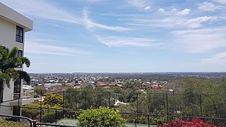
Sunnybank Hills is an outer southern suburb in the City of Brisbane, Queensland, Australia. In the 2021 census, Sunnybank Hills had a population of 18,085 people.

<span class="mw-page-title-main">Cornubia, Queensland</span> Suburb of Logan City, Queensland, Australia

Cornubia is a suburb in the City of Logan, Queensland, Australia. As of the 2021 census, Cornubia had a population of 9,076 people.

<span class="mw-page-title-main">Greenslopes, Queensland</span> Suburb of Brisbane, Queensland, Australia

Greenslopes is a suburb in the City of Brisbane, Queensland, Australia. In the 2021 census, Greenslopes had a population of 7,941 people.

<span class="mw-page-title-main">Woodridge, Queensland</span> Suburb of Logan City, Queensland, Australia

Woodridge is a town and suburb in the City of Logan, Queensland, Australia. In the 2016 census, the suburb of Woodridge had a population of 12,579 people. Woodridge was home to a major timber reserve.

<span class="mw-page-title-main">Browns Plains, Queensland</span> Suburb of Logan City, Queensland, Australia

Browns Plains is a suburb in the City of Logan, Queensland, Australia. In the 2021 census, Browns Plains had a population of 6,632 people.

<span class="mw-page-title-main">Heritage Park, Queensland</span> Suburb of Logan City, Queensland, Australia

Heritage Park is a suburb in the City of Logan, Queensland, Australia. In the 2021 census, Heritage Park had a population of 4,930 people.

<span class="mw-page-title-main">Hillcrest, Queensland</span> Suburb of Logan City, Queensland, Australia

Hillcrest is a suburb in the City of Logan, Queensland, Australia. In the 2016 census, Hillcrest had a population of 5,626.

<span class="mw-page-title-main">Waterford West, Queensland</span> Suburb of Logan City, Queensland, Australia

Waterford West is a suburb in the City of Logan, Queensland, Australia. In the 2021 census, Waterford West had a population of 6,942 people.

<span class="mw-page-title-main">Holland Park West, Queensland</span> Suburb of Brisbane, Queensland, Australia

Holland Park West is a suburb in the City of Brisbane, Queensland, Australia. In the 2016 census, Holland Park West had a population of 6,376 people.

<span class="mw-page-title-main">Karawatha, Queensland</span> Suburb of Brisbane, Queensland, Australia

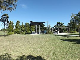
Karawatha is an outer southern suburb in the City of Brisbane, Queensland, Australia. In the 2016 census, Karawatha had a population of 19 people.

<span class="mw-page-title-main">Ellen Grove, Queensland</span> Suburb of Brisbane, Queensland, Australia

Ellen Grove is an outer south-western suburb in the City of Brisbane, Queensland, Australia. In the 2016 census, Ellen Grove had a population of 2,906 people.

<span class="mw-page-title-main">Deagon, Queensland</span> Suburb of Brisbane, Queensland, Australia

Deagon is an outer northern suburb in the City of Brisbane, Queensland, Australia. In the 2016 census, Deagon had a population of 3,675 people.

<span class="mw-page-title-main">Coopers Plains, Queensland</span> Suburb of Brisbane, Queensland, Australia

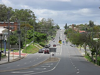
Coopers Plains is a southern suburb in the City of Brisbane, Queensland, Australia. In the 2016 census, Coopers Plains had a population of 5,483 people.

<span class="mw-page-title-main">Carina Heights, Queensland</span> Suburb of Brisbane, Queensland, Australia

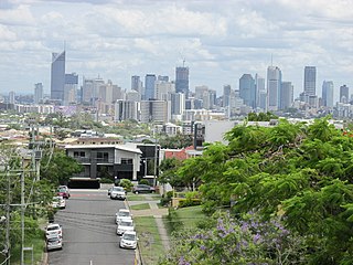
Carina Heights is both a hill and a suburb in the City of Brisbane, Queensland, Australia. In the 2016 census, Carina Heights had a population of 6,732 people.

<span class="mw-page-title-main">Parkinson, Queensland</span> Suburb of Brisbane, Queensland, Australia

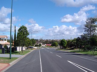
Parkinson is an outer southern suburb in the City of Brisbane, Queensland, Australia. In the 2016 census, Parkinson had a population of 10,878 people.

<span class="mw-page-title-main">Sunshine Beach, Queensland</span> Town in Queensland, Australia

Sunshine Beach is a coastal town and suburb in the Shire of Noosa, Queensland, Australia. In the 2021 census, the suburb of Sunshine Beach had a population of 2,480 people.

<span class="mw-page-title-main">Beachmere, Queensland</span> Town in Queensland, Australia

Beachmere is a coastal rural town and locality in the City of Moreton Bay, Queensland, Australia. In the 2021 census, the locality of Beachmere had a population of 4,782 people.

<span class="mw-page-title-main">Waterford, Queensland</span> Town in Queensland, Australia

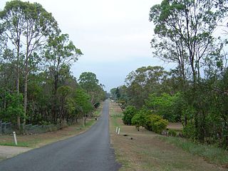
Waterford is a town and suburb in the City of Logan, Queensland, Australia. In the 2021 census, the suburb of Waterford had a population of 5,796 people.

<span class="mw-page-title-main">Cainbable, Queensland</span> Suburb of Scenic Rim Region, Queensland, Australia

Cainbable is a rural locality in the Scenic Rim Region, Queensland, Australia. In the 2016 census, Cainbable had a population of 74 people.

References

  1. 1 2 3 Australian Bureau of Statistics (28 June 2022). "Berrinba (SSC)". 2021 Census QuickStats. Retrieved 18 December 2023. OOjs UI icon edit-ltr-progressive.svg
  2. 1 2 3 "Berrinba – suburb in City of Logan (entry 50311)". Queensland Place Names. Queensland Government . Retrieved 27 December 2020.
  3. Queensland Family History Society (2010), Queensland schools past and present (Version 1.01 ed.), Queensland Family History Society, ISBN   978-1-921171-26-0
  4. "Berrinba". Logan City Council . Archived from the original on 9 March 2021. Retrieved 3 April 2021.
  5. 1 2 3 4 5 Australian Bureau of Statistics (31 October 2012). "Berrinba (SSC)". 2011 Census QuickStats. Retrieved 3 April 2021. OOjs UI icon edit-ltr-progressive.svg
  6. Australian Bureau of Statistics (27 June 2017). "Berrinba (SSC)". 2016 Census QuickStats. Retrieved 20 October 2018. OOjs UI icon edit-ltr-progressive.svg
  7. 1 2 "State and non-state school details". Queensland Government. 9 July 2018. Archived from the original on 21 November 2018. Retrieved 21 November 2018.
  8. "Berrinba East State School". Archived from the original on 20 August 2019. Retrieved 21 November 2018.
  9. "ACARA School Profile 2018". Australian Curriculum, Assessment and Reporting Authority. Archived from the original on 27 August 2020. Retrieved 28 January 2020.
  10. "Queensland Globe". State of Queensland . Retrieved 3 April 2021.
  11. "Current applications - NSSAB". nssab.qld.edu.au. Archived from the original on 5 March 2021. Retrieved 3 April 2021.
  12. "Find a church". Uniting Church in Australia, Queensland Synod. Archived from the original on 24 October 2020. Retrieved 6 May 2021.
  13. "Logan Central Multicultural Uniting Church". Archived from the original on 16 March 2021. Retrieved 27 August 2021.
  14. "Berrinba Wetlands". Logan City Council. Archived from the original on 3 September 2014. Retrieved 3 September 2014.