The Bhal region is an area of Gujarat, India. It is spread across the political boundaries of the districts of Bhavnagar, Ahmedabad, and Anand.[1] The Bhal region is situated on the deltas of the Sabarmati, Bhogawo, Bhadar, Lilka and other rivers that flow east and southeast off the Kathiawar peninsula into the Gulf of Cambay. The word Bhaal (Gujarati: ભાલ) (Hindi: भाल) seems to have been derived from the Sanskrit word भाल which means forehead. Such a name is given to this region probably because it is mostly as flat as a forehead with almost entire region's soil without any stones, pebbles or gravel.
Gamph was a small state of India, ruled by chudasama Rajputs.[2] There are 52 Estates of Chudasama Rajputs in the Dhandhuka area which all are the Bhayads of former Gamph state. These Rajputs are descended from the old Rah Dynasty of Junagadh.[citation needed]
Navaghana (late 11th century king), The King of Junagadh have 5 sons, Whom elder son Bhimji given the Jagir of Bhadli. Second son Satrasalji given the jagir of Sarva, later known as Sarvaiya rajputs on the name of village Sarva. Third and fourth son Devghanji and Savghanji given Osham Chorasi. Fifth son Raa Khengar succeeded him, his descendant Raa Bhupatsinhji of Junagadh was called as "Raizada" Mahommed Begda, Sultan of Ahemdabad so they are later known as Raizada Rajputs. Bhimjis descendants continued the main branch of chudasama. Later they moved to Bhal region. Raisalji established new capital Gorasu in 1572. His Grandson Amarsinhji abandoned Gorasu and established Gamph in 1633, it remained Capital of Chudasama Rajputs. In 1947, Vikramsinhji Manharsinhji Chudasama, The Thakore Saheb of Gamph merged his State into India.
Nani Boru - Lord Shiva Temple built by Prashnora Nagar Brahmin community
Bhadiyad - Pir Mehmudshah Bukhari Dargah Sharif and Mosque
Varna-lord hanumanji temple
Gorad [Gohil Mitali State Bhayat] Rajput's Shahayak Devi Ma Kodiyar Temple
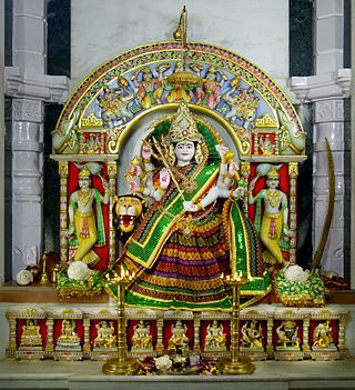
Swaminarayan Temple "Dholera- Madanmohanji Maharaj","Budhej" and "Gorad"
Akru-Madhavanand Aashram
Fairs
Urash Mubarak of Bhadiyad pir
Notable Rulers
Chudasama Rajput was notable rulers of Bhal, they came here from Junagadh. The Chudasama Rajputs moved their capital to Gamph. Gamph was a small princely state with 52 Estates, who are former Bhayads of the ruler of Gamph State.
Virbhadrasinhji Vikramsinhji Chudasama.
16th ruler of Gamph State and head of Chudasama Rajputs.
Gujarat is a state along the western coast of India. Its coastline of about 1,600 km (990 mi) is the longest in the country, most of which lies on the Kathiawar peninsula. Gujarat is the fifth-largest Indian state by area, covering some 196,024 km2 (75,685 sq mi); and the ninth-most populous state, with a population of 60.4 million in 2011. It is bordered by Rajasthan to the northeast, Dadra and Nagar Haveli and Daman and Diu to the south, Maharashtra to the southeast, Madhya Pradesh to the east, and the Arabian Sea and the Pakistani province of Sindh to the west. Gujarat's capital city is Gandhinagar, while its largest city is Ahmedabad. The Gujaratis are indigenous to the state and their language, Gujarati, is the state's official language.
Kathiawar is a peninsula, near the far north of India's west coast, of about 61,000 km2 (23,500 sq mi) bordering the Arabian Sea. It is bounded by the Gulf of Kutch in the northwest and by the Gulf of Khambhat in the east. In the northeast, it is connected to the rest of Gujarat and borders on the low, fertile hinterland of Ahmedabad. It is crossed by two belts of hill country and is drained radially by nine rivers which have little natural flow aside from in monsoon months, thus dams have been built on some of these. Kathiawar ports have been flourishing centres of trade and commerce since at least the 16th century.
Junagadh is the city and headquarters of Junagadh district in the Indian state of Gujarat. Located at the foot of the Girnar hills, 355 kilometres (221 mi) southwest of Ahmedabad and Gandhinagar, it is the seventh largest city in the state. It is dominated by the Chudasama clan of Rajputs since ancient times.
Saurashtra, also known as Kathiawar, is a peninsular region of Gujarat, India, located on the Arabian Sea coast. It covers about a third of Gujarat state, notably 11 districts of Gujarat, including Rajkot District. It was formerly a state of India before it merged with Bombay state. In 1961 it separated from Bombay and joined Gujarat.
Wadhwan, also spelled Vadhwan, is a city and a municipality in Surendranagar district in the Indian state of Gujarat. Located on the banks of the Bhogavo River, around 3 km from Surendranagar and 111 km from Ahmedabad, Wadhwan is a known location for its old world royal charm and serene space with a life and culture of its own. It was historically the capital of Wadhwan State.
Amreli is a city and a municipality in Amreli district in Indian state of Gujarat.
Botad, located in Gujarat's Saurashtra (region), is a significant city and district headquarters of the Botad district. Established as a separate district in 2013, Botad has developed into a key administrative and economic hub, connecting nearby towns and fostering growth across the region.
Dhandhuka is a city and a municipality in the Ahmedabad district in the state of Gujarat, India. Moreover, it is a part of the Bhal region.
Dholera is a town in Ahmedabad district of Gujarat state in India.
Dhari is a town in Amreli District in Indian state of Gujarat, India. It is an administrative headquarter of the Dhari tehsil(almost 87 villages and ness).Dhari is the most populous town in Amreli District as per census 2011 with 30352 population. Dhari is located on the bank of Shetrunji River, 42 km(26.2 mi) from district headquarter Amreli & 318 km(199.8 mi) from state capital Gandhinagar. Dhari is famous for kesar mango and Asiatic lion. Dhari is capital of East Gir Forest.
Gadhakda is a village in Savarkundla tehsil in the Amreli district of Indian state Gujarat. Gadhakda was formerly under the control of Junagadh State. Although it is now a part of the Amreli district, it was once a part of the Bhavnagar district.
Ashapura Mata is an aspect of Devi, a Hindu goddess. She is one of the kuldevis of Kutch and Rajasthan, and the Jadeja clan of Gujarat, Chauhans and Patiyats inhabiting the western Indian provinces. She is a goddess regarded to fulfill the wishes of her adherents.
Anand Junction is a major junction located in Anand, Gujarat. It is a junction on the railway line which connects Ahmedabad with Vadodara and Mumbai and was opened in 1901.
Botad District is a district in the state of Gujarat, India.
The Chudasama dynasty, a Samma branch, ruled parts of the present-day Saurashtra region of Gujarat state in India between the 9th and 15th centuries. Their capital was based in Junagadh and Vamanasthali.
Vihal Krupa is a Home in Raliyana in the state of Gujarat, India. Vihal Krupa is situated on the bank of the River Ghelo.
The Last Hindu Rajput Ruler Of Saurashtra Mandalika III, called by the epithet Ra Gangajalio, was a Chudasama king of Saurashtra region of western India who reigned from 1451 CE to 1472 CE. His capital was at Junagadh.
Ra Jayasimha II was a Chudasama king of Saurashtra region of western India who reigned from 1416 CE to 1430 CE. His capital was at Junagadh.
Mahipala I was a Chudasama king of Saurashtra region of western India who reigned from 1308 CE to 1331 CE. His capital was at Junagadh.
Navaghana was a Chudasama Rajput king of Saurashtra region of western India who reigned from 1306 CE to 1308 CE. His capital was at Junagadh.
This page is based on this Wikipedia article Text is available under the CC BY-SA 4.0 license; additional terms may apply. Images, videos and audio are available under their respective licenses.