
Mohave County is in the northwestern corner of the U.S. state of Arizona. As of the 2020 census, its population was 213,267. The county seat is Kingman, and the largest city is Lake Havasu City. It is the fifth largest county in the United States.
Kaibab is an unincorporated community and census-designated place (CDP) in Mohave County, Arizona, United States. It is within the Kaibab Indian Reservation. The population of the CDP was 140 at the 2020 census.
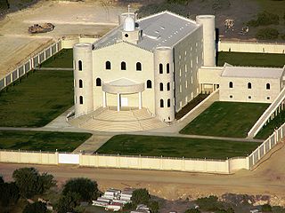
The Fundamentalist Church of Jesus Christ of Latter-Day Saints is one of the fundamentalist Mormon denominations whose members practice polygamy. The fundamentalist Mormon movement emerged in the early 20th century, when its founding members were excommunicated from The Church of Jesus Christ of Latter-day Saints, largely because of their refusal to abandon the practice of plural marriage after it was renounced in the "Second Manifesto" (1904).

Martin's Cove is a historic site in Wyoming. The 933 acre (3.8 km²) cove is located 55 miles (89 km) southwest of Casper, Wyoming, in Natrona County. It is located on the Mormon Trail and is also part of the North Platte-Sweetwater segment of the Oregon Trail. The Cove was listed in the National Register of Historic Places on March 8, 1977.

Pipe Spring National Monument is a United States National Monument located in the U.S. state of Arizona, rich with American Indian, early explorer, and Mormon pioneer history. Administered by the National Park Service, Pipe Spring was listed on the National Register of Historic Places on October 15, 1966, and the boundaries of the Pipe Spring National Monument Historic District were expanded in October 2000.

The Old Spanish Trail is a historical trade route that connected the northern New Mexico settlements of Santa Fe, New Mexico with those of Los Angeles, California and southern California. Approximately 700 mi (1,100 km) long, the trail ran through areas of high mountains, arid deserts, and deep canyons. It is considered one of the most arduous of all trade routes ever established in the United States. Explored, in part, by Spanish explorers as early as the late 16th century, the trail was extensively used by traders with pack trains from about 1830 until the mid-1850s.

The Arizona Strip is the part of Arizona lying north of the Colorado River. Despite being larger in area than several U.S. states, the entire region has a population of fewer than 10,000 people. Consisting of northeastern Mohave County and northwestern Coconino County, the largest settlements in the Strip are Colorado City, Fredonia, and Beaver Dam, with smaller communities of Scenic, Littlefield and Desert Springs. The Kaibab Indian Reservation lies within the region. Lying along the North Rim of the Grand Canyon creates physical barriers to the rest of Arizona. Only three major roads traverse the region, I-15 crosses the northwestern corner while Arizona State Route 389 and U.S. Route 89A crosses the northeastern part of the strip, US 89A crosses the Colorado River via the Navajo Bridge, providing the only direct road connection between the strip and the rest of the state. The nearest metropolitan area is the St. George, Utah metro area, to which the region is more connected than to the rest of Arizona.

The Kaibab Indian Reservation is the home of the Kaibab Band of Paiute Indians, a federally recognized tribe of Southern Paiutes. The Indian reservation is located in northern part of the U.S. state of Arizona. It covers a land area of 188.75 square miles (488.9 km2) in northeastern Mohave County and northwestern Coconino County adjacent to the southern Utah border. The Pipe Spring National Monument lies in the southwestern section of the reservation. The Thunder Mountain Pootseev Dark-sky preserve is colocated with the reservation.

Jacob Lake is a small unincorporated community on the Kaibab Plateau in Coconino County, Arizona, United States, at the junction of U.S. Route 89A and State Route 67. Named after the Mormon explorer Jacob Hamblin, the town is known as the "Gateway to the Grand Canyon" because it is the starting point of Route 67, the only paved road leading to the North Rim of the Grand Canyon some 44 miles (71 km) to the south. The town itself consists of the Jacob Lake Inn which maintains motel rooms and cabins, a restaurant, lunch counter, gift shop, bakery, and general store; a gas station/garage; campground; and a visitors center run by the U.S. Forest Service. In the summer months, there is also a nearby center for horse rides.
Fredonia-Moccasin Unified School District is a school district headquartered in Fredonia, Arizona, United States.

The Church of Jesus Christ of Latter-day Saints is the second largest religious denomination in Arizona, behind the Roman Catholic Church. In 2019, the church reported 436,521 members in Arizona, about 6% of the state's population. According to the 2014 Pew Forum on Religion & Public Life survey, roughly 5% of Arizonans self-identify most closely with The Church of Jesus Christ of Latter-day Saints.
The Great Western Trail is a north-south long distance multiple use route which runs from Canada to Mexico through five western states in the United States. The trail has access for both motorized and non-motorized users and traverses 4,455 miles (7,170 km) through Arizona, Utah, Idaho, Wyoming, and Montana. It was designated a National Millennium Trail in 1999.
The Moccasin Mountains is an 11-mile-long (18 km) mountain range located at the Arizona–Utah border in Mohave County, Arizona, and a small north section in Kane County, Utah.

The Black Suspension Bridge spans the Colorado River in the inner canyon of Grand Canyon National Park. The span length is 440 feet. The bridge is part of the South Kaibab Trail and is the river crossing used by mules going to Phantom Ranch. The Black Bridge and Silver Bridge, located about 700 meters downstream, are the only spans in hundreds of river miles.

Cane Beds is an unincorporated community and census-designated place (CDP) in Mohave County, Arizona, United States. It lies 4 miles (6 km) south of the border with Utah in the Arizona Strip, and is supported by services in Utah as well as some in Nevada.


