Blacks Beach, Queensland

Last updated

Blacks Beach
Mackay,  Queensland
Australia Queensland location map.svg
Red pog.svg
Blacks Beach
Coordinates 21°03′46″S149°11′16″E / 21.06278°S 149.18778°E / -21.06278; 149.18778 Coordinates: 21°03′46″S149°11′16″E / 21.06278°S 149.18778°E / -21.06278; 149.18778
Population3,861 (2016 census) [1]
Postcode(s) 4740
Location
LGA(s) Mackay Region
State electorate(s)
Federal Division(s) Dawson
Suburbs around Blacks Beach:
Eimeo Dolphin Heads Coral Sea
Rural View Blacks Beach Coral Sea
Beaconsfield Andergrove Slade Point

Blacks Beach is a coastal suburb, one of the "northern beaches" of the city of Mackay in the Mackay Region, Queensland, Australia. [2]

Contents

Geography

Blacks Beach boasts a continuous 6 kilometres (3.7 mi) beach, the longest in the Mackay region. It is popular for watersports. [3]

History

The suburb is named after Maurice Hume Black, who operated The Cedars sugar plantation and mill from 1871. The mill closed in 1885 and the plantation then crushed their sugarcane at the River Estate sugar mill. Black had originally lived on the plantation but later moved to the coast. [4]

In the 2011 census, the population was 2,871 people. [5]

Amenities

The Mackay Regional Council operates a mobile library service on a fortnightly schedule at Blacks Beach Road. [6] [7]

Related Research Articles

Mackay, Queensland City in Queensland, Australia

Mackay is a city and its centre suburb in the Mackay Region on the eastern or Coral Sea coast of Queensland, Australia. It is located about 970 kilometres (603 mi) north of Brisbane, on the Pioneer River. Mackay is nicknamed the sugar capital of Australia because its region produces more than a third of Australia's sugar. At June 2018 Mackay had a population of 80,148, having decreased slightly at an average annual rate of -0.32% year-on-year over the preceding five years.

Hay Point, Queensland Town in Queensland, Australia

Hay Point is a coastal locality in Mackay Region, Queensland, Australia. It contains two towns, Hector on its north coast and Half Tide on its south coast. In the 2016 census, Hay Point had a population of 1,348 people.

Edmonton, Queensland Town in Queensland, Australia

Edmonton is a former town supporting a sugar mill, but is now a suburb of Cairns in the Cairns Region, Queensland, Australia. In the 2016 census, Edmonton had a population of 10,753 people.

Petrie, Queensland Suburb of Moreton Bay, Queensland, Australia

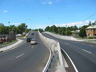
Petrie is a suburb in the Moreton Bay Region, Queensland, Australia.

Slade Point, Queensland Town in Queensland, Australia

Slade Point is a coastal town and peninsular suburb of Mackay in the Mackay Region, Queensland, Australia.

Strathpine, Queensland Suburb of Moreton Bay Region, Queensland, Australia

Strathpine is a suburb in the Moreton Bay Region, Queensland, Australia. It is home to the Pine Rivers District offices of the Moreton Bay Region as well as many businesses. The area is home to Strathpine Centre, a medium-sized urban shopping centre.

Calen, Queensland Town in Queensland, Australia

Calen is a small town and a coastal locality in the Mackay Region, Queensland, Australia. In the 2016 census, Calen had a population of 390 people.

Mackay Region Local government area in Queensland, Australia

The Mackay Region is a local government area located in North Queensland, Queensland, Australia. Established in 2008, it was preceded by three previous local government areas with modern histories extending back as far as 1869.

Te Kowai is a locality in the Mackay Region in Queensland, Australia. Its population at the 2016 Australian census was 218 people.

Mirani, Queensland Town in Queensland, Australia

Mirani is a town and locality in Mackay Region, Queensland, Australia. In the 2016 census, Mirani had a population of 1,541 people.

Cedar Creek, Queensland (Logan & Gold Coast) Suburb of Logan City / City of Gold Coast, Queensland, Australia

Cedar Creek is a locality split between Logan City and City of Gold Coast in Queensland, Australia. As at the 2011 Census, Cedar Creek had a population of 832. It is located about 41 kilometres (25 mi) south-southeast of Brisbane, Queensland's capital city.

Homebush, Queensland Town in Queensland, Australia

Homebush is a rural locality in Mackay Region, Queensland, Australia.

Marian, Queensland Town in Queensland, Australia

Marian is a town and locality in the Mackay Region, Queensland, Australia. It had a population of 3903 in 2016 census.

Ball Bay, Queensland Town in Queensland, Australia

Ball Bay is a coastal rural town, a locality and a bay in Mackay Region, Queensland, Australia. In the 2016 census, Ball Bay had a population of 360 people.

Beaconsfield, Queensland Suburb of Mackay, Queensland, Australia

Beaconsfield is a suburb of Mackay Region, Queensland, Australia. It is located 8 kilometres (5.0 mi) north of Mackay. At the 2016 census, it had a population of 5,490.

Bucasia, Queensland Suburb of Mackay, Queensland, Australia

Bucasia is a coastal town and one of the largest suburbs of Mackay in the Mackay Region, Queensland, Australia.

Habana, Queensland Suburb of Mackay Region, Queensland, Australia

Habana is a coastal locality in the Mackay Region, Queensland, Australia.

Mount Pleasant, Queensland (Mackay Region) Suburb of Mackay, Queensland, Australia

Mount Pleasant is a mountain and suburb of Mackay in the Mackay Region, Queensland, Australia.

Bloomsbury, Queensland Town in Queensland, Australia

Bloomsbury is a town and coastal locality in the Mackay Region, Queensland, Australia. In the 2016 census, Bloomsbury had a population of 598 people.

McEwens Beach, Queensland Suburb of Mackay Region, Queensland, Australia

McEwens Beach is a coastal town and locality in the Mackay Region, Queensland, Australia. In the 2016 census, McEwens Beach had a population of 202 people.

References

  1. Australian Bureau of Statistics (27 June 2017). "Blacks Beach (State Suburb)". 2016 Census QuickStats. Retrieved 18 April 2018. OOjs UI icon edit-ltr-progressive.svg
  2. "Blacks Beach (entry 46763)". Queensland Place Names. Queensland Government . Retrieved 21 April 2014.
  3. "Blacks Beach". Mackay Regional Council . Retrieved 23 April 2014.
  4. "The Cedars Sugar Mill". Mackay History. Archived from the original on 24 November 2018. Retrieved 25 November 2018.
  5. Australian Bureau of Statistics (31 October 2012). "Blacks beach (SSC)". 2011 Census QuickStats. Retrieved 21 April 2014. OOjs UI icon edit-ltr-progressive.svg
  6. "Libraries: Contact/Opening Hours". Mackay Regional Council. Archived from the original on 1 March 2016. Retrieved 28 April 2017.
  7. "Mobile Library Timetable 2017" (PDF). Mackay Regional Council. Archived from the original (PDF) on 1 March 2017. Retrieved 8 May 2017.