Dunnrock, Queensland

Last updated

Dunnrock
Queensland
Australia Queensland location map.svg
Red pog.svg
Dunnrock
Coordinates 21°15′54″S149°10′54″E / 21.265°S 149.1816°E / -21.265; 149.1816 (Dunnrock (centre of locality))
Population58 (2021 census) [1]
 • Density5.18/km2 (13.41/sq mi)
Postcode(s) 4740
Area11.2 km2 (4.3 sq mi)
Time zone AEST (UTC+10:00)
Location
LGA(s) Mackay Region
State electorate(s) Mirani
Federal division(s) Dawson
Suburbs around Dunnrock:
McEwens Beach McEwens Beach McEwens Beach
Chelona Dunnrock McEwens Beach
Balberra Balberra Balberra

Dunnrock is a coastal rural locality in the Mackay Region, Queensland, Australia. [2] In the 2021 census, Dunnrock had a population of 58 people. [1]

Contents

Geography

The locality is bounded to the south and south-east by the meandering Sandy Creek, [3] which flows into Sandringham Bay ( 21°14′59″S149°13′19″E / 21.2498°S 149.2219°E / -21.2498; 149.2219 (Sandringham Bay) ) of the Coral Sea, which forms the eastern boundary of the locality. [4] [5]

Most of the south of the locality is within Sandringham Bay Conservation Park except for a small residential area (the former town) at the mouth of the creek ( 21°16′21″S149°11′02″E / 21.27238°S 149.18402°E / -21.27238; 149.18402 (Dunnrock (former town)) ). The land use in the west of the locality is growing sugarcane. The land in the east nearest the coast is marshland with the centre of the locality being used for grazing on native vegetation.

History

The locality was named after farmer Samuel Dunn, who cut a track to the township site. Dunn was the lessee of Portion 8V, Parish of Chelona. The locality was officially named and bounded on 3 September 1999. [2]

Demographics

In the 2016 census, Dunnrock had a population of 75 people. [6]

In the 2021 census, Dunnrock had a population of 58 people. [1]

Education

There are no schools in Dunnrock. The nearest government primary school is Chelona State School in neighbouring Chelona to the west. The nearest government secondary school is Mackay State High School in South Mackay. [5]

Amenities

There is a boat ramp on Dunrock Esplanade is a boat ramp on the north bank of Sandy Creek ( 21°16′23″S149°11′01″E / 21.2731°S 149.1837°E / -21.2731; 149.1837 (Dunrock Esplanade boat ramp) ). It is managed by the Mackay Regional Council. [7]

Related Research Articles

<span class="mw-page-title-main">Hay Point, Queensland</span> Town in Queensland, Australia

Hay Point is a coastal locality in Mackay Region, Queensland, Australia. It contains two towns, Hector on its north coast and Half Tide on its south coast. In the 2021 census, the locality of Hay Point had a population of 1,306 people.

Te Kowai is a rural locality in the Mackay Region, Queensland, Australia. In the 2021 census, Te Kowai had a population of 227 people.

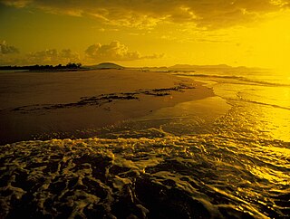
Turkey Beach is a coastal town and locality in the Gladstone Region, Queensland, Australia. In the 2021 census, the locality of Turkey Beach had a population of 148 people.

<span class="mw-page-title-main">Eimeo, Queensland</span> Town in Queensland, Australia

Eimeo is a coastal town and suburb in the Mackay Region, Queensland, Australia. In the 2021 census, the suburb of Eimeo had a population of 3,285 people.

The Leap is a coastal rural locality in the Mackay Region, Queensland, Australia. In the 2021 census, The Leap had a population of 664 people.

Karragarra Island is one of the inhabited Southern Moreton Bay Islands, near Brisbane, in Queensland, Australia. It is also a town and locality in the City of Redland, Queensland, Australia. In the 2021 census, the locality of Karragarra Island had a population of 240 people.

Bucasia is a coastal town and suburb of Mackay in the Mackay Region, Queensland, Australia. In the 2021 census, the suburb of Bucasia had a population of 4,915 people.

<span class="mw-page-title-main">Mount Jukes, Queensland</span> Suburb of Mackay Region, Queensland, Australia

Mount Jukes is a mountain and surrounding coastal rural locality north of Mackay in the Mackay Region, Queensland, Australia. In the 2021 census, Mount Jukes had a population of 373 people.

<span class="mw-page-title-main">Habana, Queensland</span> Suburb of Mackay Region, Queensland, Australia

Habana is a coastal rural locality in the Mackay Region, Queensland, Australia. In the 2021 census, Habana had a population of 1,022 people.

<span class="mw-page-title-main">Clairview</span> Town in Queensland, Australia

Clairview is a coastal town and locality in the Isaac Region, Queensland, Australia. In the 2021 census, the locality of Clairview had a population of 167 people.

Chelona is a rural locality in the Mackay Region, Queensland, Australia. In the 2021 census, Chelona had a population of 120 people.

McEwens Beach is a coastal town and rural locality in the Mackay Region, Queensland, Australia. In the 2021 census, the locality of McEwens Beach had a population of 159 people.

Freshwater Point is a coastal locality in the Mackay Region, Queensland, Australia. In the 2021 census, Freshwater Point had a population of 174 people.

Sarina Beach is a coastal town and locality in the Mackay Region, Queensland, Australia. In the 2021 census, the locality of Sarina Beach had a population of 661 people.

Campwin Beach is a coastal town and rural locality in the Mackay Region, Queensland, Australia. In the 2021 census, the locality of Campwin Beach had a population of 511 people.

<span class="mw-page-title-main">Grasstree Beach, Queensland</span> Suburb of Mackay Region, Queensland, Australia

Grasstree Beach is a coastal locality in the Mackay Region, Queensland, Australia. It contains two towns, Grasstree in the centre of the locality and Zelma on the coast. In the 2021 census, Grasstree Beach had a population of 717 people.

<span class="mw-page-title-main">Eungella Dam, Queensland</span> Suburb of Mackay Region, Queensland, Australia

Eungella Dam is a locality in the Mackay Region, Queensland, Australia. In the 2021 census, Eungella Dam had "no people or a very low population".

Tuan is a coastal rural town and locality in the Fraser Coast Region, Queensland, Australia. In the 2021 census, the locality of Tuan had a population of 140 people.

<span class="mw-page-title-main">Tully Heads, Queensland</span> Town in Queensland, Australia

Tully Heads is a coastal town and locality in the Cassowary Coast Region, Queensland, Australia. In the 2021 census, the locality of Tully Heads had a population of 354 people.

<span class="mw-page-title-main">Lower Daintree, Queensland</span> Suburb of Shire of Douglas, Queensland, Australia

Lower Daintree is a coastal rural locality in the Shire of Douglas, Queensland, Australia. In the 2021 census, Lower Daintree had a population of 83 people.

References

  1. 1 2 3 Australian Bureau of Statistics (28 June 2022). "Dunnrock (SAL)". 2021 Census QuickStats. Retrieved 28 February 2023. OOjs UI icon edit-ltr-progressive.svg
  2. 1 2 "Dunnrock – locality in Mackay Region (entry 46778)". Queensland Place Names. Queensland Government . Retrieved 3 September 2023.
  3. Google (20 August 2021). "Dunnrock, Queensland" (Map). Google Maps . Google. Retrieved 20 August 2021.
  4. "Bays - Queensland". Queensland Open Data. Queensland Government. 12 November 2020. Archived from the original on 25 November 2020. Retrieved 25 November 2020.
  5. 1 2 "Queensland Globe". State of Queensland . Retrieved 3 September 2023.
  6. Australian Bureau of Statistics (27 June 2017). "Dunnrock (SSC)". 2016 Census QuickStats. Retrieved 20 October 2018. OOjs UI icon edit-ltr-progressive.svg
  7. "Recreational Boating Facilities Queensland". Queensland Open Data. Queensland Government. 12 November 2020. Archived from the original on 22 November 2020. Retrieved 22 November 2020.