Mount Ossa, Queensland

Last updated

Mount Ossa
Queensland
Australia Queensland location map.svg
Red pog.svg
Mount Ossa
Coordinates 20°57′33″S148°50′02″E / 20.9591°S 148.8338°E / -20.9591; 148.8338 (Mount Ossa (town centre)) Coordinates: 20°57′33″S148°50′02″E / 20.9591°S 148.8338°E / -20.9591; 148.8338 (Mount Ossa (town centre))
Population224 (2016 census locality) [1]
 • Density2.011/km2 (5.208/sq mi)
Postcode(s) 4741
Area111.4 km2 (43.0 sq mi)
Time zone AEST (UTC+10:00)
Location
  • 30.8 km (19 mi) N of Mirani
  • 47.4 km (29 mi) Mackay of 997
  • NNW km (Formatting error: invalid input when rounding mi) Brisbane of
LGA(s) Mackay Region
State electorate(s) Whitsunday
Federal Division(s) Dawson
Localities around Mount Ossa:
Calen Coral Sea Seaforth
Mount Pelion Mount Ossa Kuttabul
Mount Charlton Mount Martin Kuttabul

Mount Ossa is a rural town and a coastal locality in the Mackay Region, Queensland, Australia. [2] [3] In the 2016 census the locality of Mount Ossa had a population of 224 people. [1]

Contents

Geography

The locality is bounded in the north by the Coral Sea and in north-west by Murray Creek and in the north-east by Conow Creek, both of which flow into the Coral Sea. The central and north-eastern parts of the locality are mostly low-lying land (10–20 metres above sea level) and well-watered by a number of minor creeks. This land is freehold and predominantly used for growing sugarcane on the flatter level with some cattle grazing. The south-western part of the locality is mountainous including Mount Ossa (270 metres) from which the town takes its name. The south-western part is mostly bushland and includes the Mount Ossa National Park. [4]

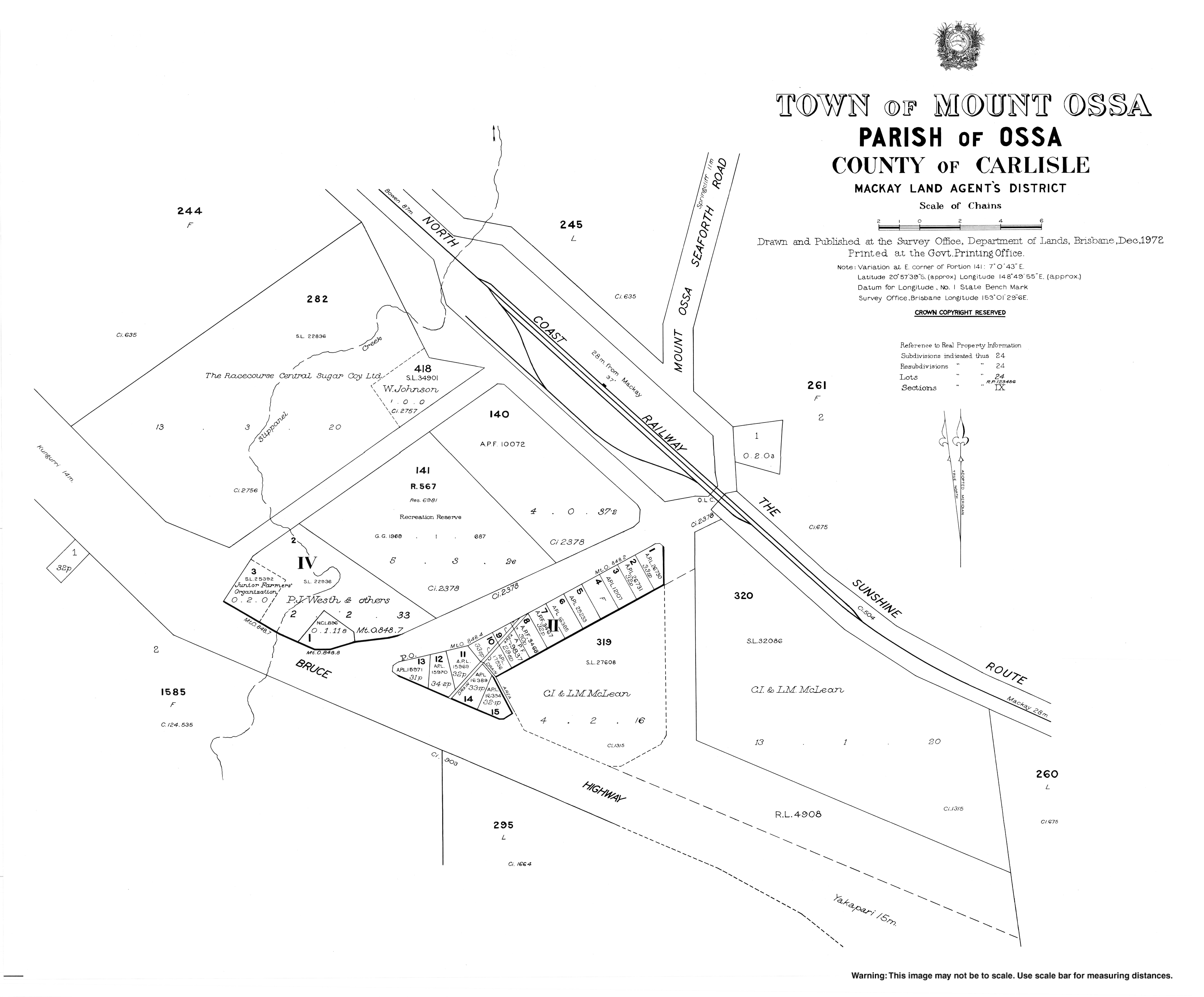
The town is situated in the centre of the locality. The Bruce Highway traverses the locality from south-east to west passing through the town. At the town, the highway has a junction with the Mount Ossa Seaforth Road which exits the locality in the north-east. About one kilometre north-west of the town, the highway has another junction with the Mirani Mount Ossa Road which exits the locality in the south-west. The North Coast railway line also traverses the locality from south-east to west roughly parallel and north-east relative to the highway. The town is served by the Mount Ossa railway station ( 20°57′28″S148°50′06″E / 20.9577°S 148.8349°E / -20.9577; 148.8349 (Mount Ossa railway station) ). [4] [5] [6] There are two other abandoned railway stations in the locality:

History

The town was named after the Mount Ossa railway station, which in turn was named after the mountain. The mountain's name was assigned by surveyor William Charles Borlase Wilson, using a name from Greek mythology (Mounts Ossa and Pelion). [2] [6]

About 8 kilometres (5 mi) south-west of Mount Ossa is the site of the former settlement of Silent Grove. The Silent Grove Provisional School opened on 29 August 1928. On 3 February 1936 the Silent Grove Upper State School opened. In 1938, the Silent Grove Provisional School closed, being replaced by the Mount Ossa State School. The Silent Grove Upper State School closed about 1964 and the Mount Ossa State School closed in 1970. [7]

In the 2016 census the locality of Mount Ossa had a population of 224 people. [1]

Education

There are no schools in Mount Ossa. The nearest primary schools are Calen District College in neighbouring Calen to the north-west, Seaforth State School in neighbouring Seaforth to the north-east, and Hampden State School in Hampden to the south-east. The nearest secondary schools are Calen District College in neighbouring Calen to the north-west, Mackay North State High School in North Mackay in Mackay to the south-west, and Mirani State High School in Mirani to the south. [4]

Related Research Articles

Sarina, Queensland Town in Queensland, Australia

Sarina is a rural town and coastal locality in the Mackay Region, Queensland, Australia. In the 2016 census, Sarina had a population of 5,522 people.

Calen, Queensland Town in Queensland, Australia

Calen is a small town and a coastal locality in the Mackay Region, Queensland, Australia. In the 2016 census, Calen had a population of 390 people.

Roman Catholic Diocese of Rockhampton

The Roman Catholic Diocese of Rockhampton is a suffragan Latin Church diocese of the Archdiocese of Brisbane, erected in 1882, covering Central Queensland, Australia.

Mackay Region Local government area in Queensland, Australia

The Mackay Region is a local government area located in North Queensland, Queensland, Australia. Established in 2008, it was preceded by three previous local government areas with modern histories extending back as far as 1869.

Mirani, Queensland Town in Queensland, Australia

Mirani is a town and locality in Mackay Region, Queensland, Australia. In the 2016 census, Mirani had a population of 1,541 people.

Finch Hatton, Queensland Town in Queensland, Australia

Finch Hatton is a rural town and locality in the Mackay Region, Queensland, Australia. In the 2016 census the locality of Finch Hatton had a population of 499 people.

Pindi Pindi Town in Queensland, Australia

Pindi Pindi is a small rural locality in Mackay Region, Queensland, Australia.

Mount Jukes, Queensland Suburb of Mackay Region, Queensland, Australia

Mount Jukes is a mountain and surrounding coastal rural locality north of Mackay in the Mackay Region, Queensland, Australia. In the 2016 census, Mount Jukes had a population of 394 people.

Mirani railway station, Queensland

Mirani railway station is a heritage-listed former railway station on the former Pioneer Valley railway line at Victoria Street, Mirani, Mackay Region, Queensland, Australia. It was built from 1885 to 1913. It is also known as Hamilton railway station. It was added to the Queensland Heritage Register on 7 July 2005.

Eton, Queensland Town in Queensland, Australia

Eton is a rural town and locality in the Mackay Region, Queensland, Australia. In the 2016 census the locality of Eton had a population of 679 people.

Netherdale, Queensland Suburb of Mackay Region, Queensland, Australia

Netherdale is a locality in the Mackay Region, Queensland, Australia.

Eungella, Queensland Town in Queensland, Australia

Eungella is a rural town and locality in the Mackay Region, Queensland, Australia. In the 2016 census, Eungella had a population of 194 people.

Oakenden, Queensland Suburb of Mackay Region, Queensland, Australia

Oakenden is a rural locality in the Mackay Region, Queensland, Australia. In the 2016 census, Oakenden had a population of 431 people.

Hampden, Queensland Suburb of Mackay Region, Queensland, Australia

Hampden is a rural locality in the Mackay Region, Queensland, Australia. In the 2016 census, Hampden had a population of 566 people.

Chelona, Queensland Suburb of Mackay Region, Queensland, Australia

Chelona is a rural locality in the Mackay Region, Queensland, Australia. In the 2016 census, Chelona had a population of 100 people.

Kuttabul, Queensland Town in Queensland, Australia

Kuttabul is a rural town and locality in the Mackay Region, Queensland, Australia. In the 2016 census the locality of Kuttabul had a population of 730 people.

Brightly, Queensland Suburb of Mackay Region, Queensland, Australia

Brightly is a rural locality in the Mackay Region, Queensland, Australia. In the 2016 census Brightly had a population of 70 people.

Crediton, Queensland Suburb of Mackay Region, Queensland, Australia

Crediton is a rural locality in the Mackay Region, Queensland, Australia. In the 2016 census, Crediton had a population of 82 people.

Mount Pelion, Queensland Suburb of Mackay Region, Queensland, Australia

Mount Pelion is a rural locality in the Mackay Region, Queensland, Australia. In the 2016 census Mount Pelion had a population of 125 people.

Gunyarra Suburb of Whitsunday Region, Queensland, Australia

Gunyarra is a rural locality in the Whitsunday Region, Queensland, Australia. In the 2016 census, Gunyarra had a population of 16 people.

References

  1. 1 2 3 Australian Bureau of Statistics (27 June 2017). "Mount Ossa (SSC)". 2016 Census QuickStats. Retrieved 20 October 2018. OOjs UI icon edit-ltr-progressive.svg
  2. 1 2 "Mount Ossa - town in Mackay Region (entry 23122)". Queensland Place Names. Queensland Government . Retrieved 27 December 2020.
  3. "Mount Ossa - locality in Mackay Region (entry 50299)". Queensland Place Names. Queensland Government . Retrieved 27 December 2020.
  4. 1 2 3 4 5 "Queensland Globe". State of Queensland . Retrieved 19 January 2021.
  5. 1 2 3 "Railway stations and sidings - Queensland". Queensland Open Data. Queensland Government. 2 October 2020. Archived from the original on 5 October 2020. Retrieved 5 October 2020.
  6. 1 2 "Mount Ossa - railway station in Mackay Region (entry 23123)". Queensland Place Names. Queensland Government . Retrieved 29 July 2017.
  7. Queensland Family History Society (2010), Queensland schools past and present (Version 1.01 ed.), Queensland Family History Society, ISBN   978-1-921171-26-0