Mentmore, Queensland

Last updated

Map all coordinates using: OpenStreetMap
Mentmore
Queensland
Australia Queensland location map.svg
Red pog.svg
Mentmore
Coordinates 20°45′48″S148°44′18″E / 20.7633°S 148.7383°E / -20.7633; 148.7383 (Mentmore (centre of locality))
Population0 (2016 census) [1]
 • Density0.000/km2 (0.000/sq mi)
Postcode(s) 4798
Area136.8 km2 (52.8 sq mi)
Time zone AEST (UTC+10:00)
Location
LGA(s) Mackay Region
State electorate(s) Whitsunday
Federal division(s) Dawson
Suburbs around Mentmore:
Bloomsbury Midge Point Coral Sea
Yalboroo Mentmore Coral Sea
Yalboroo Pindi Pindi Coral Sea

Mentmore is a coastal locality in the Mackay Region, Queensland, Australia. [2] In the 2016 census, Mentmore had no population. [1]

Contents

Geography

The Tonga Range runs through the centre of the locality with Tonga Mountain, the highest peak at 233 metres. [3]

Mentmore has the following mountains (from north to south):

Mentore has the following coastal features (from north to south):

Offshore are a number of named marine features:

The land use is grazing on native vegetation. [18]

History

Menmore was officially named and bounded by the Minister for Natural Resources on 3 September 1999. [2]

Mentmore Beach was a popular holiday destination in the 1930s and 1940s with swimming and fishing the main attractions. [19] [20] However, plans to develop the beach as a seaside resort required subdivision of land which was unable to proceed until a better access road was established and the road was never funded. [21]

Economy

There are a number of homesteads in the locality: [22]

Education

There are no schools in Mentmore. The nearest government primary schools are Pindi Pindi State School in neighbouring Pindi Pindi to the south and Bloomsbury State School in neighbouring Bloomsbury to the north-west. The nearest government secondary school is Calen District State College in Calen to the south. [23]

Related Research Articles

<span class="mw-page-title-main">Calen, Queensland</span> Town in Queensland, Australia

Calen is a rural town and coastal locality in the Mackay Region, Queensland, Australia. In the 2016 census, the locality of Calen had a population of 390 people.

<span class="mw-page-title-main">Seaforth, Queensland</span> Town in Queensland, Australia

Seaforth is a coastal town and locality in the Mackay Region, Queensland, Australia. In the 2016 census the locality of Seaforth had a population of 789 people.

Pindi Pindi is a rural locality in the Mackay Region, Queensland, Australia. In the 2016 census Pindi Pindi had a population of 98 people.

<span class="mw-page-title-main">Cannonvale, Queensland</span> Suburb of Whitsunday Region, Queensland, Australia

Cannonvale is a coastal locality and resort town in the Whitsunday Region, Queensland, Australia. In the 2016 census Cannonvale had a population of 5,716 people.

<span class="mw-page-title-main">Habana, Queensland</span> Suburb of Mackay Region, Queensland, Australia

Habana is a coastal rural locality in the Mackay Region, Queensland, Australia. In the 2016 census Habana had a population of 952 people.

Yalboroo is a rural town and locality in the Mackay Region, Queensland, Australia. In the 2016 census, the locality of Yalboroo had a population of 170 people.

Bloomsbury is a town and coastal locality in the Mackay Region, Queensland, Australia. In the 2016 census, the locality of Bloomsbury had a population of 598 people.

<span class="mw-page-title-main">Midge Point, Queensland</span> Town in Queensland, Australia

Midge Point is a coastal town and rural locality in the Mackay Region, Queensland, Australia. In the 2016 census, the locality of Midge Point had a population of 464 people.

McEwens Beach is a coastal town and rural locality in the Mackay Region, Queensland, Australia. In the 2016 census, the locality of McEwens Beach recorded a population of 202 people.

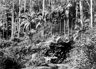
Mount Charlton is a rural locality in the Mackay Region, Queensland, Australia. In the 2016 census, Mount Charlton had a population of 150 people.

Mount Pelion is a rural locality in the Mackay Region, Queensland, Australia. In the 2016 census, Mount Pelion had a population of 125 people.

Septimus is a rural locality in the Mackay Region, Queensland, Australia. In the 2016 census, Septimus had a population of 127 people.

<span class="mw-page-title-main">Cape Conway, Queensland</span> Suburb of Whitsunday Region, Queensland, Australia

Cape Conway is a coastal locality in the Whitsunday Region, Queensland, Australia. In the 2021 census, Cape Conway had "no people or a very low population".

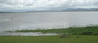
Sarina Beach is a coastal town and locality in the Mackay Region, Queensland, Australia. In the 2016 census, the locality of Sarina Beach had a population of 607 people.

<span class="mw-page-title-main">Grasstree Beach, Queensland</span> Suburb of Mackay Region, Queensland, Australia

Grasstree Beach is a coastal locality in the Mackay Region, Queensland, Australia. It contains two towns, Grasstree in the centre of the locality and Zelma on the coast. In the 2021 census, Grasstree Beach had a population of 717 people.

<span class="mw-page-title-main">Eungella Hinterland, Queensland</span> Suburb of Mackay Region, Queensland, Australia

Eungella Hinterland is a rural locality in the Mackay Region, Queensland, Australia. In the 2021 census, Eungella Hinterland had a population of 4 people.

<span class="mw-page-title-main">Eungella Dam, Queensland</span> Suburb of Mackay Region, Queensland, Australia

Eungella Dam is a locality in the Mackay Region, Queensland, Australia. IIn the 2021 census, Eungella Dam had a population of 4 people.

<span class="mw-page-title-main">Kinchant Dam, Queensland</span> Suburb of Mackay Region, Queensland, Australia

Kinchant Dam is a rural locality in the Mackay Region, Queensland, Australia. In the 2016 census Kinchant Dam had a population of 123 people.

<span class="mw-page-title-main">Dingo Beach, Queensland</span> Suburb of Whitsunday Region, Queensland, Australia

Dingo Beach is a coastal rural locality in the Whitsunday Region, Queensland, Australia. In the 2016 census, Dingo Beach had a population of 169 people.

Mount Howe is a rural locality in the Maranoa Region, Queensland, Australia. In the 2016 census Mount Howe had a population of 3 people.

References

  1. 1 2 Australian Bureau of Statistics (27 June 2017). "Mentmore (SSC)". 2016 Census QuickStats. Retrieved 9 October 2018. OOjs UI icon edit-ltr-progressive.svg
  2. 1 2 "Mentmore – locality in Mackay Region (entry 46805)". Queensland Place Names. Queensland Government . Retrieved 30 December 2017.
  3. "Queensland Globe". State of Queensland . Retrieved 9 October 2018.
  4. 1 2 3 "Mountain peaks and capes - Queensland". Queensland Open Data. Queensland Government. 12 November 2020. Archived from the original on 25 November 2020. Retrieved 25 November 2020.
  5. "Tonga Mountain – mountain in Mackay Region (entry 34821)". Queensland Place Names. Queensland Government . Retrieved 25 November 2020.
  6. "Rocky Mountain – mountain in Mackay Region (entry 28853)". Queensland Place Names. Queensland Government . Retrieved 25 November 2020.
  7. 1 2 3 "Mountain ranges beaches and sea passages - Queensland". Queensland Open Data. Queensland Government. 12 November 2020. Archived from the original on 25 November 2020. Retrieved 25 November 2020.
  8. "Stewart Peninsula – peninsula in Mackay Regional (entry 32368)". Queensland Place Names. Queensland Government . Retrieved 1 October 2023.
  9. "Dewars Point – mountain in Mackay Region (entry 9846)". Queensland Place Names. Queensland Government . Retrieved 25 November 2020.
  10. 1 2 3 4 "Marine islands - Queensland". Queensland Open Data. Queensland Government. 12 November 2020. Archived from the original on 25 November 2020. Retrieved 25 November 2020.
  11. "Gould Island – island (entry 14465)". Queensland Place Names. Queensland Government . Retrieved 25 November 2020.
  12. "Midge Island – island (entry 22004)". Queensland Place Names. Queensland Government . Retrieved 25 November 2020.
  13. "Cave Island – island (entry 6679)". Queensland Place Names. Queensland Government . Retrieved 25 November 2020.
  14. 1 2 "Island groups - Queensland". Queensland Open Data. Queensland Government. 12 November 2020. Archived from the original on 25 November 2020. Retrieved 25 November 2020.
  15. "High Islands – island (entry 15852)". Queensland Place Names. Queensland Government . Retrieved 25 November 2020.
  16. "Bays - Queensland". Queensland Open Data. Queensland Government. 12 November 2020. Archived from the original on 25 November 2020. Retrieved 25 November 2020.
  17. "St Helens Bay – bay in the Mackay Region (entry 32083)". Queensland Place Names. Queensland Government . Retrieved 15 November 2023.
  18. "Queensland Globe". State of Queensland . Retrieved 14 November 2023.
  19. "District news". Daily Mercury . Vol. 59, no. 1392. Queensland, Australia. 22 November 1926. p. 10. Retrieved 14 November 2023 via National Library of Australia.
  20. "PIONEER WILL PROCEED WITH BEACH AMENITIES". Daily Mercury . Vol. 83, no. 264. Queensland, Australia. 5 November 1949. p. 3. Retrieved 14 November 2023 via National Library of Australia.
  21. "Application For Kitty Cr. Road Loan Deferred". Daily Mercury . Vol. 83, no. 274. Queensland, Australia. 17 November 1949. p. 9. Retrieved 14 November 2023 via National Library of Australia.
  22. "Homesteads - Queensland". Queensland Open Data. Queensland Government. 18 November 2020. Archived from the original on 24 November 2020. Retrieved 24 November 2020.
  23. "Layers: Locality; Schools and school catchments". Queensland Globe. Queensland Government. Archived from the original on 19 December 2017. Retrieved 14 November 2023.