
Sarina is a rural town and coastal locality in the Mackay Region, Queensland, Australia. In the 2016 census, Sarina had a population of 5,522 people.

Hay Point is a coastal locality in Mackay Region, Queensland, Australia. It contains two towns, Hector on its north coast and Half Tide on its south coast. In the 2016 census, Hay Point had a population of 1,348 people.
The Shire of Sarina was a local government area located in the Central Queensland region of Queensland, Australia. The shire, administered from the town of Sarina, covered an area of 1,444.3 square kilometres (557.6 sq mi), and existed as a local government entity from 1912 until 2008, when it amalgamated with the City of Mackay and the Shire of Mirani to form the Mackay Region.

Cooloola is a coastal locality in the Gympie Region, Queensland, Australia. In the 2016 census, Cooloola had a population of 3 people.

Kings Beach is a coastal suburb of Caloundra in the Sunshine Coast Region, Queensland, Australia, located directly east of Caloundra CBD. In the 2016 census, Kings Beach had a population of 2,788 people.

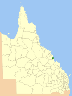
The Mackay Region is a local government area located in North Queensland, Queensland, Australia. Established in 2008, it was preceded by three previous local government areas with modern histories extending back as far as 1869.
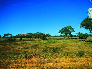
Alligator Creek is a coastal rural locality in the Mackay Region, Queensland, Australia. In the 2016 census, Alligator Creek had a population of 791 people.
Macknade is a town and coastal locality in the Shire of Hinchinbrook, Queensland, Australia.
Rural View is a suburb in the Mackay Region, Queensland, Australia. In the 2016 census, Rural View had a population of 4,793 people.

Alexandra is a suburb of Mackay in the Mackay Region, Queensland, Australia. In the 2016 census, Alexandra had a population of 193 people.

Coral Cove is a coastal locality in the Bundaberg Region, Queensland, Australia. In the 2016 census, Coral Cove had a population of 1,268 people. It has been used as a diving point by tourists and contains the Coral Cove Golf course.
Eungella is a rural town and locality in the Mackay Region, Queensland, Australia. In the 2016 census, Eungella had a population of 194 people.
Chelona is a rural locality in the Mackay Region, Queensland, Australia. In the 2016 census, Chelona had a population of 100 people.
Rosslyn is a coastal town and a locality on the Capricorn Coast in the Shire of Livingstone, Queensland, Australia.
Guthalungra is a town and a coastal locality in the Whitsunday Region, Queensland, Australia.
Paget is a coastal suburb of Mackay in the Mackay Region, Queensland, Australia.
Flying Fish Point is a coastal town, locality and headland in the Cassowary Coast Region, Queensland, Australia. In the 2016 census, Flying Fish Point had a population of 425 people.
St Helens Beach is a coastal town and a locality in the Mackay Region, Queensland, Australia.
Grasstree Beach is a coastal locality in the Mackay Region, Queensland, Australia. In the 2016 census, Grasstree Beach had a population of 745 people. It contains two towns, Grasstree in the centre of the locality and Zelma on the coast.
Mackay is the central suburb of the city of Mackay in the Mackay Region, Queensland, Australia. In the 2016 census, Mackay had a population of 3,659 people.
