Gargett is a rural locality in the Mackay Region, Queensland, Australia. In the 2021 census, the locality of Gargett had a population of 191 people.

Calen is a rural town and coastal locality in the Mackay Region, Queensland, Australia. In the 2021 census, the locality of Calen had a population of 427 people.

Mirani is a rural town and locality in the Mackay Region, Queensland, Australia. In the 2021 census, the locality of Mirani had a population of 1,806 people.

Mount Martin is a rural locality in the Mackay Region, Queensland, Australia. In the 2021 census, the locality of Mount Martin had a population of 191 people.
Alligator Creek is a coastal rural locality in the Mackay Region, Queensland, Australia. In the 2021 census, Alligator Creek had a population of 897 people.

Mount Jukes is a mountain and surrounding coastal rural locality north of Mackay in the Mackay Region, Queensland, Australia. In the 2021 census, Mount Jukes had a population of 373 people.

Eton is a rural town and locality in the Mackay Region, Queensland, Australia. In the 2021 census, the locality of Eton had a population of 728 people.

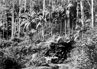
Eungella is a rural town and locality in the Mackay Region, Queensland, Australia. In the 2021 census, the locality of Eungella had a population of 190 people.
Hampden is a rural locality in the Mackay Region, Queensland, Australia. In the 2021 census, Hampden had a population of 598 people.
Kuttabul is a rural town and locality in the Mackay Region, Queensland, Australia. In the 2021 census, the locality of Kuttabul had a population of 707 people.
Mount Ossa is a rural town and a coastal locality in the Mackay Region, Queensland, Australia. In the 2021 census, the locality of Mount Ossa had a population of 250 people.
Mount Charlton is a rural locality in the Mackay Region, Queensland, Australia. In the 2021 census, Mount Charlton had a population of 151 people.

Crediton is a rural locality in the Mackay Region, Queensland, Australia. In the 2021 census, Crediton had a population of 109 people.
Septimus is a rural locality in the Mackay Region, Queensland, Australia. In the 2021 census, Septimus had a population of 120 people.
Eungella Hinterland is a rural locality in the Mackay Region, Queensland, Australia. In the 2021 census, Eungella Hinterland had "no people or a very low population".

Eungella Dam is a locality in the Mackay Region, Queensland, Australia. In the 2021 census, Eungella Dam had "no people or a very low population".
Kinchant Dam is a rural locality in the Mackay Region, Queensland, Australia. In the 2021 census, Kinchant Dam had a population of 183 people.
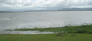
Dunnrock is a coastal rural locality in the Mackay Region, Queensland, Australia. In the 2021 census, Dunnrock had a population of 58 people.
Blue Mountain is a rural locality in the Isaac Region, Queensland, Australia. In the 2021 census, Blue Mountain had a population of 83 people.
