Seaforth, Queensland

Last updated

Map all coordinates using: OpenStreetMap  
Download coordinates as: KML
Seaforth
Queensland
Hiking in Seaforth.jpg
View in Seaforth
Australia Queensland location map.svg
Red pog.svg
Seaforth
Coordinates 20°54′05″S148°58′03″E / 20.9013°S 148.9675°E / -20.9013; 148.9675 (Seaforth (town centre))
Population789 (2016 census locality) [1]
 • Density11.535/km2 (29.88/sq mi)
Established1899
Postcode(s) 4741
Elevation0–250 m (0–820 ft)
Area68.4 km2 (26.4 sq mi)
Time zone AEST (UTC+10:00)
Location
  • 27.1 km (17 mi) E of Calen
  • 41.7 km (26 mi) NW of Mackay
  • 991 km (616 mi) NNW of Brisbane
LGA(s) Mackay Region
State electorate(s) Mackay
Federal Division(s) Dawson
Mean max tempMean min tempAnnual rainfall
30 °C
86 °F
11 °C
52 °F
?
Localities around Seaforth:
Mount Ossa Coral Sea Coral Sea
Mount Ossa Seaforth Haliday Bay
Kuttabul Mount Jukes Ball Bay

Seaforth is a coastal town and locality in the Mackay Region, Queensland, Australia. [2] [3] In the 2016 census the locality of Seaforth had a population of 789 people. [1]

Contents

Geography

Seaforth is a small holiday and fishing town located 35 kilometres (22 mi) north-northwest of Mackay.

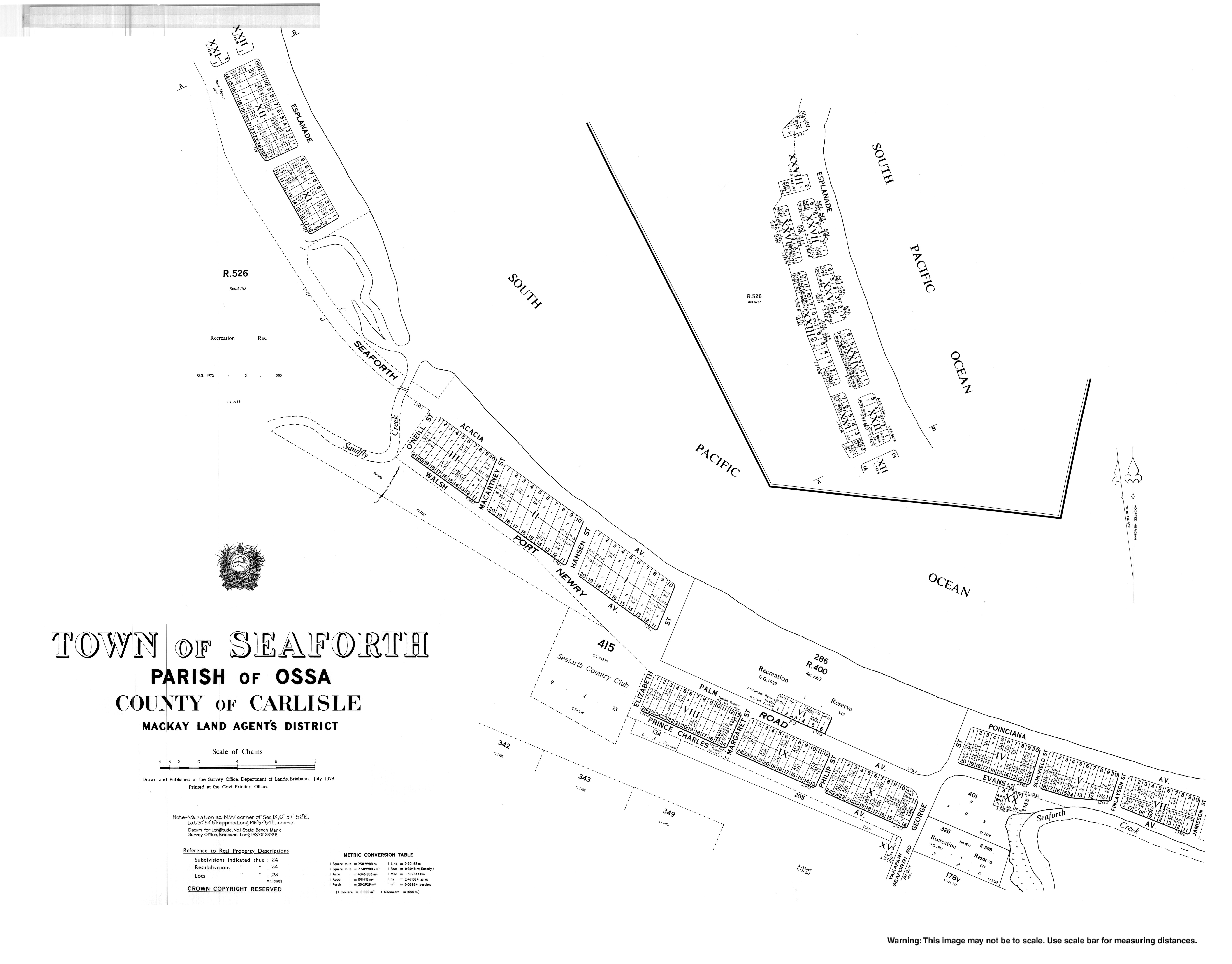
Finlaysons Point is a headland at the northernmost of the locality ( 20°52′36″S148°57′03″E / 20.8766°S 148.9509°E / -20.8766; 148.9509 (Finlaysons Point) ). [4] The coastline near the point and extending along the north-east coastline is a sandy beach. The town is beside the beach with most of the residential development in the town or along that stretch of coast.

The southern part of the locality is mountainous, rising to elevations of 250 metres (820 ft) above sea level. The northern part is lower and flatter with typical elevations of 10 to 20 metres (33 to 66 ft) above sea level and used for cropping (mostly sugarcane). Apart from this, the predominant land use is grazing on native vegetation. [5]

Seaforth has the following mountains:

and the following mountain passes:

Islands off-shore from Seaforth include:

History

In 1899 the Queensland Government bought Seaforth Estate from H.M. Finlayson, a pioneer selector, as a settlement and named it Springcliff; however local residents always called it Seaforth and it was officially renamed Seaforth in 1966. [12] Finlayson Point is named after Finlayson. [4]

Seaforth Provisional School opened on 22 August 1887 and closed in late 1891. A second Seaforth Provisional School opened on 23 April 1935. On 25 October 1948 it became Seaforth State School. [13] The old provisional school building was relocated to become the Seaforth Presbyterian Church, which opened in May 1949 and which served the congregation until May 1961 when the present church was opened. It later became known as the Seaforth Uniting Church after Methodist Church entered into the amalgamation to create the Uniting Church in Australia. [14]

At the 2006 census, Seaforth had a population of 613. [15]

In the 2016 census the locality of Seaforth had a population of 789 people. [1]

There is a former church building at 53 Palm Avenue ( 20°53′57″S148°57′48″E / 20.8993°S 148.9633°E / -20.8993; 148.9633 (Former church) ). [16]

Education

Seaforth State School is a government primary (Prep-6) school for boys and girls at 2092 Seaforth Road ( 20°55′16″S148°57′45″E / 20.9210°S 148.9626°E / -20.9210; 148.9626 (Seaforth State School) ). [17] [18] In 2018, the school had an enrolment of 80 students with 8 teachers (6 full-time equivalent) and 9 non-teaching staff (4 full-time equivalent). [19] It includes a special education program. [17]

There is no secondary school in Seaforth. The nearest government secondary schools are Calen District State College in Calen to the west and Mackay North State High School in North Mackay to the south-east. [5]

Amenities

The Mackay Regional Council operates a mobile library service on a fortnightly schedule near the school and at Seaforth Reserve Road. [20] [21]

The Seaforth branch of the Queensland Country Women's Association meets at 1-3 Margaret Street ( 20°54′00″S148°57′49″E / 20.9000°S 148.9637°E / -20.9000; 148.9637 (Seaforth CWA) ). [22]

Seaforth Uniting Church is at 43 Palm Avenue ( 20°53′59″S148°57′50″E / 20.8996°S 148.9638°E / -20.8996; 148.9638 (Seaforth Uniting Church) ). [23] [24]

Star of the Sea Catholic Church is at 2241 Yakapari-Seaforth Road ( 20°54′29″S148°57′39″E / 20.9080°S 148.9607°E / -20.9080; 148.9607 (Star of the Sea Catholic Church) ). It is part of the Farleigh parish. [25]

Seaforth Bowls Club is in Walsh Street ( 20°53′51″S148°57′39″E / 20.8976°S 148.9609°E / -20.8976; 148.9609 (Seaforth Bowls Club) ). [26]

Related Research Articles

Bowen, Queensland Town in Queensland, Australia

Bowen is a coastal town and locality in the Whitsunday Region, Queensland, Australia. In the 2016 census the locality of Bowen had a population of 10,377 people.

Sarina, Queensland Town in Queensland, Australia

Sarina is a rural town and coastal locality in the Mackay Region, Queensland, Australia. In the 2016 census, Sarina had a population of 5,522 people.

Mooloolah Valley, Queensland Suburb of Sunshine Coast Region, Queensland, Australia

Mooloolah Valley is a rural locality in the Sunshine Coast Region, Queensland, Australia. In the 2016 census, Mooloolah Valley had a population of 3,321 people.

Calen, Queensland Town in Queensland, Australia

Calen is a small town and a coastal locality in the Mackay Region, Queensland, Australia. In the 2016 census, Calen had a population of 390 people.

Haigslea, Queensland Suburb of Ipswich, Queensland, Australia

Haigslea is a locality split between the City of Ipswich and the Somerset Region in South East Queensland, Australia. In the 2016 census Haigslea had a population of 468 people.

Pindi Pindi Town in Queensland, Australia

Pindi Pindi is a rural locality in the Mackay Region, Queensland, Australia. In the 2016 census Pindi Pindi had a population of 98 people.

Andergrove, Queensland Suburb of Mackay, Queensland, Australia

Andergrove is a northern urban locality in Mackay in the Mackay Region, Queensland, Australia. In the 2016 census, Andergrove had a population of 9,419 people.

Glenden, Queensland Town in Queensland, Australia

Glenden is a mining town and rural locality in the Isaac Region, Queensland, Australia. In the 2016 census the locality of Glenden had a population of 620 people.

North Eton, Queensland Suburb of Mackay Region, Queensland, Australia

North Eton is a rural locality in the Mackay Region, Queensland, Australia. In the 2016 census North Eton had a population of 186 people.

Netherdale, Queensland Suburb of Mackay Region, Queensland, Australia

Netherdale is a rural locality in the Mackay Region, Queensland, Australia. In the 2016 census Netherdale had a population of 111 people.

Eungella, Queensland Town in Queensland, Australia

Eungella is a rural town and locality in the Mackay Region, Queensland, Australia. In the 2016 census, Eungella had a population of 194 people.

Bloomsbury, Queensland Town in Queensland, Australia

Bloomsbury is a town and coastal locality in the Mackay Region, Queensland, Australia. In the 2016 census the locality of Bloomsbury had a population of 598 people.

Midge Point, Queensland Town in Queensland, Australia

Midge Point is a coastal town and locality in the Mackay Region, Queensland, Australia. In the 2016 census, Midge Point had a population of 464 people.

Hampden, Queensland Suburb of Mackay Region, Queensland, Australia

Hampden is a rural locality in the Mackay Region, Queensland, Australia. In the 2016 census, Hampden had a population of 566 people.

Mount Ossa, Queensland Town in Queensland, Australia

Mount Ossa is a rural town and a coastal locality in the Mackay Region, Queensland, Australia. In the 2016 census, the locality of Mount Ossa had a population of 224 people.

South Mackay, Queensland Suburb of Mackay, Queensland, Australia

South Mackay is a coastal suburb of Mackay in the Mackay Region, Queensland, Australia.

Mount Charlton, Queensland Suburb of Mackay Region, Queensland, Australia

Mount Charlton is a rural locality in the Mackay Region, Queensland, Australia. In the 2016 census Mount Charlton had a population of 150 people.

Crediton, Queensland Suburb of Mackay Region, Queensland, Australia

Crediton is a rural locality in the Mackay Region, Queensland, Australia. In the 2016 census, Crediton had a population of 82 people.

Mount Pelion, Queensland Suburb of Mackay Region, Queensland, Australia

Mount Pelion is a rural locality in the Mackay Region, Queensland, Australia. In the 2016 census Mount Pelion had a population of 125 people.

Kinchant Dam, Queensland Suburb of Mackay Region, Queensland, Australia

Kinchant Dam is a rural locality in the Mackay Region, Queensland, Australia. In the 2016 census Kinchant Dam had a population of 123 people.

References

  1. 1 2 3 Australian Bureau of Statistics (27 June 2017). "Seaforth (SSC)". 2016 Census QuickStats. Retrieved 20 October 2018. OOjs UI icon edit-ltr-progressive.svg
  2. "Seaforth – town in Mackay Region (entry 30318)". Queensland Place Names. Queensland Government . Retrieved 27 December 2020.
  3. "Seaforth – locality in Mackay Region (entry 46836)". Queensland Place Names. Queensland Government . Retrieved 27 December 2020.
  4. 1 2 "Finlaysons Point – point in Mackay Regional (entry 12446)". Queensland Place Names. Queensland Government . Retrieved 27 December 2020.
  5. 1 2 "Queensland Globe". State of Queensland . Retrieved 10 March 2021.
  6. 1 2 3 4 "Mountain peaks and capes - Queensland". Queensland Open Data. Queensland Government. 12 November 2020. Archived from the original on 25 November 2020. Retrieved 25 November 2020.
  7. "Mount Springcliffe – mountain in Mackay Region (entry 31988)". Queensland Place Names. Queensland Government . Retrieved 25 November 2020.
  8. "Mount Sweetland – mountain in Mackay Region (entry 32992)". Queensland Place Names. Queensland Government . Retrieved 25 November 2020.
  9. "Island groups - Queensland". Queensland Open Data. Queensland Government. 12 November 2020. Archived from the original on 25 November 2020. Retrieved 25 November 2020.
  10. "Island groups - Queensland". Queensland Open Data. Queensland Government. 12 November 2020. Archived from the original on 25 November 2020. Retrieved 25 November 2020.
  11. "Acacia Island – island (entry 58)". Queensland Place Names. Queensland Government . Retrieved 25 November 2020.
  12. "Signpost - Seaforth State School". April 2009. Archived from the original on 24 April 2017. Retrieved 13 April 2020.
  13. Queensland Family History Society (2010), Queensland schools past and present (Version 1.01 ed.), Queensland Family History Society, ISBN   978-1-921171-26-0
  14. "Seaforth Uniting 50 Years – Northside Mackay & Seaforth Uniting Church". Archived from the original on 4 March 2021. Retrieved 10 March 2021.
  15. Australian Bureau of Statistics (25 October 2007). "Seaforth (L) (Urban Centre/Locality)". 2006 Census QuickStats. Retrieved 25 June 2011.
  16. "Palm Avenue, Seaforth Church - Former". Churches Australia. Archived from the original on 10 March 2021. Retrieved 10 March 2021.
  17. 1 2 "State and non-state school details". Queensland Government. 9 July 2018. Archived from the original on 21 November 2018. Retrieved 21 November 2018.
  18. "Seaforth State School". Archived from the original on 23 March 2020. Retrieved 21 November 2018.
  19. "ACARA School Profile 2018". Australian Curriculum, Assessment and Reporting Authority. Archived from the original on 27 August 2020. Retrieved 28 January 2020.
  20. "Libraries: Contact/Opening Hours". Mackay Regional Council. Archived from the original on 1 March 2016. Retrieved 28 April 2017.
  21. "Mobile Library Timetable 2017" (PDF). Mackay Regional Council. Archived from the original (PDF) on 1 March 2017. Retrieved 8 May 2017.
  22. "Branch Locations". Queensland Country Women's Association. Archived from the original on 26 December 2018. Retrieved 26 December 2018.
  23. "Seaforth Uniting Church – Northside Mackay & Seaforth Uniting Church". Archived from the original on 4 March 2021. Retrieved 10 March 2021.
  24. "Find a church". Uniting Church in Australia, Queensland Synod. Archived from the original on 24 October 2020. Retrieved 6 May 2021.
  25. "Farleigh". Roman Catholic Diocese of Rockhampton . Archived from the original on 30 November 2020. Retrieved 10 March 2021.
  26. "Seaforth Bowls Club". Seaforth Bowls Club. Archived from the original on 10 March 2021. Retrieved 10 March 2021.

Further reading