Mount Jukes, Queensland

Last updated

Map all coordinates using: OpenStreetMap
Mount Jukes
Queensland
StateLibQld 1 273255 Inglenook, Mt. Jukes, 1909.jpg
The house "Inglenook" with the mountain in the background, 1909
Australia Queensland location map.svg
Red pog.svg
Mount Jukes
Coordinates 20°58′50″S148°58′18″E / 20.9805°S 148.9716°E / -20.9805; 148.9716 (Mount Jukes)
Population394 (2016 census) [1]
 • Density5.232/km2 (13.552/sq mi)
Postcode(s) 4740
Area75.3 km2 (29.1 sq mi)
Time zone AEST (UTC+10:00)
LGA(s) Mackay Region
State electorate(s) Whitsunday
Federal division(s) Dawson
Suburbs around Mount Jukes:
Seaforth Ball Bay Cape Hillsborough
Belmunda
Kuttabul Mount Jukes Coral Sea
Kuttabul Kuttabul The Leap

Mount Jukes is a mountain and surrounding coastal rural locality north of Mackay in the Mackay Region, Queensland, Australia. [2] [3] In the 2016 census, Mount Jukes had a population of 394 people. [1]

Contents

Geography

The mountain is located in the south-west of the locality ( 20°59′52″S148°56′57″E / 20.9978°S 148.9492°E / -20.9978; 148.9492 (Mount Jukes (Queensland)) ) within Pioneer Peaks National Park and the Central Mackay Coast IBRA Region. [4] It rises to 547 metres (1,795 ft) above sea level and is composed of igneous rock that has been weathered and eroded. [5] The mountains originated from volcanic activity approximately 32 million years ago. [6]

Mount Jukes has a species of shrubs growing in its trees called the Mount Blackwood holly, a species only found in Mount Blackwood area. The easiest route up the mountain is by gravel road that is locked.[ citation needed ]

History

Mount Jukes was named by George Elphinstone Dalrymple in 1862 after geologist Joseph Beete Jukes, who served as a naturalist on the explorations of HMS Fly from 1842 to 1846. [2]

In 1896, Harold Forster Blaxland had purchased land on Mount Jukes to open a coffee plantation. Eight acres of coffee plants were planted in 1897 and a further seven was planted in the following years. Due to financial struggles the coffee plantation closed in 1919. [7]

See also

Related Research Articles

<span class="mw-page-title-main">Calen, Queensland</span> Town in Queensland, Australia

Calen is a rural town and coastal locality in the Mackay Region, Queensland, Australia. In the 2016 census, the locality of Calen had a population of 390 people.

<span class="mw-page-title-main">Mount Blackwood</span> Mountain in Queensland, Australia

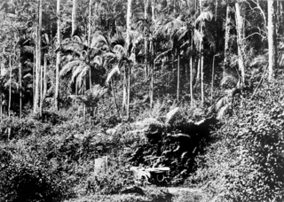
Mount Blackwood is a mountain located within the boundaries of the Mackay Regional Council in Central Queensland, Australia and has an elevation of 639m. It is covered in dense tropical rainforest and is home to the Mount Blackwood Holly, a species of shrub endemic to the area. It also has the Pioneer Valley close to the region. Also nearby mountains are Mt Jukes, Mt Ossa and Mt Brampton.

<span class="mw-page-title-main">Dysart, Queensland</span> Town in Queensland, Australia

Dysart is a town and a locality in the Isaac Region, Queensland, Australia. It is a service centre for mines and grazing properties in the district. At the 2021 census, the locality had a population of 2,918. Most residents are employed by the coal mines.

<span class="mw-page-title-main">Seaforth, Queensland</span> Town in Queensland, Australia

Seaforth is a coastal town and locality in the Mackay Region, Queensland, Australia. In the 2016 census the locality of Seaforth had a population of 789 people.

<span class="mw-page-title-main">Mount Kynoch, Queensland</span> Suburb of Toowoomba, Queensland, Australia

Mount Kynoch is a rural locality in the Toowoomba Region, Queensland, Australia. In the 2016 census, Mount Kynoch had a population of 237 people.

<span class="mw-page-title-main">Eton, Queensland</span> Town in Queensland, Australia

Eton is a rural town and locality in the Mackay Region, Queensland, Australia. In the 2016 census, the locality of Eton had a population of 679 people.

<span class="mw-page-title-main">Habana, Queensland</span> Suburb of Mackay Region, Queensland, Australia

Habana is a coastal rural locality in the Mackay Region, Queensland, Australia. In the 2016 census Habana had a population of 952 people.

Yalboroo is a rural town and locality in the Mackay Region, Queensland, Australia. In the 2016 census, the locality of Yalboroo had a population of 170 people.

<span class="mw-page-title-main">Midge Point, Queensland</span> Town in Queensland, Australia

Midge Point is a coastal town and rural locality in the Mackay Region, Queensland, Australia. In the 2016 census, the locality of Midge Point had a population of 464 people.

Hampden is a rural locality in the Mackay Region, Queensland, Australia. In the 2016 census, Hampden had a population of 566 people.

Kuttabul is a rural town and locality in the Mackay Region, Queensland, Australia. In the 2016 census, the locality of Kuttabul had a population of 730 people.

Mount Ossa is a rural town and a coastal locality in the Mackay Region, Queensland, Australia. In the 2016 census, the locality of Mount Ossa had a population of 224 people.

Mount Charlton is a rural locality in the Mackay Region, Queensland, Australia. In the 2016 census, Mount Charlton had a population of 150 people.

<span class="mw-page-title-main">Crediton, Queensland</span> Suburb of Mackay Region, Queensland, Australia

Crediton is a rural locality in the Mackay Region, Queensland, Australia. In the 2016 census, Crediton had a population of 82 people.

Mount Pelion is a rural locality in the Mackay Region, Queensland, Australia. In the 2016 census, Mount Pelion had a population of 125 people.

Septimus is a rural locality in the Mackay Region, Queensland, Australia. In the 2016 census, Septimus had a population of 127 people.

<span class="mw-page-title-main">Cape Conway, Queensland</span> Suburb of Whitsunday Region, Queensland, Australia

Cape Conway is a coastal locality in the Whitsunday Region, Queensland, Australia. In the 2021 census, Cape Conway had "no people or a very low population".

<span class="mw-page-title-main">Eungella Hinterland, Queensland</span> Suburb of Mackay Region, Queensland, Australia

Eungella Hinterland is a rural locality in the Mackay Region, Queensland, Australia. In the 2021 census, Eungella Hinterland had a population of 4 people.

<span class="mw-page-title-main">Kinchant Dam, Queensland</span> Suburb of Mackay Region, Queensland, Australia

Kinchant Dam is a rural locality in the Mackay Region, Queensland, Australia. In the 2016 census Kinchant Dam had a population of 123 people.

Mount Mackay is a locality in the Cassowary Coast Region, Queensland, Australia. In the 2016 census, Mount Mackay had a population of 0 people.

References

  1. 1 2 Australian Bureau of Statistics (27 June 2017). "Mount Jukes (SSC)". 2016 Census QuickStats. Retrieved 20 October 2018. OOjs UI icon edit-ltr-progressive.svg
  2. 1 2 "Mount Jukes – mountain in Mackay Region (entry 17422)". Queensland Place Names. Queensland Government . Retrieved 12 November 2019.
  3. "Mount Jukes – locality in Mackay Region (entry 46810)". Queensland Place Names. Queensland Government . Retrieved 5 November 2019.
  4. "Pioneer Peaks National Park". WetlandInfo. Department of Environment and Heritage Protection. Retrieved 22 September 2017.
  5. "Kuttabul". Queensland Places. Centre for the Government of Queensland, University of Queensland. Retrieved 22 September 2017.
  6. "Cape Hillsborough, Pioneer Peaks, Mount Ossa, Mount Martin and Reliance Creek National Parks and adjoining State Waters Management Plan" (PDF). Queensland Parks and Wildlife Service. 2011. Retrieved 22 September 2017.
  7. Hillier, Reuben (1 November 2018). "Mt Jukes Coffee Plantation". State Library Of Queensland. Retrieved 3 October 2023.