Mount Charlton, Queensland

Last updated

Map all coordinates using: OpenStreetMap  
Download coordinates as: KML
Mount Charlton
Queensland
Australia Queensland location map.svg
Red pog.svg
Mount Charlton
Coordinates 21°01′00″S148°44′49″E / 21.0166°S 148.7469°E / -21.0166; 148.7469 (Mount Charlton (centre of locality)) Coordinates: 21°01′00″S148°44′49″E / 21.0166°S 148.7469°E / -21.0166; 148.7469 (Mount Charlton (centre of locality))
Population150 (2016 census) [1]
 • Density1.24/km2 (3.20/sq mi)
Postcode(s) 4741
Area121.3 km2 (46.8 sq mi)
Time zone AEST (UTC+10:00)
LGA(s) Mackay Region
State electorate(s) Whitsunday
Federal division(s) Dawson
Suburbs around Mount Charlton:
Eungella Hinterland Calen Mount Pelion
Eungella Hinterland Mount Charlton Mount Ossa
Eungella Hinterland Dows Creek Mount Martin

Mount Charlton is a rural locality in the Mackay Region, Queensland, Australia. [2] In the 2016 census, Mount Charlton had a population of 150 people. [1]

Contents

Geography

There are two neighbourhoods in the locality:

The locality has the following mountains:

and the following passes:

History

Mount Charlton State School opened on 4 March 1931. [11] It was mothballed on 31 December 2009 and closed on 31 December 2010. [12] It was at 2342 Mirani-Mount Ossa Road ( 21°01′20″S148°43′47″E / 21.0222°S 148.7296°E / -21.0222; 148.7296 (Mount Charlton State School (former)) ). [13] [14] The school's website was archived. [15]

About 8 kilometres (5 mi) south-west of Mount Ossa in is the site of the former settlement of Silent Grove. The Silent Grove Provisional School opened on 29 August 1928. On 3 February 1936 the Silent Grove Upper State School opened. In 1938, the Silent Grove Provisional School closed, being replaced by the Mount Ossa State School in neighbouring Mount Ossa. The Silent Grove Upper State School closed about 1964. [16] Silent Grove Upper State School was at 2948 Mirani-Mount Ossa Road ( 20°59′21″S148°46′06″E / 20.9891°S 148.7684°E / -20.9891; 148.7684 (Silent Grove Upper State School (former)) ). [17] [18]

In the 2016 census, Mount Charlton had a population of 150 people. [1]

Related Research Articles

Calen, Queensland Town in Queensland, Australia

Calen is a rural town and coastal locality in the Mackay Region, Queensland, Australia. In the 2016 census, the locality of Calen had a population of 390 people.

Mirani, Queensland Town in Queensland, Australia

Mirani is a rural town and locality in the Mackay Region, Queensland, Australia. In the 2016 census, the locality of Mirani had a population of 1,541 people.

Seaforth, Queensland Town in Queensland, Australia

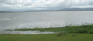
Seaforth is a coastal town and locality in the Mackay Region, Queensland, Australia. In the 2016 census the locality of Seaforth had a population of 789 people.

Mount Martin, Queensland Town in Queensland, Australia

Mount Martin is a rural locality in the Mackay Region, Queensland, Australia. In the 2016 census Mount Martin had a population of 186 people.

Mount Jukes, Queensland Suburb of Mackay Region, Queensland, Australia

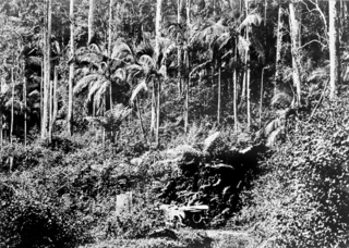
Mount Jukes is a mountain and surrounding coastal rural locality north of Mackay in the Mackay Region, Queensland, Australia. In the 2016 census, Mount Jukes had a population of 394 people.

North Eton, Queensland Suburb of Mackay Region, Queensland, Australia

North Eton is a rural locality in the Mackay Region, Queensland, Australia. In the 2016 census North Eton had a population of 186 people.

Eton, Queensland Town in Queensland, Australia

Eton is a rural town and locality in the Mackay Region, Queensland, Australia. In the 2016 census, the locality of Eton had a population of 679 people.

Netherdale is a rural locality in the Mackay Region, Queensland, Australia. In the 2016 census Netherdale had a population of 111 people.

Eungella is a rural town and locality in the Mackay Region, Queensland, Australia. In the 2016 census, Eungella had a population of 194 people.

Yalboroo is a rural town and locality in the Mackay Region, Queensland, Australia. In the 2016 census, the locality of Yalboroo had a population of 170 people.

Hampden is a rural locality in the Mackay Region, Queensland, Australia. In the 2016 census, Hampden had a population of 566 people.

Kuttabul is a rural town and locality in the Mackay Region, Queensland, Australia. In the 2016 census, the locality of Kuttabul had a population of 730 people.

Mount Ossa is a rural town and a coastal locality in the Mackay Region, Queensland, Australia. In the 2016 census, the locality of Mount Ossa had a population of 224 people.

Brightly is a rural locality in the Mackay Region, Queensland, Australia. In the 2016 census Brightly had a population of 70 people.

Crediton, Queensland Suburb of Mackay Region, Queensland, Australia

Crediton is a rural locality in the Mackay Region, Queensland, Australia. In the 2016 census, Crediton had a population of 82 people.

Dows Creek is a rural locality in the Mackay Region, Queensland, Australia. In the 2016 census, Dows Creek had a population of 136 people.

Mount Pelion is a rural locality in the Mackay Region, Queensland, Australia. In the 2016 census, Mount Pelion had a population of 125 people.

Septimus is a rural locality in the Mackay Region, Queensland, Australia. In the 2016 census, Septimus had a population of 127 people.

Kinchant Dam, Queensland Suburb of Mackay Region, Queensland, Australia

Kinchant Dam is a rural locality in the Mackay Region, Queensland, Australia. In the 2016 census Kinchant Dam had a population of 123 people.

References

  1. 1 2 3 Australian Bureau of Statistics (27 June 2017). "Mount Charlton (SSC)". 2016 Census QuickStats. Retrieved 20 October 2018. OOjs UI icon edit-ltr-progressive.svg
  2. "Mount Charlton – locality in Mackay Region (entry 50298)". Queensland Place Names. Queensland Government . Retrieved 27 December 2020.
  3. "Camerons Pocket – locality unbounded in Mackay Regional (entry 5869)". Queensland Place Names. Queensland Government . Retrieved 27 December 2020.
  4. "Kungurri – locality unbounded in Mackay Regional (entry 18615)". Queensland Place Names. Queensland Government . Retrieved 27 December 2020.
  5. 1 2 3 4 5 6 "Mountain peaks and capes - Queensland". Queensland Open Data. Queensland Government. 12 November 2020. Archived from the original on 25 November 2020. Retrieved 25 November 2020.
  6. "Bluff Hill – mountain in Mackay Region (entry 3336)". Queensland Place Names. Queensland Government . Retrieved 25 November 2020.
  7. "Crazy Cat Mountain – mountain in Mackay Region (entry 8711)". Queensland Place Names. Queensland Government . Retrieved 25 November 2020.
  8. "Mount Charlton – mountain in Mackay Region (entry 6931)". Queensland Place Names. Queensland Government . Retrieved 25 November 2020.
  9. "Camerons Gap – pass in Mackay Regional (entry 5868)". Queensland Place Names. Queensland Government . Retrieved 27 December 2020.
  10. "Kungurri Gap – pass in Mackay Regional (entry 18616)". Queensland Place Names. Queensland Government . Retrieved 27 December 2020.
  11. Queensland Family History Society (2010), Queensland schools past and present (Version 1.01 ed.), Queensland Family History Society, ISBN   978-1-921171-26-0
  12. "Queensland state school - centre closures" (PDF). Queensland Government . 20 August 2013. Archived (PDF) from the original on 20 March 2022. Retrieved 6 April 2022.
  13. "Mirani" (Map). Queensland Government. 1942. Archived from the original on 27 October 2020. Retrieved 9 April 2022.
  14. "Parish of Pelion" (Map). Queensland Government. 1975. Archived from the original on 8 April 2022. Retrieved 9 April 2022.
  15. "Home page". Mount Charlton State School. 30 October 2009. Archived from the original on 30 October 2009. Retrieved 8 April 2022.
  16. Queensland Family History Society (2010), Queensland schools past and present (Version 1.01 ed.), Queensland Family History Society, ISBN   978-1-921171-26-0
  17. "St Helens" (Map). Queensland Government. 1944. Archived from the original on 27 January 2021. Retrieved 28 April 2022.
  18. "Queensland Globe". State of Queensland . Retrieved 28 April 2022.