Walkerston is a town and locality in Mackay Region, Queensland, Australia. The town is situated on the Peak Downs Highway 14 kilometres (8.7 mi) south-west of Mackay. In the 2021 census, the locality of Walkerston had a population of 3,615 people.
The Leap is a coastal rural locality in the Mackay Region, Queensland, Australia. In the 2021 census, The Leap had a population of 664 people.

Alexandra is a suburb of Mackay in the Mackay Region, Queensland, Australia. In the 2021 census, Alexandra had a population of 189 people.

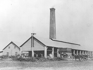
Pleystowe is a rural locality in the Mackay Region, Queensland, Australia. It is known for the former Pleystowe Sugar Mill used to crush sugar cane to produce raw sugar. In the 2021 census, Pleystowe had a population of 418 people.

Habana is a coastal rural locality in the Mackay Region, Queensland, Australia. In the 2021 census, Habana had a population of 1,022 people.
Glenella is a mixed-use town and suburb of Mackay in the Mackay Region, Queensland, Australia. In the 2021 census, the suburb of Glenella had a population of 4,545 people.
West Mackay is a suburb of Mackay in the Mackay Region, Queensland, Australia. In the 2021 census, West Mackay had a population of 6,536 people.

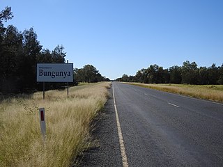
Bungunya is a rural town and locality in the Goondiwindi Region, Queensland, Australia. The locality is on the border of Queensland and New South Wales. In the 2021 census, the locality of Bungunya had a population of 62 people.

Shoal Point is a coastal suburb in the Mackay Region, Queensland, Australia. In the 2021 census, Shoal Point had a population of 1,104 people.
Farleigh is a rural town and locality in the Mackay Region, Queensland, Australia. In the 2021 census, the locality of Farleigh had a population of 814 people.

Magnolia is a rural locality in the Fraser Coast Region, Queensland, Australia. In the 2021 census, Magnolia had a population of 115 people.
Balnagowan is a rural locality in the Mackay Region, Queensland, Australia. In the 2021 census, Balnagowan had a population of 438 people.

Nindaroo is a rural locality in the Mackay Region, Queensland, Australia. In the 2021 census, Nindaroo had a population of 255 people.
Sandiford is a rural locality in the Mackay Region, Queensland, Australia. In the 2021 census, Sandiford had a population of 168 people.
Sunnyside is a rural locality in the Mackay Region, Queensland, Australia. In the 2021 census, Sunnyside had a population of 127 people.

Mackay Harbour is a coastal mixed-use locality in the Mackay Region, Queensland, Australia. In the 2021 census, Mackay Harbour had a population of 686 people.

Foulden is a rural locality in the Mackay Region, Queensland, Australia. It is on the northern bank of the Pioneer River in Mackay. In the 2021 census, Foulden had "no people or a very low population".
Erakala is a mixed-use locality in the Mackay Region, Queensland, Australia. In the 2021 census, Erakala had a population of 763 people.

Palmyra is a rural locality in the Mackay Region, Queensland, Australia. In the 2021 census, Palmyra had a population of 250 people.

Victoria Plains is a rural locality in the Mackay Region, Queensland, Australia. In the 2021 census, Victoria Plains had a population of 338 people.


