Blo' Norton

Last updated

Blo' Norton
Village
St Andrew Blo Norton - geograph.org.uk - 1229400.jpg
St Andrew's Church
Norfolk UK location map.svg
Red pog.svg
Blo' Norton
Location within Norfolk
Area4.62 km2 (1.78 sq mi)
Population269 (2001 Census)
  Density 58/km2 (150/sq mi)
OS grid reference TM0179
Civil parish
  • Blo' Norton
District
Shire county
Region
Country England
Sovereign state United Kingdom
Post town Diss
Postcode district IP22
Dialling code 01953
Police Norfolk
Fire Norfolk
Ambulance East of England
UK Parliament
Website Blo' Norton Parish Council
List of places
UK
England
Norfolk
52°22′30″N0°57′28″E / 52.375018°N 0.957870°E / 52.375018; 0.957870

Blo' Norton is a village and civil parish in the Breckland district of the English county of Norfolk.

Contents

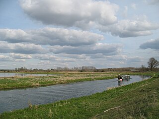
Blo' Norton is located along the course of the River Little Ouse, about 6.5 miles (10.5 km) west of Diss and 22 miles (35 km) south-west of Norwich.

History

Blo' Norton's name is of Anglo-Saxon origin and derives from the Old English for a bleak or exposed north farm or settlement. [1] The first record of 'Blo' added to the name is in 1291, which in Middle English may have meant 'bleak and cold or exposed' or it may have derived from ‘blae’ meaning blue, perhaps from the growth of woad plants from which a blue dye can be obtained. [2]

In the Domesday Book, Blo Norton is listed as a settlement of 47 households in the hundred of Guiltcross. In 1086, the village was split between the estates of William de Warenne, Roger Bigod, Bury St Edmunds Abbey and St Etheldreda's Abbey, Ely. [3]

During the Medieval Period, Blo' Norton was significantly larger than it is today. However, the Black Death dramatically decreased the population which meant much of the village was abandoned. There is archeological evidence of the location of the deserted village to this day. [4]

Blo' Norton Hall is a timber-framed, moated Tudor manor house at the end of an avenue of lime trees west of St Andrew's Church. It was enlarged in Elizabethan style in 1585. It is a Grade II* listed building. [5] In the summer of 1906 Virginia Woolf (1882–1941) stayed at Blo' Norton Hall. The visit inspired her short story, "The Journal of Miss Joan Martyn". [6]

Along 'The Street' in Blo' Norton there are numerous Grade II listed buildings. Including the 15th-century Church Farmhouse, [7] the 18th-century Blo' Norton House, [8] Hampton House [9] as well as the Fairfields Cottages which were designed by George Skipper in 1922. [10] Elm Cottage on Theltenham Road also dates from the late 17th century. [11]

Blo' Norton is mentioned in Notes from a Small Island (1995) by the American author, Bill Bryson.[ citation needed ] Furthermore, Blo' Norton briefly featured in an episode of the Channel 4 television programme, So Graham Norton .[ citation needed ]

Blo' Norton Hall Blo Norton Hall 2 by ICW.jpg
Blo' Norton Hall

Geography

According to data from the 2021 census, Blo' Norton parish has a total population of 269 people which grew from 251 in the 2011 census. [12]

Blo' Norton is located close to the course of the River Little Ouse. Amenities within the village include Dutch Barn Nurseries (a plant nursery) and the nearby Beehive Coffee Shop. [13]

St Andrew's Church

Blo' Norton's parish church is dedicated to Saint Andrew and dates from the 13th century, though its Medieval furnishings have largely been removed. The church was further remodelled in the 16th and 19th centuries, and also featuresroyal arms from the reign of William and Mary. [14] The church features a stained-glass window designed and installed by William Wailes in 1863, depicting the Resurrection and Ascension of Christ. [15] The west tower has a ring of six bells. Thomas Osborn, who had bell-foundries at Downham Market in Norfolk and St Neots in Cambridgeshire, cast five of the bells including the tenor in 1794. John Warner & Sons of Cripplegate, London cast the treble bell in 1892. [16] St Andrew's Church has been Grade II listed since 1958. [17]

Governance

Blo' Norton is part of the electoral ward of Guiltcross for local elections and is part of the district of Breckland.

The village's national constituency is South West Norfolk which has been represented by Labour's Terry Jermy since 2024.

Blo' Norton and Thelnetham Fen

South of the village and along the river is the Blo' Norton and Thelnetham Fen Site of Special Scientific Interest, an important calcareous fen wetland site supporting rare plant species including black bog rush Schoenus nigricans and saw sedge Cladium mariscus . [18] The Little Ouse Headwaters Project manages part of this area as well as surrounding wetland areas such as Hinderclay Fen and Suffolk Wildlife Trust also has a reserve on part of the site. [19] [20]

Frogstock

The village used to host the Frogstock festival, which was established in 1995 as a local music festival in answer to the perceived over-commercialisation of festivals such as Glastonbury. Frogstock was last held in 2011. [21]

Notable residents

War memorial

Blo' Norton's War Memorial is located at the junction between Church Lane and The Street, and the takes the form of a stone cross with an octagonal base. It was unveiled on 7 November 1920 and was funded by donations from local charities and the people of Blo' Norton. [22] The memorial was designed by Albert Powys and sculpted by Laurence Arthur Turner. [23] It holds the following names for the First World War:

RankNameUnitDate of DeathOther Commemoration / Burial
2Lt.C. Chad A. Norris Royal Flying Corps 26 December 1917St Andrew's Churchyard, Blo' Norton

And Ernest Footer.

And the following for the Second World War:

RankNameUnitDate of DeathOther Commemoration / Burial
Cpl.William A. Ruddock7th Battalion, Royal Norfolk Regiment 8 August 1944 Bayeux War Cemetery
LACWilliam H. ValentineNo. 2771 (Air Defence Squadron), RAF Regiment 21 December 1942 Runnymede Memorial
Gnr.T. Kenneth Cook179th (Anti-Aircraft) Regiment, Royal Artillery 25 December 1943St Luke's Churchyard, Haverigg

Related Research Articles

<span class="mw-page-title-main">River Little Ouse</span> River in east England

The River Little Ouse, also known as the Brandon River, is a river in the east of England, a tributary of the River Great Ouse. For much of its length it defines the boundary between Norfolk and Suffolk.

<span class="mw-page-title-main">Downham Market</span> Market town in Norfolk, England

Downham Market, sometimes simply referred to as Downham, is a market town and civil parish in Norfolk, England. It lies on the edge of the Fens, on the River Great Ouse, approximately 11 miles south of King's Lynn, 39 miles west of Norwich and 30 miles north of Cambridge.

<span class="mw-page-title-main">Billingford, Breckland</span> Human settlement in England

Billingford is a village and civil parish in the English county of Norfolk.

<span class="mw-page-title-main">Binham</span> Village in Norfolk, England

Binham is a village and a civil parish in the English county of Norfolk. Binham is 29.3 miles (47.2 km) north west of Norwich and 16.9 miles (27.2 km) west of Cromer. The village lies 4.9 miles (7.9 km) east south east of the town of Wells-next-the-Sea.

<span class="mw-page-title-main">Bintree</span> Village in Norfolk, England

Bintree is a village and civil parish in the English county of Norfolk.

Blofield is a village and civil parish in the Broadland district of the English county of Norfolk. The parish includes the village of Blofield and the hamlets of Blofield Heath and Blofield Corner.

<span class="mw-page-title-main">Brandon, Suffolk</span> Town in Suffolk, England

Brandon is a town and civil parish in the English county of Suffolk. Brandon is located in the Breckland area of Suffolk in the extreme north-west of the county, close to the adjoining county of Norfolk. It lies between the towns of Bury St Edmunds, Thetford, Mildenhall, Downham Market and the city of Ely. The town is almost entirely surrounded by Thetford Forest.

<span class="mw-page-title-main">East Lexham</span> Village in Norfolk, England

East Lexham is a village and former civil parish, now in the parish of Lexham, in the Breckland district, in the English county of Norfolk. It is 7.7 miles (12.4 km) north of the town of Swaffham, 30.1 miles (48.4 km) west north west of Norwich and 106 miles (171 km) north east of London. In 1931 the parish had a population of 160.
<span class="mw-page-title-main">Foxley, Norfolk</span> Human settlement in England

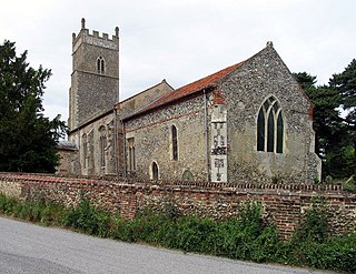
Foxley is a village and civil parish in Norfolk, England. The village is 6 miles (10 km) north-east of Dereham and 15 miles (24 km) north-west of Norwich, along the A1067 between Fakenham and Norwich.

<span class="mw-page-title-main">River Thet</span> River in Norfolk, England

The River Thet is a river in Norfolk, England and is a tributary of the River Little Ouse.It rises in Breckland with sources in Deopham Green and Rockland All Saints and joins the Little Ouse in Thetford after flowing approximately southwest.

<span class="mw-page-title-main">Hilgay</span> Human settlement in England

Hilgay is a village and civil parish in Norfolk, England, 4 miles (6 km) south of Downham Market. The parish covers an area of 33.38 km2 (12.89 sq mi) and had a population of 1,341 at the 2011 Census. For local government purposes, it falls within the district of King's Lynn and West Norfolk.

<span class="mw-page-title-main">Bodney</span> Village in England

Bodney is a village and former civil parish, now in the parish of Hilborough, in the Breckland district of the English county of Norfolk.

The Little Ouse Headwaters Project (LOHP) was set up in 2002 by local residents to promote conservation and enjoyment of the fenland habitats bordering the upper reaches of the River Little Ouse, which lies on the Norfolk-Suffolk border. The site lies between Blo' Norton in Norfolk and Thelnetham in Suffolk. It includes a number of areas including Hinderclay Fen, Blo' Norton Fen, Betty's Fen, The Frith, Blo' Norton Lowes, Blo' Norton Little Fen and Parker's Piece. The area also include parts of the Blo' Norton and Thelnetham Fen Site of Special Scientific Interest (SSSI).

<span class="mw-page-title-main">Bittering, Norfolk</span> Village in England

Bittering is a village in the civil parish of Beeston with Bittering, in the Breckland district, in the county of Norfolk, England.

<span class="mw-page-title-main">Hinderclay</span> Human settlement in England

Hinderclay is a village and civil parish in the Mid Suffolk district of Suffolk in eastern England. The village is located around 14 miles (23 km) - from Bury St Edmunds in an area of rolling arable land to the south of the Little Ouse river valley. Neighbouring villages include Thelnetham and Rickinghall. In 2005 its population was 340. The parish also contains the hamlet of Thorpe Street.

<span class="mw-page-title-main">Thelnetham</span> Village in Suffolk, England

Thelnetham is a village and civil parish in the West Suffolk district of Suffolk in eastern England. Located on the southern bank of the River Little Ouse, six miles west of Diss, in 2005 its population was 230. The village of Blo' Norton lies on the Norfolk side of the river. The name of the village derives from the Old English words "thel" which means a plank bridge, "elfitu" meaning swans and "hamm" meaning a meadow or enclosure. Hence the village is the "meadow with the plank bridge and the swans".

<span class="mw-page-title-main">North Lopham</span> Human settlement in England

North Lopham is a village and civil parish in the English county of Norfolk.
<span class="mw-page-title-main">Market Weston</span> Human settlement in England

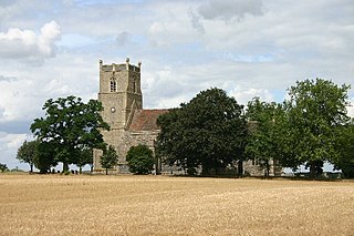
Market Weston is a small village and civil parish in the West Suffolk district of Suffolk in eastern England. It is located near the Norfolk border around seven miles east-south-east of Thetford. In 2005 its population was estimated to be 260. 245 people were recorded at 2011 census. The parish also contains the Weston Fen SSSI.
<span class="mw-page-title-main">Blo' Norton and Thelnetham Fens</span> Nature reserve in east England

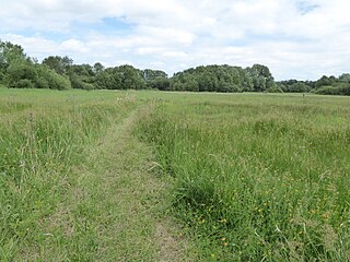
Blo' Norton and Thelnetham Fens are a 21.3-hectare (53-acre) biological Site of Special Scientific Interest (SSSI) on the Norfolk/Suffolk border. Blo' Norton Fen is in the parish of Blo' Norton in Norfolk and Thelnetham Fen is in Thelnetham parish in Suffolk. It is a Nature Conservation Review site, Grade 2, and part of the Waveney and Little Ouse Valley Fens Special Area of Conservation, Thelnetham Fen is managed by the Suffolk Wildlife Trust and Blo' Norton Fen by the Little Ouse Headwaters Project (LOHP).
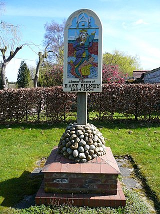
<span class="mw-page-title-main">East Bilney</span> Village in Norfolk, England

East Bilney is a village and former civil parish, now in the parish of Beetley, in the Breckland district, in the county of Norfolk, England. East Bilney is located 7.8 kilometres (4.8 mi) north-west of Dereham and 30 kilometres (19 mi) north-west of Norwich. In 1931, the parish had a population of 117.

References

  1. "Key to English Place-names". kepn.nottingham.ac.uk. Retrieved 9 November 2024.
  2. "Parish-Summary-Blo-Norton-(Parish-Summary) - Norfolk Heritage Explorer". www.heritage.norfolk.gov.uk. Retrieved 9 November 2024.
  3. "[Blo] Norton | Domesday Book". opendomesday.org. Retrieved 9 November 2024.
  4. "mnf12983 - Norfolk Heritage Explorer". www.heritage.norfolk.gov.uk. Retrieved 9 November 2024.
  5. Historic England. "Blo' Norton Hall (Grade II*) (1077439)". National Heritage List for England . Retrieved 1 December 2017.
  6. "Blo Norton". www.literarynorfolk.co.uk. Retrieved 9 November 2024.
  7. "CHURCH FARMHOUSE, Blo' Norton - 1077441 | Historic England". historicengland.org.uk. Retrieved 9 November 2024.
  8. "BLO' NORTON HOUSE, Blo' Norton - 1077443 | Historic England". historicengland.org.uk. Retrieved 9 November 2024.
  9. "HAMPTON HOUSE, Blo' Norton - 1342514 | Historic England". historicengland.org.uk. Retrieved 9 November 2024.
  10. "1-8, FAIRFIELDS, Blo' Norton - 1248339 | Historic England". historicengland.org.uk. Retrieved 9 November 2024.
  11. "ELM COTTAGE, Blo' Norton - 1068813 | Historic England". historicengland.org.uk. Retrieved 9 November 2024.
  12. "Blo' Norton (Parish, United Kingdom) - Population Statistics, Charts, Map and Location". citypopulation.de. Retrieved 9 November 2024.
  13. "Home". Dutchbarnnurseries. Retrieved 9 November 2024.
  14. "CHURCH OF ST ANDREW, Blo' Norton - 1077440 | Historic England". historicengland.org.uk. Retrieved 9 November 2024.
  15. "Norfolk Churches". www.norfolkchurches.co.uk. Retrieved 9 November 2024.
  16. Dawson, George (8 April 2011). "Blo' Norton S Andrew". Dove's Guide for Church Bell Ringers . Central Council of Church Bell Ringers . Retrieved 1 December 2017.
  17. "CHURCH OF ST ANDREW, Blo' Norton - 1077440 | Historic England". historicengland.org.uk. Retrieved 9 November 2024.
  18. "Site Name: Blo' Norton and Thelnetham Fen" (PDF). Natural England. Archived from the original (PDF) on 8 May 2014. Retrieved 31 January 2013.
  19. "Our sites". Little Ouse Headwaters Project. Retrieved 31 January 2013.
  20. "Thelnetham Fen". Suffolk Wildlife Trust. Archived from the original on 18 February 2013. Retrieved 31 January 2013.
  21. "Frogstock Festival" . Retrieved 1 December 2017.
  22. Imperial War Memorial. (2022). Retrieved 6 November 2022. https://www.iwm.org.uk/memorials/item/memorial/19713
  23. "Blo Norton War Memorial, Blo' Norton - 1453319 | Historic England". historicengland.org.uk. Retrieved 9 November 2024.

Further reading