Mount Lebanon Governorate is one of the nine governorates of Lebanon. Its capital is Baabda. Other notable towns and cities include Aley, Bikfaya, and Beit Mery.

Al-Rafid is a village in the Rashaya District, in the southeastern area of the Beqaa Governorate in Lebanon. Its population is estimated to be 3,000. Its inhabitants are predominantly Sunni Muslims. The village has two mosques, two schools, two pharmacies, and a telecommunications facility.
Mish Mish, also spelled Michmich, is a village located in Akkar Governorate, Lebanon. Mish Mish is situated 1100 metres above sea level in the mountainous terrain of the north. The closest major city to the village is Tripoli 45 km to the west; the Lebanese capital Beirut is 129 km to the southwest.

Al-Nabi Shayth is a village in eastern Lebanon, located in the Beqaa Valley and Baalbek District. The village's name comes from the considered burial-site of Seth the son of Adam. A mosque was built on the burial site and it contains the grave of Seth inside the mosque. The village is also the hometown of former leader and co-founder of Hezbollah, Abbas al-Musawi, as well as the hometown of other senior Hezbollah leaders such as the late Fuad Shukr. The village of Al-Nabi Sheeth is predominantly inhabited by people with the surnames Helbawi, Al-Moussawi, Hazimeh and Chokr.
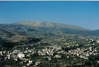
El Ain, Al Ain, or Ain is a village at an elevation of 1,000 metres (3,300 ft) on a foothill of the Anti-Lebanon Mountains in the Baalbek District of the Baalbek-Hermel Governorate, Lebanon. It is famous for agriculture and trade, located on the highway connecting Syrian borders and the Hermel area with Chtaura and Beirut.
Kahale, is a mountain village in the district of Aley, Lebanon, situated 13 km from Beirut. The population is estimated to be around 11,000 residents, with the majority being Maronite Catholic.

Rayaq - Haouch Hala, also romanized Rayak, is a Lebanese town in the Beqaa Governorate near the city of Zahlé. In the early 20th century and up to the 1975 outbreak of the civil war, it was Lebanon's most important railway center, where the 1.05-m Beirut–Damascus line met the standard-gauge line north to Baalbek, Homs, and Aleppo. It now has an air base and a hospital. Rayak Air Base was bombed by the Israeli Air Force during the 2006 Lebanon War. The landing strip was severely damaged as a result.
Sawiri or Sawairy or es-Sawairi (الصويري) is a town in the eastern part of Lebanon.

Massoudieh is a village in Akkar Governorate, Lebanon, inhabited by Alawites.
Al-Bireh, El Bire, Biré, El Bireh or Birra is a town in the Rashaya District, south-eastern portion of the Bekaa Governorate of the Republic of Lebanon. Al-Bireh is part of the Rashaya municipal district. It lies west of the road between Majdel Anjar and Rashaya. Its population is estimated to be 9000. It is a small Sunni Muslim town with two mosques and two schools.

Duris is a village located approximately 3 km (2 mi). southwest of Baalbek in the Bekaa Valley, Lebanon. It is the site of a 13th-century Muslim shrine and a necropolis from the late Roman Imperial period that is currently undergoing archaeological investigation.
Azour is a village in Lebanon, located 22 km (14 mi) from Sidon and 63 km (39 mi) south of Beirut. It is 830 meters above sea level. Azour's area stretches for 263 hectares.

Ain Aata, Ain Ata, 'Ain 'Ata or Ayn Aata is a village and municipality situated southwest of Rashaya, 99 kilometres (62 mi) south-east of Beirut, in the Rashaya District of the Beqaa Governorate in Lebanon.
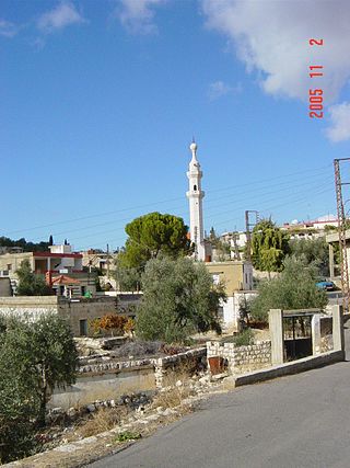
Arsal, is a town and municipality situated east of Labweh, 124 kilometres (77 mi) northeast of Beirut, in Baalbek District of Baalbek-Hermel Governorate, Lebanon. The population is predominantly Sunni Muslim.
Nahlé, is a village situated 6 kilometres (3.7 mi) northeast of Baalbek in Baalbek District, Baalbek-Hermel Governorate, Lebanon. It has the ruins of a Roman temple.
Kafr Zabad is a village in Lebanon. It is also the site of two ancient Roman antae temples.
Brital is a village located in the Baalbek District of the Baalbek-Hermel Governorate in Lebanon.
Younine, also spelled Yunin, is a municipality in the Baalbek District of the Baalbek-Hermel Governorate in northeastern Lebanon. It is located approximately 103 kilometers (64 mi) east of the national capital Beirut, and 18 kilometers (11 mi) northeast of the governorate capital of Baalbek. Its average elevation is 1,215 meters (3,986 ft) above sea level and its jurisdiction covers 7,759 hectares. It had 6,557 registered voters in 2010. Its inhabitants are Shia Muslims.
Majdaloun is a village in the Baalbek District in Baalbek-Hermel Governorate.
Haouch Snaid is a Lebanese local authority in the Baalbek District in Baalbek-Hermel Governorate.