List of cities and towns in Lebanon

Last updated

Districts of Lebanon Lebanon.geohive.gif
Districts of Lebanon

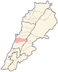
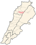
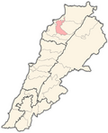
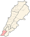
This is a list of cities and towns in Lebanon [1] distributed according to district. There are total 1000 districts. 56.21% of the population lives in 19 cities and towns, which gives the average 2,158 people per town.

Contents

Largest cities

CityRegionPopulation
Beirut Beirut Governorate 1,916,100
Tripoli North Governorate 229,398
Sidon South Governorate 163,554
Baalbek Baalbek-Hermel Governorate 150,806
Tyre South Governorate 135,204
Nabatieh South Governorate 120,000
Aley Mount Lebanon Governorate 100,000
Jounieh Mount Lebanon Governorate 96,315
Zahle Beqaa Governorate 78,145
Zgharta-Ehden North Governorate 50,000
Byblos Mount Lebanon Governorate 20,784
Batroun North Governorate 10,820

NB: Some of these numbers are either approximations or outdated.

[2]

Akkar Governorate

Akkar District (18)

Baalbek-Hermel Governorate

Baalbek District (52)

Hermel District

Beirut Governorate

Mount Lebanon Governorate

Aley District (53)

Baabda District

CityPopulation
Abadiyeh 7,900
Baabda*9,000
Bourj el-Barajneh*25,000
Chebanieh 1,300
Chiyah*17,000
Falougha 3,500
Furn el Chebbak*17,000
Ghbeireh*28,000
Hadath*20,500
Hammana 7,750
Hazmieh*3,900
Kornayel 3,600
Kfarchima 6,300
Ras el Matn 8,000
Salima 3,600
Wadi Chahrour 6,700

Note: starred cities are part of metropolitan Beirut.

Byblos District (57)

Chouf District (70)

Keserwan District (47)

Matn District

CityPopulation
Jdeideh*8,000
Bourj Hammoud*45,000
Bouchrieh*25,000
Antelias*9,500
Brummana*4,800
Baabdat*3,600
El Mansouria*17,000
Bhersaf*1,810
Bikfaya*8,200
Beit Chabab*8,700
Beit Mery*5,600
Chewyeh*500
Jal el Dib*5,400
Dekwaneh*6,450
Zalka*4,000
Sin el Fil*16,000
Dbayeh*4,900
Kornet Chehwan*4,800
Aintoura 5,100
Choueir 6,370
Khenchara 4,200
Bteghrine 4,500
Baskinta 11,000
Kaakour 1,801

| Fanar|| 15,000|

Note: starred cities are part of metropolitan Beirut.

Beqaa Governorate

Rashaya District (26)

Western Beqaa District (27)

Zahlé District (29)

Nabatieh Governorate

Bint Jbeil District (33)

Hasbaya District (15)

Marjeyoun District (25)

Nabatieh District (38)

North Governorate

Batroun District (21)

Bsharri District (11)

Koura District (34)

Miniyeh-Danniyeh District (18)

Tripoli District (3)

Zgharta District (31)

South Governorate

Jezzine District (35)

Sidon District (15)

Tyre District (25)

See also

Related Research Articles

<span class="mw-page-title-main">Kadisha Valley</span> Valley in North Governate, Lebanon

Kadisha Valley, also romanized as the Qadisha Valley and also known as the Kadisha Gorge or Wadi Kadisha, is a gorge that lies within the Bsharri and Zgharta Districts of the North Governorate of Lebanon. The valley was carved by the Kadisha River, also known as the Nahr Abu Ali when it reaches Tripoli. Kadisha means "Holy" in Aramaic, and the valley is sometimes called the Holy Valley. It has sheltered Christian monastic communities for many centuries. The valley is located at the foot of Mount al-Makmal in northern Lebanon.

Southern Lebanon is the area of Lebanon comprising the South Governorate and the Nabatiye Governorate. The two entities were divided from the same province in the early 1990s. The Rashaya and Western Beqaa Districts, the southernmost districts of the Beqaa Governorate, in Southern Lebanon are sometimes included.

<span class="mw-page-title-main">Baabda District</span> District in Mount Lebanon Governorate, Lebanon

Baabda District, sometimes spelled B'abda, is a district (qadaa) of Mount Lebanon Governorate, Lebanon, to the south and east of the Lebanon's capital Beirut. The region is also popularly known as "Southern Matn District", as distinct from Northern Matn District,. The capital of Baabda District is the city of Baabda.

<span class="mw-page-title-main">Batroun District</span> District in North Governorate, Lebanon

Batroun District is a district (qadaa) in the North Governorate, Lebanon, south of Tripoli. The capital is Batroun. Its borders are created in the south by the river El Jaouz in the north and by the river Madfoun.

<span class="mw-page-title-main">Aley District</span> District in Mount Lebanon Governorate, Lebanon

Aley is a district (qadaa) in Mount Lebanon, Lebanon, to the south-east of the Lebanon's capital Beirut. The capital is Aley. Aley city was previously known as the "bride of the summers" during the 1960 and 1970s, when Aley and neighboring Bhamdoune were attractive tourist locations for Lebanese emigres and local Lebanese

<span class="mw-page-title-main">Byblos District</span> District in Keserwan-Jbeil, Lebanon

Byblos District, also called the Jbeil District, is a district (qadaa) of the Keserwan-Jbeil Governorate of Lebanon. It is located to the northeast of Lebanon's capital Beirut. The capital is Byblos. The rivers of al-Madfoun and Nahr Ibrahim form the district's natural northern and southern borders respectively, with the Mediterranean Sea bordering it from the west and Mount Lebanon from the east, separating it from the adjacent district of Baalbek in the Beqaa Valley.

<span class="mw-page-title-main">Bint Jbeil District</span> District in Nabatiyeh Governorate, Lebanon

The Bint Jbeil District is a district in the Nabatiyeh Governorate of Lebanon. The capital of the district is Bint Jbeil.

<span class="mw-page-title-main">Shihab dynasty</span> Lebanese political family (1697–1842)

The Shihab dynasty is an Arab family whose members served as the paramount tax farmers and local chiefs of Mount Lebanon from the early 18th to mid-19th century, during Ottoman rule. Their reign began in 1697 after the death of the last Ma'nid chief. The family centralized control over Mount Lebanon, destroying the feudal power of the mostly Druze lords and cultivating the Maronite clergy as an alternative power base of the emirate. The Shihab family allied with Muhammad Ali of Egypt during his occupation of Syria, but was deposed in 1840 when the Egyptians were driven out by an Ottoman-European alliance, leading soon after to the dissolution of the Shihab emirate. Despite losing territorial control, the family remains influential in modern Lebanon, with some members having reached high political office.

<span class="mw-page-title-main">Ma'n dynasty</span> Druze chieftains of southern Mount Lebanon

The Ma'n dynasty, also known as the Ma'nids;, were a family of Druze chiefs of Arab stock based in the rugged Chouf area of southern Mount Lebanon who were politically prominent in the 15th–17th centuries. Traditional Lebanese histories date the family's arrival in the Chouf to the 12th century, when they were held to have struggled against the Crusader lords of Beirut and of Sidon alongside their Druze allies, the Tanukh Buhturids. They may have been part of a wider movement by the Muslim rulers of Damascus to settle militarized Arab tribesmen in Mount Lebanon as a buffer against the Crusader strongholds along the Levantine coast. Fakhr al-Din I, the first member of the family whose historicity is certain, was the "emir of the Chouf", according to contemporary sources and, despite the non-use of mosques by the Druze, founded the Fakhreddine Mosque in the family's stronghold of Deir al-Qamar.

<span class="mw-page-title-main">1860 civil conflict in Mount Lebanon and Damascus</span> Sectarian conflict in the Ottoman Empire in what is now Syria and Lebanon (1860)

The 1860 civil conflict in Mount Lebanon and Damascus was a civil conflict in Mount Lebanon during Ottoman rule in 1860–1861 fought mainly between the local Druze and Christians. Following decisive Druze victories and massacres against the Christians, the conflict spilled over into other parts of Ottoman Syria, particularly Damascus, where thousands of Christian residents were killed by Muslim and Druze militiamen. The fighting precipitated a French-led international military intervention.

Brih, Breeh is a village in the Chouf District in Mount Lebanon region, Lebanon. Brih is located 53 kilometres (33 mi) away from Beirut, the capital of Lebanon. It sits at an altitude of 800–1,100 metres (2,600–3,600 ft) above sea level and has an overall surface area of 305 hectares (1.18 sq mi).

<span class="mw-page-title-main">Architecture of Lebanon</span> Architecture of Lebanon

The architecture of Lebanon embodies the historical, cultural and religious influences that have shaped Lebanon's built environment. It has been influenced by the Phoenicians, Romans, Byzantines, Umayyads, Crusaders, Mamluks, Ottomans and French. Additionally, Lebanon is home to many examples of modern and contemporary architecture. Architecturally notable structures in Lebanon include ancient thermae and temples, castles, churches, mosques, hotels, museums, government buildings, souks, residences and towers.

<span class="mw-page-title-main">Temples of Mount Hermon</span> Roman shrines and temples in Lebanon, Israel, and Syria

The Temples of Mount Hermon are around thirty Roman shrines and Roman temples that are dispersed around the slopes of Mount Hermon in Lebanon, Israel and Syria. A few temples are built on former buildings of the Phoenician & Hellenistic era, but nearly all are considered to be of Roman construction and were largely abandoned during the persecution of pagans in the late Roman Empire.

<span class="mw-page-title-main">Temples of the Beqaa Valley</span> Shrines and Roman temples in the Beqaa Valley in Lebanon

The Temples of the Beqaa Valley are a number of shrines and Roman temples that are dispersed around the Beqaa Valley in Lebanon. The most important and famous are those in Roman Heliopolis. A few temples are built on former buildings of the Phoenician & Hellenistic era, but all are considered to be of Roman construction and were started to be abandoned after the fourth century with the fall of the Roman Paganism.

<span class="mw-page-title-main">People's Liberation Army (Lebanon)</span> Military wing of the Druze Progressive Socialist Party

The People's Liberation ArmyPLA, also known as the Armée populaire de libération (APL) in French or Forces of the Martyr Kamal Jumblatt, was the military wing of the left-wing Druze Progressive Socialist Party (PSP), which fought in the Lebanese Civil War. The PSP and its militia were members of the Lebanese National Movement (LNM) from 1975 to 1982.

Qaitea is an area that gathers Lebanese villages in Akkar District in Akkar Governorate.

<span class="mw-page-title-main">History of the Chouf region</span>

The Chouf region, also spelled Shouf, is a historical and geographical area located in the central part of Lebanon. Like much of Lebanon, the Chouf was inhabited by the Phoenicians, an ancient Semitic civilization known for their seafaring skills and trade. However, Evidence of inhabitance in the mountains dates back to the 5th century B.C.E. and archaeological evidence, consisting of Roman burial sites and pottery has proved a continuous inhabitation since 450 B.C.E.

References

  1. List of municipalities according to Informs.gov.lb The Lebanese Government Portal for Information and Forms Archived 2006-05-04 at the Wayback Machine
  2. "Population of Cities in Lebanon (2021)".
  3. 33:33:59N 35:24:21E
  4. localiban kharayeb-saida 33 20 35 N 35 17 59 E
  5. localiban merouaniyeh 33:28:07N 35:23:09E
  6. 33:26:16N 35:22:06E
  7. Google Earth Deir Qanoun el-Ain