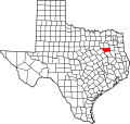
Brownsboro, Texas

Last updated

Brownsboro, Texas
Brownsboro, TX, High School IMG 0564.JPG
Brownsboro High School
Brownsboro, Texas
Brownsboro, Texas
Brownsboro, Texas
Brownsboro, Texas
Coordinates: 32°17′54″N95°36′49″W / 32.29833°N 95.61361°W / 32.29833; -95.61361
Country United States
State Texas
County Henderson
Named for John "Red" Brown
Area
[1]
  Total2.37 sq mi (6.15 km2)
  Land2.37 sq mi (6.15 km2)
  Water0.00 sq mi (0.00 km2)
Elevation
[2]
400 ft (100 m)
Population
 (2020)
  Total1,212
  Density538.98/sq mi (208.13/km2)
Time zone UTC-6 (Central (CST))
  Summer (DST) UTC-5 (CDT)
ZIP code
75756
Area code(s) 903, 430
FIPS code 48-10756 [3]
GNIS feature ID2409922 [2]
Website www.brownsboro.us

Brownsboro is a city in Henderson County, Texas, United States. The population was 1,212 at the 2020 census, [4] up from 1,039 at the 2010 census. The city is on Texas State Highway 31.

Contents

History

Brownsboro was first settled in 1849 by John "Red" Brown, who operated a toll bridge across Kickapoo Creek on the road to Jordan's Saline and Tyler. He had received a state issued license to operate a bridge near the town of Old Normandy. [5] By 1860, Henry Cade had erected a sawmill and a cotton gin. With the construction of the St. Louis Southwestern Railway through the county in 1880, the town moved to the railroad. [6]

The town of Old Normandy was near the site of present-day Brownsboro. It was established in 1845 by Johan Reinert Reiersen of Kristiansand, Norway, who urged Norwegian immigrants to settle in the new community. In the summer of 1847, a number of settlers died and many of the Norwegian immigrants moved to Four Mile Prairie in Van Zandt County and Prairieville in Kaufman County, also established by Reiersen. [7]

A Norwegian Lutheran church and cemetery were established in Normandy in 1853, but after that the community merged into the Brownsboro settlement. A nearby Lutheran church served as the chapel for the cemetery until the 1920s. [8]

Geography

Brownsboro is located in northeastern Henderson County. Texas State Highway 31 passes through the city, leading east 19 miles (31 km) to Tyler and southwest 16 miles (26 km) to Athens, the Henderson county seat.

According to the United States Census Bureau, Brownsboro has a total area of 2.4 square miles (6.1 km2), all land. [4] The city is on the south side of the valley of Kickapoo Creek, an eastward-flowing tributary of the Neches River.

Demographics

Historical population
CensusPop.Note
1940 640
1950 518−19.1%
1960 507−2.1%
1970 474−6.5%
1980 58222.8%
1990 545−6.4%
2000 79646.1%
2010 1,03930.5%
2020 1,21216.7%
U.S. Decennial Census [9]
Brownsboro racial composition as of 2020 [10]
(NH = Non-Hispanic) [lower-alpha 1]
RaceNumberPercentage
White (NH)87772.36%
Black or African American (NH)584.79%
Native American or Alaska Native (NH)70.58%
Asian (NH)30.25%
Some Other Race (NH)40.33%
Mixed/Multi-Racial (NH)534.37% Hispanic or Latino 21017.33%
Total1,212

As of the 2020 United States census, there were 1,212 people, 506 households, and 421 families residing in the city.

As of the census [3] of 2010, there were 1,039 people, 291 households, and 220 families residing in the city. The population density was 407.0 inhabitants per square mile (157.1/km2). There were 323 housing units at an average density of 165.2 per square mile (63.8/km2). The racial makeup of the city was 95.73% White, 1.38% African American, 0.50% Native American, 0.88% from other races, and 1.51% from two or more races. Hispanic or Latino of any race were 5.28% of the population.

There were 291 households, out of which 44.7% had children under the age of 18 living with them, 57.4% were married couples living together, 15.5% had a female householder with no husband present, and 24.1% were non-families. 21.6% of all households were made up of individuals, and 11.3% had someone living alone who was 65 years of age or older. The average household size was 2.74 and the average family size was 3.15.

In the city, the population was spread out, with 33.0% under the age of 18, 7.7% from 18 to 24, 28.1% from 25 to 44, 18.1% from 45 to 64, and 13.1% who were 65 years of age or older. The median age was 32 years. For every 100 females, there were 87.7 males. For every 100 females age 18 and over, there were 85.1 males.

The median income for a household in the city was $28,542, and the median income for a family was $29,844. Males had a median income of $25,729 versus $21,125 for females. The per capita income for the city was $14,851. About 20.8% of families and 22.0% of the population were below the poverty line, including 27.5% of those under age 18 and 7.7% of those age 65 or over.

Education

The city is served by the Brownsboro Independent School District.

Related Research Articles

<span class="mw-page-title-main">Brownsboro Farm, Kentucky</span> City in Kentucky, United States

Brownsboro Farm is a home rule-class city in Jefferson County, Kentucky, United States. The population was 648 at the 2010 census.

<span class="mw-page-title-main">Brownsboro Village, Kentucky</span> City in Kentucky, United States

Brownsboro Village is a home rule-class city in Jefferson County, Kentucky, United States. The population was 319 at the 2010 census.

<span class="mw-page-title-main">Druid Hills, Kentucky</span> City in Kentucky, United States

Druid Hills is a home rule-class city in Jefferson County, Kentucky, United States. The population was 308 at the 2010 census. It was incorporated in 1950.

<span class="mw-page-title-main">Old Brownsboro Place, Kentucky</span> City in Jefferson County, Kentucky, United States

Old Brownsboro Place is a home rule-class city in Jefferson County, Kentucky, United States, and a part of the united Metro government. The population was 353 at the 2010 census.

<span class="mw-page-title-main">Jourdanton, Texas</span> City in Texas, United States

Jourdanton is a city in and the county seat of Atascosa County, Texas, United States. The population is 4,094. It is part of the San Antonio metropolitan statistical area.

<span class="mw-page-title-main">Athens, Texas</span> City in Texas, United States

Athens is a city and the county seat of Henderson County, Texas, in the United States. As of the 2020 census, the city population was 12,857. The city has called itself the "Black-Eyed Pea Capital of the World." Athens was selected as one of the first "Certified Retirement Communities" in Texas. Athens was incorporated in 1856 and was named after Athens, the capital of Greece.

Berryville is a town in Henderson County, Texas, United States. The population was 824 at the 2020 census, down from 975 at the 2010 census.

<span class="mw-page-title-main">Caney City, Texas</span> Town in Texas, United States

Caney City is a town in Henderson County, Texas, United States. The population was 187 at the 2020 census.

<span class="mw-page-title-main">Chandler, Texas</span> City in Texas, United States

Chandler is a city in Henderson County, Texas, United States, at the northern end of Lake Palestine. Its population was 3,275 at the 2020 census, up from 2,734 at the 2010 census.

<span class="mw-page-title-main">Enchanted Oaks, Texas</span> Town in Texas, United States

Enchanted Oaks is a town in Henderson County, Texas, United States. The population was 347 at the 2020 census, down from 326 at the 2010 census.

<span class="mw-page-title-main">Log Cabin, Texas</span> City in Texas, United States

Log Cabin is a city in Henderson County, Texas, United States. The population was 678 at the 2020 census.

<span class="mw-page-title-main">Malakoff, Texas</span> City in Texas, United States

Malakoff is a city in Henderson County, Texas, United States. The population was 2,179 at the 2020 census. The city is named after a Russian fort of Malakoff, which played a pivotal role during the siege of Sevastopol during the Crimean War.

<span class="mw-page-title-main">Moore Station, Texas</span> City in Texas, United States

Moore Station is a city in Henderson County, Texas, United States. The population was 160 at the 2020 census. It was founded in 1876 by Anderson Moore, a former "mulatto" slave.

<span class="mw-page-title-main">Murchison, Texas</span> City in Texas, United States

Murchison is a city in Henderson County, Texas, United States. The population was 516 at the 2020 census.

<span class="mw-page-title-main">Star Harbor, Texas</span> City in Texas, United States

Star Harbor is a city in Henderson County, Texas, United States. The population was 482 at the 2020 census.

<span class="mw-page-title-main">Tool, Texas</span> City in Texas, United States

Tool is a city in Henderson County, Texas, United States. The population was 2,175 at the 2020 census. Located on the west side of Cedar Creek Lake, it is a popular second home and retiree destination.

<span class="mw-page-title-main">Trinidad, Texas</span> City in Texas, United States

Trinidad is a city in Henderson County, Texas, United States, near the Trinity River from which the town's name was derived. The population was 860 at the 2020 census, down from 886 at the 2010 census.

<span class="mw-page-title-main">Centerville, Texas</span> City in Texas, United States

Centerville is a city in Leon County, in the U.S. state of Texas. The population was 905 at the 2020 census. It is the county seat of Leon County. Centerville was so named as it is near the geographic center of Leon County.

<span class="mw-page-title-main">San Diego, Texas</span> City in Texas, United States

San Diego is a city in Duval and Jim Wells counties, Texas, United States. The population was 3,748 at the 2020 census and 4,488 at the 2010 census. It is located primarily in Duval County, of which it is the county seat.

<span class="mw-page-title-main">Kickapoo Tribal Center, Kansas</span> Unincorporated community in Brown County, Kansas

Kickapoo Tribal Center is a census-designated place (CDP) in Brown County, Kansas, United States, on the Kickapoo Indian Reservation. As of the 2020 census, the population was 177, making it the most populous location within the reservation.

References

  1. "2019 U.S. Gazetteer Files". United States Census Bureau. Retrieved August 7, 2020.
  2. 1 2 U.S. Geological Survey Geographic Names Information System: Brownsboro, Texas
  3. 1 2 "U.S. Census website". United States Census Bureau . Retrieved January 31, 2008.
  4. 1 2 "Geographic Identifiers: 2010 Census Summary File 1 (G001): Brownsboro city, Texas". American Factfinder. U.S. Census Bureau. Archived from the original on February 13, 2020. Retrieved February 9, 2018.
  5. Hudson, Linda Elaine Sybert (November 1, 1994). "Brown, John [Red] (ca 1786–1852)". The Handbook of Texas Online. Texas State Historical Association. Retrieved April 10, 2024.
  6. J. J. Faulk, History of Henderson County (Athens, Texas: Athens Review Printing, 1926).
  7. C. A. Clausen, ed., Lady With the Pen: Elise Waerenskjold in Texas (Northfield, Minnesota: Norwegian-American Historical Association, 1961)
  8. Texas Historical Commission, Historical markers, Texas State Highway 31 in Brownsboro
  9. "Census of Population and Housing". Census.gov. Retrieved June 4, 2015.
  10. "Explore Census Data". data.census.gov. Retrieved May 24, 2022.
  11. "About the Hispanic Population and its Origin". www.census.gov. Retrieved May 18, 2022.
  1. Note: the US Census treats Hispanic/Latino as an ethnic category. This table excludes Latinos from the racial categories and assigns them to a separate category. Hispanics/Latinos can be of any race. [11]