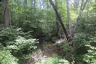
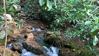
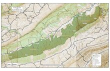
Mountain Lake Wilderness is a U.S. Wilderness Area in the George Washington and Jefferson National Forests. The wilderness area is located next to privately owned Mountain Lake, and consists of 8,314 acres (3,365 ha) in Virginia and 2,721 acres (1,101 ha) in West Virginia.

Barbours Creek Wilderness is a U.S. wilderness area in the Eastern Divide Ranger District of George Washington and Jefferson National Forests of western Virginia, United States. The wilderness area was established in 1988 and consists of 5,382 acres (2,178 ha) of forests in the Appalachian Mountains ranging in elevation from 1,700 to 3,800 feet.
Stone Mountain Wilderness is a U.S. wilderness area in the Clinch Ranger District of the George Washington and Jefferson National Forests. It is a small tract of land in western Virginia, consisting of an area of 3,273 acres (13.25 km2) next to the banks of the Powell River. It was designated as wilderness area in 2009 by Omnibus Public Land Management Act of 2009.

Garden Mountain Wilderness is a U.S. wilderness area in the Eastern Divide Ranger District of the George Washington and Jefferson National Forests. It is a small wilderness area in western Virginia, consisting of an area of 3,331 acres (13.48 km2) and bordering the Beartown and Hunting Camp Creek Wilderness. It was designated as wilderness area in 2009 by Omnibus Public Land Management Act of 2009. The wilderness area also borders a portion of the Appalachian Trail.

Brush Mountain East Wilderness is a U.S. wilderness area in the Eastern Divide Ranger District of the George Washington and Jefferson National Forests. It was designated as wilderness area in 2009 by Omnibus Public Land Management Act of 2009. The wilderness is adjacent to Brush Mountain Wilderness.

The Peters Mountain Wilderness is an area protected by act of Congress to maintain its present, natural condition. As part of the wilderness system. it helps to preserve a variety of natural life forms and contributes to a diversity of plant and animal gene pools. Over half of the ecosystems in the United States exist within designated wilderness.

The Thunder Ridge Wilderness is a 2,344 acres (949 ha) area located near Natural Bridge, Virginia, which is protected by the Eastern Wilderness Act of Congress to maintain its present, natural condition. As part of the National Wilderness Preservation System, it helps to preserve a variety of natural life forms and contributes to a diversity of plant and animal gene pools. Over half of the ecosystems in the United States exist within designated wilderness.

The Shawvers Run Wilderness, a 5784-acre area located less than one mile south of Potts Creek, Virginia, is protected by the Eastern Wilderness Act of Congress to maintain its present, natural condition. As part of the National Wilderness Preservation System, it helps to preserve a variety of natural life forms and contributes to a diversity of plant and animal gene pools. Over half of the ecosystems in the United States exist within designated wilderness.

The Kimberling Creek Wilderness is an area protected by the Eastern Wilderness Act of Congress to maintain its present, natural condition. It is managed as part of the Jefferson National Forest. As part of the wilderness system, it helps to preserve a variety of natural life forms and contributes to a diversity of plant and animal gene pools. Over half of the ecosystems in the United States exist within designated wilderness.
The Hunting Camp Creek Wilderness is an area protected by the Eastern Wilderness Act of Congress to maintain its present, natural condition. As part of the wilderness system, it helps to preserve a variety of natural life forms and contributes to a diversity of plant and animal gene pools. Over half of the ecosystems in the United States exist within designated wilderness.
The Lynn Camp Creek Wilderness Study Area, a 3226-acre site in the Eastern Divide Ranger District of the George Washington and Jefferson National Forests, was designated a wilderness study area by the Omnibus Public Lands Act of 2009.
The Raccoon Branch Wilderness is an area in the Mount Rogers National Recreation Area protected by the Eastern Wilderness Act of Congress to maintain its present, natural condition. As part of the wilderness system, it is intended to preserve a variety of natural life forms and contribute to a diversity of plant and animal gene pools. Over half of the ecosystems in the United States exist within designated wilderness.

The Lewis Fork Wilderness is an area in the Mount Rogers National Recreation Area protected by the Eastern Wilderness Act of Congress to maintain its present, natural condition. As part of the wilderness system, it is intended to preserve a variety of natural life forms and contribute to a diversity of plant and animal gene pools. Over half of the ecosystems in the United States exist within designated wilderness.

North Creek (conservation area) is a wildland in the George Washington and Jefferson National Forests of western Virginia that has been recognized by the Wilderness Society as a special place worthy of protection from logging and road construction. Tall evergreen and hardwood trees in the area around Apple Orchard Falls tower above ferns and wildflowers. The area includes a valley which extends from Sunset Fields in the east to its western border near the North Creek Camping Area.

The Clinch Ranger District Cluster is a region in the George Washington and Jefferson National Forests recognized by The Wilderness Society for its rich biodiversity and rugged scenery. It offers a unique habitat for rare plants, salamanders and other rare species.
Stone Coal Creek, a wildland in the George Washington and Jefferson National Forests of western Virginia, has been recognized by the Wilderness Society as a special place worthy of protection from logging and road construction. The Wilderness Society has designated the area as a "Mountain Treasure".
North Mountain, a wildland in the George Washington and Jefferson National Forests of western Virginia, has been recognized by the Wilderness Society as a special place worthy of protection from logging and road construction. The Wilderness Society has designated the area as a "Mountain Treasure".

The Craig Creek Cluster is a region recognized by The Wilderness Society for its unique high elevation mountains, vistas, trout streams and wildlife habitat. The cluster contains wildlands and wilderness areas along Craig Creek, a 65-mile long creek with headwaters at the Brush Mountain Wilderness near Blacksburg.
Sinking Creek Mountain, a wildland in the George Washington and Jefferson National Forests of western Virginia, has been recognized by the Wilderness Society as a special place worthy of protection from logging and road construction. The Wilderness Society has designated the area as a "Mountain Treasure".
The Kimberling Creek Cluster is a region in the Jefferson National Forest recognized by The Wilderness Society for its diversity of habitats extending along parts of Brushy and Hogback Mountains. Kimberling Creek, with headwaters in the cluster, flows into Big Walker Creek, a tributary of the New River.


