
Christchurch is the largest city in the South Island of New Zealand and the seat of the Canterbury Region. Christchurch lies on the South Island's east coast, just north of Banks Peninsula on Pegasus Bay. The Avon River / Ōtākaro flows through the centre of the city, with an urban park along its banks.

New Brighton is a coastal suburb of Christchurch, New Zealand, 8 kilometres (5.0 mi) east of the city centre. It is one of eastern Christchurch's main entertainment and tourist centres, with its architecturally unique pier and scenic coastline. The 2011 Christchurch earthquakes caused significant damage in the area.

Cathedral Square, locally known simply as the Square, is the geographical centre and heart of Christchurch, New Zealand, where the city's Anglican cathedral, ChristChurch Cathedral is located. The square stands at the theoretical crossing of the city's two main orthogonal streets, Colombo Street and Worcester Street, though in practice both have been either blocked off or detoured around the square itself. The square was badly damaged in the February 2011 Christchurch earthquake.

Rolleston is the seat and largest town in the Selwyn District, in the Canterbury region of New Zealand's South Island. It is located on the Canterbury Plains 22 kilometres (14 mi) south-west of Christchurch, and is part of the wider Christchurch metropolitan area. The town has a population of 29,600, making it New Zealand's 23rd-largest urban area and the second-largest in Canterbury.

Public transport in Christchurch, New Zealand, consists of bus services operated by two bus companies supported by a ferry, all jointly marketed as Metro, a division of Environment Canterbury (ECan).

The Christchurch tramway system was an extensive network in Christchurch, New Zealand, with steam and horse trams from 1882. Electric trams ran from 1905 to 1954, when the last line from Cashmere to Papanui was replaced by buses.

On Tuesday, 18 November 1947, a fire engulfed Ballantynes department store in central Christchurch, New Zealand. 41 people died in the fire, all of whom have found themselves trapped by the fire or overcome by smoke, since there was no fire alarm or evacuation plan. It remains the deadliest fire in New Zealand history.

Christchurch Central City or Christchurch City Centre is the geographical centre and the heart of Christchurch, New Zealand. It is defined as the area within the Four Avenues and thus includes the densely built up central city, some less dense surrounding areas of residential, educational and industrial usage, and green space including Hagley Park, the Christchurch Botanic Gardens and the Barbadoes Street Cemetery.
Christchurch tramway routes have developed from lines that were first established by a troika of private tramway companies in the latter part of the 19th century, through to a significantly expanded system under the municipal Christchurch Tramway Board, to the City Council-built heritage circuit. These routes have been worked by all three main forms of tramway motive power and have significantly contributed to the development of Christchurch City in New Zealand's South Island.

Colombo Street is a main road of the city of Christchurch, New Zealand. It runs south-north through the centre of Christchurch with a break at Cathedral Square. As with many other central Christchurch streets, it is named for a colonial Anglican bishopric, Colombo, Sri Lanka in what at the time was known as Ceylon. Parts of the street which run through Sydenham were known as Addison Street during the 1880s, and some parts were known as Colombo Road.

Oxford Terrace Baptist Church is a Baptist church located in the Christchurch Central City on a prominent corner property fronting the Avon River. It is affiliated with the Baptist Churches of New Zealand.

St Paul's Church was a heritage-listed former Presbyterian church in Cashel Street, Christchurch. Built in 1877, the church was registered by the New Zealand Historic Places Trust as a Category I heritage building. Following the February 2011 Christchurch earthquake, the building was removed from the heritage list and demolished.

The Guthrey Centre at 126 Cashel Street, Christchurch Central City, originally the offices of Andersons Foundry and later 'Andersons Ltd, was a Category I heritage building registered by the New Zealand Historic Places Trust. The building was demolished following severe damage from the February 2011 Christchurch earthquake.

City Mall is the main pedestrian mall in the central city of Christchurch, New Zealand, comprising two sections of Cashel Street plus the Bridge of Remembrance and one section of High Street. It is also known colloquially as Cashel Mall. The Bridge of Remembrance was pedestrianised in 1976. The main mall was closed to traffic on 11 January 1982 and formally reopened as a pedestrian mall on 7 August, but it was not until 1992 that the entire mall was paved. The mall was redeveloped between 2006 and 2009, and track was installed for an expansion of the heritage tram network.

J Ballantyne and Company Ltd, trading as Ballantynes is a Christchurch, New Zealand-based department store operator. Established in 1854, it is New Zealand's oldest department store. Ballantynes is also a member of the Intercontinental Group of Department Stores. Alongside their flagship store in Christchurch Central City, the Cantabrian company operates a store in Timaru. The company also operates Contemporary Lounge, offering more youth-oriented fashion styles within the Christchurch store.

The Christchurch Transport Board was an autonomous special-purpose municipal authority responsible for the construction, acquisition, and ownership of local transport assets and the operation of public transport services in the Christchurch region of New Zealand's South Island. Constituted as the Christchurch Tramway Board in 1902, it operated trams and buses to Christchurch's outer suburbs and satellite towns for 84 years until being disestablished in the 1989 local government reforms.

Container Mall was a temporary mall built from shipping containers in Christchurch Central City, New Zealand. It was a response to the 22 February 2011 Christchurch earthquake, which destroyed most buildings in City Mall, and resulted in the central city being cordoned off from public access while buildings were being demolished. Initially considered a short-term response to the lack of permanent buildings, Re:START was popular with locals and tourists alike and remained open for business until January 2018.

The Shuttle was a free bus service in Central Christchurch, New Zealand. Introduced in December 1998, the popular service represented the first use of turbine-electric hybrid vehicles in New Zealand. It was operated until the February 2011 Christchurch earthquake and carried about one million passengers per year. It was not reinstated after the central city cordons were removed in 2013.
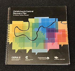
The Christchurch Central Recovery Plan, often referred to as the Blueprint, is the plan developed by the Fifth National Government of New Zealand for the recovery of the Christchurch Central City from a series of earthquakes, in particular the February 2011 Christchurch earthquake. The Canterbury Earthquake Response and Recovery Act 2010 required the Christchurch City Council to develop a recovery plan for the central city. The plan, known as Share an Idea, was presented to the Minister for Canterbury Earthquake Recovery, Gerry Brownlee, in December 2011. Brownlee rejected the city council's plan, established the Canterbury Earthquake Recovery Authority (CERA), and tasked that organisation with developing a plan based on the city council's draft. The Christchurch Central Recovery Plan was published in July 2012 and defined 17 anchor projects. All projects where a timeline was specified were to have been finished by 2017; none of the 17 projects have been delivered on time and some have not even been started yet.

The Bus Interchange is the bus station in the Christchurch Central City in New Zealand. Built as one of the 17 anchor projects identified in the Christchurch Central Recovery Plan, it opened in May 2015 after the previous Bus Exchange had been damaged in the 2011 Christchurch earthquake.
