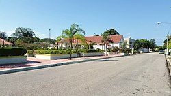
San Cristóbal is a province in the southern region of Dominican Republic, located west of the capital Santo Domingo. With approximately 642,000 inhabitants, it is the fourth most populated province in the country, only behind Santo Domingo, Santiago and the National District. It borders the provinces Monseñor Nouel (north), Monte Plata (northeast), Santo Domingo (east), Peravia (west) and San José de Ocoa (northwest). The Caribbean Sea borders the province to the south. The provincial capital is the city of San Cristóbal.

The Dominican Republic is divided into thirty–one provincias, while the national capital, Santo Domingo, is contained within its own Distrito Nacional.

Dajabón is a northwesternmost province which currently comprising one of the 32 provinces of the Dominican Republic. It is divided into 5 municipalities and its capital city with the same name. It is bordered by the provinces of Monte Cristi to the north, Santiago Rodríguez to the south, Elías Piña to the south and the Nord-Est department of Haiti to the west.

Elías Piña is a westernmost province which composing one of the 32 provinces of the Dominican Republic. It is divided into 6 municipalities and its capital city is Comendador. It is bordered by the provinces of Dajabón to the north-west, Santiago Rodríguez to the north-east, San Juan to the east, Independencia to the south and the Nord-Est department of Haiti to the west.

Monseñor Nouel is a province in the central region of the Dominican Republic. It was split from La Vega province in 1982.

Monte Cristi is a province in the northwest of the Dominican Republic. The capital city is San Fernando de Monte Cristi. The spelling Montecristi is also seen. The Montecristi province is located in the Cibao frontier region, on the north coast of the country and borders the nation of Haiti. The land area of the Montecristi province is 1,924.35 km2. It is divided into six municipalities and four municipal districts.

Pedernales is the southernmost province of the Dominican Republic, including the offshore island of Isla Beata. It was split from Barahona in 1957. Of its 2,074.53 km2, 1374 km2 belong to the Jaragua National Park. A third of its population is of Haitian origin, the highest ratio within the country.

Cotuí is a city in the central region of the Dominican Republic and is one of the oldest cities of the New World. It is the capital of Sánchez Ramírez Province in the Cibao.
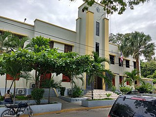
Comendador is the capital of the Elías Piña province of the Dominican Republic. It has a border crossing to the Haitian town Belladère.

Jimaní is the capital and the second largest city of the Independencia Province of the Dominican Republic. It serves as one of the two main border crossings to Haiti, with a duty-free open-air marketplace operating on the border with Haiti. The town suffered damages in the flash flood of May 25, 2004, which killed many citizens during the night and washed away hundreds of homes.
Neiba is a city in the southwest of the Dominican Republic. It is the capital city of the Baoruco province, and is located 180 kilometres west of the national capital, Santo Domingo, close to the shore of Lake Enriquillo, the largest lake in the West Indies.
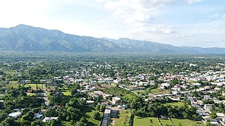
Bonao is a city in the Cibao region of Dominican Republic. It is the capital of the Monseñor Nouel province. The city is located in the center of the country, to the northwest of the national capital Santo Domingo.
Dajabón is a municipality and capital of the Dajabón province in the Dominican Republic, which is located on the northwestern Dominican Republic frontier with Haiti. It is a market town with a population of about 26,000, north of the Cordillera Central mountain range.
Duvergé, also known locally as Las Damas is the largest city in the province of Independencia in the Dominican Republic. The first settlers of this community were the gentlemen Christopher Pérez and María del Pulgar, originating from San Juan de la Maguana.
Salcedo is the capital city of the Hermanas Mirabal Province in the Dominican Republic. It is the birthplace of the Dominican heroines, the Mirabal sisters, who died in the struggle against the dictator Rafael Trujillo. A museum in the town commemorates three of sisters; it was tended to by the remaining sister, Bélgica (Dedé) Mirabal, until her death on February 1, 2014.
Villa Riva is a municipality (municipio) of the Duarte Province in the Dominican Republic.
Hondo Valle is a town in the Elías Piña province of the Dominican Republic characterized by its beautiful mountains and cold climate.

San Juan is a province of the Dominican Republic. Before 1961 it was known as Benefactor. San Juan is the Republic's largest province, bearing a size of 3,569 square kilometers, and it is landlocked.
The Haitian minority of the Dominican Republic is the largest ethnic minority in the Dominican Republic since the early 20th century.