Cabin John-Brookmont, Maryland

Last updated
Cabin John-Brookmont
Former CDP
USA Maryland location map.svg
Red pog.svg
Cabin John-Brookmont
Location within the state of Maryland
Usa edcp location map.svg
Red pog.svg
Cabin John-Brookmont
Cabin John-Brookmont (the United States)
Coordinates: 38°58′02″N77°08′51″W / 38.96722°N 77.14750°W / 38.96722; -77.14750
CountryUnited States
State Maryland
Counties Montgomery
Area
  Land2.6 sq mi (6.8 km2)
  Water1.0 sq mi (2.5 km2)
Elevation
36 ft (11 m)
Population
 (1990)
  Total5,341
Time zone UTC−5 (Eastern (EST))
  Summer (DST) UTC−4 (EDT)
ZIP codes
20816, 20818
Area code(s) 240 & 301
FIPS code 24-12087 [1]

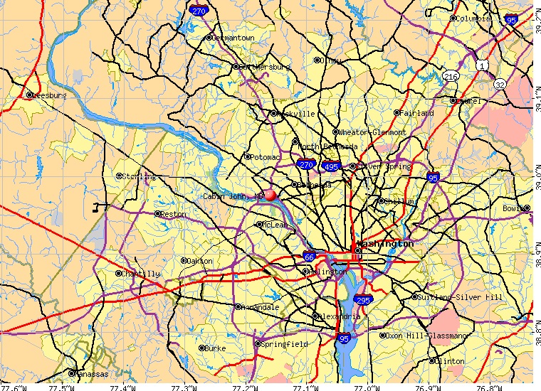
Cabin John-Brookmont was a census-designated place in Montgomery County, Maryland (adjacent to Washington, D.C.) during the 1980 and 1990 censuses, which included the primary communities of Cabin John and Brookmont. The population recorded in 1990 was 5,341 and consisted of 2,168 housing units. [2] The census area disbanded to form Cabin John and Brookmont in 2000. [3] The ZIP codes serving the area are 20816 and 20818.

Geography

Historical population
CensusPop.Note
1980 5,135
1990 5,3414.0%
source: [4] [5]

Located at 38.96737 north and 77.14763 west, [6] the census area of Cabin John-Brookmont was bounded by the census areas of Potomac to the northwest, McLean (the Potomac River) to the south and Bethesda to the northeast. [7] The land area of the CDP was 2.7 square miles. [8]

Related Research Articles

<span class="mw-page-title-main">Ferndale, Maryland</span> Census-designated place in Maryland, United States

Ferndale is a census-designated place (CDP) in Anne Arundel County, Maryland, United States. At the 2010 census, the population was 16,746.

<span class="mw-page-title-main">Potomac Heights, Maryland</span> Census-designated place in Maryland, United States

Potomac Heights is a census-designated place (CDP) in Charles County, Maryland, United States. The population was 1,117 at the 2010 census. It has a volunteer fire department and numerous older rambler homes built for workers at the nearby U.S. Navy munitions plant in Indian Head.

<span class="mw-page-title-main">Brunswick, Maryland</span> City in Maryland

Brunswick is a city in southwestern Frederick County, Maryland, United States. The city is located on the north bank of the Potomac River; Loudoun County, Virginia occupies the opposite shore. The population of Brunswick was 8,211 at the 2022 Census. There are three schools serving Brunswick: Brunswick Elementary School, Brunswick Middle School, and Brunswick High School.

<span class="mw-page-title-main">Brookmont, Maryland</span> Census-designated place in Maryland, United States

Brookmont is a census-designated place and unincorporated area in Montgomery County, Maryland, United States. As of the 2020 census, it had a population of 3,751. Brookmont is often considered part of neighboring Bethesda because it falls within Bethesda's 20816 zip code.

<span class="mw-page-title-main">Cabin John, Maryland</span> Census-designated place in Maryland, United States

Cabin John is a census-designated place and unincorporated area in Montgomery County, Maryland, United States. As of the 2020 census, it had a population of 2,459. Overlooking the Potomac River, it is a suburb of Washington, D.C.

<span class="mw-page-title-main">Glen Echo, Maryland</span> Town in Maryland, United States

Glen Echo is a town in Montgomery County, Maryland, United States, that was chartered in 1904. The population was 279 at the 2020 census.

<span class="mw-page-title-main">North Potomac, Maryland</span> Census-designated place named North Potomac in Maryland, United States

North Potomac is a census-designated place and unincorporated area in Montgomery County, Maryland, United States. It is located less than 5 miles (8.0 km) north of the Potomac River, and is about 20 miles (32 km) from Washington, D.C. It has a population of 23,790 as of 2020.

<span class="mw-page-title-main">Potomac, Maryland</span> Census-designated place in Maryland, United States

Potomac is an unincorporated community and census-designated place in Montgomery County, Maryland, United States. As of the 2020 census, it had a population of 47,018. It is named after the nearby Potomac River. A part of the Washington metropolitan area, many Potomac residents work in nearby Washington, D.C., and Northern Virginia.

<span class="mw-page-title-main">Redland, Maryland</span> Census-designated place in Maryland, United States

Redland is a census-designated place and an unincorporated area in Montgomery County, Maryland, United States. It had a population of 18,592 as of the 2020 census.

<span class="mw-page-title-main">Travilah, Maryland</span> Census-designated place in Maryland

Travilah is a United States census-designated place and an unincorporated area in Montgomery County, Maryland. It is 17.28 square miles (44.8 km2) located along the north side of the Potomac River, and surrounded by the communities of Potomac, North Potomac, and Darnestown—all census-designated places. It had a population of 11,985 as of the 2020 census.

<span class="mw-page-title-main">Accokeek, Maryland</span> Census-designated place in Maryland, United States

Accokeek, "at the edge of the hill" in Algonquin, is a census-designated place (CDP) located in Prince George's County, Maryland, United States. The CDP is located on the Potomac River, borders Charles County and is approximately 17 miles from Washington. It is a part of the Washington metropolitan area. The population of the CDP, as of the 2020 United States Census was 13,927.

<span class="mw-page-title-main">Fort Washington, Maryland</span> Census-designated place in Maryland

Fort Washington is an unincorporated area and census-designated place in Prince George's County, Maryland, United States. It borders the Potomac River, situated 20 miles south of downtown Washington, D.C. As of the 2020 census, it had a population of 24,261. The Fort Washington community is located west of Maryland Route 210, with some additional area to the east of the highway.

<span class="mw-page-title-main">Friendly, Maryland</span> Census-designated place in Maryland

Friendly is an unincorporated area and census-designated place (CDP) in Prince George's County, Maryland, United States, with an African-American majority population, located a few miles south of Washington, D.C. The population was 9,937 at the 2020 census.

<span class="mw-page-title-main">Leonardtown, Maryland</span> Town in Maryland, United States

Leonardtown is a town in and the county seat of St. Mary's County, Maryland, United States. The population was 4,563 at the 2020 census.

<span class="mw-page-title-main">Port Royal, Virginia</span> Town in Virginia, United States

Port Royal is an incorporated town in Caroline County, Virginia, United States. The population was 126 at the 2010 census.

<span class="mw-page-title-main">Fort Hunt, Virginia</span> Census-designated place in Virginia, United States

Fort Hunt is a census-designated place (CDP) in Fairfax County, Virginia, United States. The area is named after Fort Hunt, which was built on the bank of the Potomac River in 1897 to defend Washington, D.C. from naval attack and is now a public park. The area is also notable for its high population of senior citizens and for being one of the first suburbs in wealthy Fairfax County. The population was 17,231 at the 2020 census.

<span class="mw-page-title-main">McLean, Virginia</span> Census-designated place and unincorporated community in US

McLean is an unincorporated community and census-designated place in Fairfax County, Virginia, United States. The population of the community was 50,773 at the 2020 census. It is located between the Potomac River and Vienna within the Washington metropolitan area.

<span class="mw-page-title-main">Colonial Beach, Virginia</span> Town in Virginia, United States

Colonial Beach, Virginia (CBVA) is a river and beach town located in the northwestern part of Westmoreland County on Virginia's Northern Neck peninsula. It is bounded by the Potomac River, Monroe Bay and Monroe Creek. It is located 65 mi (105 km) from Washington, D.C.; 70 mi (110 km) from the state capital of Richmond; and 35 nautical miles from the Chesapeake Bay.

<span class="mw-page-title-main">Chevy Chase (town), Maryland</span> Town in Montgomery County, Maryland, US

Chevy Chase —formally, the Town of Chevy Chase—is an incorporated town in Montgomery County, Maryland, United States. The population was 2,904 at the 2020 census.

Tantallon is an unincorporated community in Prince George's County, Maryland, United States, and is a part of the census-designated place (CDP) of Fort Washington. The ZIP code for the community is 20744. Tantallon reported as a census-designated place by the U.S. Census Bureau in 1980. The population recorded was 9,945. Tantallon began in the 1960s as a country-club community of homes in a variety of architectural styles, and includes an 18-hole golf course, boat marina, and private swimming pool. It was named after Tantallon Castle in Scotland. Some homes have frontage on inlets of the Potomac River. It is governed by the Tantallon Citizens Association. The adjacent Hatton Point area, as well as nearby historic Fort Washington National Park, have very scenic views of the river. The bi-county parks commission's Harmony Hall Recreation Center, and metrobus commuter service to Washington, D.C., are nearby.

References

  1. Cabin John-Brookmont, Maryland Archived 2013-09-18 at archive.today . Roadside Thoughts. Retrieved 2013-09-18.
  2. Cabin John-Brookmont U.S. Gazetteer from 1990. Retrieved 2013-09-18.
  3. Population and housing unit counts for Maryland in 2000. United States Census Bureau. 2003. Retrieved 2013-09-18.
  4. "CENSUS OF POPULATION AND HOUSING (1790-2000)". U.S. Census Bureau. Archived from the original on 2010-07-08. Retrieved 2010-07-17.
  5. Census area disbanded in 2000.
  6. "US Gazetteer files: 2010, 2000, and 1990". United States Census Bureau. 2011-02-12. Retrieved 2011-04-23.
  7. 1990 census TIGER map of Washington, D.C., in vicinity. United States Census Bureau. Retrieved 2013-09-18.
  8. Maryland - Census Bureau. Retrieved 2013-09-18.