Related Research Articles

Rio Grande do Sul is a state in the southern region of Brazil. It is the fifth-most populous state and the ninth-largest by area. Located in the southernmost part of the country, Rio Grande do Sul is bordered clockwise by Santa Catarina to the north and northeast, the Atlantic Ocean to the east, the Uruguayan departments of Rocha, Treinta y Tres, Cerro Largo, Rivera, and Artigas to the south and southwest, and the Argentine provinces of Corrientes and Misiones to the west and northwest. The capital and largest city is Porto Alegre. The state has the highest life expectancy in Brazil, and the crime rate is relatively low compared to the Brazilian national average. The state has 5.4% of the Brazilian population and it is responsible for 6.6% of the Brazilian GDP.

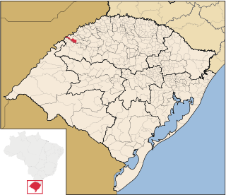
Roque Gonzales is a municipality located in the northwestern region of the southernmost state of Rio Grande do Sul, Brazil, east of the Uruguay River and the Argentinian border. Roque Gonzales was named after the jesuit missionary and saint Roque González de Santa Cruz.

Santa Rosa is a municipality in the Brazilian state of Rio Grande do Sul, located at latitude 27º52'15" and longitude 54º28'53" at a height of 277 meters above sea level. It has an area of 488.42 km2. Its estimated population is 73,575 (2020). It is known as the "National Cradle of Soybeans".

Augusto Pestana is a Brazilian municipality in the State of Rio Grande do Sul. It is located at 28°31′01″S 53°39′01″W, at an altitude of 390 m. The city is 320 km northwest of Porto Alegre, 1,540 km southwest of Brasília and just 120 km east of the border with Argentina.

Nova Prata is a municipality in the mountainous Serra Gaúcha region of Rio Grande do Sul, in southern Brazil. It is in the Guapore micro-region of the Nordeste Rio-Grandense meso-region of the state.

Santiago is a municipality of the western part of the state of Rio Grande do Sul, Brazil. It is the capital of the microregion of Santiago. The population is 49,360 in an area of 2,413.13 km2 (931.71 sq mi). Its elevation is 409 m. It is located 450 km west of the state capital of Porto Alegre and northeast of Alegrete. The nickname of the city is "The Land of the Poets".

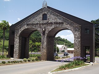
Antônio Prado is a municipality located in the Serra Gaúcha regionin The city is in the state of Rio Grande do Sul, Brazil. It boasts the largest collection of architectural heritage designated by IPHAN related to Italian colonization in Brazil. Its population is estimated at 13,045 people.

Arvorezinha is a municipality in the state of Rio Grande do Sul, Brazil. It literally means "small tree".
Gentil, Rio Grande do Sul is a municipality in the state of Rio Grande do Sul, Brazil. As of 2020, the estimated population was 1,626.

Guarani das Missões is a municipality in the state of Rio Grande do Sul, Brazil.
Lagoa dos Três Cantos is a municipality in the state of Rio Grande do Sul, Brazil. As of 2020, the estimated population was 1,607.
Marau is a municipality in the state of Rio Grande do Sul, Brazil. It was initially populated by Italian immigrants that were escaping from the war.
Mariano Moro is a municipality in the state of Rio Grande do Sul, Brazil.
Montauri is a municipality in the state of Rio Grande do Sul, Brazil. As of 2022, it has a population of 1,499 people.
Nicolau Vergueiro is a municipality in the state of Rio Grande do Sul, Brazil. As of 2020, the estimated population was 1,674.
Nova Bassano is a municipality and a city in the state of Rio Grande do Sul, south Brazil.

Planalto is a municipality in the state of Rio Grande do Sul, Brazil, located at 27°19′44″S53°03′31″W, at an elevation of 568 meters above sea level. It has a total area of 237.35 km2. Its estimated population in 2020 was 10,019 inhabitants.
Selbach is a municipality in the state of Rio Grande do Sul, Brazil. As of 2020, the estimated population was 5,107.

São José do Herval is a municipality in the state of Rio Grande do Sul, Brazil, commonly known as Dead Donkey by the inhabitants of the region. As of 2020, the estimated population was 1,943.
Vila Maria is a municipality in the state of Rio Grande do Sul in the Southern Region of Brazil.

