Montenegro, Rio Grande do Sul

Last updated
Montenegro
Bandeira de Montenegro.jpg
Brasao de Montenegro RS.jpg
RioGrandedoSul Municip Montenegro.svg
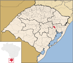
Location within Rio Grande do Sul
Brazil location map.svg
Red pog.svg
Montenegro
Location in Brazil
Coordinates: 29°41′20″S51°27′39″W / 29.68889°S 51.46083°W / -29.68889; -51.46083
Country Flag of Brazil.svg  Brazil
State Rio Grande do Sul
Population
 (2020 [1] )
  Total65,721
Time zone UTC−3 (BRT)

Montenegro is a municipality of the state of Rio Grande do Sul, Brazil. As of 2020, it has 65,721 inhabitants.

Contents

The town was established in 1847 to be settled primarily by German immigrants from the Hunsrück region of southwest Germany. The local language was Riograndenser Hunsrückisch for most of its history, and it is still spoken there after 150 years of the initial settlement. Today, however, Portuguese prevails, mostly as a result of the campaign of the "Nacionalização" (Nationalization) forcefully imposed on all German and Italian settled areas of southern Brazil by president and dictator Getúlio Vargas in the 1940s.

Railway connection

The former railway station is to be converted into a "Cultural Center". Casa da Cultura de Monteneg.jpg
The former railway station is to be converted into a "Cultural Center".

In 1909 a new railway line connected Montenegro to São Leopoldo, which led to a quickening of economic development both in Montenegro itself and in other regional municipalities such as Maratá, Salvador do Sul and Barão. The railway was extended in 1932 and again in 1950, but at the end of the 1960s it was closed. It was subsequently decided to convert the former railway station into a "Cultural Center".

Distinguished sons and daughters

Cardinal Cláudio Hummes, one of the candidates to the Catholic Church papacy in April 2005, was born in the area. On July 2, 2008, Pope Benedict XVI erected the new Roman Catholic Diocese of Montenegro, making it a Suffragan See in the province of the metropolitan archdiocese of Porto Alegre, from whose territory it was taken.

Related Research Articles

<span class="mw-page-title-main">Uruguaiana</span> Municipality in South, Brazil

Uruguaiana is a municipality in the Brazilian state of Rio Grande do Sul. It is located on the eastern shore of the Uruguay River bordering Argentina. Opposite to Uruguaiana, and joined to it by a road/railway bridge, lies the Argentine city of Paso de los Libres, Corrientes. North of Uruguaiana lies the Brazilian municipality of Itaqui, connected by a bridge constructed by the British in 1888 over the Ibicuí River. The municipality also borders the municipalities of Alegrete, Barra do Quaraí and Quaraí, and, also, Uruguay, making it one of the few international triple-border municipalities of Brazil.

<span class="mw-page-title-main">Novo Hamburgo</span> Municipality in South, Brazil

Novo Hamburgo is a municipality in the southernmost Brazilian state of Rio Grande do Sul, located in the metropolitan area of Porto Alegre, the state capital. As of 2020, its population was 247,032. The city covers an area of 217 km2 (84 sq mi), and the average temperature is 19 °C (66 °F), which is mild for the region. The Sinos River runs through the urban area.

<span class="mw-page-title-main">São Caetano do Sul</span> Municipality in Southeast Brazil, Brazil

São Caetano do Sul is a city in São Paulo state in Brazil. It is part of the Metropolitan Region of São Paulo. The population is 161,957 in an area of 15.33 km2. It is the city with the highest per capita income in Brazil and it also has the highest Human Development Index.

<span class="mw-page-title-main">Santa Maria, Rio Grande do Sul</span> Municipality in the state of Rio Grande do Sul, Brazil

Santa Maria is a municipality (município) in the central region of Rio Grande do Sul, the southernmost state of Brazil. In 2020, its population was 283,677 inhabitants in a total area of 1,823 square kilometres (704 sq mi). Santa Maria is the 5th biggest municipality in the state, and the largest in its micro-region.

<span class="mw-page-title-main">Roque Gonzales, Rio Grande do Sul</span> Place in Rio Grande do Sul, Brazil

Roque Gonzales is a municipality located in the northwestern region of the southernmost state of Rio Grande do Sul, Brazil, east of the Uruguay River and the Argentinian border. Roque Gonzales was named after the jesuit missionary and saint Roque González de Santa Cruz.

<span class="mw-page-title-main">Bento Gonçalves, Rio Grande do Sul</span> Municipality in South, Brazil

Bento Gonçalves is a municipality located in the state of Rio Grande do Sul, Brazil. Created in 1875, it is one of the centers of the Italian immigration in Brazil. It is also known as the 'wine capital of Brazil' due to its vineyards and wine production. In 2020, its estimated population was 121,803 inhabitants.

Cerro Largo is a municipality in the northwestern part of the Brazilian state of Rio Grande do Sul. It occupies an area of 174.64 km2 (67.43 sq mi) at 28º09'0" south 54º45'0" west, at an elevation of 211 m (692 ft) above sea level. Its population as of 2020 was 14,189 inhabitants.

<span class="mw-page-title-main">Polish Brazilians</span>

Polish Brazilians refers to Brazilians of full or partial Polish ancestry who are aware of such ancestry and remain connected, to some degree, to Polish culture, or Polish-born people permanently residing in Brazil. Also, a Polish Brazilian may have one Polish parent.

<span class="mw-page-title-main">Vargem Grande do Sul</span> Municipality in Southeast, Brazil

Vargem Grande do Sul is a municipality in the northeast of the state of São Paulo in Brazil. The population is 43,110 in an area of 267 km². The elevation is 721 m. Access through state roads SP-344 and SP-215. Human Development Index is 0.802.

<span class="mw-page-title-main">Pirapó</span> Municipality in Rio Grande do Sul, Brazil

Pirapó is a municipality of the western part of the state of Rio Grande do Sul, Brazil. The population is 2,254 in an area of 295.01 km². The town is situated by the Ijuí River, close to its confluence with the Uruguay River, which forms the border with Argentina. It is located 563 km west of the state capital of Porto Alegre and northeast of Alegrete.

<span class="mw-page-title-main">União da Vitória</span> City in South, Brazil

União da Vitória is a municipality in the state of Paraná in Brazil. Its population was about 57,913 people in 2020. In the economic area, União da Vitória's GDP is US$115,364,648.65.

<span class="mw-page-title-main">Bom Princípio</span> Municipality in Rio Grande do Sul, Brazil

Bom Princípio is a municipality in the state of Rio Grande do Sul, Brazil. It is known in alla Brazil as Strawberry Land.

<span class="mw-page-title-main">Guarani das Missões</span> Municipality in South, Brazil

Guarani das Missões is a municipality in the state of Rio Grande do Sul, Brazil.

<span class="mw-page-title-main">Nova Roma do Sul</span> Municipality in Rio Grande do Sul, Brazil

Nova Roma do Sul is a municipality in the state of Rio Grande do Sul, Brazil. It had a population of 3,717 persons, as of 2020. It was first settled in 1880 by immigrant families of Polish, Russian and Swedish origins. In 1885, Italian immigrants arrived, mostly from Belluno, Treviso and Vicenza, in Veneto. The Italians named it Nova Roma do Sul in honor to the capital of Italy. During World War II, the town's name was changed to Guararapes, because Brazil broke off diplomatic relations with Italy, and it was prohibited to use names with references to the Axis Powers. Later, the original name of the town returned.

<span class="mw-page-title-main">Pareci Novo</span> Municipality in Rio Grande do Sul, Brazil

Pareci Novo is a municipality in the state of Rio Grande do Sul, Brazil. It was raised to municipality status in 1992, the area being taken out of the municipality of Montenegro.

<span class="mw-page-title-main">Rolante</span> Municipality in Rio Grande do Sul, Brazil

Rolante (Rolling) is a municipality in the state of Rio Grande do Sul, Brazil.

São Pedro do Butiá is a municipality in the state of Rio Grande do Sul, Brazil. As of 2020, the estimated population was 2,949.

<span class="mw-page-title-main">Campos Novos</span> Place in South, Brazil

Campos Novos is a city in Santa Catarina, in the Southern Region of Brazil. Campos Novos is a pioneer in production of pollen and the biggest grain and oat producer of Santa Catarina. The municipality invests also into fat stock and poultry farming.

<span class="mw-page-title-main">Caibi</span> Municipality in South, Brazil

Caibi is a municipality in the state of Santa Catarina in the South region of Brazil. It covers 174.84 km2 (67.51 sq mi), and has a population of 6,130 with a population density of 35.57 inhabitants per square kilometer.

<span class="mw-page-title-main">Ipira</span> Municipality in South, Brazil

Ipira is a municipality in the state of Santa Catarina in the South region of Brazil. It is part of the "Concórdia" micro-region.

References