Ponte Preta, Rio Grande do Sul | |
|---|---|
 View of Ponte Preta, Rio Grande do Sul | |
 Flag  Seal | |
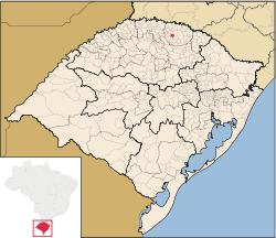 Location of Ponte Preta within Rio Grande do Sul | |
| Coordinates: 27°39′14″S52°29′16″W / 27.65389°S 52.48778°W | |
| Country | Brazil |
| State | Rio Grande do Sul |
| Mesoregion | Noroeste Rio-Grandense |
| Microregion | Microregion of Erechim |
| Government | |
| • Mayor | Luis Carlos Parise |
| Area | |
• Total | 100.407 km2 (38.767 sq mi) |
| Population (2020 [1] ) | |
• Total | 1,524 |
| • Density | 19.6/km2 (51/sq mi) |
| Time zone | UTC−3 (BRT) |
| HDI | 0.782 (UNDP 2000) |
| GDP | R$ 20,210,994.00 (IBGE 2003) |
| GDP per capita | R$ 10,135.91 (IGBE 2003) |
Ponte Preta is a municipality in the state of Rio Grande do Sul, Brazil. In 2020 it had an estimated population of 1,524.

