Trindade do Sul | |
---|---|
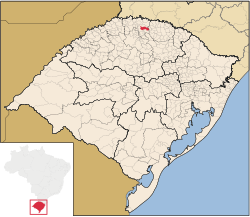
Location in Rio Grande do Sul state | |
Coordinates: 27°31′19″S52°53′38″W / 27.52194°S 52.89389°W Coordinates: 27°31′19″S52°53′38″W / 27.52194°S 52.89389°W | |
Country | Brazil |
Region | South |
State | Rio Grande do Sul |
Mesoregion | Noroeste Rio-Grandense |
Microregion | Frederico Westphalen |
Founded | December 15, 1987 |
Government | |
• Mayor | Luiz da Silva Rosa (PP) |
Area | |
• Total | 268.417 km2 (103.636 sq mi) |
Elevation | 640 m (2,100 ft) |
Demonym(s) | Trindadense |
Time zone | UTC-03:00 (BRT) |
• Summer (DST) | UTC-02:00 (BRST) |
Website | www |
Trindade do Sul is a municipality in the state of Rio Grande do Sul, Brazil.
The municipality of Trindade do Sul is a part of the Microregion of Frederico Westphalen. It is located at a latitude of 27º31'13" south and a longitude of 52º53'00" west, being at an altitude of 640 meters above sea level.
This municipality is divided in several localities, called lines (Brazilian Portuguese :Linhas). Those are:
According to IBGE statistics from 2010, Trindade do Sul has a population of 5787 people.
This geographical article relating to Rio Grande do Sul is a stub. You can help Wikipedia by expanding it. |
Uruguaiana is a municipality in the Brazilian state of Rio Grande do Sul. It is located on the left-hand (eastern) shore of the Uruguay River that forms the border with Argentina. Opposite Uruguaiana, and joined to it by a road/railway bridge, lies the Argentine city of Paso de los Libres, Corrientes. North of Uruguaiana lies the Brazilian municipality of Itaqui, connected by a bridge constructed by the English in 1888 over the Ibicuí River. The municipality also borders the municipalities of Alegrete, Barra do Quaraí and Quaraí, and, also, Uruguay, making it one of the few international triple-border municipalities of Brazil.
São Miguel is the name of the largest island of the Azores and may also refer to:
Santana may refer to:
Barra may refer to:
Cerro Largo is a municipality in the northwestern part of the Brazilian state of Rio Grande do Sul. It occupies an area of 174.64 km² (67.43 sq mi) at 28º09'0" south 54º45'0" west, at an elevation of 211 m (692 ft) above sea level. Its population as of 2010 was 15,174 inhabitants.
Santa Catarina Island is an island in the Brazilian state of Santa Catarina, located off the southern coast. It is home to the state capital, Florianópolis.
Barra Mansa is a Brazilian municipality located in the south of the state of Rio de Janeiro.
The history of the Jews in Brazil is a rather long and complex one, as it stretches from the very beginning of the European settlement in the new continent. Although only baptized Christians were subject to the Inquisition, Jews started settling in Brazil when the Inquisition reached Portugal, in the 16th century. They arrived in Brazil during the period of Dutch rule, setting up in Recife the first synagogue in the Americas, the Kahal Zur Israel Synagogue, as early as 1636. Most of those Jews were Sephardic Jews who had fled the Inquisition in Spain and Portugal to the religious freedom of the Netherlands.
Caçapava do Sul is a Brazilian municipality in the state of Rio Grande do Sul, located on the banks of the Camaquã River. As of 2016, the city has an estimated population of 34,664. It was the 2nd capital of the Piratini Republic from 1839 to 1840.
Cambará do Sul is a municipality in the state of Rio Grande do Sul, Brazil. Its population was approximately 6,600 in 2010. It has an area of approximately 1212 km².
São Valentim do Sul is a municipality in the state of Rio Grande do Sul, Brazil. It was raised to municipality status in 1992, the area being taken out of the municipality of Dois Lajeados.
São Vendelino is a municipality in the state of Rio Grande do Sul, Brazil. It was raised to municipality status in 1988, the area being taken out of the municipality of Bom Princípio.
São José da Barra is a Brazilian municipality located in the southwest of the state of Minas Gerais. Its population as of 2007 was 6,701 people living in a total area of 312 km². The city belongs to the meso-region of Sul e Sudoeste de Minas and to the micro-region of Passos. It became a municipality in 1948. The important hydroelectric plant of Furnas is located here.
The Caí River is a river of Rio Grande do Sul state in southern Brazil. It is a tributary of the Jacuí River, just above the junction with the Guaíba.
Barra is a municipality in Bahia, Brazil. Barra covers 11,422.537 km2 (4,410.266 sq mi), and has a population of 49,325 with a population density of 4.3 inhabitants per square kilometer.
Arroio Grande is a bairro in the District of Arroio Grande in the municipality of Santa Maria, in the Brazilian state of Rio Grande do Sul. It is situated in northeast of Santa Maria.
The Microregion of Frederico Westphalen was one of the Microregions of the Rio Grande do Sul state, in Brazil. It belonged to the mesoregion of the Noroeste Rio-Grandense. Its population was estimated by the IBGE to be of 175,391 in 2005, divided in 27 municipalities. Its total area is of 5,182.529 km². The IBGE has since discontinued the microregion system for population tracking, replacing it with the term "immediate geographic region".
Vale do Ribeira is a region in the south of the state of São Paulo and the northeast of the state of Paraná, Brazil. It contains a large part of the Ribeira de Iguape River valley, from which it takes its name, as well as the coastal Iguape-Cananéia-Paranaguá estuary lagoon complex. The region is environmentally rich, with large areas of well-preserved Atlantic Forest, but economically poor.