
Jaquirana is a municipality in the state of Rio Grande do Sul, Brazil. As of 2020, the estimated population was 3,662. [1]
The municipality contains part of the 6,655 hectares (16,440 acres) Tainhas State Park, created in 1975. [2]
Jaquirana is a municipality in the state of Rio Grande do Sul, Brazil. As of 2020, the estimated population was 3,662. [1]
The municipality contains part of the 6,655 hectares (16,440 acres) Tainhas State Park, created in 1975. [2]

São Bento do Sul is a municipality, pop. 85,421 (2020) located in southern Brazil, in the northeast part of the state of Santa Catarina, just south of the state of Paraná.

São Francisco de Paula is a city in the Serra Gaúcha of the state of Rio Grande do Sul, Brazil. The municipality covers about 3,289.7 km2 (1,270.2 sq mi) and sits about 112 km (70 mi) from Porto Alegre. As of 2020, the city's population was estimated to be 21,801. The municipality was originally created on December 23, 1902.
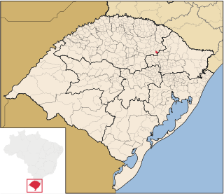
Itapuca is a Brazilian municipality in the state of Rio Grande do Sul.
São Domingos do Sul is a municipality in the Brazilian state of Rio Grande do Sul. It is situated at a latitude of 28º31'51 South and a longitude of 51º53'16" West. As of 2020, it has an estimated population of 3,083 inhabitants on an area of 78.67 km². Its current mayor is Domingos Scartazzini.

Barão de Cotegipe is a municipality in the state of Rio Grande do Sul, Brazil. As of 2020, the estimated population was 6,620.
Barra do Rio Azul is a municipality in the state of Rio Grande do Sul, Brazil. As of 2020, the estimated population was 1,655.

Cambará do Sul is a municipality in the state of Rio Grande do Sul, Brazil. Its population was approximately 6,406 in 2020. It has an area of approximately 1212 km2.

Casca is a municipality in the state of Rio Grande do Sul, Brazil. As of 2020, the estimated population was 9,051.

Erval Grande is a municipality in the state of Rio Grande do Sul, Brazil. As of 2020, the estimated population was 4,819.
Esmeralda is a municipality in the state of Rio Grande do Sul, Brazil. It was raised to municipality status in 1963, the area being taken out of the municipality of Vacaria. As of 2020, the estimated population was 3,287.
Fagundes Varela is a municipality in the state of Rio Grande do Sul, Brazil. It lies at an elevation of 610 m, covers an area of 132.32 km², and has a population of 2,741.
Gentil, Rio Grande do Sul is a municipality in the state of Rio Grande do Sul, Brazil. As of 2020, the estimated population was 1,626.
Lagoa dos Três Cantos is a municipality in the state of Rio Grande do Sul, Brazil. As of 2020, the estimated population was 1,607.

Marcelino Ramos is a municipality in the state of Rio Grande do Sul, Brazil. As of 2020, the estimated population was 4,319.
Monte Alegre dos Campos is a municipality in the state of Rio Grande do Sul, Brazil. As of 2020, the estimated population was 3,232.

Muitos Capões is a municipality in the state of Rio Grande do Sul, Brazil. It was raised to municipality status in 1992, the area being taken out of the municipalities of Vacaria, Lagoa Vermelha and Esmeralda. As of 2020, the estimated population was 3,173.

Porto Xavier is a municipality in the state of Rio Grande do Sul, Brazil. As of 2020, the estimated population was 10,194.
Selbach is a municipality in the state of Rio Grande do Sul, Brazil. As of 2020, the estimated population was 5,107.
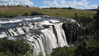
Rio Tainhas is a river in the state of Rio Grande do Sul, Brazil. It is a left tributary of the Das Antas River
Vila Maria is a municipality in the state of Rio Grande do Sul in the Southern Region of Brazil.
28°54′S50°23′W / 28.900°S 50.383°W
 | This geographical article relating to Rio Grande do Sul is a stub. You can help Wikipedia by expanding it. |
