Roque Gonzales is a municipality located in the northwestern region of the southernmost state of Rio Grande do Sul, Brazil, east of the Uruguay River and the Argentinian border. Roque Gonzales was named after the jesuit missionary and saint Roque González de Santa Cruz.

Derrubadas is a municipality of the Brazilian state of Rio Grande do Sul.

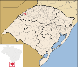
São Nicolau is a municipality of the state of Rio Grande do Sul, Brazil. It was founded in 1626 by Jesuit priest Roque González y de Santa Cruz. The population is 5,208 in an area of 485.32 km². It is located 562 km west of the state capital of Porto Alegre, northeast of Alegrete. The Uruguay River, which forms the border with Argentina, flows along the northwestern part of the municipality.
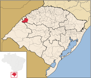
Santo Antônio das Missões is a municipality in the western part of the state of Rio Grande do Sul, Brazil. The population is 10,050 in an area of 1710.87 km2. Distance from the state capital of Porto Alegre is 534 km west and tens of kilometres east from the Argentine border but the municipality does not border since it is close.

Pirapó is a municipality of the western part of the state of Rio Grande do Sul, Brazil. The population is 2,254 in an area of 295.01 km². The town is situated by the Ijuí River, close to its confluence with the Uruguay River, which forms the border with Argentina. It is located 563 km west of the state capital of Porto Alegre and northeast of Alegrete.

Garruchos is a municipality in the western part of the state of Rio Grande do Sul, Brazil. The population is 2,886 in an area of 799.85 km². Its elevation is 69 m by the Uruguay River. It is located 627 km west of the state capital of Porto Alegre, northeast of Alegrete.

Alecrim is a municipality in the state of Rio Grande do Sul, Brazil.

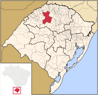
Doutor Maurício Cardoso is a municipality in the state of Rio Grande do Sul, Brazil. As of 2020, the estimated population was 4,462.
Esperança do Sul is a municipality in the state of Rio Grande do Sul, Brazil. As of 2020, the estimated population was 2,885.
Novo Machado is a municipality in the state of Rio Grande do Sul, Brazil. As of 2020, the estimated population was 3,256.
Porto Lucena is a municipality in the state of Rio Grande do Sul, Brazil. As of 2020, the estimated population was 4,594.
Porto Mauá is a municipality in the state of Rio Grande do Sul, Brazil. As of 2020, the estimated population was 2,352.

Porto Vera Cruz is a municipality in the state of Rio Grande do Sul, Brazil. As of 2020, the estimated population was 1,308.

Porto Xavier is a municipality in the state of Rio Grande do Sul, Brazil. As of 2020, the estimated population was 10,194.

Santo Cristo is a municipality in the state of Rio Grande do Sul, Brazil. As of 2020, the estimated population was 14,216.

Tiradentes do Sul is a municipality in the state of Rio Grande do Sul, Brazil. As of 2020, the estimated population was 5,616.
Tuparendi is a municipality in the state of Rio Grande do Sul, Brazil. As of 2020, the estimated population was 7,810.

The Microregion of Frederico Westphalen was one of the Microregions of the Rio Grande do Sul state, in Brazil. It belonged to the mesoregion of the Noroeste Rio-Grandense. Its population was estimated by the IBGE to be of 175,391 in 2005, divided in 27 municipalities. Its total area is 5,182.529 km². The IBGE has since discontinued the microregion system for population tracking, replacing it with the term "immediate geographic region".

The Panambí Dam, or Roncador Dam, is a planned hydroelectric dam and generating station on the Uruguay River between Argentina and Brazil, part of the Garabí-Panambi Hydroelectric Complex. There is controversy over the environmental impact on the fast-flowing river.
The Microregion of Ijuí was one of the Microregions of the Rio Grande do Sul state, in Brazil. It belonged to the mesoregion of the Noroeste Rio-Grandense. Its population was estimated by the IBGE to be of 183.142 inhabitants in 2005, and it was divided in 15 Municipalities. Its total area was of 5.100,402 km². The IBGE has since discontinued the microregion system for population tracking, replacing it with the term "immediate geographic region".