This article needs additional citations for verification .(January 2017) |
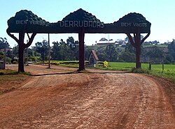
Derrubadas | |
|---|---|
 | |
 Flag  Coat of arms | |
 Location of Derrubadas in Rio Grande do Sul | |
| Country | |
| Region | South |
| State | Rio Grande do Sul |
| Mesoregion | Noroeste Rio-Grandense |
| Microregion | Três Passos |
| Founded | 20 March 1992 |
| Government | |
| • Mayor | Alair Cemin (MDB, 2021 - 2024) |
| Area | |
• Total | 360.851 km2 (139.325 sq mi) |
| Population (2021) | |
• Total | 2,718 |
| • Density | 7.532/km2 (19.51/sq mi) |
| Demonym | Derrubadense |
| Time zone | UTC−3 (BRT) |
| Website | Official website |
Derrubadas is a municipality of the Brazilian state of Rio Grande do Sul.

