
Santa Fe County is located in the U.S. state of New Mexico. As of the 2010 census, the population was 144,170, making it New Mexico's third-most populous county, after Bernalillo County and Doña Ana County. Its county seat is Santa Fe, the state capital.

The name Jornada del Muerto translates from Spanish as "Single Day's Journey of the Dead Man" or even "Route of the Dead Man, though the modern literal translation is closer to "The Working Day of the Dead". It was the name given by the Spanish conquistadors to the Jornada del Muerto Desert basin, and the particularly dry 100-mile (160 km) stretch of a route through it from Las Cruces to Socorro, New Mexico. The trail led northward from central Spanish colonial New Spain, present-day Mexico, to the farthest reaches of the viceroyalty in northern Nuevo México Province. The route later became a section of the Camino Real.
Paraje, a Spanish term meaning in English place or spot. Paraje is a term from the original Spanish speaking settlers, in use among English speakers in the southwestern United States, particularly in New Mexico, that refers to a camping place along a long distance trail where travelers customarily stopped for the night. A paraje can be a town, a village or pueblo, a caravanserai, or simply a good location for stopping.

The Camino Real de Tierra Adentro, also known as the Silver Route, was a Spanish 2,560-kilometre-long (1,590 mi) road between Mexico City and San Juan Pueblo, New Mexico, USA, that was used from 1598 to 1882. It was the northernmost of the four major "royal roads" that linked Mexico City to its major tributaries during and after the Spanish colonial era.

The Cora are an indigenous ethnic group of North Western Mexico which live in the municipality El Nayar, Rosamorada, Ruiz, Tepic, Mezquital Durango in the Mexican state of Nayarit and in a few settlements in the neighboring state of Jalisco. They call themselves náayerite, whence the name of the present day Mexican state of Nayarit. They reside within a series of comunidades indígenas and ejidos. The 2000 Mexican census reported that there were 24,390 people who were members of Cora-speaking households, these being defined as households where at least one parent or elder claims to speak the Cora language. Of these 24 thousand, 67 percent (16,357) were reported to speak Cora, 17 percent were nonspeakers, and the remaining 16 percent were unspecified with regard to their language.
Fort Selden was a United States Army post, occupying the area in what is now Radium Springs, New Mexico. The site was long a campground along the El Camino Real de Tierra Adentro. It was the site of a Confederate Army camp in 1861. The U. S. Army established Fort Selden in 1865 for the purpose of protecting westward settlers from Native American raids, but the post fell into disrepair after the American Civil War. It was ultimately abandoned in 1891, due in large part to the decision to expand Fort Bliss and the lack of any expenditures for repair of the facility.

The Santa Fe River is river in Santa Fe and Sandoval counties in New Mexico, United States, that is a tributary of the Rio Grande.

The Santa Fe Plaza is a National Historic Landmark in downtown Santa Fe, New Mexico in the style of traditional Spanish-American colonial cities. The plaza, or city square is a gathering place for locals and also a tourist attraction. It is home to annual events including Fiestas de Santa Fe, the Spanish Market, the Santa Fe Bandstand, and the Santa Fe Indian Market.

The Albuquerque–Santa Fe–Las Vegas combined statistical area is made up of eight counties in north central New Mexico. The combined statistical area consists of the Albuquerque and Santa Fe metropolitan statistical areas, and the Las Vegas, Los Alamos, and Española micropolitan statistical areas. The 2013 delineations included the Grants micropolitan statistical area, but it was removed in the 2018 revisions. As of the 2020 census, the CSA had a population of 1,162,523. Roughly 56% of New Mexico's residents live in this area. Prior to the 2013 redefinitions, the CSA consisted only of the Santa Fe metropolitan statistical area and the Española micropolitan statistical area. The total land area of the Albuquerque–Santa Fe–Las Vegas combined statistical area in the 2013 definition is 26,421 sq mi (68,430 km2).

Interstate 25 (I-25) in the US state of New Mexico follows the north–south corridor through Albuquerque and Santa Fe. It replaced U.S. Route 85 (US 85), which is no longer signed, but still exists in route logs sharing the I-25 alignment. I-25 starts in New Mexico at an interchange with I-10 in Las Cruces and extends roughly 460 miles (740 km) before reaching Colorado. I-25 passes through principally rural land through central New Mexico and passes through or near the cities of Las Cruces, Truth or Consequences, Socorro, Belen, Albuquerque, Santa Fe, Las Vegas, and Raton.
New Mexico Road 599 (NM 599) is a 14.019-mile (22.561 km) state highway in northern Santa Fe County, New Mexico, United States. The divided highway expressway is also known as the Veterans Memorial Highway and the Santa Fe Relief Route; and both names are used on road signs. The latter name alludes to the highway's original purpose of bypassing the urbanized areas of Santa Fe and thereby relieving it from shipments of hazardous waste. It passes through less densely developed terrain in and around the northwestern boundary of the municipality. Speed limits on it range from 45 to 65 miles per hour.

The Rio Grande Trail is a proposed long distance trail along the Rio Grande in the U.S. state of New Mexico. The river extends over 1,800 total miles, some 700 miles (1,100 km) of which pass through the heart of New Mexico. It is the state's primary drainage feature and most valuable natural and cultural resource. The river and its bosque provide a wide variety of recreation, including hunting and fishing, birdwatching, river rafting, hiking, biking, and horseback riding. The river also flows through or beside numerous spectacular and geologically interesting landforms, the result of extensive volcanism and erosion of the valley within the Rio Grande Rift. Although some trail advocates would like to see the trail extended the full distance through New Mexico, from the Colorado border to the United States–Mexico border, the portion proposed for initial development extends 300 miles (480 km), from Bernalillo south to Las Cruces.
Santa Fe Public Schools (SFPS) is a school district based in Santa Fe, New Mexico. Santa Fe Public Schools serves the city of Santa Fe, the communities of Tesuque and Eldorado, and the historic neighborhood of Agua Fria, and other communities with a total area of 1,016 square miles (2,630 km2). The school district has a total of 31 schools: three high schools, three combined high/middle schools, three middle schools, and 21 elementary schools.
Engle is an unincorporated community in Sierra County, New Mexico.
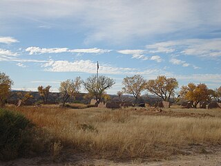
Paraje was a populated place along the east bank of the Rio Grande, in Socorro County, New Mexico, United States, now a ghost town. It is located north northeast of the Fra Cristobal Range.
Point of Rocks, named by the Spanish Cerros del Perrillo, is a 5,115 foot / 1,559 meter summit and the name of a range of hills of which the summit is the highest. The summit and the hills are in the Jornada del Muerto plateau, mostly in Sierra County, New Mexico. The southernmost part of the hills are within Doña Ana County, New Mexico.
Paraje del Perrillo, was a dependable watering and stopping place along the Camino Real de Tierra Adentro, where it passed through the Jornada del Muerto in the vicinity of Point of Rocks in Sierra County, New Mexico. Paraje del Perillo was the next water to the north beyond the Paraje de San Diego overlooking the Rio Grande 5 leagues beyond Paraje de Robledo and a half league from the River.
Aleman is a locale, a formerly populated place in Sierra County, New Mexico, United States. It lies at an elevation of 4,669 feet / 1,423 meters.
Engle Lake, originally named Laguna del Muerto by the Spanish, is a seasonal lake in the Jornada del Muerto region in Sierra County, New Mexico. It lies at an elevation or 4,715 feet (1,437 m) in the depression in the Jornada Del Muerto basin.
Contadero, is a ghost town along the east bank of the Rio Grande in Socorro County, New Mexico, United States.
