Carnarvon and Llanberis Railway

Last updated

Carnarvon and Llanberis Railway
Overview
Termini Caernarfon
Llanberis
Service
Operator(s) London and North Western Railway 1869-1923
London Midland and Scottish Railway 1923-1948
British Railways 1948-1964
History
Opened1 July 1869 (1869-07-01)
Closed20 October 1964 (1964-10-20)
Technical
Line length8 mi (13 km)
Track gauge 1,435 mm (4 ft 8 12 in) standard gauge
Route map
BSicon exCONTg.svg
Bangor and Carnarvon Railway
to Bangor
BSicon exHST.svg
Caernarvon
BSicon exKRW+l.svg
BSicon exKRWlr.svg
BSicon POINTERf@g.svg
BSicon exKRW+r.svg
BSicon exTUNNEL2.svg
BSicon exlv-ENDE@F.svg
BSicon udKHSTa.svg
BSicon exdSTR.svg
BSicon exv-STR.svg
Caernarfon
(WHR)
BSicon cd.svg
BSicon uv-STR.svg
BSicon exv-SHI2g+r.svg
BSicon +c.svg
BSicon exSTR.svg
Quay Sidings
BSicon uSTR.svg
BSicon exHST.svg
Caernarvon (Morfa)
BSicon uSTR.svg
BSicon exHST.svg
BSicon exSTR.svg
Carnarvon (Pant)
BSicon uSTR.svg
BSicon exHST.svg
Pont Rug
BSicon uSTR.svg
BSicon exHST.svg
Pontrhythallt
BSicon uHST.svg
BSicon exSTR.svg
Bontnewydd
(WHR)
BSicon uSTR.svg
BSicon exHST.svg
Cwm-y-Glo
BSicon uSTR.svg
BSicon exTUNNEL2.svg
Llanberis Tunnel
BSicon uSTR.svg
BSicon exBST.svg
Glynrhonwy Quarries
BSicon uSTR.svg
BSicon exHST.svg
Padarn Halt
BSicon uSTR.svg
BSicon exKHSTe.svg
Llanberis Gnome-searchtool.svg
BSicon exlHST.svg
BSicon uSTR2.svg
BSicon ulv-HST.svg
BSicon exSTR.svg
BSicon uSTRc3.svg
Dinas Junction
BSicon uSTRc1.svg
BSicon exSTR.svg
BSicon uCONT4.svg
BSicon exHST.svg
Llanwnda
BSicon exHST.svg
Groeslon
BSicon exHST.svg
Penygroes
BSicon exABZg2.svg
BSicon exSTRc3.svg
Nantlle Branch Junction
BSicon exSTR+c1.svg
BSicon exKHST4.svg
Nantlle
BSicon lGIPl.svg
BSicon exSTR.svg
Summit
BSicon exHST.svg
Pant Glas
BSicon exHST.svg
Brynkir
BSicon exHST.svg
Ynys
BSicon exHST.svg
Llangybi
BSicon exHST.svg
Chwilog
BSicon CONT2.svg
BSicon xSTR+c3.svg
BSicon STRc1.svg
BSicon exlv-HST@F.svg
BSicon ABZ2+4xg.svg
BSicon STRc3.svg
Afon Wen
BSicon STRc1.svg
BSicon CONT4.svg

The Carnarvon and Llanberis Railway, built under the Caernarvon and Llanberis Railway Act 1864, was an eight-mile branch line from the Carnarvonshire Railway running from Caernarfon to Llanberis, via Pont Rhythallt (for Llanrug), Cwm y Glo, and Padarn Halt.

Contents

History

The Carnarvon and Llanberis railway bill passed through parliament in 1864. [1] The estimated cost of construction of the line 8 miles (13 km) long was £110,000 (equivalent to £10,895,314in 2019). [2]

Construction started on 15 September 1864 when the first sod was cut by the Hon. Emily Wynne of Glynllifon, daughter of Spencer Bulkeley Wynn, 3rd Baron Newborough. The event was marked with a procession of 700 children with the Llanrug Brass Band, and the Revd. W. Lloyd William, vicar of St Padarn's Church, Llanberis. [3] The plan was for the railway to be operated by the London and North Western Railway. [4]

The railway opened on 1 July 1869 [5] but was overshadowed by a nitro-glycerine explosion at a quarry near Cwm-y-Glo railway station which resulted in 5 deaths and 12 severe injuries.

The line from Llanberis to Caernarfon was built from Llanberis towards Caernarfon. For a while the railway terminated at Caernarvon (Morfa) railway station. When the "Caernarfon Town Line" [6] was built through a tunnel under the centre to join the various routes. Morfa station was closed on 5 July 1870, though it appears that formal paperwork was not concluded until the following January. [7]

In 1870 the London and North Western Railway took full ownership of the line, and the Carnarvon and Llanberis railway company was dissolved. [8]

The railway was initially built as a local link between villages, serving the local population. However tourist traffic increased hugely after the Snowdon Mountain Railway opened in 1897. [9] [ page needed ]

Accidents

On 25 August 1872 the market train from Llanberis was approaching Carnarvon when it was run into by a ballast engine. A second class carriage received the full shock of the ballast engine and was knocked to pieces. The two passengers aboard were uninjured. [10]

Closure and traces of the railway

The station closed for regular passenger services in 1930 but was still used by summer excursion trains [11] until 7 September 1962 and freight services until 3 September 1964. [12] [13]

The last fare-paying passenger service was an enthusiasts' special on 20 October 1964. [14] [15] The line was lifted in 1965. [16]

Some evidence of the railbed still exists. The site of the track in Llanberis now carries the A4086 road where it by-passes the village along the lakeshore, and the former station is occupied by a craft centre. An area known locally as the Sidings on the shores of Llyn Padarn also shows some evidence of its past. The next section of railbed runs alongside the lake and is now the Lon Las Peris ("Peris Green Lane") cycle path., There is also evidence of the former railway on bridges and a tunnel near Cwm y Glo, near Llwyncoed Farm - mentioned in the song Tylluanod ("Owls") by the local band Hogia'r Wyddfa ("Snowdon Lads") in 1969. The railbed then follows the line of the A4086 through Cwm y Glo past Y Fricsan Inn, the site of Cwm-y-Glo railway station. It then follows the River Seiont downstream for the rest of its route to Caernarfon.

Related Research Articles

Snowdonia Region in north Wales

Snowdonia is a mountainous region in northwestern Wales and a national park of 823 square miles (2,130 km2) in area. It was the first to be designated of the three national parks in Wales, in 1951. It contains the highest peaks in the United Kingdom outside Scotland.

Caernarfon Human settlement in Wales

Caernarfon is a royal town, community, and port in Gwynedd, Wales, with a population of 9,852. It lies along the A487 road, on the eastern shore of the Menai Strait, opposite the Isle of Anglesey. The city of Bangor is 8.6 miles (13.8 km) to the north-east, while Snowdonia fringes Caernarfon to the east and south-east. Carnarvon and Caernarvon are Anglicised spellings that were superseded in 1926 and 1974 respectively.

Carnarvon and Caernarvon are forms of the name Caernarfon which are no longer used for the town in north Wales, but remain in use in other contexts. The first two forms are in English orthography and the third is the Welsh spelling, adopted in English since the 1970s. Most places and things named after Caernarfon use one of the former spellings.

Dinas railway station

Dinas is a station on the narrow gauge Welsh Highland Railway, which was built in 1877 as the North Wales Narrow Gauge Railways Moel Tryfan Undertaking to carry dressed slate for trans-shipment to the LNWR. Passenger services ceased on 26 September 1936 until which time Dinas had been a joint station, known as Dinas Junction with the LNWR and later the LMS. In 1951, British Railways closed their part of the station but the line through the station remained open until the line from Caernarvon to Afon Wen was closed in 1964. The trackbed was subsequently developed as the Lôn Eifion tourist cycle route.

Criccieth railway station

Criccieth railway station serves the seaside town of Criccieth on the Llŷn Peninsula in Gwynedd, Wales.

Caernarvon railway station was a station on the former Bangor and Carnarvon Railway between Caernarfon, Gwynedd and Menai Suspension Bridge near Bangor. The station was closed to all traffic in January 1972. The station has since been demolished and the site redeveloped.

Pontrhythallt railway station

Pontrhythallt was a railway station in the village of Pont Rhythallt, Gwynedd, Wales. This station opened in 1869 and closed for regular passenger services in 1930, but trains continued to pass through until the last goods train of all on 3 September 1964, which delivered a panel of lap fencing.

Penygroes railway station

Penygroes railway station was located in Penygroes, Gwynedd, Wales.

Groeslon railway station

Groeslon railway station served the village of Groeslon, Gwynedd, Wales. It operated first as part of the Nantlle Tramway and afterwards as a railway under the auspices of several different companies. The station and line closed on 7 December 1964 as recommended in the Beeching Report.

Llanberis railway station was located in Llanberis, Gwynedd, Wales. It opened 1 July 1869. The station closed for regular passenger services in 1930 but was still used by summer excursion trains until 7 September 1962 and freight services until 3 September 1964.

Cwm-y-Glo railway station

Cwm-y-Glo railway station served the village of Cwm y Glo, Gwynedd, Wales, at the north-west end of Llyn Padarn. The station was closed for regular passenger services in 1930 but trains passed through until September 1964.
A4086 road

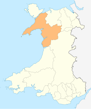
The A4086 is an A road in Gwynedd. The road goes between Caernarfon and the A5 near Capel Curig.

Llanrug Human settlement in Wales

Llanrug is a large village and community in Gwynedd, north-west Wales. It lies about 4 miles (6.4 km) to the east of Caernarfon, 7 miles (11 km) south of Bangor and 3 miles (4.8 km) northwest of Llanberis. It is the largest populated village in the Arfon area of Gwynedd, Wales. The old name of the village was Llanfihangel-y-Rug, derived from Eglwys Sant Mihangel situated about half a mile west of the village. It has a Welsh-speaking community of approximately 88%, the highest in Wales and a population of 2,911.

Cwm y Glo Human settlement in Wales

Cwm y Glo is a small village in Wales, some 4 miles to the east of Caernarfon, between Llanberis and Llanrug. It is in the Arfon Parliamentary constituency, the community of Llanrug, and the Gwynedd Council electoral ward.

The Bangor and Carnarvon Railway was a railway company promoted to build a branch railway connecting Caernarfon with the main line at Bangor, in north-west Wales. It opened in 1852 as far as Port Dinorwic and was extended to Caernarfon later in the same year.

Padarn Halt was a passenger only railway station located in Llanberis, Gwynedd, Wales, on the western shore of Llyn Padarn. It opened on 21 November 1936 and closed on the outbreak of the Second World War. The line through the station remained in use for excursions until 1962 and for freight until 1964; it was lifted in 1965.

Caernarvon (Morfa) was the temporary western terminus of the Carnarvon and Llanberis Railway, located on the southern fringe of Caernarfon, Gwynedd, Wales.
Nantlle railway station

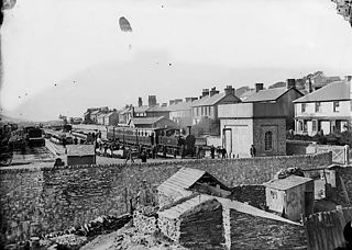
Nantlle was a railway station located in Talysarn, a neighbouring village to Nantlle, in Gwynedd, Wales.
Carnarvon Castle railway station

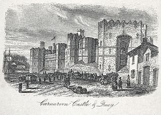
Carnarvon Castle railway station was opened in 1856 by the narrow gauge Nantlle Railway near the foot of what is today the Allt Y Castell which slopes down to Caernarfon's harbour area. It was the line's northern terminus and was the closest of Caernarfon's ultimately five stations to the historic town centre.

References

  1. "Carnarvon & Llanberis Railway" . North Wales Chronicle . Wales. 2 April 1864. Retrieved 22 October 2016 via British Newspaper Archive.
  2. UK Retail Price Index inflation figures are based on data from Clark, Gregory (2017). "The Annual RPI and Average Earnings for Britain, 1209 to Present (New Series)". MeasuringWorth. Retrieved 2 February 2020.
  3. "Cutting of the First Sod of the Carnarvon and Llanberis Railway" . North Wales Chronicle . Wales. 17 September 1864. Retrieved 22 October 2016 via British Newspaper Archive.
  4. "Carnarvon and Llanberis Railway" . Cardiff and Merthyr Guardian, Glamorgan, Monmouth and Brecon Gazette . Wales. 29 September 1865. Retrieved 22 October 2016 via British Newspaper Archive.
  5. "The Terrible Accident near Carnarvon" . Bolton Evening News . England. 2 July 1869. Retrieved 22 October 2016 via British Newspaper Archive.
  6. Town line history, via Disused Stations
  7. Quick 2009, p. 110.
  8. "Carnarvon and Llanberis Railway" . Aberystwyth Times . Wales. 21 May 1870. Retrieved 22 October 2016 via British Newspaper Archive.
  9. Baughan, Peter E. (1988). The North Wales Coast Railway. ISBN   0-9510302-9-9.
  10. "Alarming railway accident near Carnarvon" . South Wales Daily News . Wales. 27 August 1872. Retrieved 22 October 2016 via British Newspaper Archive.
  11. Johnson 1995, p. 71.
  12. Shannon & Hillmer 1999, p. 18.
  13. Kneale 1980, Plate 129.
  14. 20 October 1963 railtour record, via Six Bells Junction
  15. Rear 2012, p. 71.
  16. Rear 1979, pp. 87 & 89.

Sources