Casstown, Ohio

Last updated

Casstown, Ohio
Casstown Lutheran Stone Church from southwest.jpg
OHMap-doton-Casstown.png
Location of Casstown, Ohio
Map of Miami County Ohio Highlighting Casstown Village.png
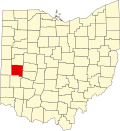
Location of Casstown in Miami County
Coordinates: 40°03′10″N84°07′43″W / 40.05278°N 84.12861°W / 40.05278; -84.12861
Country United States
State Ohio
County Miami
Township Lostcreek
Area
[1]
  Total0.10 sq mi (0.25 km2)
  Land0.10 sq mi (0.25 km2)
  Water0.00 sq mi (0.00 km2)
Elevation
[2]
932 ft (284 m)
Population
 (2020)
  Total270
  Estimate 
(2023) [3]
271
  Density2,783.51/sq mi (1,073.76/km2)
Time zone UTC-5 (Eastern (EST))
  Summer (DST) UTC-4 (EDT)
ZIP code
45312
Area code(s) 937, 326
FIPS code 39-12462 [4]
GNIS feature ID2397572 [2]

Casstown is a village in Miami County, Ohio, United States. The population was 270 at the 2020 census. It is part of the Dayton Metropolitan Statistical Area.

Contents

History

Casstown was originally called Trimmensburgh, and under the latter name was laid out in 1832 by one Mr. Trimmens, and named for him. [5] The present name honors Lewis Cass, an American military officer, politician, and statesman. [5] A post office called Casstown has been in operation since 1846. [6]

Geography

According to the United States Census Bureau, the village has a total area of 0.10 square miles (0.26 km2), all land. [7]

Demographics

Historical population
CensusPop.Note
1850 394
1860 232−41.1%
1870 2413.9%
1880 33137.3%
1890 292−11.8%
1900 262−10.3%
1910 2651.1%
1920 2919.8%
1930 2982.4%
1940 3062.7%
1950 36820.3%
1960 366−0.5%
1970 3803.8%
1980 331−12.9%
1990 246−25.7%
2000 32230.9%
2010 267−17.1%
2020 2701.1%
2023 (est.)271 [3] 0.4%
U.S. Decennial Census [8]

2010 census

As of the census [9] of 2010, there were 267 people, 113 households, and 71 families living in the village. The population density was 2,670.0 inhabitants per square mile (1,030.9/km2). There were 122 housing units at an average density of 1,220.0 per square mile (471.0/km2). The racial makeup of the village was 100.0% White.

There were 113 households, of which 30.1% had children under the age of 18 living with them, 46.9% were married couples living together, 10.6% had a female householder with no husband present, 5.3% had a male householder with no wife present, and 37.2% were non-families. 34.5% of all households were made up of individuals, and 14.2% had someone living alone who was 65 years of age or older. The average household size was 2.36 and the average family size was 3.07.

The median age in the village was 36.8 years. 24% of residents were under the age of 18; 11.2% were between the ages of 18 and 24; 27.7% were from 25 to 44; 23.6% were from 45 to 64; and 13.5% were 65 years of age or older. The gender makeup of the village was 46.8% male and 53.2% female.

2000 census

As of the census [4] of 2000, there were 322 people, 127 households, and 83 families living in the village. The population density was 3,017.0 inhabitants per square mile (1,164.9/km2). There were 132 housing units at an average density of 1,236.8 per square mile (477.5/km2). The racial makeup of the village was 100.00% White.

There were 127 households, out of which 28.3% had children under the age of 18 living with them, 56.7% were married couples living together, 6.3% had a female householder with no husband present, and 34.6% were non-families. 31.5% of all households were made up of individuals, and 15.7% had someone living alone who was 65 years of age or older. The average household size was 2.54 and the average family size was 3.17.

In the village, the population was spread out, with 25.5% under the age of 18, 9.3% from 18 to 24, 26.7% from 25 to 44, 23.6% from 45 to 64, and 14.9% who were 65 years of age or older. The median age was 40 years. For every 100 females there were 92.8 males. For every 100 females age 18 and over, there were 83.2 males.

The median income for a household in the village was $41,250, and the median income for a family was $48,333. Males had a median income of $31,250 versus $23,000 for females. The per capita income for the village was $16,296. About 2.6% of families and 4.3% of the population were below the poverty line, including 7.9% of those under age 18 and 5.6% of those age 65 or over.

Education

The Miami East High School district's middle school was formerly located in Casstown. The district recently has built a new K-8 building around 2002 and has sold all other school buildings except the high school to private buyers. The building is now privately owned.

Casstown, Ohio (2020).jpg
Casstown in 2020

Related Research Articles

<span class="mw-page-title-main">Miami County, Ohio</span> County in Ohio, United States

Miami County is a county located in the U.S. state of Ohio. As of the 2020 census, the population was 108,774. Its county seat is Troy. The county is named in honor of the Miami people. Miami County is part of the Dayton, OH Metropolitan Statistical Area.

<span class="mw-page-title-main">Spencerville, Ohio</span> Village in Ohio, United States

Spencerville is a village in Allen County, Ohio, United States. The population was 2,198 at the 2020 census. It is included in the Lima, Ohio Metropolitan Statistical Area.

<span class="mw-page-title-main">Arcanum, Ohio</span> Village in Ohio, United States

Arcanum is a village in Darke County, Ohio, United States. The population was 2,457 at the 2020 census.

<span class="mw-page-title-main">Castine, Ohio</span> Village in Ohio, United States

Castine is a village in Darke County, Ohio, United States. The population was 110 at the 2020 census.

<span class="mw-page-title-main">Spring Valley, Ohio</span> Village in Ohio, United States

Spring Valley is a village in Greene County, Ohio, United States. The population was 415 at the 2020 census. It is part of the Dayton Metropolitan Statistical Area.

<span class="mw-page-title-main">Addyston, Ohio</span> Village in Ohio, United States

Addyston is a village in Miami Township, Hamilton County, Ohio, United States. Located along the Ohio River, it is a western suburb of the neighboring city of Cincinnati. The population was 927 at the 2020 census.

<span class="mw-page-title-main">Cleves, Ohio</span> Village in Ohio, United States

Cleves is a village in Miami Township, Hamilton County, Ohio, United States. Located along the Ohio River, it is a western suburb of Cincinnati. The population was 3,414 at the 2020 census.

<span class="mw-page-title-main">Covington, Ohio</span> Village in Ohio, United States

Covington is a village in Miami County, Ohio, United States. The population was 2,548 at the 2020 census. It is part of the Dayton Metropolitan Statistical Area. The village was incorporated as Covington in 1835 on the site of the 1793 Fort Rowdy.

<span class="mw-page-title-main">Fletcher, Ohio</span> Village in Ohio, United States

Fletcher is a village in Miami County, Ohio, United States. The population was 451 at the 2020 census. It is part of the Dayton Metropolitan Statistical Area.

<span class="mw-page-title-main">Laura, Ohio</span> Village in Ohio, United States

Laura is a village in Miami County, Ohio, United States. The population was 398 at the 2020 census. It is part of the Dayton Metropolitan Statistical Area.

<span class="mw-page-title-main">Ludlow Falls, Ohio</span> Village in Ohio, United States

Ludlow Falls is a village in Miami County, Ohio, United States. The population was 175 at the 2020 census. It is part of the Dayton Metropolitan Statistical Area. Ludlow Falls is named after surveyor Israel Ludlow.

<span class="mw-page-title-main">Pleasant Hill, Ohio</span> Village in Ohio, United States

Pleasant Hill is a village in Miami County, Ohio, United States. The population was 1,241 at the 2020 census. It is part of the Dayton Metropolitan Statistical Area.

<span class="mw-page-title-main">Potsdam, Ohio</span> Village in Ohio, United States

Potsdam is a village in Miami County, Ohio, United States. The population was 225 at the 2020 census. It is part of the Dayton Metropolitan Statistical Area.

<span class="mw-page-title-main">Port Jefferson, Ohio</span> Village in Ohio, United States

Port Jefferson is a village in Salem Township, Shelby County, Ohio, United States. The population was 308 at the 2020 census.

<span class="mw-page-title-main">Butlerville, Ohio</span> Village in Ohio, United States

Butlerville is a village in central Harlan Township, Warren County, Ohio, United States, located in the southwestern part of the state. The population was 155 at the 2020 census.

<span class="mw-page-title-main">Corwin, Ohio</span> Village in Ohio, United States

Corwin is a village in Wayne Township, Warren County, Ohio, United States. The population was 484 at the 2020 census.

<span class="mw-page-title-main">Macksburg, Ohio</span> Village in Ohio, United States

Macksburg is a village in Washington County, Ohio, United States, along the West Fork of Duck Creek. The population was 120 at the 2020 census. The village is about 28 miles (45 km) south of Cambridge, Ohio.

<span class="mw-page-title-main">Clifton, Ohio</span> Village in Ohio, United States

Clifton is a village in Clark and Greene counties in the U.S. state of Ohio and is home to the Clifton Mill, one of the largest water-powered grist mills still in existence. The population was 131 at the 2020 census.

<span class="mw-page-title-main">Bradford, Ohio</span> Village in Ohio, United States

Bradford is a village in Darke and Miami counties in the U.S. state of Ohio. The population was 1,796 at the 2020 census.

<span class="mw-page-title-main">Verona, Ohio</span> Village in Ohio, United States

Verona is a village in Montgomery and Preble counties in the U.S. state of Ohio. The population was 403 at the 2020 census. It is part of the Dayton Metropolitan Statistical Area.

References

  1. "ArcGIS REST Services Directory". United States Census Bureau. Retrieved September 20, 2022.
  2. 1 2 U.S. Geological Survey Geographic Names Information System: Casstown, Ohio
  3. 1 2 "Annual Estimates of the Resident Population for Incorporated Places in Ohio: April 1, 2020 to July 1, 2023". United States Census Bureau. Retrieved June 9, 2024.
  4. 1 2 "U.S. Census website". United States Census Bureau . Retrieved January 31, 2008.
  5. 1 2 The History of Miami County, Ohio: Containing a History of the County; Its Cities, Towns, Etc. Windmill Publications. 1880. pp. 395–396.
  6. "Miami County". Jim Forte Postal History. Retrieved January 9, 2016.
  7. "US Gazetteer files 2010". United States Census Bureau. Archived from the original on July 2, 2012. Retrieved January 6, 2013.
  8. "Census of Population and Housing". Census.gov. Retrieved June 4, 2015.
  9. "U.S. Census website". United States Census Bureau . Retrieved January 6, 2013.